- Outline of the Palestinian territories
-

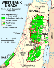
 An enlargeable map of the West Bank
 An enlargeable map of the Gaza Strip
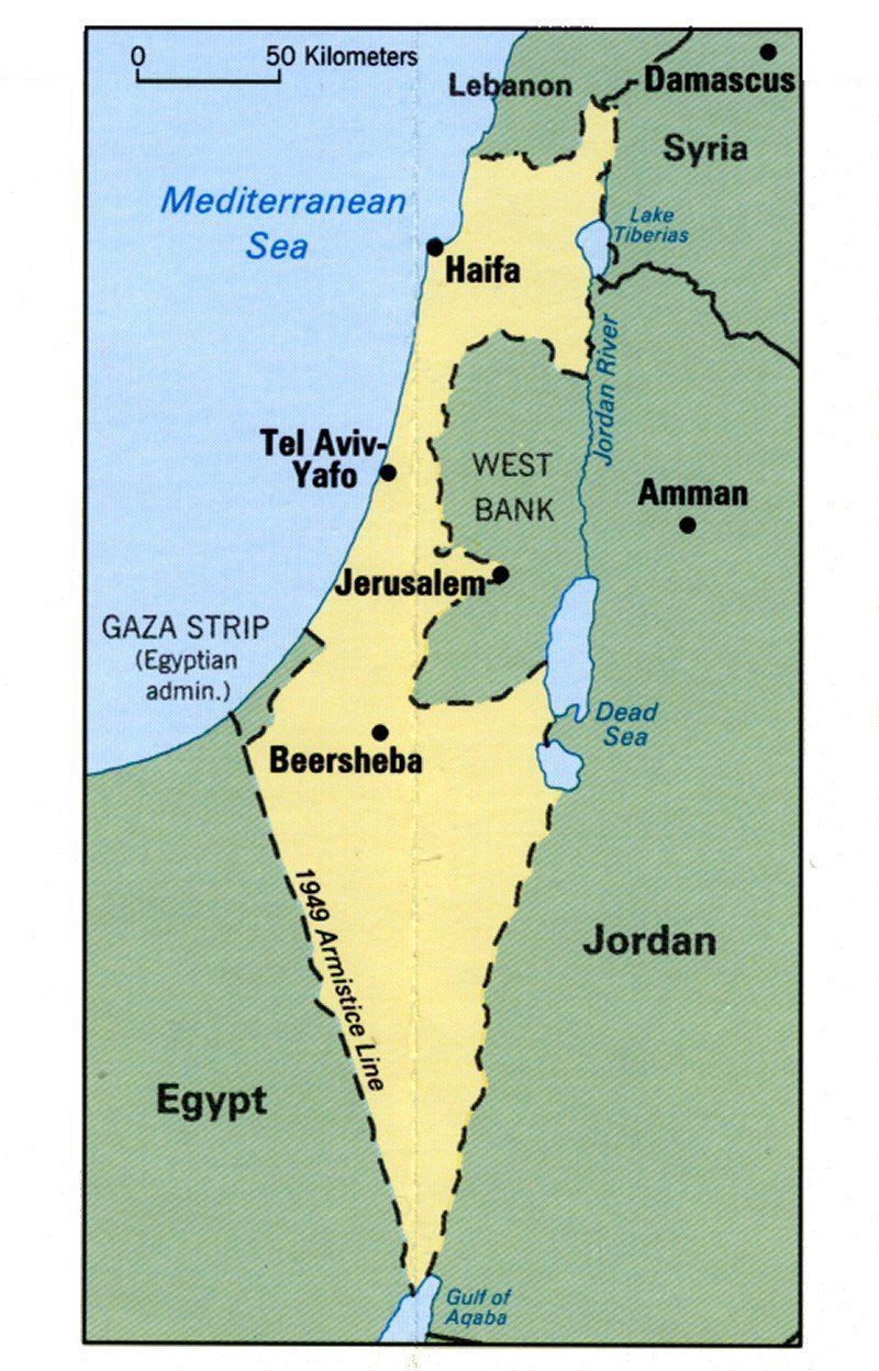
The Palestinian territories or Occupied Palestinian Territory are two conventional name used, among others, to describe the territories of the West Bank, East Jerusalem and the Gaza Strip, which were designated as the jurisdiction of the Palestinian Authority in the Palestinian-Israeli agreement of 13 September 1993.[1] Occasionally these territories are also referred to as Palestine, which creates some ambiguity with the term Palestine as a geographic region between the Mediterranean Sea and the Jordan River, and various adjoining lands.[2]
The final status of the Palestinian territories and their final boundaries are two issues that have been subject to deep dispute within the context of the Israeli-Palestinian conflict. The names and terminology used to describe the territory or locations within its current boundaries are also often disputed. In the Palestinian National Charter, the Palestinian homeland is defined as the territory of British Mandate Palestine (excluding Transjordan).[3] The State of Israel was established as a national homeland for the Jews in approximately three-quarters of this territory in May 1948, amid the 1948 Arab-Israeli war. The remaining quarter, comprising the Gaza Strip and the West Bank (including what is now known as East Jerusalem), were occupied by Egypt and by Jordan, and later by Israel during the 1967 Six Day War.
The Palestinian people, including the Palestinian diaspora, have been represented before the international community by the Palestine Liberation Organization (PLO) since its establishment in 1964. In November 1988, the Palestinian National Council (PNC), the parliament-in-exile of the PLO proclaimed the establishment of the State of Palestine, diplomatically recognized by several tens of countries.[4] Deviating from the usual criteria governing the classic definition of a state or country, the precise boundaries of Palestine have yet to be determined and full autonomy has yet to be secured.[5][6] The Palestinian National Authority, established pursuant to the Oslo Accords, is an interim administrative body responsible for governance in population Palestinian centers in the West Bank and Gaza Strip until final status negotiations are concluded.[7]
The following outline is provided as an overview of and topical guide to the Palestinian territories:
General reference
- Pronunciation: /ˈpælɨstaɪn/
- Common English country names: Palestinian territories; Occupied Palestinian Territories/Occupied Palestinian Territory/Palestinian Territory, Occupied; Palestinian Authority territories; Palestinian Authority areas; West Bank and Gaza Strip
- Official English country name: U.S. State Department: Palestinian Territories [2]; E.U. ISO 3166-1: Palestinian Territory, Occupied [3]; UN-affiliated organizations: Occupied Palestinian Territory [4]
- Common endonym(s): al-ʼarāḍi-l-filasṭinīya (Arabic: الأراضي الفلسطينيّة); filasṭīn (Arabic: فلسطين, also transliterated falasṭīn and filisṭīn; al-ʼarāḍi-l-muḥtalla
- Official endonym(s): N/A
- Adjectival(s): Palestinian
- Demonym(s): Palestinian people (aš-šaʿb al-filasṭīnīy), Palestinians (al-filasṭīnīyūn), or Palestinian Arabs (al-ʿarab al-Filasṭīnīyūn)
- Etymology: Timeline of the name Palestine, Name of Palestine, Place names in Palestine
- International rankings of the Palestinian territories
- ISO country codes: PS, PSE, 275
- ISO region codes: See ISO 3166-2:PS
- Internet country code top-level domain: .ps
Geography of the Palestinian territories
 An enlargeable topographic map of Israel and the Palestinian territories. Outlined in red are the 1949-designated boundaries of the West Bank and Gaza StripMain articles: Palestinian territories and Geography of the Palestinian territories
- The Palestinian territories are: Israeli-occupied/Semi-autonomous region, with status to be determined by further negotiations
- Location:
- Northern Hemisphere and Eastern Hemisphere
- Eurasia
- Time zone: UTC+02, summer UTC+03
- Extreme points of the Palestinian territories
- Land boundaries: Officially undefined, figures given are the de facto boundaries of the Green Line as they apply to the West Bank and Gaza Strip (See also Israeli West Bank barrier, Israeli Gaza Strip barrier and the Seam Zone)
-
- Total: 466 km (290 mi)
- Coastline: Mediterranean Sea 40 km (25 mi)
- Population of the Palestinian territories:
- Palestinian population worldwide, including diaspora: est. 10,000,000 - 11,000,000
- Population of the Palestinian territories: est. 3,800,000
- Area of the Palestinian territories:
- Palestinian territories (post-1967): 6,220 km2 (2,400 sq mi); The West Bank (including East Jerusalem) is (5,860 km2 (2,260 sq mi) and the Gaza Strip is 360 km2 (140 sq mi)
- Atlas of Palestine
Environment of the Palestinian territories
 An enlargeable satellite image of Israel and the Palestinian territories.

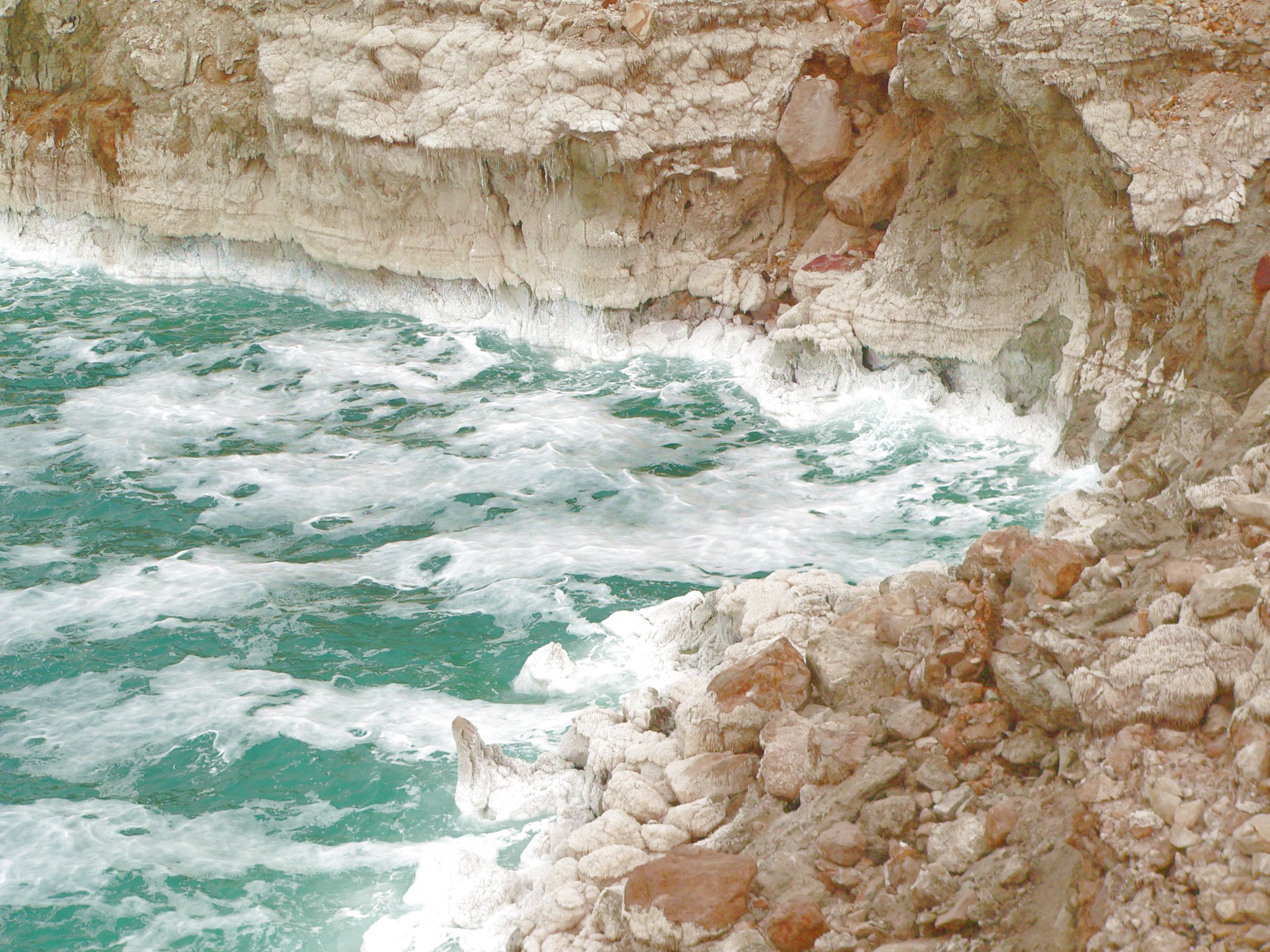
 The Dead Sea on a rough day, with salt deposits on cliffs.
 Main article: Environment of the Palestinian territories
- Climate of the Palestinian territories
- Environmental issues in the Palestinian territories
- Ecoregions in the Palestinian territories
- Renewable energy in the Palestinian territories
- Geology of the Palestinian territories
- Protected areas of the Palestinian territories
- Biosphere reserves in the Palestinian territories
- National parks of the Palestinian territories
- Wildlife of the Palestinian territories
- Flora of the Palestinian territories
- Fauna of the Palestinian territories
- Banded Newt
- Calopteryx syriaca
- Telescopus hoogstraali
- Birds of the Palestinian territories
- Mammals of the Palestinian territories
- Palestinian Environmental NGOs Network
Natural geographic features of the Palestinian territories
Main article: Landforms of the Palestinian territories- Glaciers of the Palestinian territories: N/A
- Islands of the Palestinian territories: N/A
- Lakes of the Palestinian territories
- Seas of the Palestinian territories
- Mountains of the Palestinian territories
- Volcanoes in the Palestinian territories
- Rivers of the Palestinian territories
- Jordan River
- Water politics in the Jordan River basin
- Headwater Diversion Plan (Jordan River)
- Water politics in the Jordan River basin
- Wadi Fa'rah
- Waterfalls of the Palestinian territories
- Jordan River
- Wells of the Palestinian territories
- Valleys of the Palestinian territories
- Jordan Rift Valley
- Wadi Qelt
- Villages named for Wadis ("Valleys")
- Wadi al-Arayis
- Wadi Ara, Haifa (depopulated in 1948)
- Wadi al-Far'a
- Wadi Fukin
Regions of the Palestinian territories
Main article: Regions of the Palestinian territoriesEcoregions of the Palestinian territories
Main articles: List of ecoregions in Palestine and Ecoregions in the Palestinian territoriesAdministrative divisions of the Palestinian territories
Main article: Administrative divisions of the Palestinian territoriesAdministrative divisions of the Palestinian National Authority
- Governorates of the Palestinian National Authority: 16 (11 in the West Bank, 5 in Gaza)
- Electorial districts of the Palestinian National Authority: 16 (11 in the West Bank, 5 in Gaza)
- Jerusalem Governorate: Jerusalem District
- Bethlehem Governorate: Bethlehem District
- Deir Al-Balah Governorate: Deir Al-Balah District
- Gaza Governorate: Gaza District
- Hebron Governorate: Hebron District
- Jenin Governorate: Jenin District
- Jericho Governorate: Jericho District
- Khan Yunis Governorate: Khan Younis District
- Nablus Governorate: Nablus District
- North Gaza Governorate: North Gaza District
- Qalqilya Governorate: Qalqilya District
- Rafah Governorate: Rafah District
- Ramallah and Al-Bireh Governorate: Ramallah and Al-Bireh District
- Salfit Governorate: Salfit District
- Tubas Governorate: Tubas District
- Tulkarm Governorate: Tulkarm District
- Electorial districts of the Palestinian National Authority: 16 (11 in the West Bank, 5 in Gaza)
- Cities under PNA administration
Demography of the Palestinian territories
Main article: Demographics of Palestine- Demographics of British Mandate Palestine (1918–1948)
- Demographics of the Palestinian territories
- Demographics of the Palestinian people
Government and politics of the Palestinian territories
- Main article: Government of the Palestinian territories and Politics of the Palestinian territories

- Form of government: semi-presidential parliamentary democracy[7]
- Capital of Palestine:
- Proclaimed capital: East Jerusalem (also proclaimed by Israel)
- de facto capital: Ramallah
- Elections in the Palestinian territories
- Elections of the Palestinian National Authority
- PNA governments
- Political parties of the Palestinian territories
- Political parties of the PNA
- Political parties of the PLO
- Political scandals of the Palestinian territories
- Taxation in the Palestinian territories
Branches of the government of the Palestinian territories
Executive branch of the PLO
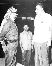 Yasser Arafat and Abu Jihad meet Gamal Abdel Nasser upon arrival in Cairo to attend first emergency Arab League summit, 1970
Executive branch of the PNA
- Palestinian Authority
- NB. As a result of the Fatah-Hamas conflict, there is a dispute over the Presidency and Prime Ministership of the Palestinian Authority.
- Ministries of the PNA
Legislative branches of the government of the Palestinian territories
- Palestinian Legislative Council (PNA, unicameral)
- Palestinian National Council (PLO, unicameral, parliament-in-exile[8])
Judicial branch of the government of the Palestinian territories
- According to the Constitution of Palestine, all courts relating to the country shall be independent.
Foreign relations of the Palestinian National Authority
Main article: Foreign relations of the Palestinian National Authority- Diplomatic missions in Palestine
- Holy See – Palestinian relations
- India-Palestine relations
- Iran-Palestine relations
- Palestine-Russia relations
- Pakistan-Palestine relations
- Romania-Palestine relations
Palestine and the United Nations
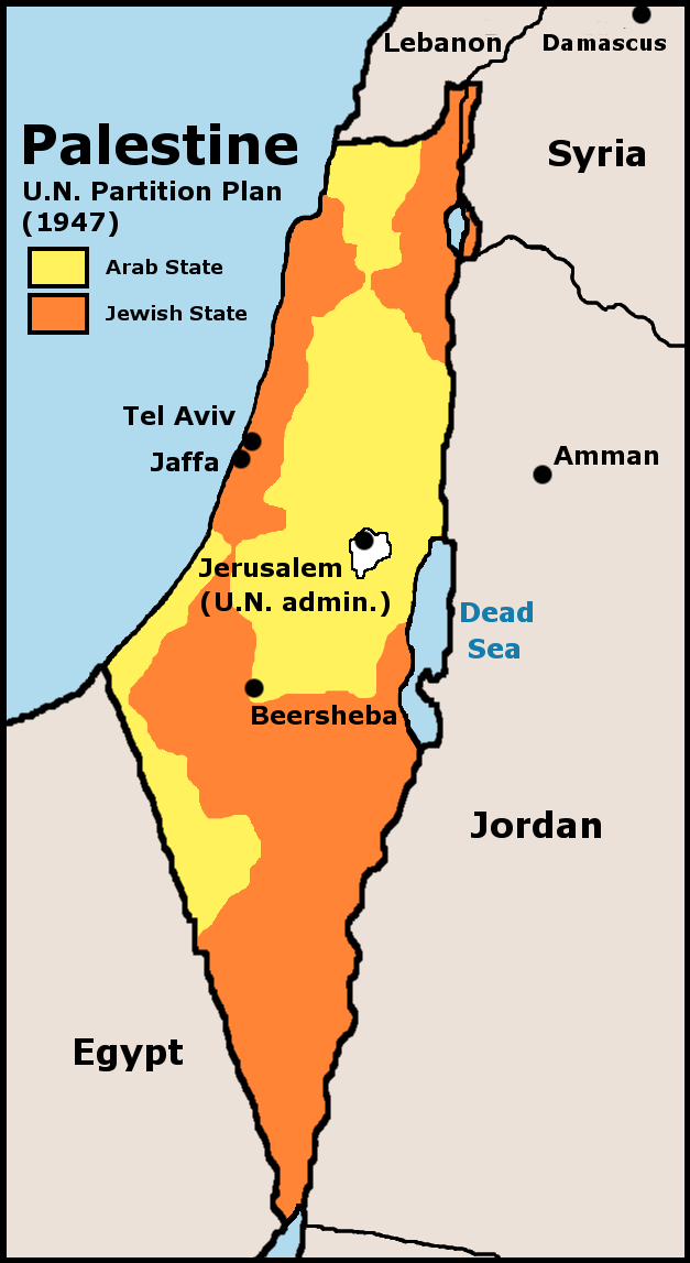
 UN 1947 partition plan for Palestine
- United Nations Partition Plan for Palestine
- United Nations Palestine Commission
- United Nations Relief and Works Agency for Palestine Refugees in the Near East (UNRWA)
- United Nations resolutions concerning Palestine
- United Nations Special Committee on Palestine (UNSCOP)
- United Nations Division for Palestinian Rights (UNDPR)
- Israel, Palestine, and the United Nations
International organization membership
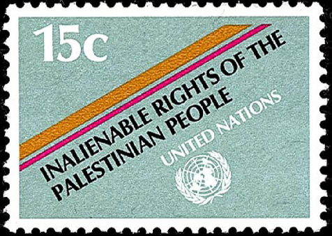
 UN stamp commemorating the inalienable rights of the Palestinian people
Palestine is a member in a number of international organizations. In others, it enjoys affiliation in a lesser capacity or under another designation (such as PLO or Occupied Palestinian Territory). In the list below, if the membership is not full or not for the state of Palestine, the type and name of affiliation is denoted in parentheses.
- Arab Fund for Economic and Social Development (AFESD)
- Arab League (AL)
- Arab Monetary Fund (AMF)
- Council of Arab Economic Unity (CAEU)
- FIFA (Asian Football Confederation (AFC)
- Group of 77 (G77)
- International Olympic Committee (IOC)
- International Trade Union Confederation (ITUC) (affiliate member)
- International Telecommunication Union (ITU) (non-voting observer status)
- International Organization for Standardization (ISO) (representation for 'Occupied Palestinian Territory' equivalent to that of a state)
- International Paralympic Committee (IPC)
- International Federation of Red Cross and Red Crescent Societies (IFRC)
- International Committee of the Red Cross (ICRC)
- Islamic Development Bank (IDC)
- Organisation of Islamic Cooperation (OIC)
- Non-Aligned Movement (NAM)
- United Nations (UN) (permanent observer with special privileges) (current representative:Riyad H. Mansour)
- UNESCO (observer status)
- Universal Postal Union (UPU) (special observer status)
- World Health Organization (WHO) (observer status for the PLO) (see also: Palestine's application to the WHO)
- World Intellectual Property Organization (WIPO)
International aid to the Palestinian territories
International solidarity movements
- Palestinian solidarity organizations
Law and order in the Palestinian territories
Main article: Palestinian Law A veteran of the Popular Front for the Liberation of Palestine (PFLP) in 1969, cleaning his rifle in Jordan. Palestinian fedayeen groups were driven out to Lebanon after Black September in Jordan.
- Capital punishment in the Palestinian territories
- Palestinian National Charter
- Crime in the Palestinian territories
- Human rights in the Palestinian territories
- Human rights in the Palestinian National Authority
- Freedom of religion in the Palestinian territories
- LGBT rights in the Palestinian territories
- Polygamy in the Palestinian territories
- Human rights organizations in the Palestinian territories
- Human rights record of Israel in the Occupied Palestinian Territories
- Israeli settlements, Palestinians, and human rights
- Israeli targeted killings
- Human rights in the Palestinian National Authority
- Law enforcement in the Palestinian territories
Military of the Palestinian territories
Main article: Military of the Palestinian territories- Command
- Commander-in-chief: N/A
- Ministry of Defence of the Palestinian territories: N/A
- Commander-in-chief: N/A
- Forces
- Army of the Palestinian territories: N/A
- Navy of the Palestinian territories: N/A
- Air Force of the Palestinian territories: N/A
- Special forces of the Palestinian territories:
- Military history of the Palestinian territories
- Military ranks of the Palestinian territories: N/A
Paramilitary forces of the PNA
Main article: Palestinian National Security Forces- Preventive Security Force
Irregular Palestinian forces
Main article: Palestinian political violenceSee also: Palestinian fedayeen- Al-Aqsa Martyrs' Brigades (armed wing affiliated with Fatah)
- al-Quds Brigades (armed wing of Palestinian Islamic Jihad)
- Izz ad-Din al-Qassam Brigades (armed wing of Hamas)
- Popular Front for the Liberation of Palestine - General Command (PFLP-GC) (armed wing of the PFLP)
- Popular Resistance Committees
- Palestinian domestic weapons production
- Qassam rocket
- al-Quds rocket
- Rocket and mortar attacks on southern Israel
- Yassin RPG
- Al-Bana RPG
- Batar RPG
Israeli military and intelligence forces
Main article: Israel Defense Forces- Central Command
- Coordinator of Government Activities in the Territories
- Israel Defense Forces checkpoint
- Paratroopers Brigade
- Shabak
International civilian forces
- European Union Border Assistance Mission Rafah
- European Union Police Mission for the Palestinian Territories
- Temporary International Presence in Hebron
Local government in the Palestinian territories
Main article: Local government in the Palestinian territoriesHistory of Palestine
- Main article: History of Palestine, Timeline of the history of Palestine, and Current events of Palestine

 Propaganda label issued by Fatah, 1968-1969
- Economic history of Palestine
- Postage stamps and postal history of Palestine
- Military history of Palestine
- Battle of Bitter Lakes (925 BCE)
- Siege of Gezer (c. 733 BCE)
- Siege of Gaza (332 BCE)
- Muslim conquest of Palestine (635 CE)
- Arab conquest of Roman Syria (634 - 638)
- Civil War in Palestine (793-796)
- Crusades (1095 - 1291)
- Battle of Wadi al-Khazandar (1299)
- Siege of Jaffa (1799)
- Siege of Acre (1799)
- 1834 Arab revolt in Palestine
- Sinai and Palestine Campaign (1915-1918)
- Battle of Megiddo (1918)
- 1920 Palestine riots
- Jaffa riots
- 1929 Palestine riots
- 1936–1939 Arab revolt in Palestine
- Bombing of Palestine in World War II
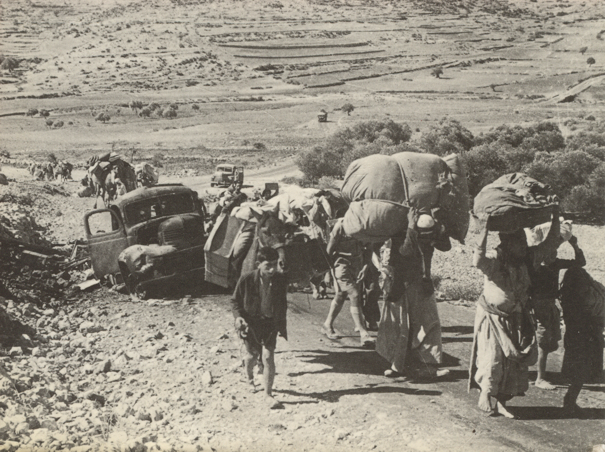
- 1948 Palestine war
- 1948 Palestinian exodus
- 1949-1956 Palestinian exodus
- Kfar Qasim massacre
- 1967 War
- 1967 Palestinian exodus
- Battle of Karameh
- Black September in Jordan (1970)
- 1982 Lebanon War
- Second Intifada (2000-ongoing)
- Gaza–Israel conflict
- Political history of Palestine
- Covenant of Umar I
- Jund Filastin
- Partitioning of the Ottoman Empire
- History of the Israeli–Palestinian conflict
- Palestine Jewish Colonization Association
- British Mandate Palestine
- Arab Higher Committee
- All-Palestine Government
- Palestine Liberation Organization
- Peace process in the Israeli–Palestinian conflict
- First Intifada
- Second Intifada
- Road map for peace
Palestinian culture
Main article: Palestinian culture
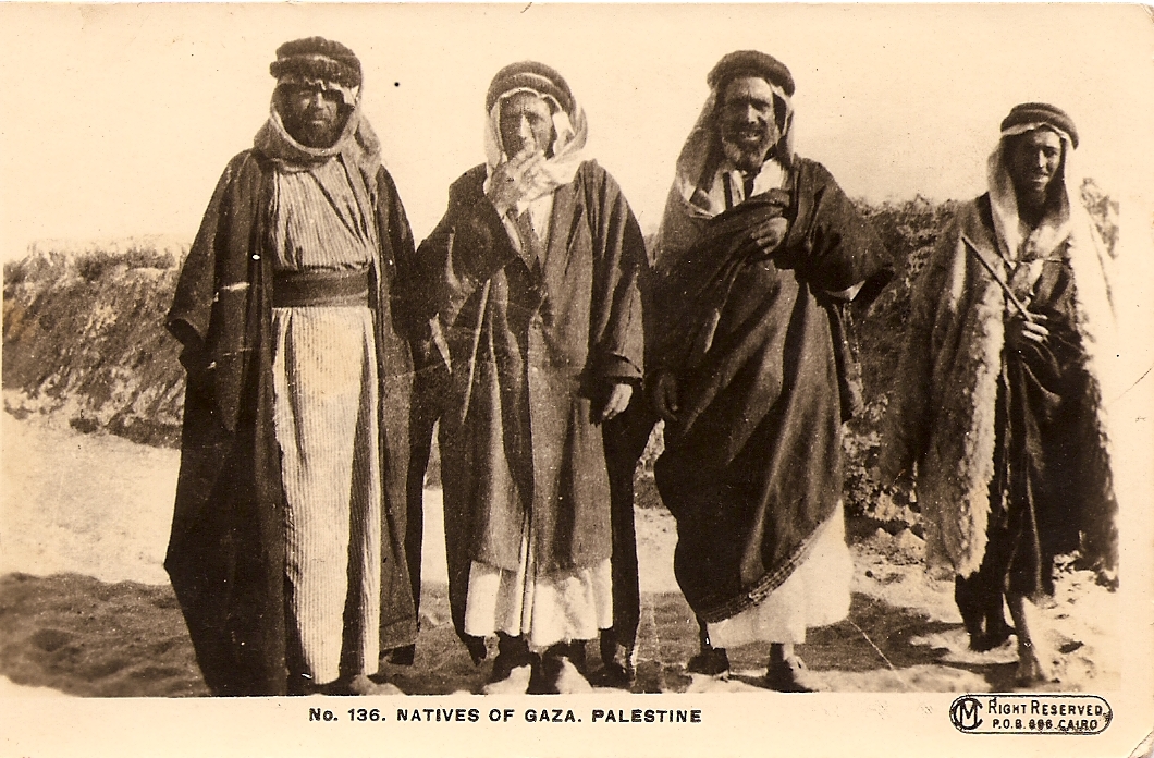
 Old postcard depicting a woman, in traditional Palestinian costume, and children from Ramallah, British Mandate of Palestine
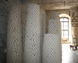
 200pxNabulsi soap, a Palestinian handicraft, stacked for drying in "Camel" factory in Nablus in 2008
 An artist's rendering of Palestinian pottery practices in Jaffa, Palestine in 1859, entitled, "The Potter and Wheel"
- Archaeology of the Palestinian territories
- Architecture of the Palestinian territories
- Abd al-Hadi Palace
- Hisham's Palace
- Jacir Palace
- Khan al-Tujjar (Nablus)
- Khirbat al-Minya
- Manara Clock Tower
- Qasr al-Basha
- Costume of the Palestinian territories
- Cuisine of the Palestinian territories
- Ethnic minorities in the Palestinian territories
- Festivals of the Palestinian territories
- Al-Quds Capital of Arab Culture
- Boston Palestine Film Festival
- Chicago Palestine Film Festival
- Feast of Saint George
- Khader Grape Festival
- Thursday of the Dead
- Palestine Festival of Literature
- Nabi Musa (pre-1948)
- Nabi Rubin (pre-1948)
- Al-Nabi Yusha' (pre-1948)
- Humor in Palestine
- Languages of the Palestinian territories
- Media in the Palestinian territories
- Print media of the Palestinian territories
- Palestinian Broadcasting Corporation
- Radio in Palestine
- Television in the Palestinian territories
- Al Aqsa TV
- Palestinian Satellite Channel
- National symbols of Palestine
- Coat of arms of Palestine
- Palestinian Flag
- Flag of the British Mandate of Palestine
- Keffiyeh
- National anthem of Palestine
- Palestinian nationalism
- Sumud
- Palestinians
- Prostitution in the Palestinian territories
- National holidays of the Palestinian territories
- Records of the Palestinian territories
- Religion in the Palestinian territories
- Christianity in the Palestinian territories
- Eastern Orthodox
- Oriental Orthodoxy
- Armenian Patriarch of Jerusalem
- Latin Rite
- Latin Patriarch of Jerusalem
- Church of Saint Lazarus
- Latin Patriarch of Jerusalem
- Eastern Catholic Churches
- Anglican Communion
- Protestantism
- Church of the Holy Sepulcher
- Druzism in the Palestinian territories
- Islam in the Palestinian territories
- Waqf
- Jerusalem Islamic Waqf
- Moroccan Quarter
- Sabil Abu Nabbut
- List of mosques in Israel and the Palestinian territories
- Great Mosque of Gaza
- Great Mosque of Nablus
- Al-Hamadiyya Mosque
- Ibn Marwan Mosque
- Ibn Uthman Mosque
- Al-Khadra Mosque
- Mahmoudiya Mosque
- Mosque of Omar (Bethlehem)
- An-Nasr Mosque
- Sayed al-Hashim Mosque
- Sultan Ibrahim Ibn Adham Mosque
- Umm al-Naser Mosque
- Welayat Mosque
- Supreme Muslim Council
- Waqf
- Sites holy to Christians, Jews, and Muslims
- Cave of the Patriarchs (Al-Haram Al-Ibrahimi)
- Joseph's Tomb
- Jacob's Well (also holy to Samaritans)
- Rachel's Tomb (Bilal ibn Rabah)
- Tomb of Samuel (Nabi Samwil)
- Judaism in Palestine
- Palestinian synagogues
- Ancient Synagogue of Gaza
- Samaritans in Palestine
- Christianity in the Palestinian territories
Art in the Palestinian territories
- Art in the Palestinian territories
- Museums in the Palestinian territories
- Cinema of the Palestinian territories
- Handicrafts of the Palestinian territories
- Literature of the Palestinian territories
- Music of the Palestinian territories
- Theatre in the Palestinian territories
Sports and leisure in the Palestinian territories
Main article: Sports and leisure in the Palestinian territories- Football in the Palestinian territories
- Palestine national football team
- Palestinian Football Federation
- Faisal Al-Husseini International Stadium
- Palestine Stadium
- Hammams (bathhouses)
- Hamam al-Sammara
- Palestine Olympic Committee
- Palestine at the Paralympics
- Palestinian Scout Association
- Girl Guides of Palestine
Economy and infrastructure of the Palestinian territories
Main article: Economy of the Palestinian territories The Palestine pound, the currency of British Mandate Palestine
 Logo of the Taybeh Beer company
 The logo of the Palestine Securities Exchange
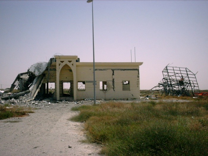
 The Yasser Arafat International Airport in Gaza. Severely damaged by an Israeli airstrike in 2001, the airport has remained closed ever since.
- Economic rank, by nominal GDP (2007): 134th (one hundred and thirty fourth)
- Agriculture in the Palestinian territories
- Banking in the Palestinian territories
- Arab Bank
- National Bank of Palestine
- Communications in the Palestinian territories
- Internet in the Palestinian territories
- Telephone numbers in the Palestinian territories
- Companies of the Palestinian territories
- National Trade Union of Palestine
- Fair Trade organizations in the Palestinian territories
- Canaan Fair Trade
- Palestine Fair Trade Association
- Zaytoun
- Currency of Palestine: Dinar/Sheqel
- Economic history of Palestine
- Gold Market
- Palestine pound
- Economy of Gaza
- Energy in the Palestinian territories
- Energy policy of the Palestinian territories
- Oil industry in the Palestinian territories
- Health care in the Palestinian territories
- Palestine Red Crescent Society
- Augusta Victoria Hospital
- Al-Shifa Hospital
- Housing in the Palestinian territories
- Mining in the Palestinian territories
- Public squares in the Palestinian territories
- Manger Square
- Palestine Square
- Soldier's Square
- Tourism in the Palestinian territories
- Transport in the Palestinian territories
- Airports in the Palestinian territories
- RAF Haifa (1942–1948) (now Haifa Airport in Israel)
- Wilhelma Airport (1936–1948) (now Ben-Gurion Airport in Israel)
- Yasser Arafat International Airport (1998–2001)
- Rail transport in the Palestinian territories
- Palestine Railway (1891–1948)
- Port of Gaza
- Roads in the Palestinian territories
- Highway 57
- Omar Mukhtar Street
- Star Street
- Wehda Street
- Airports in the Palestinian territories
- Water supply and sanitation in the Palestinian territories
- Palestine Stock Exchange
Education in the Palestinian territories

 Main article: Education in the Palestinian territories
- Education Minister of the Palestinian National Authority
- Universities and colleges of the Palestinian territories
- Student organizations in the Palestinian territories
- Student organizations for the Palestinian territories
- Palestinian cultural club
- Palestine Solidarity Movement
- Solidarity for Palestinian Human Rights
- Students for Justice in the Palestinian territories
- Students for the Palestinian territories
Books on the Palestinian territories
- Correcting a Mistake: Jews and Arabs in Palestine/Israel, 1936-1956
- The Ethnic Cleansing of Palestine
- Palestine (comics)
- Palestine Peace Not Apartheid
- Underground to Palestine
See also
Main article: Palestine- Index of Palestine-related articles
- List of international rankings
- List of Palestine-related topics
- Years in the Palestinian territories
- Outline of Asia
- Outline of geography
- Outline of Israel
References
- ^ Paragraph IV of the 1993 Declaration of Principles, which is part of the Oslo Accords, full text on the BBC News website.
- ^ "The Palestine Exploration Fund". The Palestine Exploration Fund. http://www.pef.org.uk/oldsite/Paldef.htm. Retrieved 2008-04-04.
- ^ Said and Hitchens, 2001, p. 199.
- ^ There are contradicting reports about the actual number ranging from 67 [1] to about 100
- ^ Forji Amin George (June 2004). "Is Palestine a State?". Expert Law. http://www.expertlaw.com/library/international_law/palestine.html. Retrieved 2008-04-04.
- ^ Milton-Edwards, 2008, p. 5.
- ^ a b Martijn Schoonvelde (26 June 2009). "Palestinian Territories". http://www.europeanforum.net/country/palestinian_territories. Retrieved 2009-07-26.
- ^ Sela and Ma'oz, 1997, p. 16.
Bibliography
- Roberto Remo Bissio, ed (1995). The world: a Third World guide 1995-96 (Illustrated ed.). Instituto del Tercer Mundo. ISBN 0855982918, 9780855982911.
- Milton-Edwards, Beverley (2008), The Israeli-Palestinian Conflict: A People's War (Illustrated ed.), Taylor & Francis, ISBN 0415410436, 9780415410434
- Kogan Page (2004). Middle East Review (27th, illustrated ed.). Kogan Page Publishers. ISBN 074944066X, 9780749440664. http://books.google.ca/books?id=NYszJtC66FAC&pg=PA161&dq=%22official+name%22+palestine&lr=#v=onepage&q=%22official%20name%22%20palestine&f=false.
- Said, Edward W.; Hitchens, Christopher (2001), Blaming the victims: spurious scholarship and the Palestinian question (2nd, illustrated ed.), Verso, ISBN 1859843409, 9781859843406
- Sela, Avraham; Ma'oz, Moshe (1997), The PLO and Israel: from armed conflict to political solution, 1964-1994 (Illustrated ed.), Palgrave Macmillan, ISBN 0312129068, 9780312129064, http://books.google.ca/books?id=0OisRvSZIiAC&pg=PA16&lpg=PA16&dq=%22PLO%22+%22parliament-in-exile%22&source=bl&ots=IbA51ymG6I&sig=f72QyD5xQPCnqRA-3lfhfagVwh0&hl=en&ei=hzJsSuu7JJahjAeCweG2Cw&sa=X&oi=book_result&ct=result&resnum=9
External links
- The Hope Simpson Report (London, 1930) [5]
- Palestine Royal Commission Report (the Peel Report) (London, 1937) [6]
- Report to the Council of the League of Nations (1928) [7]
- Report to the Council of the League of Nations (1929) [8]
- Report to the Council of the League of Nations (1934) [9]
- Report to the Council of the League of Nations (1935) [10]
- www.mideastweb.org - A website with a wealth of statistics regarding population in Palestine
- Coins and Banknotes of Palestine under the British Mandate
- WorldStatesmen- Maps, flags, chronology, see Israel and Palestinian National Authority
- hWeb - Israel-Palestine in Maps
- Palestine Fact Sheet from the Common Language Project
- 1911 Encyclopedia description of Palestine
- Liberal Democrat Friends of Palestine
- History of the Palestine Problem, UN website
- Maps
- Sykes-Picot Agreement, 1916
- 1947 UN Partition Plan
- 1949 Armisitice Lines
- Israel After 1949 Armistice Agreements
- Liberal Democrat Friends of Palestine
Outlines General reference · Culture and the arts · Geography and places · Health and fitness · History and events · Mathematics and logic · Natural and physical sciences · People and self · Philosophy and thinking · Religion and belief systems · Society and social sciences · Technology and applied sciences Arab towns and villages depopulated during the 1948 Palestine War
Acre al-Amqa · Arab al-Samniyya · al-Bassa · al-Birwa · al-Damun · Dayr al-Qassi · al-Ghabisiyya · Iqrit · Iribbin · Jiddin · al-Kabri · Kafr 'Inan · Kuwaykat · al-Manshiyya · al-Mansura · Mi'ar · al-Nabi Rubin · al-Nahr · al-Ruways · Suhmata · al-Sumayriyya · Suruh · al-Tall · Tarbikha · Umm al-Faraj · al-Zeeb
Baysan Arab al-'Arida · Arab al-Bawati · Arab al-Safa · al-Ashrafiyya · al-Bira · Beisan · Danna · Farwana · al-Fatur · al-Ghazzawiyya · al-Hamidiyya · al-Hamra · Jabbul · Kafra · Kawkab al-Hawa · al-Khunayzir · Masil al-Jizl · al-Murassas · Qumya · al-Sakhina · al-Samiriyya · Sirin · Tall al-Shawk · al-Taqa · al-Tira · Umm 'Ajra · Umm Sabuna, Khirbat · Yubla · Zab'a · al-Zawiya
Beersheba Gaza Arab Suqrir · Barbara · Barqa · al-Batani al-Gharbi · al-Batani al-Sharqi · Bayt 'Affa · Bayt Daras · Bayt Jirja · Bayt Tima · Bil'in · Burayr · Dayr Sunayd · Dimra · al-Faluja · Hamama · Hatta · Hiribya · Huj · Hulayqat · Ibdis · Iraq al-Manshiyya · Iraq Suwaydan · Isdud · al-Jaladiyya · al-Jiyya · Julis · al-Jura · Jusayr · Karatiyya · Kawfakha · Kawkaba · al-Khisas · al-Masmiyya al-Kabira · al-Masmiyya al-Saghira · al-Muharraqa · Najd · Ni'ilya · Qastina · al-Sawafir al-Gharbiyya · al-Sawafir al-Shamaliyya · al-Sawafir al-Sharqiyya · Simsim · Summil · Tall al-Turmus · Yasur
Haifa Abu Shusha · Abu Zurayq · Arab al-Fuqara · Arab al-Nufay'at · Arab Zahrat al-Dumayri · 'Atlit · Ayn Ghazal · Ayn Hawd · Balad ash-Sheikh · Barrat Qisarya · Burayka · al-Burj · al-Butaymat · Daliyat al-Rawha' · al-Dumun · al-Ghubayya al-Fawqa · al-Ghubayya al-Tahta · Hawsha · Ijzim · Jaba' · al Jalama · Kabara · al-Kafrayn · Kafr Lam · al-Kasayir · Khubbayza · Lid · al-Manara · al-Mansi · al-Mansura · al-Mazar · Naghnaghiya · Qamun · Qannir · Qira · Qisarya · Qumbaza · al-Rihaniyya · Sabbarin · al-Sarafand · Khirbat al-Sarkas · Khirbat Sa'sa' · al-Sawamir · Khirbat al-Shuna · al-Sindiyana · al-Tantura · al-Tira · Umm al-Shawf · Umm al-Zinat · Wa'arat al-Sarris · Wadi Ara · Yajur
Hebron 'Ajjur · Barqusya · Bayt Jibrin · Bayt Nattif · al-Dawayima · Deir al-Dubban · Dayr Nakhkhas · Kudna · Mughallis · al-Qubayba · Ra'na · Tell es-Safi · Umm Burj · az-Zakariyya · Zayta · Zikrin
Jaffa al-'Abbasiyya · Abu Kabir · Abu Kishk · Bayt Dajan · Biyar 'Adas · Fajja · al-Haram · Ijlil al-Qibliyya · Ijlil al-Shamaliyya · al-Jammasin al-Gharbi · al-Jammasin al-Sharqi · Jarisha · Kafr 'Ana · al-Khayriyya · al-Mas'udiyya · al-Mirr · al-Muwaylih · Rantiya · al-Safiriyya · Salama · Saqiya · al-Sawalima · al-Shaykh Muwannis · Yazur
Jerusalem Allar · Aqqur · Artuf · Bayt 'Itab · Bayt Mahsir · Bayt Naqquba · Bayt Thul · Bayt Umm al-Mays · al-Burayj · Dayr Aban · Dayr 'Amr · Dayr al-Hawa · Dayr Rafat · Dayr al-Shaykh · Deir Yassin · Ayn Karim · Ishwa · Islin · Ism Allah · Jarash · al-Jura · Kasla · al-Lawz · Lifta · al-Maliha · Nitaf · al-Qabu · Qalunya · al-Qastal · Ras Abu 'Ammar · Sar'a · Saris · Sataf · Sheikh Badr · Suba · Sufla · al-Tannur · al-'Umur · al-Walaja
Jenin Nazareth Indur · Ma'alul · al-Mujaydil · Saffuriyya
Ramla Abu al-Fadl · Abu Shusha · Ajanjul · Aqir · Barfiliya · al-Barriyya · Bashshit · Bayt Far · Bayt Jiz · Bayt Nabala · Bayt Shanna · Bayt Susin · Bir Ma'in · Bir Salim · al-Burj · al-Buwayra · Daniyal · Dayr Abu Salama · Dayr Ayyub · Dayr Muhaysin · Dayr Tarif · al-Duhayriyya · al-Haditha · Idnibba · Innaba · Jilya · Jimzu · Kharruba · al-Khayma · Khulda · al-Kunayyisa · al-Latrun · Lydda · al-Maghar · Majdal Yaba · al-Mansura · al-Mukhayzin · al-Muzayri'a · al-Na'ani · an-Nabi Rubin · Qatra · Qazaza · al-Qubab · al-Qubayba · Qula · Ramla · Sajad · Salbit · Sarafand al-Amar · Sarafand al-Kharab · Saydun · Shahma · Shilta · al-Tina · al-Tira · Umm Kalkha · Wadi Hunayn · Yibna · Zakariyya · Zarnuqa
Safad Abil al-Qamh · al-'Abisiyya · 'Akbara · Alma · Ammuqa · Arab al-Shamalina · Arab al-Zubayd · Ayn al-Zaytun · Baysamun · Biriyya · al-Butayha · al-Buwayziyya · Dallata · al-Dawwara · Dayshum · al-Dirbashiyya · al-Dirdara · Fara · al-Farradiyya · Fir'im · Ghabbatiyya · Ghuraba · al-Hamra' · Harrawi · Hunin · al-Husayniyya · Jahula · al-Ja'una · Jubb Yusuf · Kafr Bir'im · al-Khalisa · Khan al-Duwayr · Karraza, Khirbat · al-Khisas · Khiyam al-Walid · Kirad al-Baqqara · Kirad al-Ghannama · Lazzaza · Madahil · Al-Malkiyya · Mallaha · al-Manshiyya · al-Mansura · Mansurat al-Khayt · Marus · Meiron · al-Muftakhira · Mughr al-Khayt · al-Muntar · al-Nabi Yusha' · al-Na'ima · Qabba'a · Qadas · Qaddita · Qaytiyya · al-Qudayriyya · al-Ras al-Ahmar · Sabalan · Safsaf · Saliha · al-Salihiyya · al-Sammu'i · al-Sanbariyya · Sa'sa' · al-Shawka al-Tahta · al-Shuna · Taytaba · Tulayl · al-'Ulmaniyya · al-'Urayfiyya · al-Wayziyya · Yarda, Safad · al-Zahiriyya al-Tahta · al-Zanghariyya · al-Zawiya · al-Zuq al-Fawqani · al-Zuq al-Tahtani
Tiberias Awlam · al-Dalhamiyya · Ghuwayr Abu Shusha · Hadatha · al-Hamma · Hittin · Kafr Sabt · Lubya · Ma'dhar · al-Majdal · al-Manara · al-Manshiyya · al-Mansura · Nasir al-Din · Nimrin · al-Nuqayb · Samakh · al-Samakiyya · al-Samra · al-Shajara · al-Tabigha · al-'Ubaydiyya · al-Wa'ra al-Sawda', Khirbat · Yaquq
Tulkarm Khirbat Bayt Lid · Bayyarat Hannun · Fardisya · Ghabat Kafr Sur · al Jalama · Kafr Saba · al-Majdal · al-Manshiyya · Miska · Qaqun · Raml Zayta · Tabsur · Umm Khalid · Wadi al-Hawarith · Wadi Qabbani · al-Zabadida · Khirbat Zalafa
Categories:- Outlines of countries
- Palestinian territories
- Palestine-related lists


Wikimedia Foundation. 2010.