- Sarafand al-Amar
-
Sarafand al-Amar 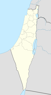
 Sarafand al-Amar
Arabic صرفند العمار Also Spelled Sarafand al-Kubra District Ramla Coordinates 31°57′34.13″N 34°50′57.46″E / 31.9594806°N 34.8492944°ECoordinates: 31°57′34.13″N 34°50′57.46″E / 31.9594806°N 34.8492944°E Population 1,950[1] (1945) Area 13,267 dunums 13.3 km²
Date of depopulation Not known[2] Cause(s) of depopulation Current localities Zerifin and Nir Zevi Sarafand al-Amar (Arabic: صرفند العمار) was a Palestinian Arab village situated on the coastal plain of Palestine, about 5 kilometers (3.1 mi) northwest of Ramla. It had a population of 1,950 in 1945 and a land area of 13,267 dunams.[1] It was depopulated during the 1948 Arab-Israeli War.[3]
Contents
History
Ottoman era
Sarafand al-Amar was also known as Sarafand al-Kubra ("the larger Sarafand") to distinguish it from its nearby sister village, Sarafand al-Sughra ("the smaller Sarafand"). In 1596, Sarafand al-Kubra was under the administration of the nahiya ("subdistrict") of Ramla, part of the Liwa of Gaza. had a population of 358. It paid taxes on wheat, barley, sesame, fruit, orchards, beehives, and goats. The Egyptian Sufi traveler Mustafa al-Dumyuti al-Luqaymi (d. 1764) reported visiting the shrine of Luqman (Luke) in Sarafand.[3]
In 1838, Edward Robinson reported that there were two villages by the name of Sarafand in the area, one of which was inhabited and the other ruined. Thus, it may be that Sarafand al-Kubra became also known as "Sarafand al-Amar" from the Arabic 'amara meaning "to build up; populate". When the authors of the Survey of Western Palestine passed through the area in the 1870s they noticed only Sarafand al-Amar. They said it was a village built of adobe bricks and situated on rising ground; a few olive trees were scattered around it.[3]
British Mandate period
See also: Surafend affairIn December 1918, after World War I but prior to the British Mandate of Palestine, New Zealand and Australian soldiers from the Anzac Mounted Division camped near the village massacred its inhabitants as retribution for the murder of a New Zealand soldier. Between 40 and 120 people are believed to have been killed in the massacre, and many houses in the village were burnt to the ground.[4]
In the British Mandate period (1920–1948), the British Army established their largest military base in the Middle East near Sarafand al-Amar and built the village up significantly. The British also built a prison, under the name of Sarafand, for Palestinian nationalist activists next to the base. Sarafand al-Amar was laid out in the shape of a rectangle and its houses were made of mud. There were 265 houses in the village in 1931. The population consisted of 1,910 Muslims and 40 Christians.[3]
Sarafand al-Amar was the site of a popular shrine for Luqman al-Hakim (Luke the Wise). The village had two elementary schools, one for boys and one for girls. The boy's school was founded in 1921 and became a full elementary school in 1946-47 with an enrollment of 292 students. The girls' school was founded in 1947 and had an enrollment of 50 students. Adjacent to it was the al-Raja ("Hope") Orphanage set up for the children of Palestinians killed during the 1936-1939 Arab revolt in Palestine. In addition, Sarafand had a public hospital and an agricultural station.[3]
Agriculture was the main economic activity, with citrus being the main crop. In 1944-45, a total of 3,059 dunams were devoted to citrus and bananas and 4,012 dunams were allocated to grains; 1,655 dunams were irrigated or used for orchards. The orchards were irrigated from artesian wells, while the rest of the crops were rain-fed. Artesian wells also provided drinking water.[3][5]
1948 War and aftermath
On the morning of January 2, 1948, Arab workers at the British Army camp in Sarafand al-Amar discovered twelve timed charges set to explode at noon, a time when they would have been lined up to collect their wages. The Palestinian newspaper Filastin noted that none of the Jewish workers in the camp had reported to work that day, implying that Zionist groups had warned them of an attack.[3]
On April 15, 1948, a group of Haganah sappers carried out a raid on the village. According to a New York Times report, the attackers penetrated "deep into Arab territory" and demolished a three-storey building. British authorities stated that 16 people were killed and 12 wounded in the destruction of the building. The Haganah charged that the building was used by the Holy War Army of Hasan Salama, Palestinian guerrilla commander of the Jaffa district, and that 39 people were killed in the raid.[3]
As the British Army evacuated Palestine in mid-May, they allowed Arab forces to take over the military base on May 14. According to the Haganah, a "small, semi-regular" Arab unit positioned there, but were driven out by two prolonged attacks from the southeast and the north; the Arab unit's defensive formation was only prepared for an attack from the Jewish town of Rishon LeZion in the west. No casualties were reported. Sarafand al-Amar was most likely captured on May 19-20 by the Second Battalion of the Givati Brigade during Operation Barak. The residents probably fled or were evicted at the same time.[6]
Israel established the Tzrifin IDF military base on the ruins of Sarafand al-Amar and the British military base in 1949, and the town of Nir Tzvi was built on village lands in 1954. According to Palestinian historian Walid Khalidi, "the site, which contains what may be the largest Israeli army camp as well as an airbase, has been designated as a military base. No more than six houses remain; most of them are deserted, but one or two are occupied by Israelis. The school is also deserted..."[6]
References
Bibliography
- Hadawi, Sami (1970), Village Statistics of 1945: A Classification of Land and Area ownership in Palestine, Palestine Liberation Organization Research Center, http://www.palestineremembered.com/Articles/General-2/Story3150.html
- Khalidi, Walid (1992), All That Remains, Washington D.C.: Institute for Palestine Studies, ISBN 0-88728-224-5
- Morris, Benny (2004). The Birth of the Palestinian Refugee Problem Revisited. Cambridge University Press. ISBN 9780521009676. http://books.google.com/?id=uM_kFX6edX8C&printsec=frontcover&dq=benny+morris&q.
External links
Arab towns and villages depopulated during the 1948 Palestine War Acre al-Amqa · Arab al-Samniyya · al-Bassa · al-Birwa · al-Damun · Dayr al-Qassi · al-Ghabisiyya · Iqrit · Iribbin · Jiddin · al-Kabri · Kafr 'Inan · Kuwaykat · al-Manshiyya · al-Mansura · Mi'ar · al-Nabi Rubin · al-Nahr · al-Ruways · Suhmata · al-Sumayriyya · Suruh · al-Tall · Tarbikha · Umm al-Faraj · al-Zeeb
Baysan Arab al-'Arida · Arab al-Bawati · Arab al-Safa · al-Ashrafiyya · al-Bira · Beisan · Danna · Farwana · al-Fatur · al-Ghazzawiyya · al-Hamidiyya · al-Hamra · Jabbul · Kafra · Kawkab al-Hawa · al-Khunayzir · Masil al-Jizl · al-Murassas · Qumya · al-Sakhina · al-Samiriyya · Sirin · Tall al-Shawk · al-Taqa · al-Tira · Umm 'Ajra · Umm Sabuna, Khirbat · Yubla · Zab'a · al-Zawiya
Beersheba Gaza Arab Suqrir · Barbara · Barqa · al-Batani al-Gharbi · al-Batani al-Sharqi · Bayt 'Affa · Bayt Daras · Bayt Jirja · Bayt Tima · Bil'in · Burayr · Dayr Sunayd · Dimra · al-Faluja · Hamama · Hatta · Hiribya · Huj · Hulayqat · Ibdis · Iraq al-Manshiyya · Iraq Suwaydan · Isdud · al-Jaladiyya · al-Jiyya · Julis · al-Jura · Jusayr · Karatiyya · Kawfakha · Kawkaba · al-Khisas · al-Masmiyya al-Kabira · al-Masmiyya al-Saghira · al-Muharraqa · Najd · Ni'ilya · Qastina · al-Sawafir al-Gharbiyya · al-Sawafir al-Shamaliyya · al-Sawafir al-Sharqiyya · Simsim · Summil · Tall al-Turmus · Yasur
Haifa Abu Shusha · Abu Zurayq · Arab al-Fuqara · Arab al-Nufay'at · Arab Zahrat al-Dumayri · 'Atlit · Ayn Ghazal · Ayn Hawd · Balad ash-Sheikh · Barrat Qisarya · Burayka · al-Burj · al-Butaymat · Daliyat al-Rawha' · al-Dumun · al-Ghubayya al-Fawqa · al-Ghubayya al-Tahta · Hawsha · Ijzim · Jaba' · al Jalama · Kabara · al-Kafrayn · Kafr Lam · al-Kasayir · Khubbayza · Lid · al-Manara · al-Mansi · al-Mansura · al-Mazar · Naghnaghiya · Qamun · Qannir · Qira · Qisarya · Qumbaza · al-Rihaniyya · Sabbarin · al-Sarafand · Khirbat al-Sarkas · Khirbat Sa'sa' · al-Sawamir · Khirbat al-Shuna · al-Sindiyana · al-Tantura · al-Tira · Umm al-Shawf · Umm al-Zinat · Wa'arat al-Sarris · Wadi Ara · Yajur
Hebron 'Ajjur · Barqusya · Bayt Jibrin · Bayt Nattif · al-Dawayima · Deir al-Dubban · Dayr Nakhkhas · Kudna · Mughallis · al-Qubayba · Ra'na · Tell es-Safi · Umm Burj · az-Zakariyya · Zayta · Zikrin
Jaffa al-'Abbasiyya · Abu Kabir · Abu Kishk · Bayt Dajan · Biyar 'Adas · Fajja · al-Haram · Ijlil al-Qibliyya · Ijlil al-Shamaliyya · al-Jammasin al-Gharbi · al-Jammasin al-Sharqi · Jarisha · Kafr 'Ana · al-Khayriyya · al-Mas'udiyya · al-Mirr · al-Muwaylih · Rantiya · al-Safiriyya · Salama · Saqiya · al-Sawalima · al-Shaykh Muwannis · Yazur
Jerusalem Allar · Aqqur · Artuf · Bayt 'Itab · Bayt Mahsir · Bayt Naqquba · Bayt Thul · Bayt Umm al-Mays · al-Burayj · Dayr Aban · Dayr 'Amr · Dayr al-Hawa · Dayr Rafat · Dayr al-Shaykh · Deir Yassin · Ayn Karim · Ishwa · Islin · Ism Allah · Jarash · al-Jura · Kasla · al-Lawz · Lifta · al-Maliha · Nitaf · al-Qabu · Qalunya · al-Qastal · Ras Abu 'Ammar · Sar'a · Saris · Sataf · Sheikh Badr · Suba · Sufla · al-Tannur · al-'Umur · al-Walaja
Jenin Nazareth Indur · Ma'alul · al-Mujaydil · Saffuriyya
Ramla Abu al-Fadl · Abu Shusha · Ajanjul · Aqir · Barfiliya · al-Barriyya · Bashshit · Bayt Far · Bayt Jiz · Bayt Nabala · Bayt Shanna · Bayt Susin · Bir Ma'in · Bir Salim · al-Burj · al-Buwayra · Daniyal · Dayr Abu Salama · Dayr Ayyub · Dayr Muhaysin · Dayr Tarif · al-Duhayriyya · al-Haditha · Idnibba · Innaba · Jilya · Jimzu · Kharruba · al-Khayma · Khulda · al-Kunayyisa · al-Latrun · Lydda · al-Maghar · Majdal Yaba · al-Mansura · al-Mukhayzin · al-Muzayri'a · al-Na'ani · an-Nabi Rubin · Qatra · Qazaza · al-Qubab · al-Qubayba · Qula · Ramla · Sajad · Salbit · Sarafand al-Amar · Sarafand al-Kharab · Saydun · Shahma · Shilta · al-Tina · al-Tira · Umm Kalkha · Wadi Hunayn · Yibna · Zakariyya · Zarnuqa
Safad Abil al-Qamh · al-'Abisiyya · 'Akbara · Alma · Ammuqa · Arab al-Shamalina · Arab al-Zubayd · Ayn al-Zaytun · Baysamun · Biriyya · al-Butayha · al-Buwayziyya · Dallata · al-Dawwara · Dayshum · al-Dirbashiyya · al-Dirdara · Fara · al-Farradiyya · Fir'im · Ghabbatiyya · Ghuraba · al-Hamra' · Harrawi · Hunin · al-Husayniyya · Jahula · al-Ja'una · Jubb Yusuf · Kafr Bir'im · al-Khalisa · Khan al-Duwayr · Karraza, Khirbat · al-Khisas · Khiyam al-Walid · Kirad al-Baqqara · Kirad al-Ghannama · Lazzaza · Madahil · Al-Malkiyya · Mallaha · al-Manshiyya · al-Mansura · Mansurat al-Khayt · Marus · Meiron · al-Muftakhira · Mughr al-Khayt · al-Muntar · al-Nabi Yusha' · al-Na'ima · Qabba'a · Qadas · Qaddita · Qaytiyya · al-Qudayriyya · al-Ras al-Ahmar · Sabalan · Safsaf · Saliha · al-Salihiyya · al-Sammu'i · al-Sanbariyya · Sa'sa' · al-Shawka al-Tahta · al-Shuna · Taytaba · Tulayl · al-'Ulmaniyya · al-'Urayfiyya · al-Wayziyya · Yarda, Safad · al-Zahiriyya al-Tahta · al-Zanghariyya · al-Zawiya · al-Zuq al-Fawqani · al-Zuq al-Tahtani
Tiberias Awlam · al-Dalhamiyya · Ghuwayr Abu Shusha · Hadatha · al-Hamma · Hittin · Kafr Sabt · Lubya · Ma'dhar · al-Majdal · al-Manara · al-Manshiyya · al-Mansura · Nasir al-Din · Nimrin · al-Nuqayb · Samakh · al-Samakiyya · al-Samra · al-Shajara · al-Tabigha · al-'Ubaydiyya · al-Wa'ra al-Sawda', Khirbat · Yaquq
Tulkarm Khirbat Bayt Lid · Bayyarat Hannun · Fardisya · Ghabat Kafr Sur · al Jalama · Kafr Saba · al-Majdal · al-Manshiyya · Miska · Qaqun · Raml Zayta · Tabsur · Umm Khalid · Wadi al-Hawarith · Wadi Qabbani · al-Zabadida · Khirbat Zalafa
Categories:- Arab villages depopulated during the 1948 Arab–Israeli War
- District of Ramla

Wikimedia Foundation. 2010.