- North Ferriby
-
For the football club, see North Ferriby United A.F.C..
Coordinates: 53°43′12″N 0°30′28″W / 53.720029°N 0.507805°W
North Ferriby 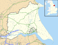
 North Ferriby
North Ferriby shown within the East Riding of YorkshirePopulation 3,819 (2001 census)[1] OS grid reference SE985258 Parish North Ferriby Unitary authority East Riding of Yorkshire Ceremonial county East Riding of Yorkshire Region Yorkshire and the Humber Country England Sovereign state United Kingdom Post town NORTH FERRIBY Postcode district HU14 Dialling code 01482 Police Humberside Fire Humberside Ambulance Yorkshire EU Parliament Yorkshire and the Humber UK Parliament Haltemprice and Howden List of places: UK • England • Yorkshire North Ferriby is a village and civil parish in the Haltemprice area of the East Riding of Yorkshire, England.
Contents
Geography
It is situated on the north bank of the Humber Estuary, approximately 8 miles (13 km) to the west of Hull city centre. To the north, atop a hill, lies Swanland via the B1231. South Ferriby is directly opposite the village, on the south bank of the Humber. North Ferriby is generally referred to as plain Ferriby by locals on the north bank, except where confusion might arise. Melton is close by to the west which is where the large South Hunsley School is.
North Ferriby lies in the constituency of Haltemprice and Howden, in 2003 cited as the 10th most affluent in the country.[2]
Transport
The village is served by the main A63 road, being bypassed in 1961, which links to the M62 motorway to the west and Hull to the east. The former A63 is now the B1231. Access to the village is from the new grade separated junction that was fully completed in early 2007.
The village is served by Ferriby railway station which is on the Hull to York and Hull to Sheffield railway lines. To get to places further away users must change at another station, the most commonly used is Brough to the west.
The Yorkshire Wolds Way National Trail and the Trans Pennine Trail long distance footpaths pass through the village.
Amenities
 North Ferriby station
Ferriby parish had a population of 3,819 according to the 2001 UK census.[1] The school has approximately 300 pupils.
In the village is a pub called the Duke of Cumberland, a British Legion, an Italian restaurant called Medici, a fish and chip shop, a newsagent, designer children's clothes shop, chemist, estate agents, a squash club with three courts, post office, village hall, parish hall and three hairdressers. North Ferriby's main shop is a Co-operative Group convenience store. North Ferriby is also home to Tom Harland, a local artist of some renown. Several members of the rock/indie rock band, TripManhattan, live in the village.
The village has a riding for disabled association (RDA) which is run throughout the year to give people the chance to learn new skills and make new friends, this group is run by volunteers working in their own time to keep the yard up and running.
The local football club, North Ferriby United A.F.C., plays in the Northern Premier League.
There also the Anne Turner allotments and playing fields, home of North Ferriby Cricket Club. There are also three tennis courts and a newly built skate park.
Further down to the river there is a walk along the banks of the Humber which will take you to the Humber Bridge and towards Hessle. This walk takes you past the site where the Ferriby boats were found.
The village no longer has a police house. They can now be reached in Brough and Hessle.
With the backing of the Parish Council, the Twinning Association was formed in the spring of 2003 and links North Ferriby with Le Pellerin, a French village to the south of Brittany, on the estuary of France’s longest river, the Loire.
The village has an attractive church with a distinctive spire, designed by John Loughborough Pearson, R.A. (1817–97), and was completed in 1848. The current vicar is Reverend Matthew Brailsford. The parish used to have extensive holdings, including Holy Trinity church in Hull.
 All Saints Church
Archaeology
Main article: Ferriby BoatsIn 1931, wooden planks belonging to an ancient boat were discovered by a local man on the shore of the Humber. Two further boats have since been discovered. Estimates using radiocarbon dating have placed the origin of the boats to the Bronze Age, between 2030 and 1680 bc. The Ferriby boats are the earliest known boats found in Europe. Details on the boats can be found on an information board on Ferriby foreshore, on a public footpath that forms part of the Trans Pennine Trail. The path goes from Ferriby to Hessle alongside the River Humber, and gives probably the best views of the Humber Bridge. In addition, Bronze Age round barrows were found near North Ferriby by archaeologists excavating the land on which the A63 junction was built. There was also evidence of Iron Age and early Romano-British activity in that area.
The first wave of Danes arrived in the area around 900 AD with each ship setting up a local village. Amongst these was what is now North Ferriby from the Danish Ferja bi (place by a ferry), which would have been the chief Danish settlement of the area and linked by ferry to South Ferriby. A wooden church was built at that time, replaced by its first stone church circa 1150 AD.
Ferriby Priory
The village was also once famous for a stately and magnificent priory, circa 1160, of the order of knights templar, founded by Lord Eustace Broomfleet de Vesci (see The Order of the Temple at North Ferriby), in the reign of King John of England, anno 1200, as appears from an ancient manuscript formerly in the possession of the late Luke Lillingston, Esq. of North Ferriby, the Owner of the priory. It was dissolved along with the lesser monasteries, in 1536. The site of this priory is said to have been in the possession of 100 different persons, "in the space of no more than 130 years after its dissolution.
The village has, in succession, been the patrimonial possession of the Mortimers, the Poles, and the Bacons. It retains the elements of several elegant mansions from circa 1750 as Hull merchants started to build large houses (such as Ferriby House) with cottages for workers (such as Moss & Honeysuckle cottages in 1787, which still stand today).
Notable residents
- Alex Deakin, weather forecaster
Former residents
- William Wilberforce - Anti-Slavery Campaigner
- Phil Brown - Football Manager
- Xander Parish - former dancer with the Royal Ballet, currently dancing with the Mariinsky Ballet[3]
- Andy Pemberton - Journey South
- George Witty, New Zealand MP
References
- ^ a b "2001 Census: Key Statistics: Parish Headcounts: Area: North Ferriby CP (Parish)". Neighbourhood Statistics. Office for National Statistics. http://neighbourhood.statistics.gov.uk/dissemination/LeadTableView.do?a=3&b=791011&c=North+Ferriby&d=16&e=15&g=391294&i=1001x1003x1004&m=0&r=1&s=1211196713692&enc=1&dsFamilyId=779. Retrieved 19 May 2008.
- ^ "North tops 'real' rich league". BBC News Online. BBC. 14 May 2003. http://news.bbc.co.uk/1/hi/business/3025321.stm. Retrieved 30 May 2008.
- ^ "Preview: Yorkshire Ballet Seminar's Summer Gala Evening, Grand Opera House, York, July 31". www.thisisyork.co.uk. Newsquest Media Group. 22 July 2005. http://archive.thisisyork.co.uk/2005/7/22/331065.html. Retrieved 6 March 2010.
- Gazetteer — A–Z of Towns Villages and Hamlets. East Riding of Yorkshire Council. 2006. p. 8.
External links
Categories:- Villages in the East Riding of Yorkshire
- Yorkshire Wolds Way
- Civil parishes in the East Riding of Yorkshire


Wikimedia Foundation. 2010.