- Delijan
-
For the administrative subdivision, see Delijan County. For the city in Armenia, see Dilijan.
Delijan
دليجان— city — 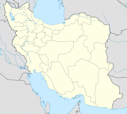
 Delijan
Coordinates: 33°59′26″N 50°41′02″E / 33.99056°N 50.68389°ECoordinates: 33°59′26″N 50°41′02″E / 33.99056°N 50.68389°E Country  Iran
IranProvince Markazi County Delijan Bakhsh Central Population (2006) – Total 31,852 Time zone IRST (UTC+3:30) – Summer (DST) IRDT (UTC+4:30) Area code(s) 0866 Delijan (Persian: دليجان, also Romanized as Delījān, Dalijān, and Dilījān)[1] is a city in and the capital of Delijan County, Markazi Province, Iran. At the 2006 census, its population was 31,852, in 8,779 families.[2]
Delijan is located 80 km (50 Mi) from Qom and 160 km (100 Mi) from Isfahan.
The native population of Delijan speaks a dialect they call Delijani (or Diligoni in the native language). The native language of Delijan seems to be a version of the old-Persian language, which is similar to the language spoken in Abyaneh one of the oldest Persian village located about an hour away from Delijan.
Sites of interest include the 15th Khordad dam and Chal Nakhjir cave as well as its hot spring resort.
Delijan is an industrial town and is home to several popular carpet companies like the Mahestan, Setareh Talaii and Said companies. Also home of several companies producing a type of roof isolation called "Isogam".The area North-East of Delijan is populated by seven villages, this area is referred to as Jasb.
Moreover Chal-nakhjir Cave or Delijan Cave[3] is one of the natural touristic attractions of Delijan.[4]
References
- ^ Delijan can be found at GEOnet Names Server, at this link, by opening the Advanced Search box, entering "-3060975" in the "Unique Feature Id" form, and clicking on "Search Database".
- ^ "Census of the Islamic Republic of Iran, 1385 (2006)" (Excel). Islamic Republic of Iran. http://www.amar.org.ir/DesktopModules/FTPManager/upload/upload2360/newjkh/newjkh/00.xls.
- ^ "Cave". Hamidshams.com. http://hamidshams.com/album/ghar/imagepages/Ghar%20Delijan%201%20007.html. Retrieved 2011-01-17.
- ^ "عکس های غار چال نخچیر دلیجان". Atelie.ir. http://www.atelie.ir/show.php?ID=1188. Retrieved 2011-01-17.
 Markazi Province
Capital 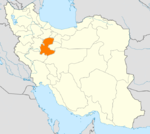
Counties and Cities AshtianDelijan · NaraqFarahan CountyFarmahin · SaruqiKhomeyn CountyKhomeyn · Qurchi BashiKhondab CountyKhondabKomijan CountyKomijan · MilajerdSights Chal nakhjir cave, Delijan · Khorheh · Atashkoh fire temple, Nimvar · Mausoleum of Mahmoud Hessaby ,Tafresh · Arak's grand Bazzar · Mahallat's flower and plant festival · Aveh ancient cite, Saveh · Chaharfasl bath museum, Arak · Hezaveh village · Jameh Mosque of Saveh · Panzdah khordad dam · Emarat lake, Shazand · Azadkhan cave, Mahallat · Mostufi-al-mamalek's castle, Ashtian · Dudahak caravansary, Delijan · Naragh's historical complex · Sepahdar school, Arak · Sheshnaveh mosque · Mahdiabad's Yakhchal ·Categories:- Delijan County
- Cities in Iran
- Cities in Markazi Province
- Iran geography stubs


Wikimedia Foundation. 2010.