- Austevoll
-
Austevoll kommune — Municipality — 

Coat of arms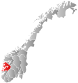
Hordaland within
NorwayAustevoll within Hordaland
Coordinates: 60°2′16″N 5°16′6″E / 60.03778°N 5.26833°ECoordinates: 60°2′16″N 5°16′6″E / 60.03778°N 5.26833°E Country Norway County Hordaland District Midhordland Administrative centre Storebø Government - Mayor (2007) Helge André Njåstad (Frp) Area - Total 117 km2 (45.2 sq mi) - Land 114 km2 (44 sq mi) Area rank 376 in Norway Population (2009) - Total 4,417 - Rank 215 in Norway - Density 39/km2 (101/sq mi) - Change (10 years) 6.6 % Demonym Austevolling[1] Time zone CET (UTC+1) - Summer (DST) CEST (UTC+2) ISO 3166 code NO-1244 Official language form Nynorsk Website austevoll.kommune.no Data from Statistics Norway  Flag of Austevoll.
Historical populations Year Pop. ±% 1951 3,231 — 1961 3,366 +4.2% 1971 3,854 +14.5% 1981 3,912 +1.5% 1991 4,148 +6.0% 2001 4,446 +7.2% 2011 4,680 +5.3% 2021? 5,443 +16.3% 2031? 6,106 +12.2% Source: Statistics Norway[2][3]. Austevoll is a municipality and an archipelago in the district of Midthordland in the county of Hordaland in Western Norway, Norway. Austevoll was separated from Sund on 1 January 1886.
The municipality consists of several islands, located south-west of Bergen. The municipality is considered to be among the ports in the world with the largest ocean-going fish trawler fleet. Since the 1980s the offshore oil industry and fish farming have grown to be important industries in Austevoll.
Contents
General information
Name
The municipality is named after the Austevoll farm (Old Norse Austrvǫllr), since this was the old church site. The first element is austr which means "east" and the last element is vǫllr m which means "meadow".
The municipality has changed the spelling of its name three times. Before 1889 the name was written "Østevold" or "Østervold". From 1889-1917, it was spelled "Austevold", and since 1918 it has been spelled "Austevoll".
Coat-of-arms
The coat-of-arms were granted on 30 November 1984. The arms show a shoal of herring, since herring fishing is of great local importance for the municipality.[4]
See also: Flora, NorwayGeography
Austevoll consists of 667 islands off the west coast of West Norway. The municipality has a total land area of 114,0 km² and a costal line of 337 km.[5] The tallest point in Austevoll is the mountain Loddo, 244 meters above sea level.
Largest islands
- Møkster
- Selbjørn
- Hundvåkøy
- Stolmen
- Storekalsøy
- Huftarøy
Neighbours
The municipality borders on Sund, Bergen, and Os municipalities to the north and northeast, Tysnes municipality to the east, and Fitjar and Bømlo municipalities to the south. The North Sea lies to the west of Austevoll.
Demographics
Of the 667 islands, only eight are populated year-round. 29 percent of the inhabitants live in densely-populated areas. 28 percent of the inhabitants are under the age of 17, which is 4.4 percent over the national average. 4.7 percent of the inhabitants are 80 years or older.[5]
Villages
Rank Village Village Population (2005)[6] District Population (2001)[7] 1 Storebø 1,032 1,341 2 Bekkjarvik 355 489 3 Kolbeinsvik 481 4 Vinnes 378 5 Haukanes 235 Inhabited islands
Rank Island Area (km²) Population [7] Density (/km²) Largest settlement Highest point Elevation (m) 1 Huftarøy 50,4 2,435 48.3 Storebø Loddo 244 2 Selbjørn 25 956 38.24 Bekkjarvik Kongsafjellet 185 3 Hundvåkøy 10,7 554 51.7 Austevollshella 61 4 Stolmen 7,9 206 26.0 Våge Såta 60 5 Storekalsøy 6 167 27.0 Bakkasund Mjuken 57 6 Møkster 65 7 Litlekalsøy 26 Gallery
-

Marstein lighthouse.
-
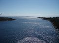
Stolmasundet, between Stolmen and Selbjørn.
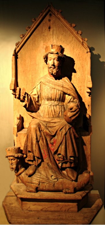
-
Olaf II of Norway from Austevoll church, Storebø.
Industry
Fishing is the most important industry in Austevoll, and has been for centuries. Traditionally fishing has taken place in coastal near areas. After decades of overfishing, the herring, which was the most important fish, disappeared in the 1950s. This forced a restructuring of the fishing fleet. From the 1960s the shipping companies built bigger ships, and went further out seas, fishing other fish species. The overfishing of herring also forced better research on fishing, resulting in the Norwegian Institute of Marine Research.
Since the early 1980s the offshore industry has emerged in the prolongation from the offshore Norwegian oil industry. The offshore shipping company DOF, which is enlisted on the Oslo Stock Exchange, has its headquarters at Storebø.
Education
There are five primary schools and one middle school in Austevoll, all municipal. There is also one secondary school, teaching mainly fishing and nautical subjects. This is operated by the county authority.
Communication
Austevoll has car ferry communications from Hufthammar on the north tip of Huftarøy to Krokeide, Bergen, and Husavik, south on Huftarøy, to Sandvikvåg in Fitjar. The municipality is also connected by express boats to Bergen in north, and Stord, Haugesund and Stavanger in the south.
The islands of Huftarøy and Selbjørn, Selbjørn and Stolmen, and Hundvåkøy and Storekalsøy are connected with bridges. A fourth bridge, connection Huftarøy and Hundvåkøy, was opened on 17 November 2007. This bridge, which in fact consists of two bridges and two stone fillings, bears the name of the municipality, "Austevollsbrua", and symbolizes the fact that the largest islands in the municipality are connected.
All ferry and boat routes are operated by Fosen Namsos. The lighthouse at Marstein is also in the municipality.
Politics
Austevoll is governed by the municipal council, consisting of 21 seats, elected every fourth year. Since the 2003 election a coalition consisting of the Progress Party, Center Party and Christian Democratic Party has held power in the council. In the 2007 election they won 13 of the 21 seats in the municipal council and has an electoral and political cooperation. The Conservative Party and Labour Party make up the opposition.
The council has the following composition:[8]
- Progress Party (9 seats)
- Conservative Party (5 seats)
- Labour Party (3 seats)
- Center Party (2 seats)
- Christian Democratic Party (2 seats)
In the 2003-2007 election period The Liberal Party was represented in the municipal council and held one seat. In the 1999-2003 election period an all-party female electoral list held one seat in the council. From 1995 to 1999 the Socialist Left Party held one seat.
Executive committee of local council
The executive committee of local council consists of 9 seats, divided between all parties in the municipal council. Divided like this:
- The Progress Party (4 seats)
- The Conservative Party (2 seats)
- Labour Party (1 seat)
- Center Party (1 seat)
- Christian Democratic Party (1 seat)
Mayors
The following is a list of mayors of Austevoll:[9][10]
# Name Office Political Party Occupation 1 Ole Olsen Strømme 1886–1901 Church bell ringer 2 Peder Olai Kleppe 1902–1919 Fisherman 3 Olai Naustheller 1920–1925 Farmer 4 Mikkel Nilsen Birkeland 1926–1935 Farmer 5 Magnus Larssen 1935–1937 School teacher 6 Salomon O. Fagerbakke 1938–1945 Fisherman 7 Salomon V. Kalvenes 1946–1959 Fisherman 8 Rikard S. Storebø 1960–1969 Liberal Party Social security manager 9 Peder Kalve 1970–1975 Conservative Party Maritime pilot 10 Magnus Stangeland 1976–1981 Centre Party School principal 11 Knut K. Kalvenes 1982–1985 Conservative Party[11] Retailer 12 Hallvard Møgster 1986–1989 Christian Democratic Party Captain 13 Inge Bjarne Storebø 1990–2001 Conservative Party Bank manager 14 Olav P. Årland 2001–2003 Christian Democratic Party Shipmaster 15 Helge André Njåstad 2003- Progress Party Student Famous people
- Halvor Olai Birkeland, gold medalist in 1920 Summer Olympics.
- Rasmus Ingvald Birkeland, gold medalist in 1920 Summer Olympics.
- Knut Fagerbakke, Deputy Mayor of Trondheim.
- Claus Lundekvam, professional footballer.
- Abelone Møgster, merchant and resistance fighter during World War II.
- Halvor O. Larsen Møgster, gold medalist in 1920 Summer Olympics.
- Magnus Stangeland, member of parliament, mayor and entrepreneur.
- Henrik Olsen Østervold, gold medalist in 1920 Summer Olympics.
- Jan Bertin Østervold, known as Jan Thomas, stylist[disambiguation needed
 ] and actor.
 - Jan Olsen Østervold, gold medalist in 1920 Summer Olympics.
- Kristian Olsen Østervold, gold medalist in 1920 Summer Olympics.
- Ole Olsen Østervold, gold medalist in 1920 Summer Olympics.
References
- ^ "Personnemningar til stadnamn i Noreg" (in Norwegian). Språkrådet. http://www.sprakrad.no/nb-no/Sprakhjelp/Rettskrivning_Ordboeker/Innbyggjarnamn/.
- ^ Projected population - Statistics Norway
- ^ Per 1 January 1964, a part of 1222 Fitjar (696 persons) and 1244 Austevoll were merged to one municipality, 1244 Austvoll.
- ^ Norske Kommunevåpen (1990). "Nye kommunevåbener i Norden". http://www.ngw.nl/int/nor/a/austevol.htm. Retrieved 21 September 2008.
- ^ a b Statistics Norway (2006). Tall om Austevoll kommune. http://www.ssb.no/kommuner/hoyre_side.cgi?region=1244. (Norwegian)
- ^ Statistics Norway (1 January 2006). Urban settlements. Population and area, by municipality. http://www.ssb.no/english/subjects/02/01/10/beftett_en/tab-2006-07-05-01-en.html.
- ^ a b Statistics Norway (PDF). Folke- og bustadteljing 2001. http://www.ssb.no/fob/kommunehefte/1244/fob_1244_tabeller.pdf. (Norwegian)
- ^ "Politics". http://www.nlproxy.nl/browse.php?u=http%3A%2F%2Fwww.austevoll.kommune.no%2Fpolitikk.html&b=4.
- ^ Former mayors of Austevoll municipality (Norwegian)
- ^ Fattigstyret i Møkster sokn (Norwegian)
- ^ "Knut Kalvenes". Høyre. 2003. http://austevoll.hoyre.no/personer/01. Retrieved 19 December 2007. (Norwegian)
External links
 The Wiktionary definition of Austevoll
- Municipal fact sheet from Statistics Norway
- Hordaland travel guide from Wikitravel
- Austevoll travel guide from Wikitravel
Municipalities of Hordaland Nordhordland 
Voss Hardanger Midthordland Sunnhordland Categories:- Municipalities of Hordaland
- Fishing communities in Norway
- Austevoll


Wikimedia Foundation. 2010.