- Nedre Eiker
-
Nedre Eiker kommune — Municipality — 
Coat of arms
Buskerud within
NorwayNedre Eiker within Buskerud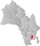
Coordinates: 59°45′53″N 10°2′0″E / 59.76472°N 10.033333°ECoordinates: 59°45′53″N 10°2′0″E / 59.76472°N 10.033333°E Country Norway County Buskerud District Eiker Administrative centre Mjøndalen Government - Mayor (2007) Elly Therese Thoresen (H) Area - Total 122 km2 (47.1 sq mi) - Land 114 km2 (44 sq mi) Area rank 369 in Norway Population (2004) - Total 21,377 - Rank 42 in Norway - Density 187/km2 (484.3/sq mi) - Change (10 years) 11.5 % Demonym Eikværing[1] Time zone CET (UTC+1) - Summer (DST) CEST (UTC+2) ISO 3166 code NO-0625 Official language form Bokmål Website nedre-eiker.kommune.no Data from Statistics Norway Nedre Eiker is a municipality in Buskerud county, Norway. It is part of the traditional region of Eiker. The administrative centre of the municipality is the village of Mjøndalen. The old municipality of Eiker was divided into Nedre Eiker and Øvre Eiker on 1 July 1885.
Contents
General information
Name
The Old Norse form of the name was Eikjar. The name is the plural form of eiki which means "oak wood". The meaning of Nedre Eiker is "(the) lower (part of) Eiker". (The municipality of Eiker was divided in 1885.)
See also: Øvre EikerCoat-of-arms
The coat-of-arms is from modern times. They were granted on 26 June 1970. The arms show three gold-colored oak leaves on a red background. The arms are canting because the meaning of the name (Eik) comes from the word for oak.[2]
(See also coat-of-arms of Eigersund, Songdalen, Tingvoll and Øvre Eiker)
Geography
 Drammenselva river
The municipality is located in the southern part of Buskerud county. It borders the municipalities of Lier, Drammen, Hof, and Øvre Eiker. The majority of the residents live in the villages of Mjøndalen, Krokstadelva, Solbergelva, and Steinberg.
The Drammenselva river flows through the municipality of Nedre Eiker. It is one of the largest rivers in Norway, with a course running from Tyrifjorden in the north to Drammensfjord in the south.
Notable residents
- Lars Korvald, former Prime Minister of Norway
- Herman Wildenvey (1886-1959), poet and author
- Svein Johannessen (1937-2007), international master of chess
- Jørn Hurum (b. 1967), paleontologist
- Ragnar Christiansen (born 1922), former Minister and Member of Parliament
Sister cities
The following cities are twinned with Nedre Eiker:[3]
References
- ^ "Personnemningar til stadnamn i Noreg" (in Norwegian). Språkrådet. http://www.sprakrad.no/nb-no/Sprakhjelp/Rettskrivning_Ordboeker/Innbyggjarnamn/.
- ^ Norske Kommunevåpen (1990). "Nye kommunevåbener i Norden". http://www.ngw.nl/int/nor/n/nedreeik.htm. Retrieved 2009-01-10.
- ^ "Vennskaps- og samarbeidsavtale". Nedre Eiker kommune. http://www.nedre-eiker.kommune.no/vennskaps-og-samarbeidsavtale.533183-86396.html. Retrieved 2009-01-10. (Norwegian)
External links
- Municipal fact sheet from Statistics Norway
- Buskerud travel guide from Wikitravel
- Culture in Nedre Eiker on the map from Kulturnett.no
Municipalities of Buskerud  Categories:
- Municipalities of Buskerud
- Nedre Eiker


Wikimedia Foundation. 2010.