- Høylandet
-
Høylandet kommune — Municipality — View of Høylandet village

Coat of arms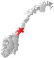
Nord-Trøndelag within
NorwayHøylandet within Nord-Trøndelag
Coordinates: 64°43′27″N 12°20′2″E / 64.72417°N 12.33389°ECoordinates: 64°43′27″N 12°20′2″E / 64.72417°N 12.33389°E Country Norway County Nord-Trøndelag District Namdalen Administrative centre Høylandet Government – Mayor (1993) Lars Otto Okstad (Sp) Area – Total 754.39 km2 (291.3 sq mi) – Land 702.44 km2 (271.2 sq mi) – Water 51.95 km2 (20.1 sq mi) Area rank 144 in Norway Population (2011) – Total 1,270 – Rank 389 in Norway – Density 1.8/km2 (4.7/sq mi) – Change (10 years) -4.6 % Demonym Hålling[1] Time zone CET (UTC+1) – Summer (DST) CEST (UTC+2) ISO 3166 code NO-1743 Official language form Neutral Website hoylandet.kommune.no Data from Statistics Norway Høylandet is a village and a municipality in Nord-Trøndelag county, Norway. It is part of the Namdalen region. The administrative centre of the municipality is the village of Høylandet. Other villages include Kongsmoen and Vassbotna.
The village lies along the river Søråa in the southern part of Høylandet, about 10 kilometres (6.2 mi) north of Vassbotna and about 15 kilometres (9.3 mi) northwest of European route E6. The 0.58-square-kilometre (140-acre) village has a population (2011) of 378. The population density is 652 inhabitants per square kilometre (1,690 /sq mi).[2]
Contents
General information
The municipality of Høylandet was established on 1 January 1901 when it was separated from the large municipality of Grong. Initially, the population of Høylandet was 1,046. On 1 January 1964, the Kongsmoen area (population: 221) of eastern Foldereid was merged into Høylandet. On that same date the Galguften and Hauknes areas (population: 15) were transferred to neighboring Overhalla.[3]
Name
The Old Norse form of the name was Høylandir. The first element is høy which means "hay" and the last element is the plural form of land which means "land" or "region". The name was historically spelled Hølandet.[4]
Coat-of-arms
The coat-of-arms is from modern times; they were granted on 1990. The arms show a silver Whooper Swan (Cygnus cygnus) on a green background.[5]
Churches
The Church of Norway has one parish (sokn) within the municipality of Høylandet. It is part of the Namdal deanery in the Diocese of Nidaros.
Churches in Høylandet Parish
(Sokn)Church Name Location
of the ChurchYear Built Høylandet Drageid Church Vassbotna 1976 Høylandet Church Høylandet 1860 Kongsmo Chapel Kongsmoen 1937 Geography
There are several large lakes in Høylandet including Almåsgrønningen, Eidsvatnet, Grungstadvatnet, Øyvatnet, and Storgrønningen. The innermost part of the Foldafjord is located in northern Høylandet. Norwegian County Road 17 runs through the municipality from south to north through the central valley.
References
- ^ "Personnemningar til stadnamn i Noreg" (in Norwegian). Språkrådet. http://www.sprakrad.no/nb-no/Sprakhjelp/Rettskrivning_Ordboeker/Innbyggjarnamn/.
- ^ Statistisk sentralbyrå (1 January 2011). "Urban settlements. Population and area, by municipality.". http://www.ssb.no/english/subjects/02/01/10/beftett_en/tab-2011-06-17-01-en.html.
- ^ Jukvam, Dag (1999). "Historisk oversikt over endringer i kommune- og fylkesinndelingen" (in Norwegian). Statistisk sentralbyrå. http://www.ssb.no/emner/00/90/rapp_9913/rapp_9913.pdf.
- ^ Rygh, Oluf (1903) (in Norwegian) (dokpro.uio.no). Norske gaardnavne: Nordre Trondhjems amt (15 ed.). Kristiania, Norge: W. C. Fabritius & sønners bogtrikkeri. p. 267. http://www.dokpro.uio.no/perl/navnegransking/rygh_ng/rygh_bla.prl?enhid=232580&avid=51681.
- ^ Store norske leksikon. "Høylandet – kommune i Nord-Trøndelag" (in Norwegian). http://snl.no/H%C3%B8ylandet/kommune_i_Nord-Tr%C3%B8ndelag. Retrieved 2011-09-21.
External links
Municipalities of Nord-Trøndelag Current 
Former Categories:- Municipalities of Nord-Trøndelag
- Villages in Nord-Trøndelag
- Høylandet


Wikimedia Foundation. 2010.