- Flatanger
-
Flatanger kommune — Municipality — 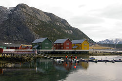

Coat of arms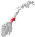
Nord-Trøndelag within
NorwayFlatanger within Nord-Trøndelag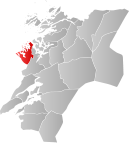
Coordinates: 64°25′11″N 10°54′28″E / 64.41972°N 10.90778°ECoordinates: 64°25′11″N 10°54′28″E / 64.41972°N 10.90778°E Country Norway County Nord-Trøndelag District Namdalen Administrative centre Lauvsnes Government – Mayor (2003) Reidar Lindseth (V) Area – Total 459.30 km2 (177.3 sq mi) – Land 434.17 km2 (167.6 sq mi) – Water 25.13 km2 (9.7 sq mi) Area rank 219 in Norway Population (2011) – Total 1,109 – Rank 390 in Norway – Density 2.6/km2 (6.7/sq mi) – Change (10 years) -4.2 % Demonym Flatangring[1] Time zone CET (UTC+1) – Summer (DST) CEST (UTC+2) ISO 3166 code NO-1749 Official language form Neutral Website flatanger.kommune.no Data from Statistics Norway Flatanger is a municipality in Nord-Trøndelag county, Norway. It is part of the Namdalen region. The administrative centre of the municipality is the village of Lauvsnes. Other villages include Jøssund and Vik.
Contents
General information
Flatanger was established as a municipality on 1 January 1871 when it was separated from the large municipality of Fosnes. Initially, Flatanger had 1,472 residents. It is one of the few municipalities in Norway whose boundaries have not changed since it was established.[2]
Name
The municipality is named after the old name for one of the fjords in the area, but it is not known which one. The name is composed of two parts: flat, which probably means "shallow water", and angr, which means "fjord or inlet".[3][4]
Coat-of-arms
The coat-of-arms is from modern times; they were granted in 1990. The arms show three silver chevrons on a green background. The design was chosen to represent the bow of a boat, seen from the front.
Churches
The Church of Norway has one parish (sokn) within the municipality of Flatanger. It is part of the Namdal deanery in the Diocese of Nidaros.
Churches in Flatanger Parish
(Sokn)Church Name Location
of the ChurchYear Built Flatanger Vik Church Vik 1873 Løvøy Church Lauvøya 1871 Geography
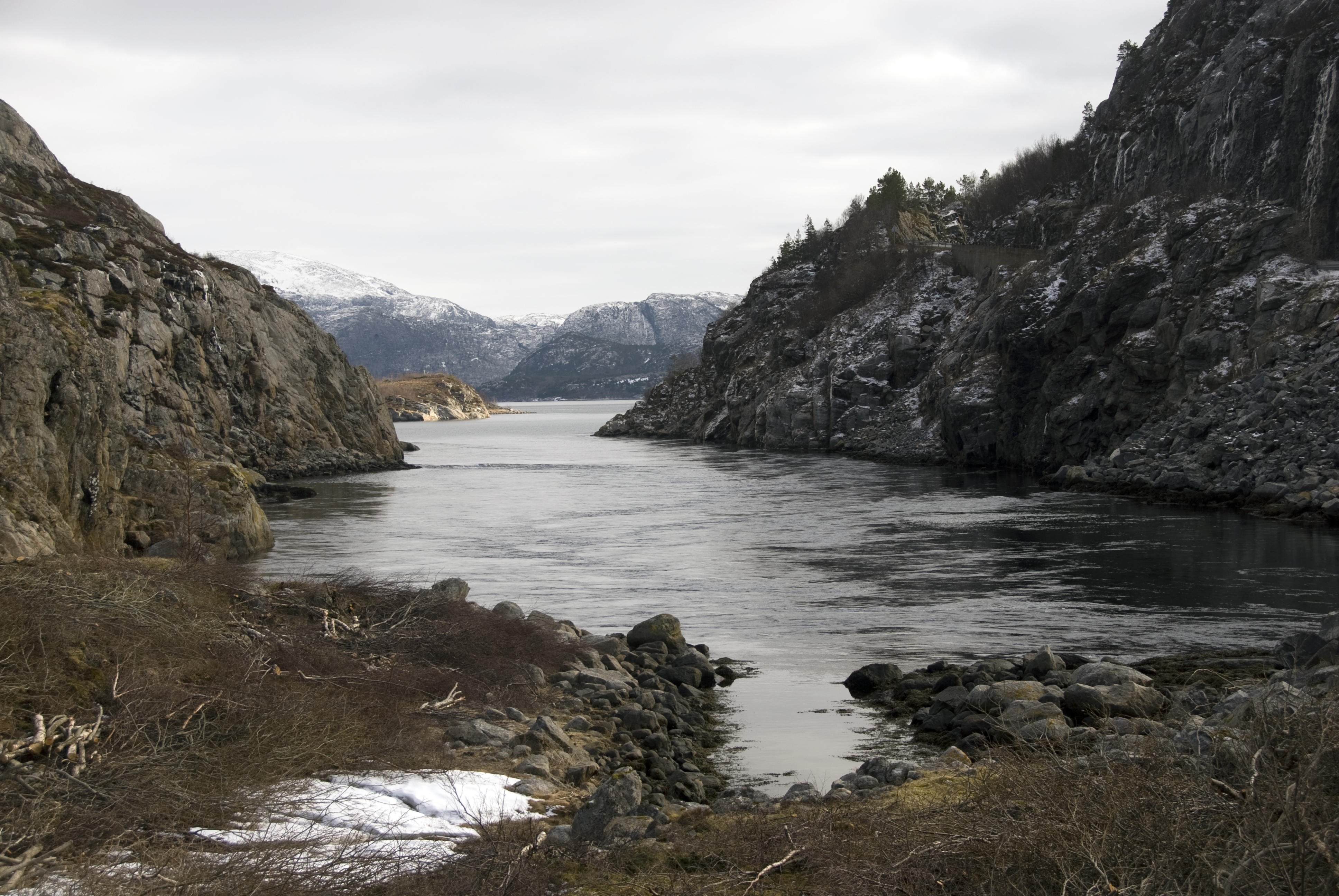
 View of a small fjord in Flatanger
The municipality consists mostly of mainland, but also includes almost 1,400 islands of various sizes. Some of the major islands include Bjørøya, Lauvøya, Villa, Halmøya, and Kvernøya. Ellingråsa Lighthouse is located on the island of Bjørøya and Villa Lighthouse is on Villa. These islands all lie on the south side of the Folda firth. The Namsenfjorden forms part of the northern boundary of the municipality.
Politics
In the 2007 municipal elections, Flatanger had the highest vote for the Venstre party in all of Norway, at 42.9 per cent.
References
- ^ "Personnemningar til stadnamn i Noreg" (in Norwegian). Språkrådet. http://www.sprakrad.no/nb-no/Sprakhjelp/Rettskrivning_Ordboeker/Innbyggjarnamn/.
- ^ Jukvam, Dag (1999). "Historisk oversikt over endringer i kommune- og fylkesinndelingen" (in Norwegian). Statistisk sentralbyrå. http://www.ssb.no/emner/00/90/rapp_9913/rapp_9913.pdf.
- ^ Store norske leksikon. "Flatanger" (in Norwegian). http://snl.no/Flatanger. Retrieved 2011-08-18.
- ^ Rygh, Oluf (1903) (in Norwegian) (dokpro.uio.no). Norske gaardnavne: Nordre Trondhjems amt (15 ed.). Kristiania, Norge: W. C. Fabritius & sønners bogtrikkeri. p. 344. http://www.dokpro.uio.no/perl/navnegransking/rygh_ng/rygh_bla.prl?enhid=251056&avid=55693.
External links
Municipalities of Nord-Trøndelag Current 
Former Categories:- Municipalities of Nord-Trøndelag
- Flatanger


Wikimedia Foundation. 2010.