- Målselv
-
Målselv kommune — Municipality — 
Coat of arms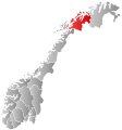
Troms within
NorwayMålselv within Troms
Coordinates: 68°58′30″N 19°3′52″E / 68.975°N 19.06444°ECoordinates: 68°58′30″N 19°3′52″E / 68.975°N 19.06444°E Country Norway County Troms District Midt-Troms Administrative centre Moen Government – Mayor (2003) Viggo Fossum (Ap) Area – Total 3,322.38 km2 (1,282.8 sq mi) – Land 3,233.56 km2 (1,248.5 sq mi) – Water 88.82 km2 (34.3 sq mi) Area rank 10 in Norway Population (2010) – Total 6,510 – Rank 147 in Norway – Density 2/km2 (5.2/sq mi) – Change (10 years) -7.7 % Demonym Målselvdøl[1] Time zone CET (UTC+1) – Summer (DST) CEST (UTC+2) ISO 3166 code NO-1924 Official language form Neutral Website malselv.kommune.no Data from Statistics Norway Målselv (Northern Sami: Málatvuomi suohkan) is a municipality in Troms county, Norway. The administrative centre of the municipality is the village of Moen. Some other villages include Andslimoen, Bardufoss, Alappmoen, Holmen, Fossmoen, and Heggelia. Besides bordering Sweden to the east and the ocean (Malangen fjord) to the west, it borders on the municipalities of Balsfjord, Storfjord, Bardu, Sørreisa, and Lenvik.
Contents
General information
 Map of Målselv municipality
Maalselven was established in 1849 when it was separated from the municipality of Lenviken. The initial population of Maalselven was 2,616. In 1891, some parts of the Målsnes area (population: 30) were transferred to neighboring Malangen. On 1 January 1904, an area with 5 inhabitants was transferred from Balsfjord to Maalselven. The spelling of the name was changed to Målselv in 1918. On 1 July 1925, the district of Øverbygd was separated from Målselv to form a new municipality of its own. This left Målselv with 3,531 residents.
On 1 January 1964, the municipality of Øverbygd (population: 1,232), municipality of Målselv (population: 5,584), the Naveren and Målsnes areas of Malangen (population: 118), and the Skogli ved Heia farm in Balsfjord (population: 2) were all merged together to form a new, larger municipality of Målselv with a new population of 6,936. On 1 January 1966, the Sørelvmo area (population: 131) was transferred from Balsfjord to Målselv. Then on 1 January 1972, the Blomli i Fagerfjell area of Målselv (population: 63) was transferred to Lenvik.[2]
Name
The municipality is named after the river Målselva. The first element is the genitive case of the old uncompounded name of the Malangen fjord: Malr and the last element is the finite form of elv which means "river". The old name of the fjord is identical with the word malr which means "bag" or "sack" (referring to the shape of the fjord). Prior to 1918, the name was written "Maalselven".[3]
Coat-of-arms
The coat-of-arms is from modern times. They were granted on 1 February 1985. The arms are a canting that represent the Målselva river which runs through the municipality.[4]
Geography
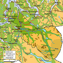
Målselv was settled by farmers from southern Norway, especially Østerdalen from 1788 and onwards. They were attracted by the uninhabited land with vast forests and areas of fertile land in the broad Målselvdalen. The valley and municipality take their name from the river Målselva. The river is well known for its salmon, and forms the Målselv waterfall (Norwegian: Målselvfossen), which has been selected as Norway's national waterfall. The Målselva empties into the Malangen fjord north of Olsborg. There are several mountains in the municipality: Njunis (1,713 metres (5,620 ft)) is the highest and Istind is popular among hikers. There are many lakes such as Andsvatnet, Finnfjordvatnet, Rostajavri, Lille Rostavatn, and Takvatnet. One of the rarest orchids in Europe, Lysiella oligantha (Norwegian: Sibirnattfiol), is found in Målselv. Øvre Dividal National Park (740 square kilometres (290 sq mi)) is located in the easternmost part of Målselv, near the border with Sweden.
Image gallery
-

Istind mountain at the border with Bardu
-

Målselv river and valley
-

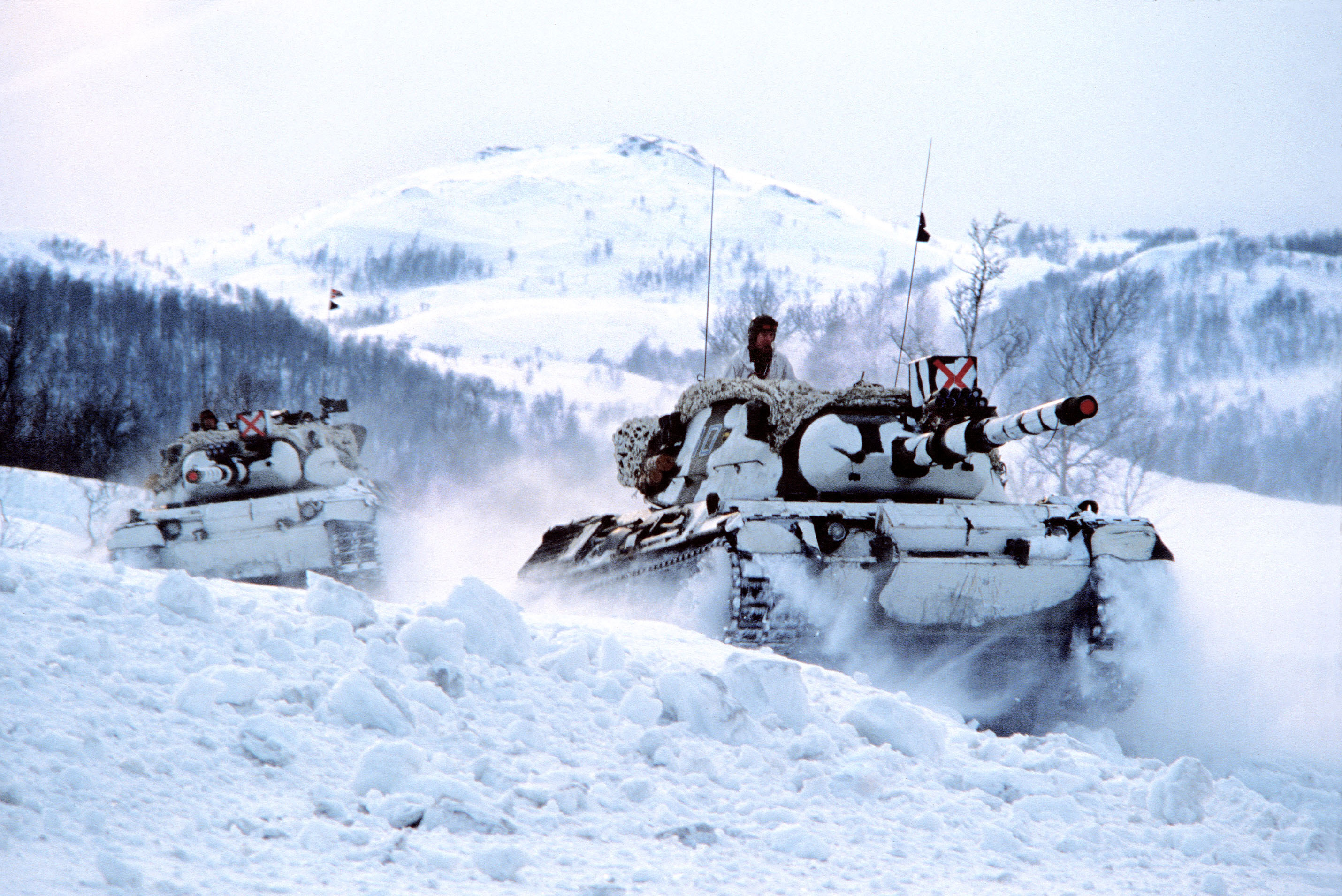
The Norwegian Armed Forces has a long history in Målselv
-

Heggelia in Målselv
-

Memorial for those killed during WW2 in Målselv
-

Øvre Dividal national park
-

Blåtindan mountain
Climate
Målselv is fairly sheltered from the coastal weather, and has a somewhat inland climate. Mean annual precipitation is 745 millimetres (29.3 in) at Moen, 652 millimetres (25.7 in) at Bardufoss and only 282 millimetres (11.1 in) in the Divi valley, which sits at 282 m (925 ft) above sea level. April through June is the driest period.[5]
Climate data for Bardufoss (10 last years) Month Jan Feb Mar Apr May Jun Jul Aug Sep Oct Nov Dec Year Average high °C (°F) −5
(23)−5
(23)−2
(28)4
(39)9
(48)14
(57)17
(63)15
(59)10
(50)4
(39)−1
(30)−4
(25)4.7
(40.4)Average low °C (°F) −11
(12)−10
(14)−9
(16)−2
(28)4
(39)8
(46)11
(52)9
(48)5
(41)−1
(30)−6
(21)−10
(14)−1
(30.2)Source: [6] Economy
A local newspaper, Nye Troms, covering Målselv, Bardu, and Balsfjord, has its main office in the Olsborg area. The municipality administration is located at Moen, about 2 kilometres (1.2 mi) east of Olsborg. Further south along European route E6 is the Bardufoss region, which encompasses the local communities Andselv and Heggelia, the latter including the Norwegian army's 6th division. Near Andselv is the Bardufoss Airport and the Bardufoss Air Station of the Royal Norwegian Air Force, including the 337th and 339th Air Force helicopter squadrons. Målselv municipality, together with neighbouring Bardu, has the largest concentration of army bases in the country. Moving further up the valley, another local community is Rundhaug, and moving eastwards, closer to Øvre Dividal National Park, is the community of Øverbygd, housing two more sub-communities Skjold and Holt. The former also houses the Skjold base for mechanized infantry and combat engineers.
Tourism is a growing industry in Målselv, with the opening of Målselv Fjellandsby, an alpine ski destination. Målselv is also home to Målselvfossen, Norway's national waterfall and a mecca for salmon fishermen. Bardufoss concentration camp was located here during World War II.
References
- ^ "Personnemningar til stadnamn i Noreg" (in Norwegian). Språkrådet. http://www.sprakrad.no/nb-no/Sprakhjelp/Rettskrivning_Ordboeker/Innbyggjarnamn/.
- ^ Jukvam, Dag (1999). "Historisk oversikt over endringer i kommune- og fylkesinndelingen" (in Norwegian). Statistisk sentralbyrå. http://www.ssb.no/emner/00/90/rapp_9913/rapp_9913.pdf.
- ^ Rygh, Oluf (1911) (in Norwegian). Norske gaardnavne: Troms amt (17 ed.). Kristiania, Norge: W. C. Fabritius & sønners bogtrikkeri. pp. 103. http://www.dokpro.uio.no/perl/navnegransking/rygh_ng/rygh_bla.prl?enhid=273560&avid=60603.
- ^ Norske Kommunevåpen (1990). "Nye kommunevåbener i Norden". http://www.ngw.nl/int/nor/m/malselv.htm. Retrieved 2008-12-07.
- ^ "Climate statistics Målselv" (in Norwegian). met.no. http://retro.met.no/observasjoner/troms/normaler_for_kommune_1924.html?kommuner.
- ^ "Værvarsel for Bardufoss Målselv i Troms" (in Norwegian). Storm Weather Center. http://www.storm.no/vaer/647374/klima. Retrieved 2009-12-03.
External links
 Media related to Målselv at Wikimedia Commons
 The Wiktionary definition of målselv
- Troms travel guide from Wikitravel
- Municipal fact sheet from Statistics Norway
- Picture and information regarding Bardufoss Airport from Avinor
Municipalities of Troms  Categories:
- Municipalities of Troms
- Målselv
- Populated places of Arctic Norway
-


Wikimedia Foundation. 2010.