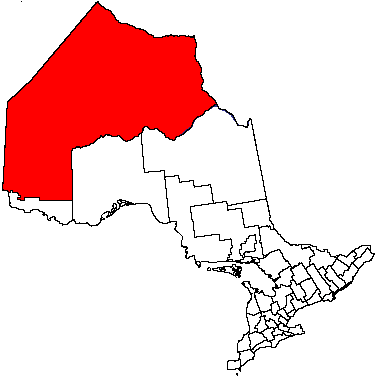
- Kenora
-
This article is about a city in Northwestern Ontario, Canada. For other uses, see Kenora (disambiguation).
Kenora — City — 
 Kenora
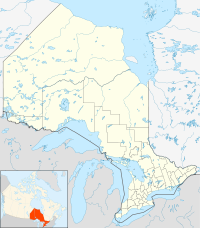
Coordinates: 49°46′N 94°29′W / 49.767°N 94.483°WCoordinates: 49°46′N 94°29′W / 49.767°N 94.483°W Country  Canada
Province  Ontario
District Incorporated (town) 1882 as Rat Portage Renamed 1905 as Kenora Amalgamated (City) 2000[1] Government – Mayor Dave Canfield – MP Greg Rickford (Kenora, CPC) – MPP Sarah Campbell (Kenora—Rainy River, NDP) Area[2] – Land 210.91 km2 (81.4 sq mi) Elevation[3] 409.70 m (1,344 ft) Population (2006)[2][4] – City 15,177 – Density 72.0/km2 (186.5/sq mi) – Urban 11,306 Time zone CST (UTC−6) – Summer (DST) CDT (UTC−5) Postal Code FSA P9N, P0X Area code(s) 807 Website www.kenora.ca Kenora (2006 population 15,177), originally named Rat Portage, is a small city situated on the Lake of the Woods in Northwestern Ontario, Canada, close to the Manitoba boundary, and about 200 km (124 mi) east of Winnipeg. It is the seat of Kenora District.
The town of Kenora was amalgamated with the towns of Keewatin and Jaffray Melick in 2000 to form the present-day City of Kenora.
Contents
History
Kenora's future site was in the territory of the historic Ojibway when the first European, Jacques De Noyon, sighted Lake of the Woods in 1688. Indigenous peoples of varying cultures had occupied the area for thousands of years.
Pierre La Vérendrye established a secure French trading post, Fort St. Charles, to the south of present-day Kenora near the current Canada/U.S. border in 1732, and France maintained the post until 1763 when it lost the territory to the British in the Seven Years' War — until then, it was the most northwesterly settlement of New France. In 1836 the Hudson's Bay Company established a post on Old Fort Island, and in 1861, the Company opened a post on the mainland at Kenora's current location.
In 1878, the company surveyed lots for the permanent settlement of Rat Portage ("portage to the country of the muskrat")[5] — the community kept that name until 1905, when it was renamed to Kenora. The name, "Kenora," was coined by combining the first two letters of Keewatin, Norman (two nearby communities) and Rat Portage.
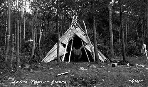
 Ojibwa tipi, Kenora, 1922.
Kenora was once claimed as part of the Province of Manitoba, and there are early references to Rat Portage, Manitoba. There was a long lasting argument between the two provinces known as the Ontario-Manitoba boundary dispute. Each province claimed the town as part of their territory and the dispute lasted from 1870-1884. Although Ottawa had ruled the town part of Manitoba in 1881, the issue was finally taken up with the Privy Council of the United Kingdom whom eventually decided in Ontario's favour.[6] Kenora officially became part of the province of Ontario in 1889.[7] Boundaries were drawn up for the provinces and the Northwest Angle on Lake of the Woods which definitively drew the borders between Ontario, Manitoba, Canada, and Minnesota, U.S.A.
Gold and the railroad were both important in the community's early history: gold was first discovered in the area in 1850, and by 1893, 20 mines were operating within 24 km (15 mi) of Rat Portage, and the first Canadian ocean-to-ocean train passed through in 1886 on the Canadian Pacific Railway. Later, a highway was built through Kenora in 1932, becoming part of Canada's first coast-to-coast highway in 1943, and then part of the Trans-Canada Highway, placing the community on both of Canada's major transcontinental transportation routes. The original barrier to the completion of the highway concerned the crossing of the Winnipeg River at two locations. The single span arch bridges are among the longest of their type in North America.
Rat Portage was a small town of ill repute with storied brothels collected along the early Canadian Pacific Rail line. Large tracts of land were allocated to Marathon Realty for the purpose of gathering and controlling lands along the railway for commercial and development purposes. Recent excavation of garbage dumps adjacent to the brothels has revealed opium bottles, prescription tranquilizers similar to Lorazepam,[8][dead link] champagne bottles, and pickle jars. Early suppliers of patent medicines from Johnson's Pharmacy during that era had products such as Lydia Pinkam's Vegetable Compount, Kickapoo Indian Oil, Dr. Thomas Electric Oil, and many others. During the Prohibition era in the United States, the Lake of the Woods served as a smugglers' route for the transport of Drewery's alcohol.
The Stanley Cup was won by the Kenora Thistles hockey team in 1907. The team featured such Hall of Famers as Billy McGimsie, Tommy Phillips, Roxy Beaudro, and Art Ross, for whom the Art Ross Trophy is named. Kenora is the smallest town to have won a major North American sports title.
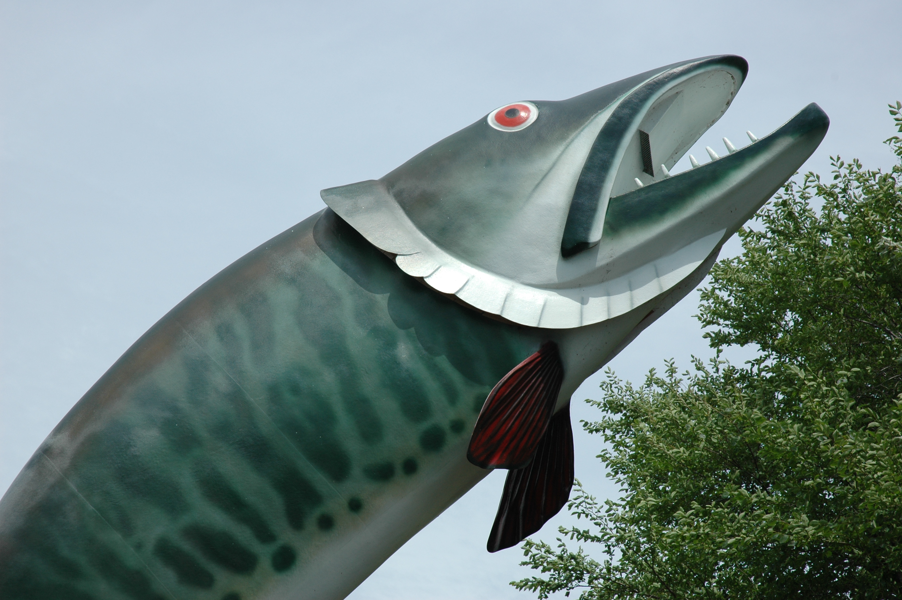
 Husky the Muskie
In 1967, the year of the Canadian Centennial, Kenora erected a sculpture known as Husky the Muskie. It has become the town's mascot and one of its most recognizable features.[1]
A dramatic bank robbery took place in Kenora on May 10, 1973. An unknown man entered the Canadian Imperial Bank of Commerce heavily armed and wearing a "dead man's switch", a device utilising a clothespin, wires, battery and dynamite, where the user holds the clothespin in the mouth, exerting force on the clothespin. Should the user release the clothespin, two wires attached to both sides of the pin complete an electrical circuit, sending current from the battery, detonating the explosives. After robbing the bank, the robber exited the CIBC, and was preparing to enter a city vehicle driven by undercover police officer Don Milliard. A sniper, Robert Letain, positioned across the street, shot the robber, causing the explosives to detonate and kill the robber. Most of the windows on the shops on the main street were shattered as a result of the blast. Recently, Kenora Police submitted DNA samples from the robber's remains to a national database to identify him; however, the suspect was never positively identified.
The importance of the logging industry declined in the second part of the 20th century, and the last log boom was towed into Kenora in 1985. The tourist and recreation industries have become more important.
Community
In addition to the formerly separate towns of Keewatin and Jaffray Melick, the city also includes the neighbourhoods of Norman, Rabbit Lake, Rideout, Pinecrest, Minto and Lakeside.
Keewatin currently forms the western-most section of the City of Kenora. Norman was a small community located half-way between the village of Keewatin and Rat Portage. The Village of Keewatin was founded in 1877 while the Village of Norman was founded in 1892; both communities amalgamated with Rat Portage in 1905 to form the Township of Kenora. Keewatin eventually separated and was founded as a Township in 1908.
The Jaffray Melick neighbourhood currently delineates the north-eastern most section of the City of Kenora. The Township of Jaffray was founded in 1894 and the Township of Melick in 1902; the two townships were amalgamated in 1908 as Jaffray and Melick, and renamed as Jaffray Melick in 1911. Compared to Keewatin, Norman, and Rat Portage, Jaffray Melick is the most rural communities, with few retail stores and one golf course, Beauty Bay, on Black Sturgeon lake.
Economy
Forestry, tourism and mining are the three largest sectors of the Kenora economy. The population balloons in the spring and summer to almost double the normal population when summer residents move in. The Lake of the Woods and numerous smaller lakes situated all around Kenora are the major draw for cottagers who summer here. Many are from the neighbouring province of Manitoba and the state of Minnesota.
Tourism
Kenora, a natural attraction is home to visitors from all over the world year round. In the summer months visitors flock to the area to experience many different opportunities including, swimming, biking, fishing, boat rentals and tours, hiking as well as many other events and activities. Kenora's tourist industry is also active during the winter months as visitors come not only to observe its natural beauty but also to partake in ice fishing, snow boarding, skiing (both down hill and cross country) and snowmachining to name a few.
Kenora currently has two travel information centers. One is the newly renovated (2011) pavillion, convienently located on the Harbourfront (the blue and grey building on Bernier Dr). The second information Center known as 'The Discovery Center' opened July 22nd 2011, and serves visitors year round from its location at 931 Lake View Drive (just off of highway 17 West aka the Trans Canada highway).
There are various publications available to both visitors and locals to aid them in finding there way around the city, events and every thing Kenora has to offer. A few of these publications include the city map, Kenora's Visitor guide, and the STUFF Magazine.
Climate
Climate data for Kenora Airport Month Jan Feb Mar Apr May Jun Jul Aug Sep Oct Nov Dec Year Humidex 6.8 8.5 19.3 30 39.3 41.2 41.7 41.6 41.6 28.9 18.9 8.7 41.7 Record high °C (°F) 8.3
(46.9)8.8
(47.8)23.3
(73.9)30.6
(87.1)35.4
(95.7)35.6
(96.1)35.8
(96.4)35
(95)34.6
(94.3)26.7
(80.1)19.4
(66.9)9.4
(48.9)35.8
(96.4)Average high °C (°F) −12.6
(9.3)−7.9
(17.8)−0.5
(31.1)9
(48)17.4
(63.3)21.8
(71.2)24.4
(75.9)23.1
(73.6)16.4
(61.5)8.9
(48.0)−1.5
(29.3)−9.9
(14.2)7.4 Daily mean °C (°F) −17.3
(0.9)−12.9
(8.8)−5.6
(21.9)3.6
(38.5)11.8
(53.2)16.7
(62.1)19.5
(67.1)18.2
(64.8)11.9
(53.4)5.1
(41.2)−4.9
(23.2)−14.1
(6.6)2.7 Average low °C (°F) −22
(−8)−17.8
(0.0)−10.6
(12.9)−1.8
(28.8)6.2
(43.2)11.6
(52.9)14.5
(58.1)13.3
(55.9)7.4
(45.3)1.3
(34.3)−8.2
(17.2)−18.3
(−0.9)−2 Record low °C (°F) −43.9
(−47.0)−41.4
(−42.5)−36.1
(−33.0)−27.2
(−17.0)−12.2
(10.0)−0.6
(30.9)3.9
(39.0)1.1
(34.0)−6.7
(19.9)−13.9
(7.0)−31.3
(−24.3)−38.3
(−36.9)−43.9
(−47.0)Wind chill −57.5 −54.3 −46.7 −37.7 −20.5 −5.9 0.8 −2 −12.6 −22.2 −46.8 −51.5 −57.5 Precipitation mm (inches) 26.1
(1.028)19.3
(0.76)27.7
(1.091)32.7
(1.287)64.3
(2.531)107.8
(4.244)95.3
(3.752)85.8
(3.378)81.2
(3.197)53.7
(2.114)42.3
(1.665)25.7
(1.012)661.8
(26.055)Rainfall mm (inches) 0.4
(0.016)2.7
(0.106)6.9
(0.272)19.8
(0.78)63
(2.48)107.7
(4.24)95.3
(3.752)85.8
(3.378)80.2
(3.157)42.7
(1.681)9.3
(0.366)0.6
(0.024)514.4
(20.252)Snowfall cm (inches) 28
(11)17.9
(7.05)22.3
(8.78)13.6
(5.35)1.5
(0.59)0.1
(0.04)0
(0)0
(0)0.8
(0.31)11.4
(4.49)35.2
(13.86)27.4
(10.79)158.2
(62.28)% humidity 67.3 61.3 54.9 44.6 45.2 51.7 52.4 54.4 58.6 62.4 72.1 71.7 58.1 Source: Environment Canada[3] Culture
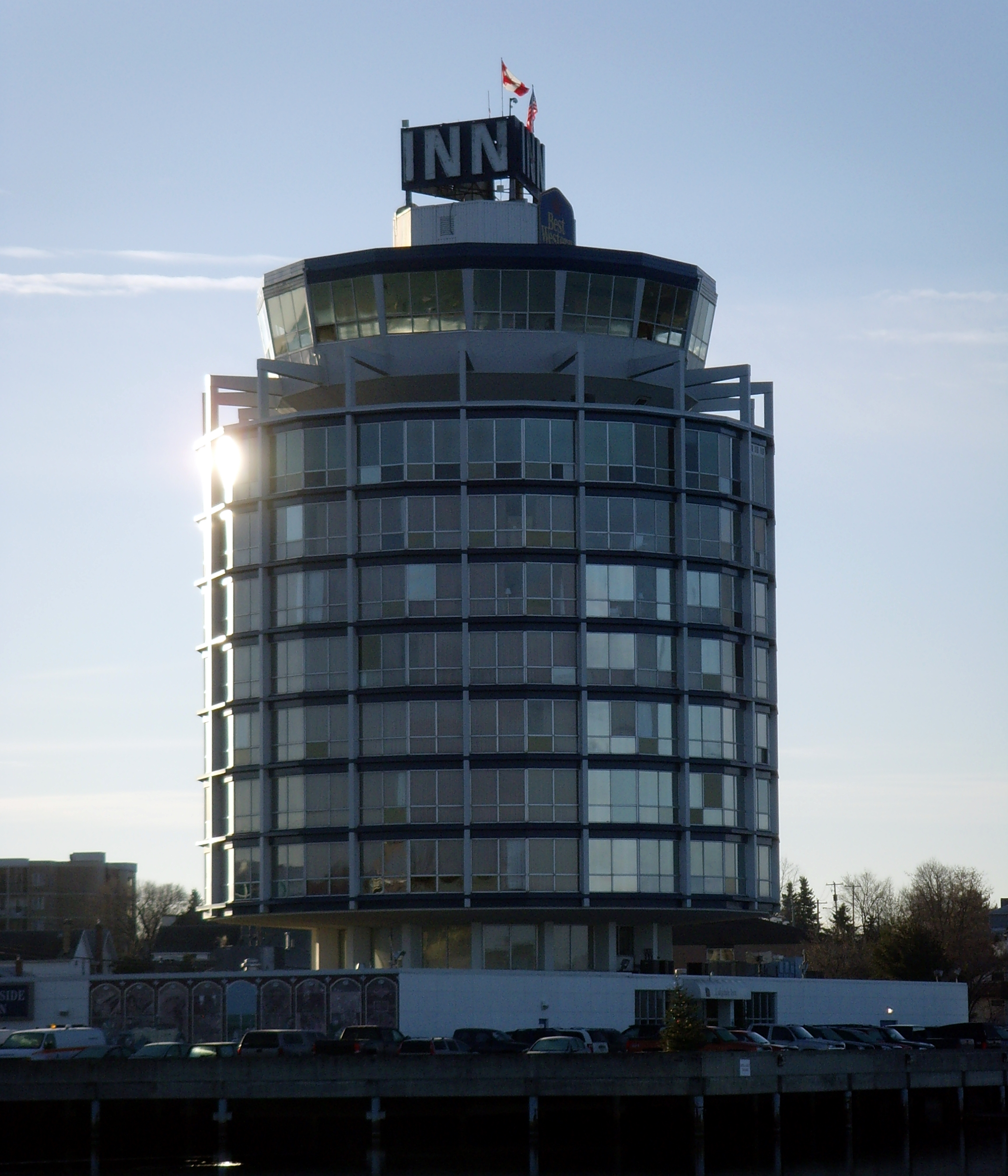
 Lakeside Inn
The city's most prominent cultural venue is the downtown Harbourfront, a park on the shore of Lake of the Woods which hosts the city's annual winter and summer festivals, as well as concert series, and other special events. The Harbourfront is also the docking point for the M/S Kenora, a small cruise ship which offers a guided tour of the lake. It has a mascot, Husky the Muskie.
The city's downtown core has a public arts project, with 20 murals depicting the region's history painted on buildings in the business district.
The city is also home to a major international bass fishing tournament.
Kenora is sometimes stereotyped as an archetypal hoser community, evidenced by the phrase "Kenora dinner jacket"[9] as a nickname for a hoser's flannel shirt.
The City of Kenora is home to the Lake of the Woods Museum, which has won awards from the Ontario Historical Society for its exhibits. It was called "one of the coolest little museums in Canada" by the CAA.[10] In June 2011, the Museum received another Ontario Historical Society Award for its exhibit, Bakaan nake'ii ngii-izhi-gakinoo'amaagoomin (We Were Taught Differently): The Indian Residential School Experience, based on stories of residential school life told by local residents.[11]
Bands including the Beach Boys featuring John Stamos, Blue Rodeo, Great Big Sea, Paul Brandt, Flock of Seagulls, Sloan, and Collective Soul as well as various other big names have all had shows in Kenora, many under Kenora's Big Tent on the Harbourfront. With the construction of Kenora's New Permanent Tent structure set to be completed in late 2011 many other big names are sure to make an appearance in the near future.
Transportation
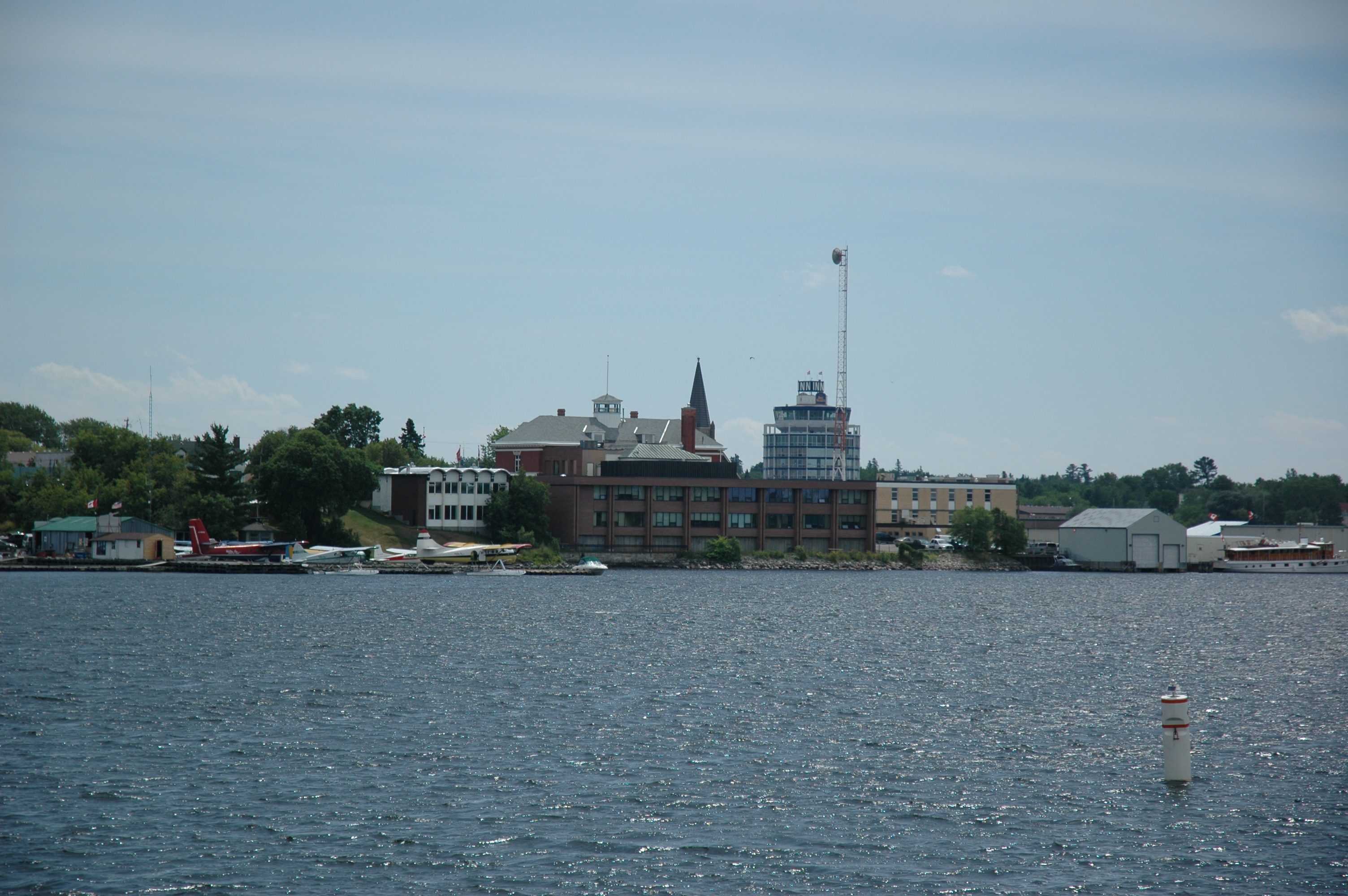
 Kenora waterfront
Via Rail offers passenger service to Redditt on the CN transcontinental rail line, approximately 30 minutes and 20 km (12 mi) north of Kenora. The CP transcontinental rail line passes directly through town.
Kenora Airport is located 5 nautical miles (9.3 km) east northeast of the city centre.
M.S. Kenora is a cruise located at the waterfront.
Greyhound Lines offers intercity bus services from the Excel Coach Lines terminal.[12]
Highway 17 passes through Kenora, and the Highway 17A Kenora By-Pass goes around the city. Both routes are designated as part of the Trans-Canada Highway. Highway 658 extends northerly from Kenora to Redditt.
Kenora Transit operates three routes, from Monday to Saturday, 7:00am to 6:30pm.[13]
Politics
Kenora is represented at in the House of Commons by Conservative Member of Parliament Greg Rickford, and in the Ontario Legislative Assembly by MPP Howard Hampton, former leader of the Ontario New Democratic Party.
Kenora has been served by two mayors since the municipal amalgamation in 2000. Dave Canfield served from 2000 until 2006, when he was defeated by Len Compton in the 2006 municipal election; Compton did not run in the subsequent 2010 municipal election, however, and Canfield was re-elected as his successor.[14]
Some residents of Kenora, citing dissatisfaction with the level of government service provided to the region by the provincial government, have proposed that the region secede from Ontario to join the province of Manitoba. Canfield was the most notable public figure to have endorsed this proposal.[6]
Health Care
Kenora's hospital, Lake of the Woods District Hospital, has three facilities in the City of Kenora. The Hospital itself, Morningstar Rehabilitation Centre, and Counselling Services, located in St. Joseph's Health Centre. St. Joseph's also hosts the Northwestern Health Unit, which provides care to the community including a Sexual Health Clinic and Vaccine Administration.
Kenora's hospital provides quality care in the following departments:
- Diagnostic Imaging: Ultrasound, X-Ray, Mammography etc.
- Maternity/Obstetrics
- Physio,Occupational, Speech and Respiratory Therapy
- EKG/ECG
- Surgical
- Chronic/Palliative Care
- Psychiatry
- Dialysis
- Chemotherapy/Cancer Care
- I.C.U.
Also at the hospital are a Laboratory, CSR Unit, Telehealth Rooms for Telemedicine (the use of cameras and instruments for off-site specialists to consult on a patient case), a Hostel, Diabetes Education, Pharmacy,Cafeteria Dietitian/Nutritionist and Social Services.
LWDH has a staff of approximately 485 full time, part time and casual employees, as well as an active Board which meets monthly.
The Catchment area of LWDH includes Kenora, Sioux Narrows and 10 First Nation Communities with 84 beds and an active Emergency Area.
LWDH is provided with approximately 80% of its operating budget by the Ontario Government. No funding is provided for capital equipment. Lake of the Woods District Hospital Foundation (LWDHF) works through the year to raise the funds needed to keep LWDH up to date with their equipment and infrastructure. Approximately $500,000 is transferred to LWDH through their fundraising efforts. for more information visit www.lwdhf.com.
Also raising funds for LWDH is a group of primarily ladies called the Lake of the Woods District Hospital Auxiliary. This group is 100% volunteer and they work together to raise funds for the hospital. Their approximate hospital transfers average at $150,000 per year, which is outstanding for the area, and an entirely volunteer-based group.
Education
Two school boards and a community college function in the Kenora Area.
The Keewatin-Patricia District School Board operates one high school (Beaver Brae Secondary School) and 5 elementary schools (Lakewood School, Keewatin Public School, Evergreen School, King George IV School, and Valleyview School).
The Kenora Catholic District School Board operates one high school (Saint Thomas Aquinas High School) and three elementary schools (École Ste. Marguerite-Bourgeois, Pope John Paul II School and St. Louis School). The elementary school, officially named Pope John Paul II, amalgamated approximately 350 students from the former Mount Carmel and Our Lady of the Valley schools. École Ste. Marguerite-Bourgeois is a French immersion school.
Confederation College has a Kenora campus and serves post-secondary and adult education needs in the city and surrounding area.
Housed within the college is Contact North, which offers Kenora residents local access to university and college programs not directly offered by the college campus. Contact North is Ontario's most extensive distance education network providing access to education and training opportunities in remote locations of Northern Ontario through a network of access centres. Contact North works with 13 colleges and universities.
Demographics
Kenora had a population of 15,177 people in 2006, which was a decrease of 4.2% from the 2001 census count. The median household income in 2005 for Kenora was $59,946, which is slightly below the Ontario provincial average of $60,455.[15]
Census Population 1891 1,806 1901 5,202 1911 6,158 1921 5,407 1931 6,766 1941 7,672 1951 8,695 1961 10,904 1971 10,952 1981 9,817 1991 9,782 2001 15,838 2006 15,177 Ethnic Groups (according to the 2006 Canadian Census):[2]
- White: 83.2
- Aboriginal: 15.8
- Others: 0.9
Media
The major news source in Kenora is the Kenora Daily Miner and News, one of Canada's smallest daily newspapers. On the weekends, the Lake of the Woods Enterprise is delivered free to area households. NWO Update, offers regional news coverage.
It is also Canada's smallest (and North America's second smallest) television market, with just a single, low-powered local station (CJBN-TV), and three relays.
Radio
- FM 89.5 - CJRL-FM ("Mix FM"), adult contemporary
- FM 93.5 - CKSB-7-FM, Première Chaîne (relays CKSB, Winnipeg)
- FM 98.7 - CBQX-FM, CBC Radio One (relays CBQT-FM, Thunder Bay)
- FM 104.5 - CKQV-FM-2 ("Q104"), hot adult contemporary (relays CKQV-FM, Vermilion Bay)
Television
- Channel 2: CBWFT-7 - (Radio-Canada; relays CBWFT, Winnipeg)
- Channel 8: CBWAT - (CBC; relays CBWT, Winnipeg)
- Channel 13: CJBN-TV - (CTV/Global)
- Channel 44: CICO-TV-91 - (TVOntario relay)
CBWAT was once a separate CBC Television station from Winnipeg-based CBWT. It would air basic news, weather and sports from Winnipeg followed by a locally produced current affairs programs. This was discontinued when CBWAT became a repeater of CBWT.
Notable people
- Gary Bergman - former NHL and Team Canada 1972 player
- Glory Annen Clibbery - actress
- Ralph Connor - writer
- Tim Coulis - former NHL player
- Phil Eyler - politician
- Silas Griffis - Hockey Hall of Famer
- Robert Hilles - poet
- Tom Hooper - Hockey Hall of Famer
- Kyle Koch - CFLer, Offensive Guard (Edmonton Eskimos)
- Victor Lindquist - Olympic hockey gold medal winner (1932), two-time world gold medalist (1931 and 1935) and Olympic Swedish coach (1936)
- Tom Phillips - Hockey Hall of Famer
- Mike Richards - Former Team Canada Captain and NHL player currently playing for the Los Angeles Kings
- Rick St. Croix - former NHL goaltender and coach. - Currently runs the Rick St. Croix School of Goaltending, Winnipeg, MB[16]
- Jacques Schyrgens - painter
- Mike Smith - Canadian silver medalist in the decathlon at the 1991 World Championships
- Tim & Deanna Treadway - Pioneers for a year in the TV show Pioneer Quest.
References
- ^ a b City of Kenora - History Milestones and City of Kenora - History and Culture both accessed 9 November 2007
- ^ a b c "Kenora community profile". 2006 Census data. Statistics Canada. http://www12.statcan.ca/english/census06/data/profiles/community/Details/Page.cfm?Lang=E&Geo1=CSD&Code1=3560010&Geo2=PR&Code2=35&Data=Count&SearchText=kenora&SearchType=Begins&SearchPR=01&B1=All&Custom=. Retrieved 2011-05-20.
- ^ a b Environment Canada — Canadian Climate Normals 1971–2000, accessed 6 November 2009
- ^ Statistics Canada GeoSearch2006 Map (Zoom in to Kenora, select "Urban Areas" and identify to find the population of the urban area)
- ^ History of Kenora, Ontario, Canada
- ^ a b "Residents of Ontario town want to join Manitoba". CTV. 10 August 2005. http://www.ctv.ca/servlet/ArticleNews/story/CTVNews/1123686168881_24/?hub=Canada. Retrieved 2010-05-28.
- ^ "Lake of the Woods History". Lake of the Woods Museum. http://www.kenorapubliclibrary.org/museum/history/History.aspx?id=3241. Retrieved 2010-05-28.
- ^ http://drugsprescriptiondirect.com/pill?id=469&sub_id=mf183
- ^ "True North strong and plaid". Globe & Mail. http://www.canadianaconnection.com/cca/headlines.html. Retrieved 23 September 2006.
- ^ "Magazine rates Lake of the Woods museum one of Canada’s ‘coolest’". Miner & Newsl. http://www.kenoradailyminerandnews.com/ArticleDisplay.aspx?archive=true&e=1480704. Retrieved 26 January 2011.
- ^ ["Residential school exhibit honoured with Ontario Historical Society award". Daily Miner & News. [http://www.kenoradailyminerandnews.com/ArticleDisplay.aspx?e=3182466. Retrieved 22 June 2011.
- ^ City of Kenora - Getting Here and Getting Around accessed 9 November 2007
- ^ Kenora Transit. Accessed 14 January 2008.
- ^ "Former mayor to lead council of veterans, newcomers". Kenora Daily Miner, October 26, 2010.
- ^ "Kenora, Ontario - Detailed City Profile". http://www.recensement2006.ca/census-recensement/2006/dp-pd/prof/92-591/details/page.cfm?Lang=E&Geo1=CSD&Code1=3560010&Geo2=PR&Code2=48&Data=Count&SearchText=Kenora&SearchType=Begins&SearchPR=01&B1=All&Custom=. Retrieved 9 September 2009.
- ^ [1][2]
External links

The Dalles 38C Unorganized Kenora District (Redditt) Unorg. Kenora District 
Unorg. Kenora District  Kenora

Rat Portage 38A Lake of the Woods, Kenora 38B Cities Dryden • Kenora
Towns Red Lake • Sioux LookoutTownships Indian reserves Attawapiskat 91A • Bearskin Lake • Cat Lake 63C • Deer Lake • Eagle Lake 27 • English River 21 • Fort Albany 67 (part) • Fort Hope 64 • Fort Severn 89 • Kasabonika Lake • Keewaywin • Kenora 38B • Kingfisher Lake 1 • Kitchenuhmaykoosib Aaki 84 • Lac Seul 28 • Lake of the Woods 31G • Lake of the Woods 37 • Marten Falls 65 • Muskrat Dam Lake • Neskantaga • North Spirit Lake • Northwest Angle 33B • Osnaburgh 63B • Pikangikum 14 • Poplar Hill • Rat Portage 38A • Sabaskong Bay 35C and 35D • Sachigo Lake 1 and 2 • Sandy Lake 88 • Shoal Lake 39A (part) • Shoal Lake 40 (part) • Shoal Lake 34B2 • The Dalles 38C • Wabaseemoong • Wabauskang 21 • Wabigoon Lake 27 • Wapekeka 1 and 2 • Wawakapewin • Weagamow Lake 87 • Whitefish Bay 32A • Whitefish Bay 33A • Whitefish Bay 34A • Wunnumin 1 and 2Indian settlements Unorganized areas See also: Communities in Kenora District • Census divisions of OntarioCategories:- Kenora
- Portages in Canada
- Hudson's Bay Company trading posts


Wikimedia Foundation. 2010.