- Tochigi Prefecture
Infobox Prefecture Japan
Name = Tochigi
JapaneseName = 栃木県
Rōmaji = Tochigi-ken
Symbol = PrefSymbol-Tochigi.png
Region = Kantō
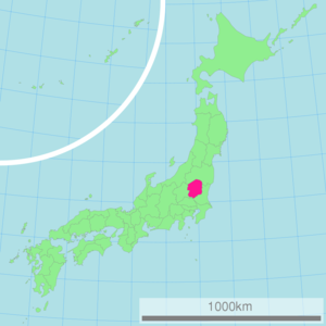
Island =Honshū
TotalArea = 6,408.28
AreaRank = 20th
PCWater = 0.2
PopDate = January 1, 2003
Population = 2,011,313
PopRank = 20th
Density = 314
Districts = 6
Municipalities = 31
ISOCode = JP-09
Flower = Yashio tsutsuji ("Rhododendron albrechtii")
Tree = Japanese horsechestnut ("Aesculus turbinata")
Bird =Blue-and-white Flycatcher ("Cyanoptila cyanomelana")
Website = [http://tia21.or.jp/life/english/index.html http://tia21.or.jp/life/ english/index.html]
Governor =Tomikazu Fukuda Kantō region on the island ofHonshū ,Japan . The capital is the city of Utsunomiya. Utsunomiya is famous for its many delicious gyoza specialist shops. Also located in Utsunomiya, Tochigi Prefecture has one of the largest shopping malls in the North Kantō region, Bell Mall.Nikkō , whose ancient Shinto shrines andBuddhist temple s UNESCO has recognized by naming them aWorld Heritage Site , is in this prefecture. Fact|date=April 2008 Nikkō is approximately one hour bytrain from Tokyo and approximately 35 km west of the capital Utsunomiya.Other famous parts of Tochigi include a region called
Nasu known foronsen and localsake and ski resorts. The Imperial family has a villa in Nasu. Nasu Shiobara is a majorShinkansen station.Another onsen resort is at
Kinugawa Onsen .Prefectural overview
Situated among the inland prefectures of the Northern portion of the Kanto region, Tochigi is contiguous with the four prefectures of Ibaraki, Gunma, Saitama, and Fukushima.
The climate of Tochigi may be classified as a humid temperate zone in which there are broad variations in temperature. Winters are arid with dry winds, while summers are humid and puncuated with frequent thunderstorms.
The population of Tochigi as of March, 2007, was approximately 2,014,900 and was increasing up until 2005. Fact|date=April 2008 In 2006, the population started to decrease mirroring that of the nation's population decrease. About 500,000 people live in the prefectural capital city of Utsunomiya, with the remainder dispersed over 14 other cities and 17 towns. Fact|date=April 2008
Situated in the center of the prefecture is the largest open plain in the Kanto region. To the north stand the mountains Shirane (2,578m), Nantai (2,484m) and Nasudake (1,917m). Originating in this region are the Kinugawa, Nakagawa, and Watarase Rivers, which flow across the Kanto plain before emptying in the Pacific Ocean. Tochigi is the 20th largest prefecture in Japan with a total area of 6,408 square km.
History
In the late 7th century, Tochigi formed
Shimotsuke Province . Fact|date=April 2008 During that time was built the Shimotsuke-Yakushi temple, making it the Buddhist capital of the Kanto Region.In the early 15th century,
Ashikaga University , Japan's oldest school of higher education, was re-established, holding over 3000 students by the 16th century. Saint Francis Xavier introduced Ashikaga to the world as the best university in Japan.In the early 17th century, Japan was unified by the
Shogun Tokugawa Ieyasu . After his death, Toshogu was built in Nikko on what the shoguns thought of as holy ground to protect and worship Ieyasu. The establishment of theNikkō Toshogu in 1617 brought Nikkō to national attention. Fact|date=April 2008 TheTokugawa Shogunate developed theNikkō kaidō (日光街道, part of the major road connecting Nikkō withEdo ) and required lavish processions to worship Ieyasu, the founder of the Tokugawa line of shoguns.In the late 19th century the Tokugawa Shogunate fell and the new government established the prefectures. The prefectural capital was established in the city of Tochigi after the unification of Utsunomiya Prefecture and Tochigi Prefecture in 1873. Fact|date=April 2008 By 1884, however, the capital was transferred to Utsunomiya.
Municipalities
Cities
Fourteen cities are located in Tochigi Prefecture.(Taken from the 2004 Industrial Analysis Report published by the Ministry of Economy, Trade and Industry.)
Tochigi's annual gross agricultural output is roughly 274 billion yen and includes rice, vegetables, and livestock. Tochigi is also known for its strawberries, Chinese chives, and Japanese pears which are sold throughout the country as well as exported to various nations. Approximately 55% of Tochigi is covered by forests. Mushrooms, such as
Shiitake mushrooms, make up half of the forest industry, its output being approximately 5.6 billion yen.Education
Tochigi is home to many universities and colleges including those for science and technology, literature, medicine, education, and art. Below is a list of some of the universities located in Tochigi:
* Utsunomiya University
* Ashikaga Institute of Technology
* International University of Health and Welfare, Otawara
* Sakushin Gakuin University, Utsunomiya
* Jichi Medical School, Shimotsuke
* Teikyo University, Utsunomiya
* Dokkyo University School of Medicine, Mibu
* Utsunomiya Kyowa University, Utsunomiya and Nasushiobara
* Hakuoh University, Oyama
* Bunsei University of Art, Utsunomiya
* Oyama National College of Technology
* Tochigi College of Industry and Technology (Central), Utsunomiya
* Tochigi College of Industry and Technology (North), Nasu
* Tochigi College of Industry and Technology (South), AshikagaPeople
Sports
The sports teams listed below are based in Tochigi.
Football (soccer)
*Tochigi S.C. (Utsunomiya)Ice Hockey
*Nikkō Ice Bucks (Nikkō)Basketball
* [http://www.tochigibrex.com/ Tochigi Brex]Motorsport
*Twin Ring Motegi circuitTourism
Nikkō National Park is famous for its UNESCO
World Heritage Site which was registered as the 10th World Heritage Site in 1999. This encompasses Rinnō-ji,Nikkō Tōshō-gū ,Mount Nantai , andFutarasan Shrine . TheKegon Falls , also in Nikkō, is popular with tourists. To travel between the city and the falls, automobiles and buses take the Irohazaka, a road with dozens of switchbacks. In addition, 400 year-old Japanese Cedars (about 13,000 in total) line the famous Nikko Cedar Avenue for roughly 37 km, making it the longest tree lined avenue in the world.Japan's oldest university,
Ashikaga University , as well as traditional towns such as the city of Tochigi are also part of the prefecture's rich heritage.A more recent and modern attraction is the
Twin Ring Motegi Circuit race course, which hosts the onlyIndyCar race outside the United States. The track also hosts many other race events includingFormula One and motorcycle races as well as festivals and fireworks events.Tochigi has many traditional festivals and events such as Nikkō Tōshō-gū's
1000 Samurai Procession and Horseback Archery Festival, and the city of Tochigi's Autumn Festival where doll floats are pulled around the city once every five years.Other attractions include
*
Nikkō Tōshō-gū
*Rinnō-ji
*Futarasan Shrine
*Kegon Falls
*Lake Chuzenji
* Kirifuri Falls
* Mashiko
* Shiobara Hot Spring
* Nasu resort area
* Kinugawa Hot Spring
*Twin Ring Motegi (motorsports complex)Transportation and Access
Roadways
Traversing the prefecture along the north-south axis and connecting to the rest of the country are the
Tōhoku Expressway and the new and old Route 4. From east to west spans Rout 50, connecting southern Tochigi with Ibaraki and Gunma Prefectures.Also connecting Tochigi, Gunma, and Ibaraki is the
Kita-Kantō Expressway , with the 18.5 km that connect the Tochigi-Tsuga Interchange and the Utsunomiya-Kaminokawa Interchange. Portions of the Kita-Kantō Expressway are still being constructed and is set to be fully completed by 2011. The highway will link the region's other main transport arteries, the Tōhoku, the Jōban and theKan-Etsu Expressway s, providing a link to the international port of Hitachinaka in Ibaraki.Railways
The main railways running north and south in Tochigi are the
Tohoku Shinkansen and the JRUtsunomiya Line . ja-stalink|Oyama (south Tochigi) can be reached in 43 minutes fromTokyo Station by shinkansen, with the fastest trains arriving in ja-stalink|Utsunomiya in 48 minutes, placing many parts of Tochigi within commuting range of central Tokyo. To the east and west, the Mito and Ryōmō Lines connect Tochigi to Ibaraki and Gunma Prefectures.Freight is served by the Utsunomiya Freight Terminal.
*East Japan Railway Company
**Tōhoku Shinkansen
**Shōnan-Shinjuku Line
**Utsunomiya Line (Tōhoku Main Line )
**Nikkō Line
**Ryōmō Line
**Mito Line
**Karasuyama Line Air travel
Within approximately an hour's drive along the Tohoku Expressway from Utsunomiya is Fukushima Airport. International and national air transportation is through
Narita International Airport to the east of Tokyo and approximately three hours by vehicle from Utsunomiya.In popular culture
* Tochigi prefecture is the home of street racing team
Team Emperor in the popularmanga andanime "Initial D ".External links
* [http://tia21.or.jp/life/english/index.html Official Tochigi Prefecture homepage]
* [http://www.pref.tochigi.jp/kogyo/english/01/index.html Industries of Tochigi]
* [http://www.bellmall.co.jp/ Bell Mall Website] Japanese
*wikitravel|TochigiReferences
* [http://www.pref.tochigi.jp/intro/gaikokugo/english/englishtop.html Official Tochigi Website]
* [http://www.pref.tochigi.jp/kogyo/english/index.html Guide to Industrial Locations in Tochigi]
* http://www.kunaicho.go.jp/e07/ed07-04.html#NASU

Wikimedia Foundation. 2010.