- Corryong, Victoria
-
Corryong
Victoria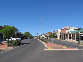
Hansen St, the main street of Corryong
 Corryong
Population: 1,228 (2006 census) Postcode: 3707 Elevation: 313.5 m (1,029 ft) Location: LGA: Shire of Towong State District: Benambra Federal Division: Indi Mean max temp Mean min temp Annual rainfall 21.2 °C
70 °F7.4 °C
45 °F774.2 mm
30.5 inCorryong is a small town in Victoria, Australia. It is located 120 kilometres (75 mi) east of Albury-Wodonga, near the upper reaches of the Murray River and thus close to the New South Wales border. At the 2006 Census in Australia, Corryong had a population of 1,228.[1]
Contents
History
The Post Office opened on 1 February 1874.[2]
The town today
It is reachable by road along the Murray Valley Highway, and is indeed the eastern endpoint of this highway. Further eastern travel puts a driver on the Alpine Way, until recently a dirt road, before encountering any major settlements.
Industries in the area involve mainly agriculture and forestry, particularly beef and dairy farming, though some farmers are experimenting with more exotic farming enterprises. The forestry industries include both harvesting native eucalypts and the extensive pine plantations in the area. The town itself exists primarily to service these industries.
Corryong is supported by a variety of service clubs, a hospital and schools. It has a Catholic primary and Corryong College P-12 school. The College has approximately 460 (2006) students. Corryong is also home to the Australian Institute of Flexible Learning (AIFL) which offers 100% online education to all of Australia.
Its location makes it the Victorian gateway to the New South Wales snowfields, including the Thredbo ski village, and the Snowy Mountains Scheme. It is a way station for many travellers, particularly those on motorcycles, travelling across Australia's highest mountains. Other tourists come to fish in the river and other nearby waterways, or to partake in horseriding around the mountain areas surrounding the town.
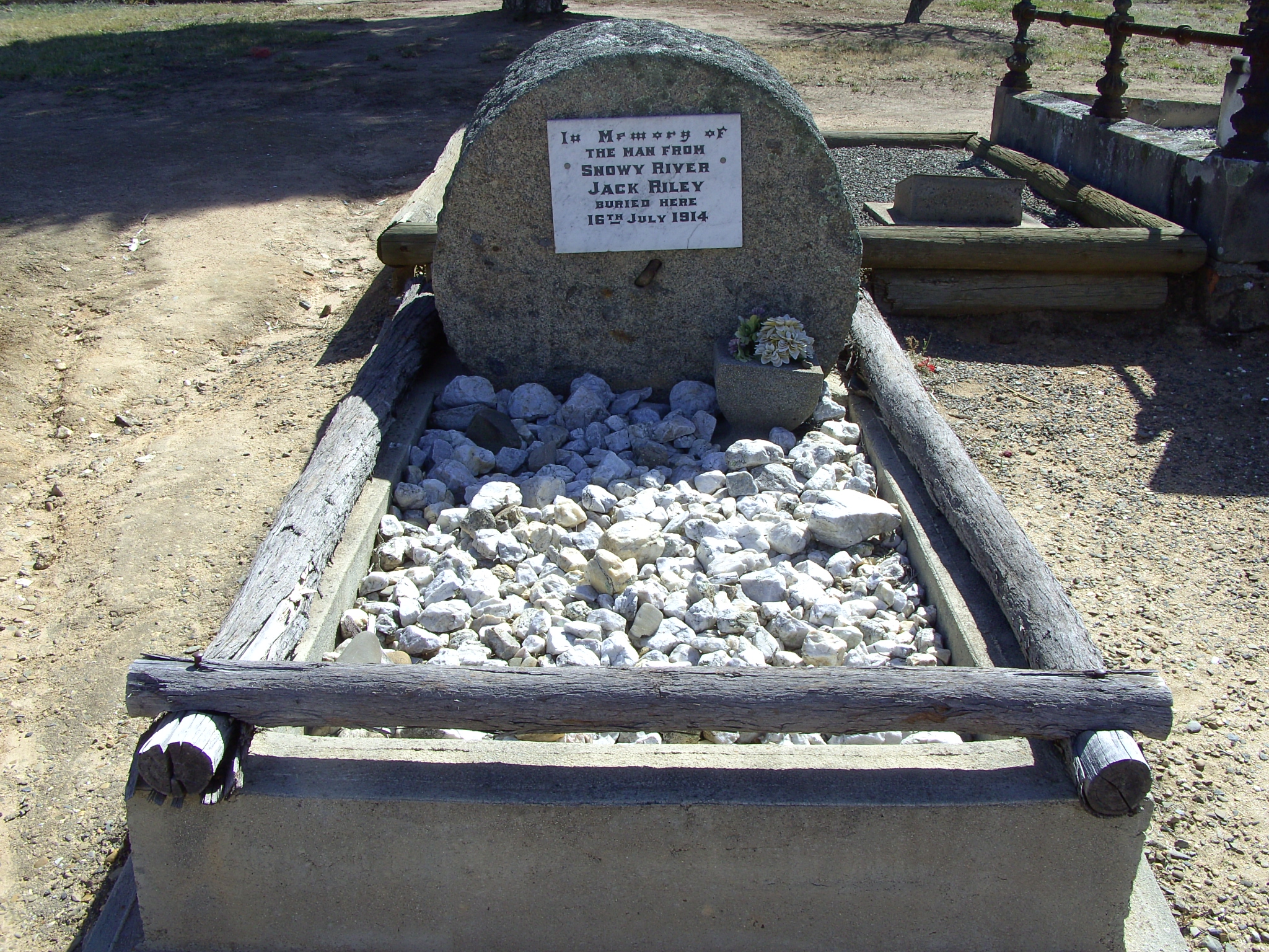
It is also of note as the home of Jack Riley, a hermit stockman employed by John Pearce of Greg Greg Station at Corryong to run cattle at "Tom Groggin" 60km upriver from Khancoban, New South Wales. Riley's horseriding skills reputedly made him the inspiration for Banjo Paterson's The Man from Snowy River. Whether this is true or not, the local government uses this claim extensively in its tourist promotions and holds a "high country festival" annually.
 Grave of Jack Riley (1841-1914), The Man from Snowy River, Corryong cemetery
Corryong is close to the Burrowa-Pine Mountain National Park and the massive Alpine National Park. The Kosciuszko National Park is located nearby across the state border. Both of these areas were extensively burnt in the bushfires which raged through the region in January 2003.
Golfers play at the Corryong Golf Club on Donaldson Street, a nine-hole course. [3]
The town is the center of the Upper Murray Football League, an Australian Rules Football competition which began in 1893. Corryong is home to two of the three foundation clubs: Corryong FC, which has been based in the town from 1893 and Federal FC, formerly the Mount Elliot Miners and renamed in 1901 to celebrate the Federation of Australia and moved to be fully based at Corryong around the same time.
See also
The town is birthplace to several famous Australians including: Country music singer Lee Kernaghan. [4] and Actress and comedian Corrine Grant.[5]
References
- ^ Australian Bureau of Statistics (25 October 2007). "Corryong (Urban Centre/Locality)". 2006 Census QuickStats. http://www.censusdata.abs.gov.au/ABSNavigation/prenav/LocationSearch?collection=Census&period=2006&areacode=UCL212200&producttype=QuickStats&breadcrumb=PL&action=401. Retrieved 2009-03-20.
- ^ Premier Postal History, Post Office List, https://www.premierpostal.com/cgi-bin/wsProd.sh/Viewpocdwrapper.p?SortBy=VIC&country=, retrieved 2008-04-11
- ^ Golf Select, Corryong, http://www.golfselect.com.au/armchair/courseView.aspx?course_id=1338, retrieved 2009-05-11
- ^ http://www.leekernaghan.com.au/bio/
- ^ http://www.tv.com/people/corinne-grant/
Coordinates: 36°11′53″S 147°53′56″E / 36.198°S 147.899°E
Towns in the Shire of Towong Bellbridge • Bethanga • Corryong • Cudgewa • Dartmouth • Eskdale • Granya • Koetong • Mitta Mitta • Talgarno • Tallangatta • Tintaldra • Towong • Walwa
Categories:- Towns in Victoria (Australia)


Wikimedia Foundation. 2010.