- Millers Point, New South Wales
-
Millers Point
Sydney, New South Wales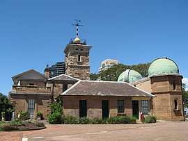
Sydney ObservatoryPopulation: 2,015 (2006)[1] Postcode: 2000 Area: 0.5 km² (0.2 sq mi) Location: 1 km (1 mi) north-west of Sydney CBD LGA: City of Sydney Parish: St. Philip State District: Sydney Federal Division: Sydney Suburbs around Millers Point: Port Jackson Port Jackson Dawes Point Barangaroo Millers Point The Rocks Darling Harbour Sydney CBD Sydney CBD Millers Point is an urban locality within Sydney's city centre, in the state of New South Wales, Australia. Millers Point is located on the north-western edge of the Sydney central business district, adjacent to The Rocks and is part of the local government area of the City of Sydney.
Millers Point lies on the southern shore of Sydney Harbour, beside Darling Harbour. The Barangaroo development is taking place on 22 hectares of land on the western side of the suburb.[2] Sections of Millers Point have been included as part of the The Rocks area in the past and some residents and businesses still use it in their address.
Contents
History
A small mill that was owned by Jack Leighton was located here. The area became known as Jack, the Miller's Point.[3]
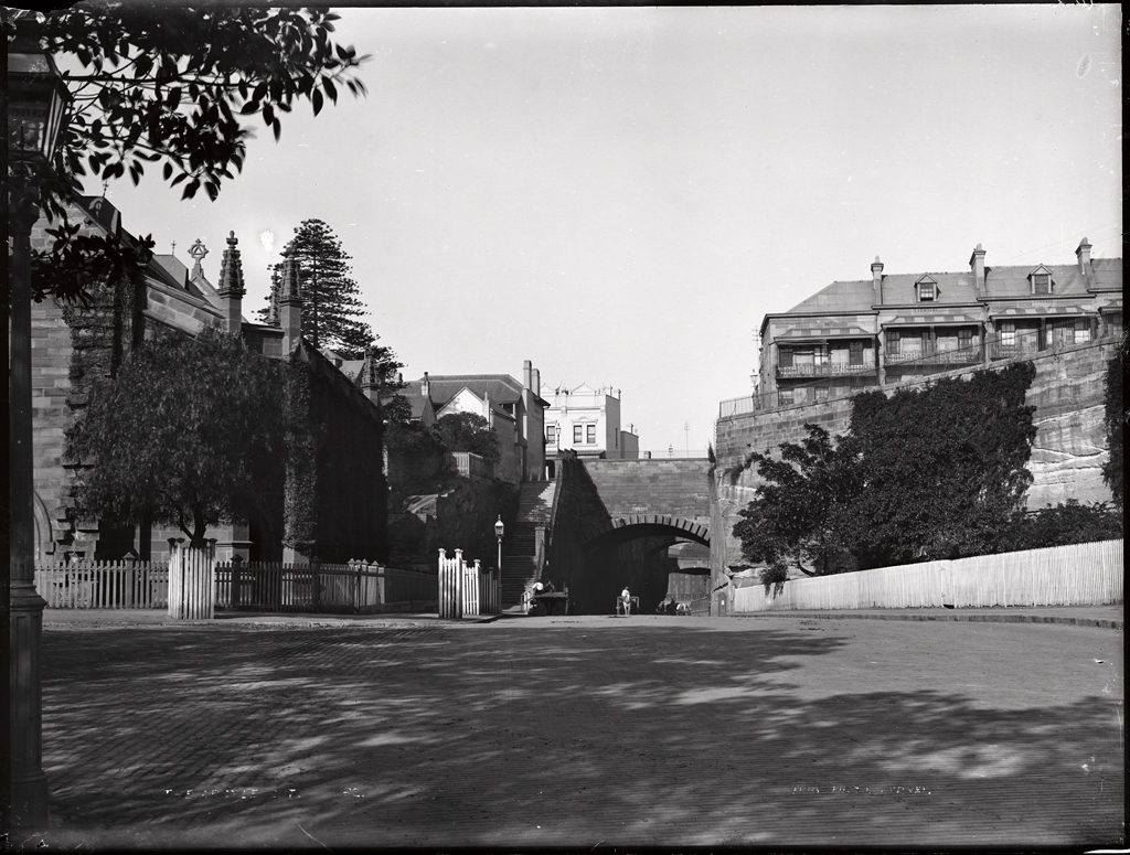
 Argyle Cut, from Millers Point. The Powerhouse Museum Collection
 Lord Nelson, one of Sydney's oldest pubs
In 1833 Governor Bourke granted the Catholic Church land at Millers Point for the construction of a school house that could serve as a chapel on Sundays. The Colonial Architect, Ambrose Hallen in consultation with Bishop Ullathorne, designed the school building which was completed by May, 1835. It was a one story building constructed in sandstone with two rooms that could be opened into one. St Brigid's Millers Point is the oldest existing place of Catholic worship in Australia. The school was closed in 1992 but the church continues to be used by the local community. [4] [5]
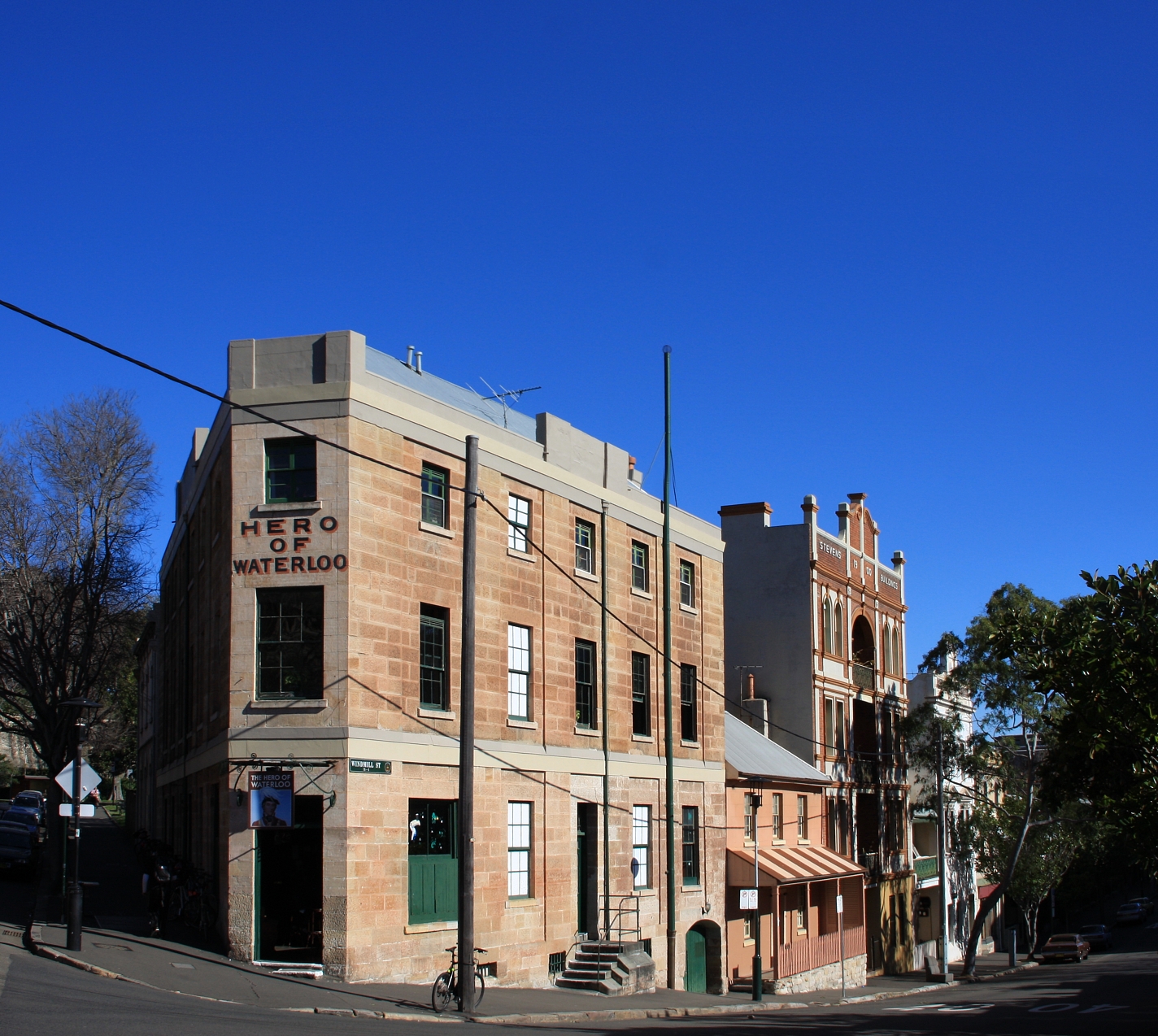
The current Sydney Observatory building on Observatory Hill was completed in 1858 by English astronomer and clergyman William Scott. Two separate pubs in the area claim to be Sydney's oldest surviving pubs, the Lord Nelson here at Millers Point and the Fortune of War nearby at The Rocks. Others in the area include the Palisade and the Hero of Waterloo.
-

The Hero of Waterloo pub
-

The Palisade Hotel
-

Federation Filigree homes, High Street
Further reading
- Grace Karskens. Inside The Rocks. Published by Hale & Iremonger, Australia. 1999. (ISBN 0 86806 666 4)
- Shirley Fitzgerald & Christopher Keating. Millers Point, The Urban Village. Hale & Iremonger, Australia,1991. (ISBN 086806443 2)
- Isadore Brodsky. Heart Of The Rocks. Published by Old Sydney Free Press, Australia. 1965.
See also
References
- ^ "2006 Census Community Profile Series : Millers Point (State Suburb)". Australian Bureau of Statistics. Accessed 31 October 2009.
- ^ Barangaroo a north shore girl, City of Sydney, 19 October 2006. Accessed 2006-12-05.
- ^ The Book of Sydney Suburbs, Compiled by Frances Pollon, Angus & Robertson Publishers, 1990, Published in Australia ISBN 0-207-14495-8, page 189
- ^ http://www.stpatschurchhill.org/StBrigids/history.html
- ^ http://www.deh.gov.au/cgi-bin/heritage/photodb/imagesearch.pl?proc=detail;barcode_no=rt46731
External links
- Millers Point, New South Wales is at coordinates 33°51′39″S 151°12′10″E / 33.86085°S 151.20281°ECoordinates: 33°51′39″S 151°12′10″E / 33.86085°S 151.20281°E
Suburbs and localities within the City of Sydney Suburbs Alexandria · Annandale · Barangaroo · Beaconsfield · Camperdown · Centennial Park · Chippendale · Darlinghurst · Darlington · Dawes Point · Elizabeth Bay · Erskineville · Eveleigh · Forest Lodge · Glebe · Haymarket · Millers Point · Moore Park · Newtown · Paddington · Potts Point · Pyrmont · Redfern · Rosebery · Rushcutters Bay · Surry Hills · Sydney CBD · The Rocks · Ultimo · Waterloo · Woolloomooloo · Zetland
Localities Categories:- Suburbs of Sydney
-


Wikimedia Foundation. 2010.