- Yuba River
-
Yuba River Henneet[1], Rio De Los Yubas[1] River  Satellite view of the lower Yuba River -- Yuba City/Marysville and the Feather River lie near the bottom left; Yuba Goldfields are in the upper right center
Name origin: Derived from Spanish uva meaning grape Country United States State California Regions Nevada County, Yuba County Part of Feather River basin Tributaries - left Middle Yuba River, South Yuba River, Deer Creek - right North Yuba River Cities North San Juan, Marysville, Yuba City Source Confluence of North and Middle Yuba River [1] - location Near North San Juan, Borderline Yuba and Nevada Counties - elevation 1,129 ft (344 m) - coordinates 39°22′07″N 121°08′11″W / 39.36861°N 121.13639°W Mouth Feather River - location Yuba City-Marysville, Yuba County - elevation 49 ft (15 m) - coordinates 39°07′39″N 121°35′48″W / 39.1275°N 121.59667°W Length 40 mi (64 km), Southeast [2] or 115 miles (185 km) including the North Fork[2] Basin 1,339 sq mi (3,468 km2) [3] Discharge mouth - average 2,432 cu ft/s (69 m3/s) [3] - max 180,000 cu ft/s (5,097 m3/s) - min 10 cu ft/s (0 m3/s)  Map of the Yuba River basin
The Yuba River is a tributary of the Feather River in the Sacramento Valley of the U.S. state of California. It is one of the Feather's most important branches, providing about a third of its flow. The main stem of the river is about 40 miles (64 km) long, and its headwaters are split into North, Middle and South forks; the confluence of the former two is considered the beginning of the Yuba. The river drains about 1,339 square miles (3,470 km2) of the western slopes of the Sierra Nevada mountain range as well as a small portion of the Sacramento Valley.
The Yuba was probably named by early Spanish or Mexican scouting expeditions in the region who found wild grapes growing along the banks of the river, and dubbed it using a variant spelling of the Spanish word uva (grape).[4]
Contents
Course
Most of the Yuba's flow is incorporated from its three main tributaries, the North Yuba, Middle Yuba and South Yuba. All three rivers run westwards from the crest of the Sierra Nevada to form the main stream of the Yuba. The beginning of the main stem is defined as the confluence of the North and Middle Yuba Rivers. The North Fork is longer, but the Middle Fork is considered the main stem.[1]
North fork
The North Yuba River, 61.0 miles (98.2 km) long,[5] rises near the eastern border of the Tahoe National Forest, on a mountainside along California State Route 49. It flows southwest then west through a 3,000-foot-deep (910 m) canyon past the small villages of Downieville, where it receives the Downie River, and Goodyears Bar. It then incorporates the flow of Canyon Creek and Slate Creek, two of its main tributaries, and very soon after widens into New Bullards Bar Reservoir, which is impounded by the 645-foot (197 m) New Bullards Bar Dam. Very soon after leaving the dam it joins with the Middle Yuba to form the Yuba River.[6]
Middle fork
Originating in a bowl-shaped valley in Moscove Meadow, the 55.4-mile-long (89.2 km) Middle Yuba River[5] flows north into Jackson Meadows Reservoir, then turns west, descending steeply into a gorge, defining over almost its entire length the boundary of Nevada County in the north and Yuba County in the south. The river bends to the southwest, then west again, receiving Kanaka Creek from the right and Grizzly Creek from the left. It intersects California State Route 49 about 2 miles (3.2 km) northwest of North San Juan, then a few miles after joins with the North Yuba River.[6]
South fork
The 65.0-mile-long (104.6 km) South Yuba River[5] originates at Donner Pass at the crest of the Sierra Nevada, near the town of Soda Springs. Gathering numerous snowfed tributaries, it runs west through a marshy, lake-filled valley, shadowed by Interstate 80. The river then flows into Lake Spaulding, which is formed by Spaulding Dam. After escaping from the dam the river plunges northwards into a steep-sided valley. Canyon Creek enters from the right, then Poorman Creek also from the right near the town of Washington. The river continues west into the foothills, crossing under State Route 49. Its mouth is on the east shore of Englebright Lake, formed by a dam across the Yuba River.[6]
Main stem
From the joining of the North and Middle forks, the Yuba flows southwards, then southwest, through the Sierra Nevada foothills, forming the Yuba-Nevada County border. The river widens into the main arm of Englebright Lake near French Bar, and is joined by the South Yuba within the reservoir. The Yuba leaves the Englebright Dam near Lake Wildwood, California and is then joined by Deer Creek, the stream flowing from that lake, on the left. The Yuba slows down as it flows from the mountains out into the Sacramento Valley near the Yuba Goldfields, a section of the Yuba River valley consisting of dredged sediments washed down by hydraulic mining in the 19th century. The river then turns southwest, flowing through irrigated farmland. It then skirts the south side of Marysville and reaches its destination at the Feather River between the cities of Marysville, Yuba City and Linda.[6]
History
The Yuba River valley was originally situated in one of California's largest Native American population centers. Historians divide the natives living in the Yuba area into several groups – the Konkow, Maidu, Nisenan and Miwok.[7][8] Despite the connotations of these names, they are only used for reference purposes. The truth about pre-19th century Yuba River peoples was that they were divided into hundreds of small villages, with distinct names but similar customs. Like other Sierra Nevada people, their staple food were acorns, but they also hunted and gathered for other foods from the environment in which they lived.[9]
The California Gold Rush brought some of the first American settlers into the area, followed by many Mexican, African and Chinese emigrants. Within a few years diseases which the Native Americans had no immunity over, brought by the incoming people, wiped out most of the native population. The Yuba River and its forks were one of the more popular destinations for the gold miners, who poured to the region in great numbers.[10] Although first gold was extracted by simple methods such as panning and sluicing, mining operations quickly turned into large-scale industrial hydraulic mining. About 685,000,000 cubic feet (19,400,000 m3) of debris was carried down the Yuba alone. Hundreds of acres of land were covered, the riverbed was raised by tens of feet in places and flooding events became more severe for the river was no longer in its old channel.[11] After farmers whose fields had been buried under the onslaught sued the gold mining companies, the practice ended. The debris left by the destruction of hydraulic mining still remains as the Yuba Goldfields.[12][13]
River modifications
Like the majority of California rivers, the Yuba is dammed at many points along its length and irrigation agriculture in the Sacramento Valley takes a heavy draw of water from the river. The first significant man-made changes to the watershed came with gold mining practices in the 19th century, specifically hydraulic mining. Basically consisting of washing down entire hillsides with high-pressure hoses in search of gold pockets, hydraulic mining was profitable, but caused massive physical and environmental damage. Millions of tons of sediment were carried down the Yuba and other Central Valley rivers, eventually ending up in places ranging from the original riverbed to San Francisco Bay, creating enormous difficulties for water-borne transportation.
In the more recent past, the Yuba's periodic rages have been subdued by the construction of many dams. The largest of these are the New Bullards Bar Dam, which lies on the North Fork directly above the confluence with the Middle Fork;[14] and the Englebright Dam, situated on the main stem as it winds its way south through the Sierra Nevada foothills.[15] Both are large concrete arch structures standing hundreds of feet high. Other dams include Jackson Meadows Reservoir on the Middle Fork; Scotts Flat and Wildwood on Deer Creek; and Mildred and Virginia Ranch on Dry Creek, a lower tributary of the Yuba.
Tributaries
In hierarchical order, going upstream:
- Dry Creek
- Keystone Creek
- New York Creek
- Deer Creek
- Squirrel Creek
- North Fork Deer Creek
- South Fork Deer Creek
- South Yuba River
- Shady Creek
- Humbug Creek
- Poorman Creek
- South Fork Poorman Creek
- Fordyce Creek
- North Creek
- Rattlesnake Creek
- Lower Castle Creek
- Upper Castle Creek
- Dobbins Creek
- Middle Yuba River
- Oregon Creek
- Grizzly Creek
- Brush Creek
- Grizzly Creek
- Indian Creek
- Kanaka Creek
- Wolf Creek
- East Fork Creek
- Pass Creek
- Oregon Creek
- North Yuba River
- Willow Creek
- Bridger Creek
- Brandy Creek
- Mill Creek
- Slate Creek
- Canyon Creek
- Little Canyon Creek
- East Fork Canyon Creek
- South Fork Canyon Creek
- Cherokee Creek
- Fiddle Creek
- Goodyears Creek
- Downie River
- Pauley Creek
- Lavezzola Creek
- Empire Creek
- Sunnyside Creek
- Spencer Creek
- West Branch Downie River
- Haypress Creek
- Salmon Creek
- Deer Creek
- Lincoln Creek
- Dorsey Creek
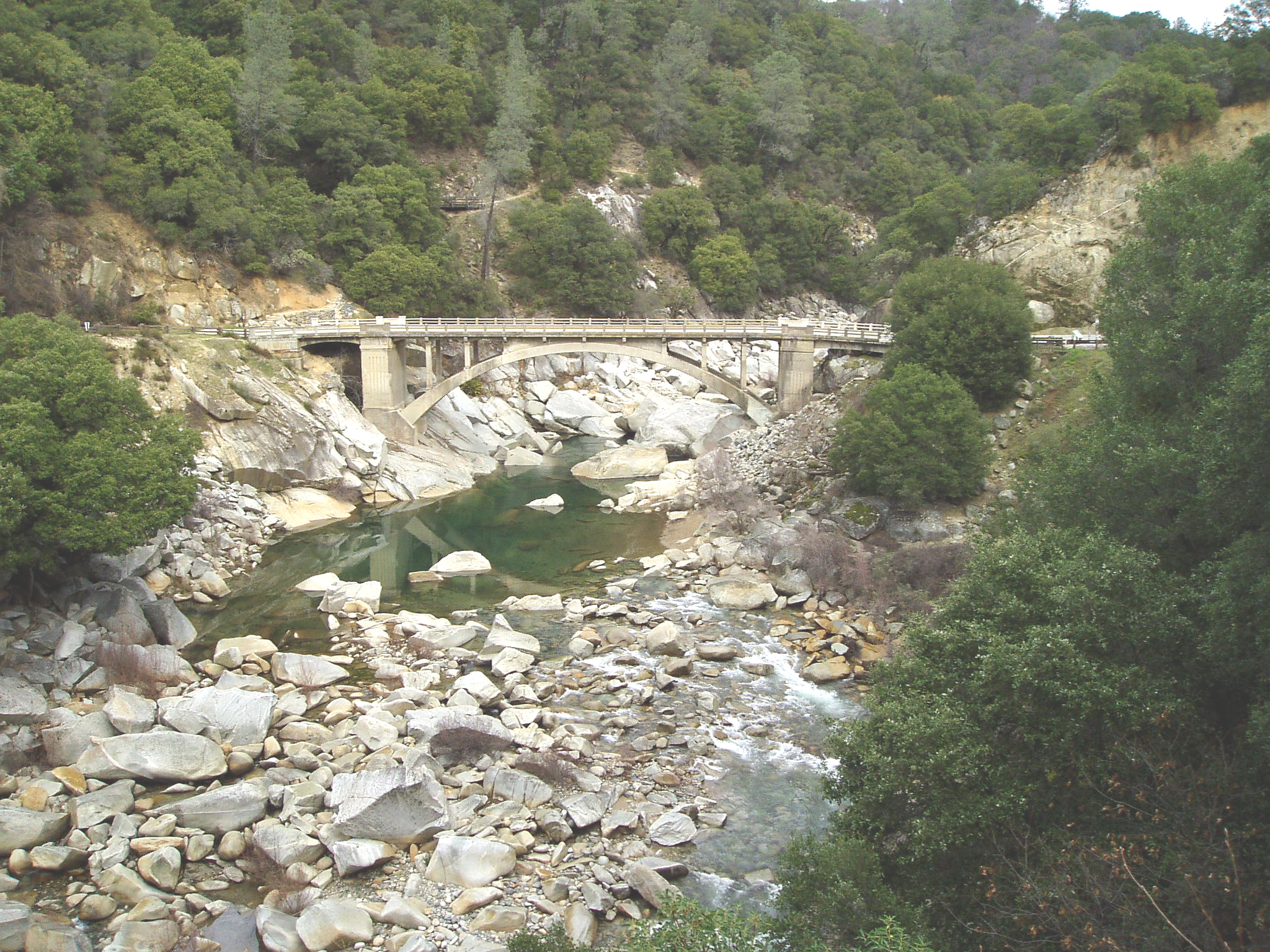
Various views of the Yuba  A view of the South Fork of the Yuba River from the North Bloomfield Road bridge
 A waterfall on the South Fork Yuba River in South Yuba River State Park
 The Bridgeport covered bridge on the South Fork Yuba River in South Yuba River State Park
 The South Fork of the Yuba River as it intersects with State Highway 49
 USGS map of the Yuba River watershed
References
- ^ a b c d "Yuba River". Geographic Names Information System, U.S. Geological Survey. 1981-01-19. http://geonames.usgs.gov/pls/gnispublic/f?p=gnispq:3:::NO::P3_FID:238295. Retrieved 2010-08-23.
- ^ a b Length measured in Google Earth
- ^ a b "USGS Gage #11421000 on the Yuba River near Marysville, CA: Water-Data Report 2009". National Water Information System. United States Geological Survey. 2009. http://wdr.water.usgs.gov/wy2009/pdfs/11421000.2009.pdf. Retrieved 2010-08-23.
- ^ Yuba City budget
- ^ a b c U.S. Geological Survey. National Hydrography Dataset high-resolution flowline data. The National Map, accessed March 10, 2011
- ^ a b c d ACME Mapper. USGS Topo Maps for United States (Map). Cartography by United States Geological Survey. http://mapper.acme.com/. Retrieved 2010-08-23.
- ^ "California Native Americans Map". San Manuel Band of Mission Indians. http://www.sanmanuel-nsn.gov/images/sm_CA-NA-map-big.gif. Retrieved 2010-08-08.
- ^ "California Indian Tribal Groups". California Indian Library Collections. http://www4.hmc.edu:8001/humanities/indian/california/tribemap.gif. Retrieved 2010-08-08.
- ^ Hanson, George Emmanuel (2007). "Native Races of Yuba River Valley". The Early History of the Yuba River Valley. Yuba County History. http://yubaroots.com/history/yrv-4.htm. Retrieved 2010-08-24.
- ^ "Cultural History of the South Yuba River Canyon". South Yuba River State Park. Nevada County Gold. http://www.ncgold.com/Museums_Parks/syrp/syrc/index.html. Retrieved 2010-08-25.
- ^ Garvin, Cosmo (2002-10-24). "This land ain't your land: Much of the Yuba Goldfields are supposed to be public property, but the mining industry is treating the moon-like landscape as personal property. That's not sitting well with the locals.". newsreview.com. http://www.newsreview.com/sacramento/content?oid=13402. Retrieved 2010-08-25.
- ^ "Yuba Goldfields, California". NASA Earth Observatory. National Aeronautics and Space Administration. 2005-05-24. http://earthobservatory.nasa.gov/IOTD/view.php?id=5522. Retrieved 2010-08-25.
- ^ Baumgart, Don. "Pressure Builds to End Hydraulic Gold Mining". California Gold Rush History. Nevada County Gold. http://www.ncgold.com/History/BecomingCA_Archive26.html. Retrieved 2010-08-25.
- ^ "New Bullards Bar Dam and Reservoir". Northern California Water Association. http://www.norcalwater.org/watermap/bullardsbar.shtml. Retrieved 2010-08-25.
- ^ Childs, Jonathan R.; Snyder, Noah P.; Hampton, Margaret A. (2003). "Bathymetric and geophysical surveys of Englebright Lake, Yuba-Nevada Counties, California". Western Coastal & Marine Geology. U.S. Geological Survey. http://geopubs.wr.usgs.gov/open-file/of03-383/. Retrieved 2010-08-25.
Sacramento River Valley Pit River • McCloud River • Mill Creek • Deer Creek • Battle Creek •Stony Creek •Butte Creek • Feather River • Yuba River • Bear River • American River • Cache Creek • Putah CreekSan Joaquin River Valley Tulare Basin Categories:- Tributaries of the Feather River
- Sierra Nevada (U.S.)
- Rivers of Nevada County, California
- Rivers of Sierra County, California
- Rivers of Yuba County, California
- Dry Creek


Wikimedia Foundation. 2010.