- Willetton, Western Australia
-
Willetton
Perth, Western Australia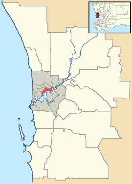
 Willetton
Population: 17243 (2006 census)[1] Established: 1970s Postcode: 6155 Area: 8.6 km² (3.3 sq mi) Location: 16 km (10 mi) from Perth City LGA: City of Canning State District: Riverton Federal Division: Tangney Suburbs around Willetton: Rossmoyne Riverton Bull Creek Willetton Parkwood Leeming Leeming Canning Vale Coordinates: 32°03′11″S 115°53′20″E / 32.053°S 115.889°E
Willetton is a large southern suburb of Perth, Western Australia. Its Local Government Area is the City of Canning.
Contents
History
Willetton's name derives from Henry Willett of Willett & Co, who was granted Canning Location 21 (roughly the location of modern Lynwood and Parkwood) and settled in the area in June 1832. In November 1964, the Shire of Canning proposed the names "Burtsdale" and "Willetton" for Willetton and Lynwood/Parkwood respectively, the name Burtsdale honouring Septimus Burt, who purchased the land in 1882. In August 1965, developers at Lynwood requested the name "Clovercrest Estate", but finally agreed to "Lynwood". The name Willetton was shifted westwards and gazetted in December 1965 within its present boundaries.[2]
The original subdivision was opened in the early 1970s under the developer's name "Burrendah Heights". (The name survives as Burrendah Boulevard and Burrendah Primary School). The section to the east of Vahland Avenue was developed in the 1980s under the unofficial name "Rostrata". Most housing and infrastructure was completed in the 1990s.
Geography
Willetton is located about 15 kilometres south of the Perth CBD. It is built on a section of flat sandy coastal plain which was originally covered with open Banksia woodland and stands of Paperbark trees marking the edges of shallow seasonal swamps.
Willetton is bounded by Karel Avenue to the west, Leach Highway and High Road to the north, Willeri Drive to the east and South Street and Roe Highway to the south. Vahland Avenue runs north-south through the suburb.[3]
At the ABS 2001 census, Willetton had a mostly average-income population of 17,571 people living in 6,300 dwellings, nearly all of which are detached houses on single lots. The ABS reported that almost 20% of the suburb's population were of East, Southeast or South Asian origin. Retail trade (1,515), property and business services (1,118), manufacturing (944), education (911), and health and community services (904) were the key occupations of Willetton's residents.
Facilities
Willetton contains the Southlands Boulevarde shopping centre, with two levels and businesses including two supermarkets, Hoyts cinemas and a food court. A light industrial area exists in the north of the suburb near Leach Highway and High Road, containing a Bunnings, pool shops and various trades. Three small neighbourhood shopping centres offer local services in the corners of the suburb.
Adjacent to Willetton on High Road, the Riverton Leisureplex, a large facility with sporting, fitness and recreation facilities first opened on 9 November 2001,[4] is operated by the City of Canning and includes the council's largest library. The Willetton Library is located near Southlands Boulevarde.
Willetton contains the Castlereagh, Burrendah, Willetton, Rostrata primary schools and Orana Catholic Primary School, as well as Willetton Senior High School, the largest public high school in Western Australia with nearly 1,850 students.
Transport
Willetton is situated between two major east-west routes - Leach Highway (west to the Bull Creek railway station, Kwinana Freeway to Perth's CBD and Fremantle; east to Cannington and Perth Airport) and South Street (west to Murdoch railway station, Murdoch University and Fremantle; east to Canning Vale and Armadale). Roe Highway is on the southeastern fringe of the suburb, while Karel Avenue (to Jandakot Airport), Vahland Avenue and Willeri Drive are major north-south routes.
Willetton contains the Southlands bus station, where the CircleRoute takes passengers to Murdoch Train Station, Murdoch University and Curtin University of Technology, while other bus routes go to Cannington.All services are operated by the Public Transport Authority.
Politics
Willetton has a broadly upper-middle-class, mixed-ethnic population. Historically it has been fairly safe for the Liberal Party at both Federal and state elections, although three of the suburb's four booths delivered majorities to the Australian Labor Party at state level in 2001 and 2005. In 2008 it returned a Liberal member of parliament by a very slim majority.
The suburb is located within the Federal Division of Tangney, the State seat of Riverton and the Beeliar ward of the City of Canning.
See also
References
- ^ Australian Bureau of Statistics (25 October 2007). "Willetton (State Suburb)". 2006 Census QuickStats. http://www.censusdata.abs.gov.au/ABSNavigation/prenav/LocationSearch?collection=Census&period=2006&areacode=SSC52551&producttype=QuickStats&breadcrumb=PL&action=401. Retrieved 2008-10-05.
- ^ Western Australian Land Information Authority. "History of metropolitan suburb names". http://www.landgate.wa.gov.au/corporate.nsf/web/History+of+metropolitan+suburb+names. Retrieved 2007-01-17.
- ^ 2006 StreetSmart directory, Department of Lands and Surveys, Perth.
- ^ Riverton Leisureplex - City Of Canning
Suburbs of the City of Canning | Perth | Western Australia Bentley¹ · Canning Vale¹ · Cannington · East Cannington · Ferndale · Leeming¹ · Lynwood · Parkwood · Queens Park · Riverton · Rossmoyne · Shelley · St James¹ · Welshpool¹ · Willetton¹ · Wilson
¹ Suburb shared with other Local Government AreasCategories:- Suburbs of Perth, Western Australia

Wikimedia Foundation. 2010.