- Yamagata Prefecture
Infobox Prefecture Japan
Name = Yamagata
JapaneseName = 山形県
Rōmaji = Yamagata-ken
Symbol = PrefSymbol-Yamagata.png
Region = Tohoku
Island =Honshū
TotalArea = 9,323.34
AreaRank = 9th
PCWater = 0.02
PopDate =October 1 ,2004
Population = 1,223,000
PopRank = 33rd
Density = 133
Districts = 8
Municipalities = 35
ISOCode = JP-06
Flower =Safflower ("Carthamus tinctorius")
Tree =Cherry
Bird = Mandarinduck ("Aix galericulata")
Website = [http://www.pref.yamagata.jp/english/index-e.html http://www.pref.yamagata.jp/ english/index-e.html]
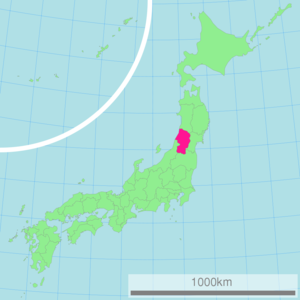
Governor =Hiroshi Saito Japan located in theTohoku region onHonshū island. Its capital is Yamagata.History
The aboriginal
Ezo people (蝦夷)once inhabited the area now known as Yamagata. During theHeian Period (794–1185), the Fujiwara (藤原) family ruled the area. Yamagata City flourished during theEdo Period (1603–1867) due to its status as a castle town and post station, famous for" beni" (redsafflower dye used in the production of handspun silk). In 1649, the famoushaiku poet,Matsuo Bashō visited Yamagata during his five-month trip to the northern regions of Japan. Yamagata, withAkita Prefecture , composedDewa Province until theMeiji Restoration .Geography
Yamagata Prefecture is located in the southwest corner of Tohoku, facing the
Sea of Japan . It bordersNiigata Prefecture andFukushima Prefecture on the south,Miyagi Prefecture on the east, andAkita Prefecture on the north. All of these boundaries are marked by mountains, with most of the population residing in a limited central plain.Cities
Thirteen cities are located in Yamagata Prefecture:
*Higashine
*Kaminoyama
*Murayama
*Nagai
*Nan'yō
*Obanazawa
*Sagae
*Sakata
*Shinjō
*Tendō
*Tsuruoka
*Yamagata (capital)
*YonezawaTowns and villages
Towns and villages in each district:‡ Scheduled to be dissolved following mergers.
Mergers
Economy
Fruit
Yamagata Prefecture is the largest producer of cherries and pears in Japan. A large quantity of other kinds of fruits such as grapes, apples, peaches, melons, persimmons and watermelons are also produced here.
Demographics
As of October 2004, Yamagata Prefecture had a population of 1,223,000 [http://www.stat.go.jp/english/data/jinsui/2004np/zuhyou/15k16-04.xls] . This represented a 5.3% decrease on the previous year, giving Yamagata the equal-fourth highest depopulation rate in Japan [http://www.stat.go.jp/english/data/jinsui/2004np/zuhyou/15k16-07.xls] . This figure consists of a 2.2% natural decrease in the population, and a net 3.1% emigration to other prefectures, again one of the highest rates in Japan.
The prefecture also has one of the oldest populations in Japan. As of 2004, 12.8% of the population was aged between 65 and 74, and 12.1% was over 75 (the fourth and third highest in Japan, respectively) [http://www.stat.go.jp/english/data/jinsui/2004np/zuhyou/15k16-12.xls] . Over 40% of households in Yamagata contain one or more relatives aged 65 or over (one of the three highest in Japan) [http://www.stat.go.jp/data/chiri/map/c_koku/pdf/map15.pdf] .
Culture
Festivals and events
Yamagata Prefecture has a number of annual festivals and events.
The largest is the "hanagasa matsuri" (花笠祭り) which takes place in
Yamagata City on the first weekend in August, when thousands of people perform the hanagasa dance in the city centre and attracts up to 300,000 spectators. Yamagata City is the home of the bi-annualYamagata International Documentary Film Festival in October.In February, a snow lantern festival is held in
Yonezawa at theUesugi Shrine . Hundreds of candle-lit lanterns light pathways dug into the snow around the shrine. Yonezawa is also the site of the "Uesugi Festival" (上杉祭り, "uesugi matsuri") in mid-spring. The festival's highlight is a re-enactment of the 'Battle of Kawanakajima' on the banks of the Matsukawa River.In September, Yamagata Prefecture is famous for its
imoni , a potato stew popular in Northern Japan during the autumn. Imonikai, potato soup parties, are very popular during this season, and many tourists come to Yamagata Prefecture specifically for its particular style of imoni.Art
Beginning in 2003, Yamagata city officials with the aid of Tohoku University of Art and Design began a three-year project in which the Buddhist art of the city’s temples would be catalogued and compared to a set of guidelines in order to identify “cultural assets.” [cite news
last=
first=
coauthors=
title=Yamagata: City unearths wealth of Buddhist Treasure
work= The Asahi Shimbun
pages=
language=
publisher=
date=December 5, 2006
url=http://www.asahi.com/english/Herald-asahi/TKY200612050117.html
accessdate= ] One hundred and ninety temples have had their works of art examined and several significant examples of Buddhist sculpture have been discovered. At Heisenji Temple, in the Hirashimizu district, a particularly rare statue, a seatedVairocana Buddha made fromzelkova wood, was found. Other significant works include sculptures from theHeian Period (794–1185) andKamakura Period (1192–1333).The Yamagata Museum of Art, located in Yamagata City, was opened in 1964 through the efforts of a foundation led by Yoshio Hattori, the president of Yamagata Shimbun and Yamagata Broadcasting Co, Ltd. The permanent collection consists of three types of art: Japanese and Asian, regional, and French. Special exhibitions are held periodically.
Language
Yamagata Prefecture is also known for its local dialect Yamagata-ben, sometimes thought of as backward sounding and the butt of jokes in other parts of Japan. The
2004 movie "Swing Girls " (スウィングガールズ), co-written and directed byShinobu Yaguchi , is set in Yamagata and makes use of Yamagata-ben for comedic purposes.Sports
The sports teams listed below are based in Yamagata.
Football (soccer)
*Montedio Yamagata Volleyball
*Pioneer Red Wings (Tendo)Transportation
Airports
*Yamagata Airport(Tokyo,Osaka,Nagoya,Sapporo byJALGroup)
*Shonai Airport(Tokyo,Osaka,Sapporo byANAGroup)
=Railways (JR East)=*
Yamagata Shinkansen
*Senzan Line
*Aterazawa Line
*Yonesaka Line
*West Riku'u Line
*East Riku'u Line
*Flower Nagai Line
*Ōu Main Line
*Uetsu Main Line Tourism
The temple of
Yamadera , carved into the mountainside near Yamagata City, is a major attraction.The
Dewa Sanzan are three holy mountains that form a traditional pilgrimage for followers of theShugendo branch of Shinto. The famous Gojudo (five-story pagoda) is at the base ofMt. Haguro , the lowest of the three mountains.Mount Zao is a famous winter ski resort, also known for its "snow monsters" (frozen snow covered trees) in the winter, and the "Okama crater lake", also known as the "Goshiki Numa" (Five Color Swamp) because its colour changes according to the weather.Media
Newspapers
*Yamagata Shimbun [http://yamagata-np.jp/]
*Yonezawa Shimbun
*Shonai Nippo
*Okitama Times [http://www.okitamatimes.co.jp/]TV and radio
*YBC TV and Radio (NNN, JRN, and NRN)
*YTS TV(ANN)
*TUY TV(JNN)
*SAY TV(FNN)
*Boy-FM(Japan FM Network )Film
*Yamagata International Documentary Film Festival [http://www.yidff.jp/home-e.html]
References
External links
* [http://www.pref.yamagata.jp/ Official Yamagata Prefecture homepage (Japanese)]
* [http://www.pref.yamagata.jp/english/index-e.html/ Official Yamagate Prefecture homepage (English)]
* [http://www.pref.yamagata.jp/sr/quest/index_e.html Industry Location Guide of Yamagata Prefecture]
* [http://www.yamagatakanko.com/english/index.html Yamagagata Info(Data Base of Tourism Information)]
* [http://www-h.yamagata-u.ac.jp/~irwin/yamagataweather.htm Climate in Yamagata City]
*wikitravelpar|Yamagata (prefecture)
* [http://www.yamagata-art-museum.or.jp/en/index.html Yamagata Museum of Art]
* [http://www.yidff.jp/home-e.html Yamagata International Documentary Film Festival]

Wikimedia Foundation. 2010.