- Denton, Greater Manchester
-
Coordinates: 53°27′19″N 2°06′44″W / 53.4554°N 2.1122°W
Denton 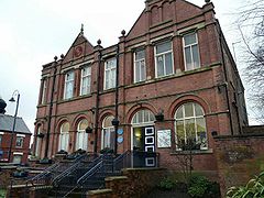
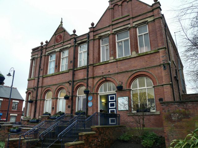
Denton Town Hall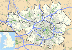
 Denton
Denton shown within Greater ManchesterPopulation 26,866 OS grid reference SJ925954 Metropolitan borough Tameside Metropolitan county Greater Manchester Region North West Country England Sovereign state United Kingdom Post town MANCHESTER Postcode district M34 Dialling code 0161 Police Greater Manchester Fire Greater Manchester Ambulance North West EU Parliament North West England UK Parliament Denton and Reddish List of places: UK • England • Greater Manchester Denton is a town within the Metropolitan Borough of Tameside, in Greater Manchester, England. It is five miles (eight km) to the east of Manchester city centre, and has a population of 26,866.[1]
Historically part of Lancashire, Denton grew as a significant centre of hat manufacture, though today it is a predominantly residential town.
Contents
History
Toponymy
Denton probably derives its name from Dane-town, an etymology supported by other place names in the area such as Danehead-bank and Daneditch-bourne.[2] The word 'Dane' is itself derived from Anglo-Saxon denu, dene, daenland, meaning a valley. So literally Denton means valley town.
Prehistory
A Byzantine coin was discovered in Danesheadbank, dating from the sixth or seventh century, as part of the Denton coin hoard.[3] The early medieval linear earthwork Nico Ditch passes through Denton; it was probably used as an administrative boundary and dates from the 8th or 9th centuries. A 300 m stretch is still visible on Denton golf course, about 4 m wide and 1.5 m deep.[4]
Middle Ages
In the early 13th century it lay within the Manor of Withington, a feudal estate which also encompassed the townships of Withington, Didsbury, Chorlton-cum-Hardy, Moss Side, Rusholme, Burnage and Haughton, ruled by the Hathersage, Longford, Mosley and Tatton families.[5]
Hat industry
Felt hatting was recorded in Denton as early as 1702 and Denton gained supremacy in the hatting industry towards the end of the 19th century. The increasing importance of Denton and Haughton as centres of felt hat production is demonstrated by the increase of manufacturers in the area: in 1800 there were 4 hatting firms in Denton and Haughton, but by 1825 there were 25 manufacturers, making it the third largest hat making centre in the north west. By 1840, 24,000 felt hats were produced in Denton a week. The prosperity of the hatting industry is reflected in the growth of the town from 2,501 in 1801 to 6,759 in 1841.[6]
During the 1840s, the felt hat industry went into depression; the recession affected Denton, with wages in the area falling by 35% and only 12 hat manufacturers remaining in Denton. The depression was partially due to changes in fashion away from felt towards silk hats. The revitalisation of the felt hat industry came in the 1850s, once again on a whim of fashion but also the increased use of machinery led to reduced production costs. The resurgence was demonstrated by the doubling of the number of hat manufacturers in the town between 1861 and 1872. At its peak in the Edwardian period, Denton's felt hat industry was the largest felt hat manufacturing centre in Britain[citation needed]. There were 36 firms directly involved in the felt hat making industry. In 1907 the majority of the 16,428,000 felt hats made in England (worth £2,068,000) were made in Denton and Stockport. In 1921, the working population of Denton was 9,653 with about 41% of those people in occupations related to the hatting industry. The last hat factory in Denton closed in 1980.[6]
Although the felt hat industry in Denton and Haughton was prosperous and an integral part of the town, working conditions in the factories were not risk free. One of the problems workers faced was mercury poisoning; mercury was used to separate the fur from the rabbit hide and workers were in regular contact with fur impregnated with mercury or exposed to mercury vapour. Inadequate ventilation in some parts of the hat making process led to other sorts of dangers; solvents were also used and on 14 January 1901 there was an explosion at the factory of Joseph Wilson & Sons in Denton, killing 13 people and injuring many more. The explosion was of vapour from methylated spirits used in the dying process.[6]
Throughout the 19th century and well into the 20th century, a wide range of hats was manufactured to suit all tastes and purses. The names used by the competing manufacturers to describe their products was bewildering and some of these were; felt hats, silk hats, fur hats, wear fur hats, soft hats, stiff hats, velour hats, wool hats, straw hats and, of course, the ubiquitous cloth cap. In the 1930s the 'Attaboy' trilby hat was introduced. This brand quickly became famous and it was in production for many years. Ladies' hats were not forgotten either and at least one works specialised in making these and the hat master's wife designed them at home. Hats were made for home consumption and for export. The well-known saying, "If you want to get ahead, get a hat" arose in Denton[citation needed] and, needless to say, anyone attending for a job interview not wearing a hat was quickly shown the door. Similarly, until the early 20th century, anyone entering a Denton shop without a hat would receive much cursing. The term, "mad as a hatter" also arose in Denton[citation needed] because the mercury used in the felting process led to mercury poisoning.
In 2003, the prominent Wilson's Hat Factory on Wilton Street, together with the adjacent mill-workers' houses, other factories, Wilton Street Chapel and Mainstream Studios was demolished to make way for a new retail shopping park 'Crown Point North', part of a major town centre regeneration scheme. The shopping park has attracted the country's first Tesco Homeplus store, together with other major names, such as Bhs, Burton, River Island, TK Maxx, H&M, Boots, Jessops, Clarks, Mothercare and a Zavvi. In March 2007, the final unit opened as a Marks and Spencer Outlet store.
Coal mining
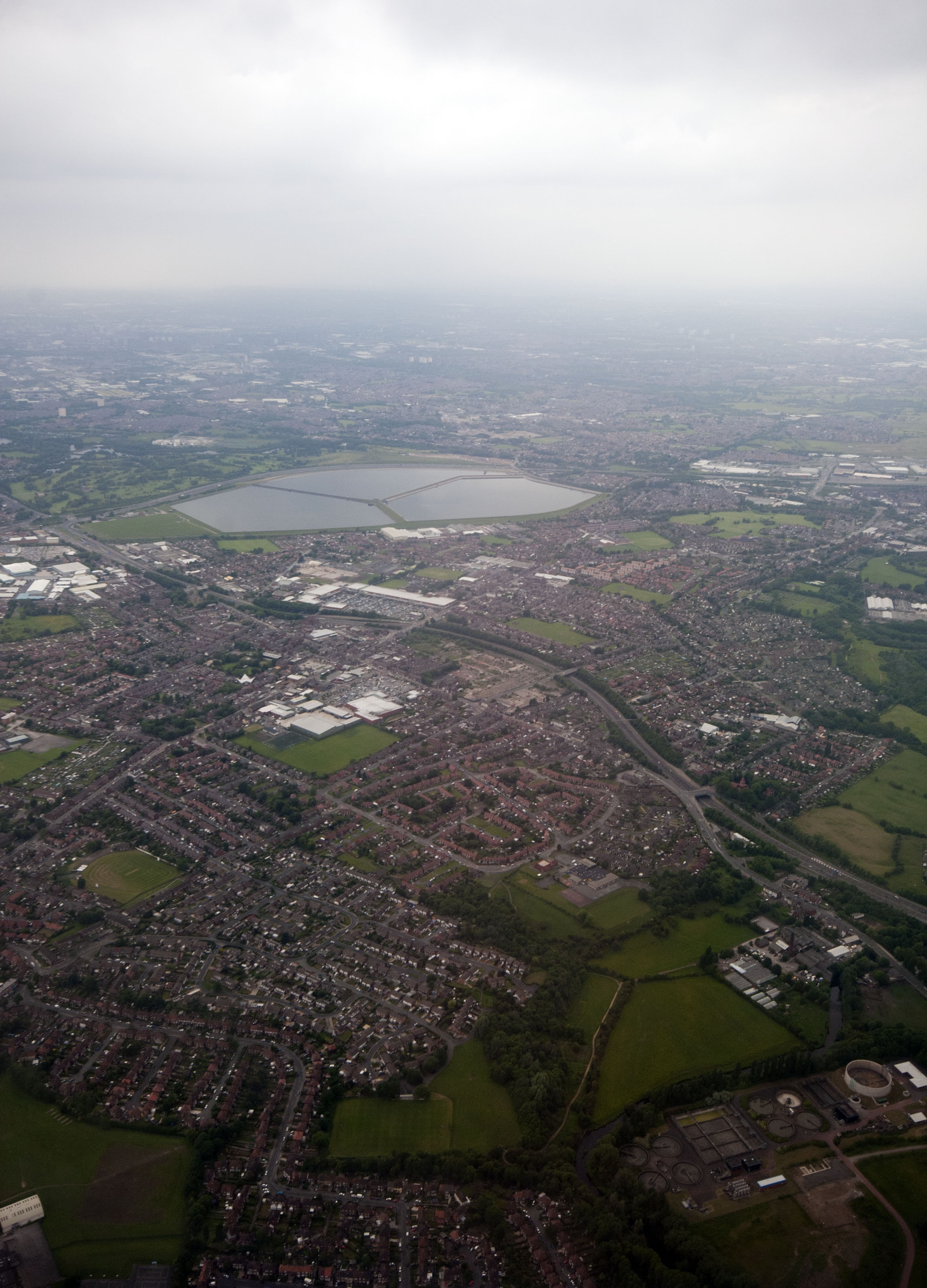
 Viewed from the air, looking west
Denton is situated on the Lancashire coalfield and once had a number of collieries in operation. These included the Ellis Colliery (Which became Denton Colliery), Top Pit, Hard Mine Pit and, further south and near to the river Tame, Hulmes Pit. Much of the coal that they produced was consumed by local industry, there being an abundance of steam powered mills in the area.
Denton Colliery was the largest of these mines and eventually absorbed the other local pits, often using their shafts for ventilation or, in the case of Hulmes Pit, as a pumping station to drain water from the main workings. Denton Colliery was connected to the London & North Western Railway's line from Guide Bridge to Stockport by a standard gauge tramway. The tramway was worked by steam power, rather than horses, as evidenced by a photograph held in the Tameside Local History Library archives.
In 1926, miners at Denton Colliery joined the national strike against reduced wages and longer working hours. This dispute led to the general strike (May 3 – 12, 1926). When the general strike was called off, coal miners stayed out for several more months.
As the strike started to crumble, miners at Denton Colliery remained steadfast, not returning to work until November 5, 1926,[7] some 6 weeks and one day after their colleagues at the nearby Ashton Moss Colliery, the only other significant colliery left in Tameside at that time. They returned to face longer working hours and their pre-strike rates of pay.
Unfortunately, months without maintenance during the strike had taken their toll on many coal mines. Denton Colliery had flooded to the extent that it was no longer workable and the Denton Colliery Co. went into voluntary liquidation in 1929. The headstock was demolished in 1932 and the shaft was finally filled and capped in 1974.[7]
Some traces of Denton Colliery can still be found. The colliery offices, situated on Stockport Road, still stand and are now the showroom of a company of monumental stonemasons. Behind the office building is a small section of wall from the colliery. On the opposite side of the road and slightly nearer to Crown Point is the building that once housed the local mines rescue station, now two private houses. Two miners cottages, much altered and now converted into one house, stand near the junction of Stockport Road and Cemetery Road. The foundations of Hulmes Pit were excavated during the early 1970s and can still be seen. Parts of the track bed of the tramway to Denton Colliery can still be traced, both on modern maps and on the ground, as can traces of a canal, known as the Beat Bank Branch, intended to link local collieries to the Stockport branch of the Ashton Canal at Reddish, which was partially built and then abandoned.
Oldham Batteries
After hatting, the most important industry in Denton was the manufacture of lead-acid batteries by Oldham Batteries (Oldham & Son Ltd). In 1865, Joseph Oldham established a millwright general engineering shop and by 1887 this company was manufacturing machinery for the hat-making industry. Another important industry in the area was coal mining and shortly after 1887 the company began making machinery and equipment for this industry, which included miners' portable lamps. Up to this time, miners had always used the safety lamp devised in 1815 by Sir Humphry Davy (1778–1829) but this new battery-powered Davy Lamp lamp eventually replaced the traditional safety lamp.
In 1920, the manufacture of automotive batteries for commercial vehicles, cars and motorcycles commenced and over the years this business expanded into the manufacture of traction batteries, which also included submarine batteries.
Nonetheless, the company never converted exclusively to the manufacture of batteries and they still continued to make machinery for the hatting industry, general engineering equipment, portable lamps and lighting systems as well as helmet-lamps and other related equipment for the mining industry. It also produced attachments for the mechanical handling industry.
Oldham Batteries became a major Denton employer with over 1,000 employees, but by the beginning of 2002 the decision to close the factory had been made. The factory, which used to be off Lime Grove, Denton, is no longer there. It has been demolished, and a planning application for a further town centre retail park has been approved by Tameside Council.
Governance
Civic history and councillors
Denton was originally one of the townships of the ancient parish of Manchester in the Salford Hundred of Lancashire. In 1866 it became a civil parish in its own right.[8] The parish was expanded in 1894 by the inclusion of the Haughton township, the former area of which now covers the eastern part of the town.[9] The name of Haughton survives as local place names at Haughton Green and Haughton Dale, both in south Denton. Clues to the former township do still exist at Haughton Street, Haughton Hall Road, the Parish Church of St. Anne, Haughton, and etched onto an ancient boundary marker on Broomstair Bridge on the A57 Hyde Road - (CHESHIRE Township of Hyde | Township of Haughton LANCASHIRE). Also in 1894 the enlarged parish became Denton Urban District in the administrative county of Lancashire.
In 1974 Denton's Urban District status was abolished and its assets and area were transferred to form part of the new Metropolitan Borough of Tameside in the metropolitan county of Greater Manchester.[10]
Since 1974, Denton has consisted of three council wards on Tameside Council; Denton North East, Denton South and Denton West, each returning three councillors. The new wards took the same format as the original six Denton UDC wards (which were East, North, South-east, South, South-west and West). There have been minor ward boundary changes in 1982 and 2004. Denton West is the most Conservative-inclined of the three wards, and from 1975 to 1991 had Conservative Party representation. No Conservative councillor has been elected since 1987 in the town, although the party came within 13 votes of re-gaining the Denton West seat in 2008 on the back of government unpopularity over the abolition of the 10p tax rate and the proposals for a congestion charge in Greater Manchester with the proposed outer charging zone cutting the ward in two.
After the most recent local elections held in May 2008, the nine councillors for the town are:
Denton North East Denton South Denton West Vincent Ricci Mike Fowler Mike Smith Allison Gwynne Claire Francis Brenda Warrington Martin Wareing Margaret Downs Dawson Lane A by-election was held on 30 July in the Denton North East Ward to elect a Councillor following the death of Martin Wareing. Labour held the seat with 48% of the vote to the 25% polled by the second-place Conservatives. This represented a 7% swing to Labour from the May 2008 local elections. Denise Ward is the new representative, and will serve a term of office to May 2012.
Since 1998 there has been a degree of devolution, with District Assemblies established in the Tameside townships and consisting of the councillors and an advisory group. Assembly meetings are open to the public. Each Assembly has a town manager and devolved staff and budgets to deal with local services such as grounds maintenance, road repairs, parks, Britain in Bloom, community events, youth services, crime and disorder and town centre regeneration. The Denton and Audenshaw District Assembly controls an annual budget in excess of £1.5m. The old council chamber in Denton Town Hall was refurbished to provide a permanent home and meeting place for the Denton and Audenshaw District Assembly as the town's millennium project in 2000.
Since its formation the District Assembly Chairs have been: Andrew Gwynne (1998–2001); Mike Craven (2001–2004); Allison Gwynne (2004–2005); Margaret Downs (2005-.)
Twinning
On 5 December 1992, Denton became a twin-town to Montigny le Bretonneux, near Paris, France. On one side of the town hall, there is a 'French road sign' which was a gift from the Municipal Authority in Montigny and states how far it is to Montigny le Bretonneux from Denton. There is a similar 'English road sign' outside Montigny's Town Hall pointing to Denton.
For ten years the French sign on Denton Town Hall pointed north, implying that Denton's French twin-town is located in the sea somewhere to the west of Orkney. However, Tameside MBC installed a 'mock' French road sign, pointing left (i.e. south) in February 2007.
Parliamentary representation
The area of the former Denton urban district initially formed part of the Gorton Parliamentary Division of South East Lancashire from 1885 to 1918; it then became part of the Lancashire, Mossley Parliamentary Division from boundary changes effective in that year's election until 1950. From 1950 to 1955 the town was contained within the short-lived Droylsden constituency. From 1955 to 1983 Denton was re-grouped with Gorton to form the Manchester, Gorton constituency. Since the 1983 boundary changes, Denton has formed part of the Denton and Reddish parliamentary constituency. Andrew Gwynne is Denton's current Member of Parliament. He was elected in 2005 to represent the Denton and Reddish seat, after long-serving MP Andrew Bennett retired.
Members of Parliament representing Denton since 1885:
Election Member Party Parliamentary constituency 1885 Richard Peacock Liberal S.E. Lancs., Gorton Division 1889 by-election Sir William Mather Liberal S.E. Lancs., Gorton Division 1895 Ernest Frederic George Hatch Conservative S.E. Lancs., Gorton Division 1904 Liberal S.E. Lancs., Gorton Division 1906 John Hodge Labour S.E. Lancs., Gorton Division 1918 Austin Hopkinson Coalition Liberal Lancs., Mossley Division 1922 Independent Lancs., Mossley Division 1929 Herbert Gibson Labour Lancs., Mossley Division 1931 Austin Hopkinson National Independent Lancs., Mossley Division 1945 Rev. George Savile Woods Labour Co-op Lancs., Mossley Division 1950 Rev. George Savile Woods Labour Co-op Droylsden Borough 1951 William Richard Williams Labour Droylsden Borough 1955 Konni Zilliacus Labour Manchester, Gorton Borough 1967 by-election Kenneth Marks Labour Manchester, Gorton Borough 1983 Andrew Bennett Labour Denton and Reddish Borough 2005 Andrew Gwynne Labour Denton and Reddish Borough Landmarks
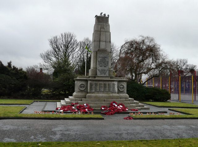
 Denton War Memorial
There is one main war memorial, or cenotaph, in Denton, located in Victoria Park. This memorial commemorates people from Denton and Haughton who served in two world wars. The names on the war memorial were collected from their relatives who wrote to the council with details of their loved ones who served in either war. The war memorial was unveiled on 23 July 1921. Figures from the Denton section of the Tameside council website, state that 3,500 Denton men served in the Great War (1914–1918), of that number, 369 people were killed.
The oldest church in Denton is St. Lawrence's. It is almost 500 years old, originally built in 1531. It is a listed Grade II* building.[11] The church is also known locally as "Th'owd Peg" (the old peg) due to the fact, as a timber-framed building, it was constructed with wooden pegs rather than nails. It is more commonly known as the black and white church, because of its appearance. A local Myth is also said to have a pirate buried within its grounds because of a grave stone marked with a skull and crossbones at its front door. In a more thorough investigation and article printed by Denton Local History Society (1995), it was found that the Gravestone was actually a Masonic Gravestone belonging to a deceased Soldier Named Samuel Bromley from the Royal Artillery.
The magnificent Victorian St Anne's Church, Haughton, is a Grade I listed building, and is built in the Gothic Revival style.[12]
Transport
One of Denton's claims to fame is that, along with Reddish South, it has the UK's least frequent train service, at once per week, in one direction, from Stockport to Stalybridge. It runs on a Friday only, and departs from Stockport at 09:22, calling at Denton at 09:31 and arriving at Stalybridge at 09:49.[13]
Network Rail, in their Route Utilisation Strategy (RUS) for the North West, have proposed closure of Reddish South and Denton railway stations and withdrawal of the remaining passenger service.[citation needed] The line itself would remain open for freight and diverted passenger workings. However, a new open-access operator called Grand Union has proposed using the line for services between London and Bradford via the West Coast Main Line, using Guide Bridge railway station as a stop.
There is a campaign, led by MP Andrew Gwynne to re-instate a commuter service using an existing line linking the Stockport-Stalybridge line and the Ashton-Manchester Victoria line. With the support of Tameside and Stockport Councils and GMPTE, a business case is being drawn up to possibly introduce a train service from Chester to Manchester Victoria via Stockport, Reddish South and Denton stations. It would take around 20 minutes from Reddish South and 15 minutes from Denton into Manchester, making such a service competitive against other forms of public transport.[citation needed]
Currently, however, there are more frequent bus links to Manchester city centre, Hyde, and Ashton-under-Lyne operated by Stagecoach.
Education
Further information: List of schools in TamesidePrimary schools
- Corrie Primary School
- Dane Bank Primary School
- Denton West End Primary School
- Greswell Primary School
- Linden Road Primary School
- Manor Green Primary School
- Russell Scott Primary School
- St. Anne's Primary School
- St. John Fisher RC Primary School
- St. Mary's RC Primary School
- Denton Central (Duke Street) Primary School and ASD (autism spectrum disorder) Resource Base (now closed)
Secondary schools
- St Thomas More RC College (A specialist mathematics and IT college)
- Denton Community college
Sports
Cricket
Denton is home to three semi-professional cricket clubs all of which play in the Lancashire County League.
Denton CC play at Egerton Street. They were league champions in 1994 and 1995 (runners up in 1998) with previous professionals including West Indies players Malcolm Marshall and Kenneth Benjamin.
Denton West CC play at Windsor Park in the Dane Bank area of Denton. They have a long history of Sri Lankan professionals and the incumbent for 2004 and 2005 was Niroshan Bandaratilleke. They were league champions in 1996, 1997, 2002, 2003, 2009 & 2010 and Walkden Cup winners in 1975, 1998 & 2009.
Denton St Lawrence CC play at Sycamore Park and their 2005 professional was West Indian Ryan Nurse. In July 2005 they won the Walkden Cup for the first time in 30 years defeating Flowery Field Cricket Club.
FootballDenton Town FC currently play in the Cheshire Football League Division One, after winning the Division Two championship in 2011. The club was formed in 1920 as Bradford Parish and was a force in local non-league football for many years before relocating with a change of name in the mid 1990's, their ground is now based on the Whittles Park Estate in south east Denton.
Notable people
Notable people who come from Denton include:
Jimmy Armfield OBE, England footballer. Freeman of the Borough of Blackpool, was born in Denton. Although he has spent most of his life in Blackpool, he was honoured by Tameside Council in July 2009 and was presented with a lifetime achievement award by Denton and Audenshaw District Assembly.[citation needed]
- Thomas Bowler (17 September 1826 – 15 September 1893) and his uncle: William (25 January 1808–1878): Hatters, who were born in Denton and moved to Southwark in London around 1840/1, where they became involved in the development of the hat which bears their name.[14]
- Mick Hucknall, who became the lead singer of Simply Red lived in Denton and attended Audenshaw School.
- Sir Geoff Hurst the West Ham United and England 1966 World Cup footballer lived in Denton until he was 8-years old. His grandfather lived on Cemetery Road until his death.
- Paul Lake, attended St. Thomas More Roman Catholic College and played for Manchester City and was destined for England until his career was cut short with a knee injury.
- Alan "Reni" Wren, lived in Denton and attended Egerton Park Arts College and is the drummer for The Stone Roses.
- Col Needham, Creator of the Internet Movie Database (IMDB) lived in Denton and attended Audenshaw School.
References
- ^ "KS01 Usual resident population: Census 2001, Key Statistics for urban areas". National Statistics. http://www.statistics.gov.uk/StatBase/ssdataset.asp?vlnk=8271&Pos=2&ColRank=1&Rank=224. Retrieved 2010-05-02.
- ^ "Denby - Denton, West". British History Online. University of London & History of Parliament Trust. http://british-history.ac.uk/report.asp?compid=50917. Retrieved 2007-04-22.
- ^ Mike Nevell (1992). Tameside Before 1066. Tameside Metropolitan Borough Council. p. 76. ISBN 1-871324-07-6.
- ^ Mike Nevell (1998). Lands and Lordships in Tameside. Tameside Metropolitan Borough Council with the University of Manchester Archaeological Unit. pp. 40–41. ISBN 1-871324-18-1.
- ^ Sussex & Helm (1988). Looking Back at Withington and Didsbury. Willow. p. 45. ISBN 0-946361-25-8.
- ^ a b c Mike Nevell, Brian Grimsditch and Ivan Hradil (2007). Denton and the Archaeology of the Felt Hatting Industry. Tameside Metropolitan Borough and University of Manchester Archaeological Unit. pp. 26, 29–32, 40, 74–76. ISBN 1-871324-36-X.
- ^ a b C. Wilkins-Jones, Tameside, Tameside Metropolitan Libraries Committee, 1978
- ^ Vision of Britain - Denton unit history
- ^ Vision of Britain - Boundaries of Denton with 1894 enlargement shown
- ^ Arnold-Baker, C., Local Government Act 1972, (1973)
- ^ Mike Nevell (1991). Tameside 1066–1700. Tameside Metropolitan Borough and University of Manchester Archaeological Unit. pp. 80, 86, 123–4, 136. ISBN 1-871324-02-5.
- ^ Mike Nevell (1993). Tameside 1700–1930. Tameside Metropolitan Borough and University of Manchester Archaeological Unit. p. 143. ISBN 1-871324-08-4.
- ^ "Stockport to Denton, leaving at 00:00 on Friday". Accessible UK Train Timetables. Matthew Somerville. http://traintimes.org.uk/Stockport/Denton/00:00/Friday. Retrieved 2009-06-21.
- ^ Hopkins, Susie (2004). "Bowler, William". Oxford Dictionary of National Biography. Oxford University Press. http://www.oxforddnb.com/view/articleHL/63532. Retrieved 2006-11-29.
Harold Nuttall, Photographer
External links
- Tameside Council website - Section about Denton
- Virtual Tameside site - Information about St. Lawrence's Church
- Denton Local History Society
- Denton Denton Manchester History, Photographs, Maps and much more.
Ceremonial county of Greater Manchester Statutory City Region - Greater Manchester Combined Authority
- Greater Manchester Statutory City Region
Metropolitan districts Major settlements - Altrincham
- Ashton-in-Makerfield
- Ashton-under-Lyne
- Atherton
- Audenshaw
- Blackley
- Bolton
- Bury
- Cadishead
- Chadderton
- Clifton
- Denton
- Droylsden
- Dukinfield
- Eccles
- Failsworth
- Farnworth
- Golborne
- Heywood
- Hindley
- Horwich
- Hyde
- Irlam
- Kearsley
- Leigh
- Littleborough
- Manchester
- Middleton
- Milnrow
- Mossley
- Oldham
- Partington
- Pendlebury
- Prestwich
- Radcliffe
- Ramsbottom
- Rochdale
- Royton
- Sale
- Salford
- Shaw and Crompton
- Stalybridge
- Stockport
- Stretford
- Swinton
- Tottington
- Tyldesley
- Urmston
- Walkden
- Westhoughton
- Whitefield
- Wigan
- Worsley
See also: List of civil parishes in Greater Manchester
Rivers Topics - Castles
- Churches
- Demography
- Football clubs
- Geography
- Grade I listed buildings
- Grade II* listed buildings
- Museums
- Parliamentary constituencies
- People
- Places
- Schools
- SAMs
- SSSIs
Categories:- Towns in Greater Manchester
- Geography of Tameside
- Hat making

Wikimedia Foundation. 2010.