Mandogalup, Western Australia

Mandogalup, Western Australia
Mandogalup
PerthWestern Australia
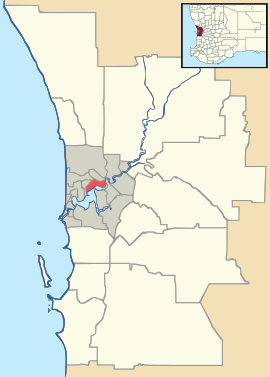
Mandogalup is located in Perth
{{{alt}}}
Mandogalup
Postcode: 6167
Location:
LGA: Town of Kwinana
State District: Kwinana
Federal Division: Brand
Suburbs around Mandogalup:
Wattleup Hammond Park Aubin Grove
Hope Valley Mandogalup Wandi
Postans The Spectacles Anketell

Coordinates: 32°12′18″S 115°48′54″E / 32.205°S 115.815°E / -32.205; 115.815

Mandogalup is a suburb of Perth, Western Australia, located within the Town of Kwinana. Its postcode is 6167.

The area of this suburb was originally referred to as "7 Mile Camp", but when a townsite was declared here in 1923 it was named "Balmanup". Lake Balmanup was an alternative name for Mandogalup Swamp. In 1945 it was found that the townsite was more commonly known as Mandogalup and it was changed to Mandogalup in 1946. It is an Aboriginal name, the meaning of which is unknown.

As part of the Group Settlement Scheme and incoming families avoiding Perth during the war years, the area was a food bowl containing many farms in the arable land amongst the wetlands. Agriculture has declined with the sprawl of the urban area and the resulting increases in land values.

The suburb also comprises a volunteer fire station with 5 vehicles and is fairly busy in the summer months.

External links


Wikimedia Foundation. 2010.

Игры ⚽ Нужно сделать НИР?

Look at other dictionaries:

  • Postans, Western Australia — Infobox Australian Place | type = suburb name = Postans city = Perth state = wa caption = lga = Town of Kwinana postcode = 6167 stategov = Kwinana fedgov = Brand near nw = Hope Valley near n = Mandogalup near ne = Mandogalup near w = Kwinana… …   Wikipedia

  • Medina, Western Australia — Not to be confused with Medina, Saudi Arabia. For other uses, see Medina (disambiguation) Medina Perth, Western Australia …   Wikipedia

  • Orelia, Western Australia — Orelia Perth, Western Australia …   Wikipedia

  • Wattleup, Western Australia — Infobox Australian Place | type = suburb name = Wattleup city = Perth state = wa caption = lga = City of Cockburn postcode = 6166 est = pop = 844 (2006 census)Census 2006 AUS|id=SSC52486|name=Wattleup (State Suburb)|quick=on|accessdate=2008 10… …   Wikipedia

  • Naval Base, Western Australia — This article is about the suburb of Perth. For the military installation, see Naval base. Naval Base Perth, Western Australia …   Wikipedia

  • The Spectacles, Western Australia — Infobox Australian Place | type = suburb name = The Spectacles city = Perth state = wa caption = lga = Town of Kwinana postcode = 6167 stategov = Kwinana fedgov = Brand near nw = Mandogalup near n = Hope Valley near ne = Wandi near w = Postans… …   Wikipedia

  • Hope Valley, Western Australia — Infobox Australian Place | type = suburb name = Hope Valley city = Perth state = wa caption = lga = Town of Kwinana postcode = 6165 est = pop = 213 (2006 census)Census 2006 AUS|id=SSC51651|name=Hope Valley (State Suburb)|quick=on|accessdate=2008… …   Wikipedia

  • Murugan — Subramanian redirects here. For other uses, see Subramanian (disambiguation). Murugan Murugan by Raja Ravi Varma s impression God of war and victory Tamil script …   Wikipedia

  • Kwinana Freeway — Infobox Australian Road road name = Kwinana Freeway route route photo = Kwinana Freeway Kings Park.jpg caption = Kwinana Freeway as seen from Kings Park length = 46 direction = North South start = finish = through = South Perth, Bull Creek,… …   Wikipedia

  • Town of Kwinana — Kwinana is a Local Government Area of Western Australia. It covers an area of approximately 118 square kilometres in metropolitan Perth, and lies about 40 km south of the Perth CBD, via the Kwinana Freeway. Kwinana maintains 287 km of roads and… …   Wikipedia

Share the article and excerpts

Direct link
Do a right-click on the link above
and select “Copy Link”