- North Fremantle, Western Australia
-
North Fremantle
Perth, Western Australia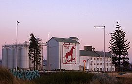
Dingo Flour mill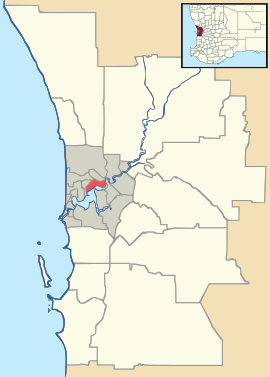
 North Fremantle
Population: 2,585 (2006 census)[1] Postcode: 6159 Location: - 15 km (9 mi) SW of Perth
- 3 km (2 mi) N of Fremantle
LGA: City of Fremantle State District: Cottesloe Federal Division: Fremantle Suburbs around North Fremantle: Mosman Park Mosman Park Indian Ocean North Fremantle East Fremantle Fremantle Fremantle Coordinates: 32°02′02″S 115°45′22″E / 32.034°S 115.756°E
 The old Leighton Marshalling Yards and Leighton Station.
North Fremantle is a small suburb of Perth, Western Australia, located within the City of Fremantle. Its postcode is 6159.
The suburb is situated on the Swan River, north of the Port of Fremantle. The suburb stretches from the old Fremantle Traffic Bridge, north to McCabe Street and is bordered by the Swan River and the Indian Ocean.
The northern part of the suburb was once home to the Leighton Marshalling Yards run by the former Western Australian Government Railways which changed to Westrail. The area is planned for redevelopment by the State Government into a coastal urban village and recreational area, known as North Port Quay. This may see the re-opening of the now-demolished Leighton train station. North Fremantle is also home to the famous night bar called Mojos [1], Railway Hotel and Tonic Cafe.
References
- ^ Australian Bureau of Statistics (25 October 2007). "North Fremantle (State Suburb)". 2006 Census QuickStats. http://www.censusdata.abs.gov.au/ABSNavigation/prenav/LocationSearch?collection=Census&period=2006&areacode=SSC52056&producttype=QuickStats&breadcrumb=PL&action=401. Retrieved 2008-10-05.
External links
Suburbs of the City of Fremantle | Perth | Western Australia Beaconsfield · Fremantle · Hilton · North Fremantle · O'Connor · Samson · South Fremantle · White Gum Valley
Categories:- Suburbs of Perth, Western Australia
- Perth, Western Australia geography stubs


Wikimedia Foundation. 2010.