- Drangme Chhu
-
Drangme Chhu 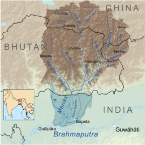
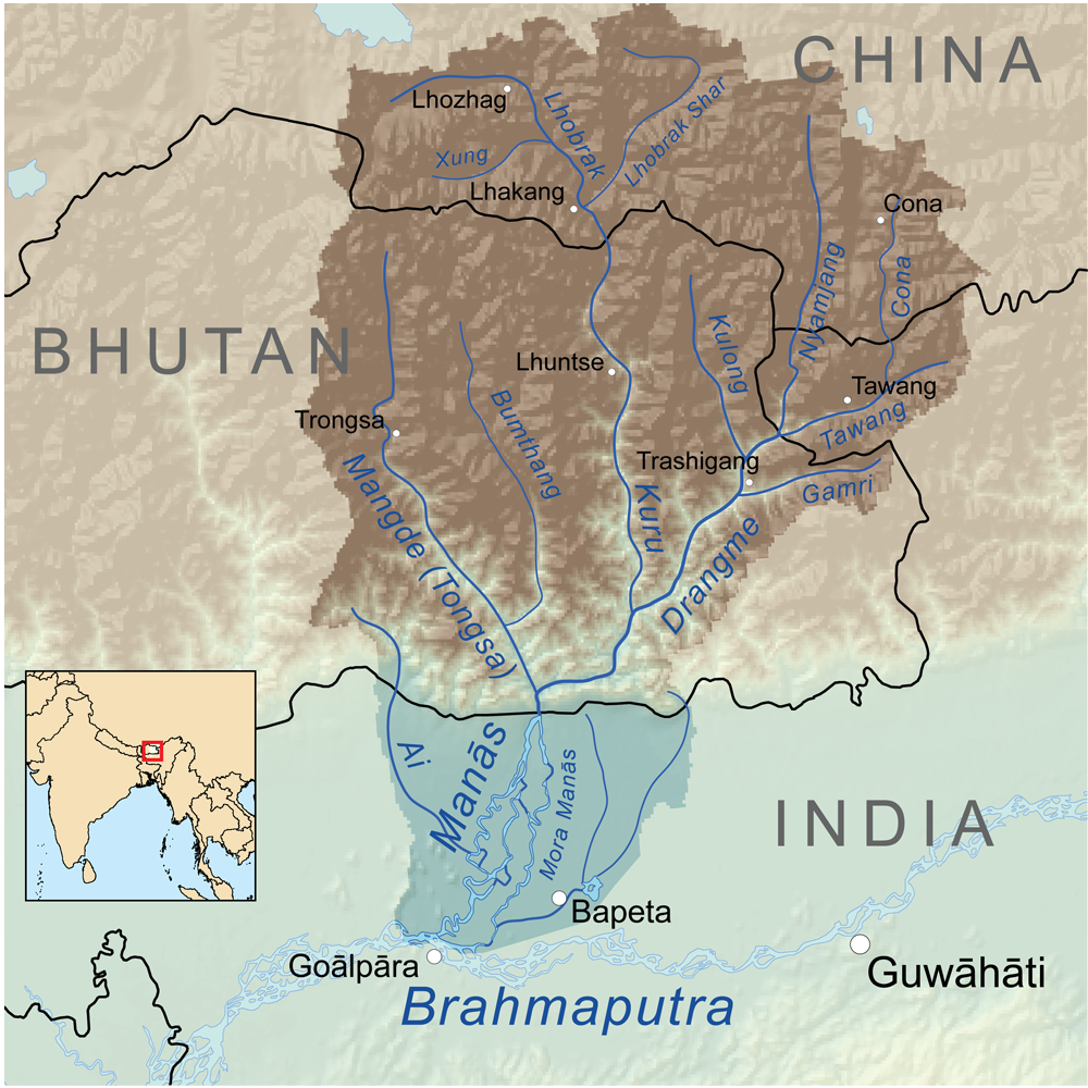
Drangme River (lower right of centre)Basin countries Bhutan River system Manas River, Brahmaputra River Drangme Chhu river drains a large portion of central and eastern Bhutan. The word Chhu means "river" or "water" in Dzongkha. The river rises in the western portion of Arunachal Pradesh, India, and flows southwest first into the Bhutanese district (or dzongkhag) of Trashiyangtse and then into Tashigang. The south flowing Kulong and the west flowing Gamri join the Drangme near the town of Tashigang. Continuing to the southwest, the river forms the boundary between Tashigang and Mongar, and then between Pemagatsel and Mongar. Along this stretch is the confluence with another major tributary, the south flowing Kuru, and a name change to the Manas River. Shortly before turning south and leaving Bhutan, the river is augmented again with the waters of the south flowing Mangde Chhu River. The lowest point in Bhutan is at the point where the Manas Chhu river crosses into India (Assam) near the town of Manas. The river empties into the Brahmaputra River some 50 miles (80 km) south of the Bhutanese border.
References
- Jordans, Bart (2005). Bhutan: A Trekker's Guide. Cicerone. ISBN 1 85284 398 5.
- Himalayan Maphouse. Bhutan Himalaya, 1:390,000 (Map).
- Geocenter (1994). Tibet, Nepal, Bhutan, 1:2,000,000 (Map).
Rivers of Bhutan Western Bhutan Amo Chhu or Torsa • Di Chhu or Jaldhaka • Ha Chhu • Mo Chhu/Puna Tsang Chhu or Sankosh • Paro Chhu • Tang Chuu • Wong Chhu or RaidakEastern Bhutan Bumthang or Murchangphy Chhu • Kuri Chhu or Lhobrak • Manas River/ Drangme Chhu • Mangde or Tongsa ChhuHydrology of Northeast India1 Rivers Bhogdoi • Siang/Dihang/Brahmaputra • Dhansiri • Dihing • Diphlu • Feni • Gumti • Haora • Iril • Kaladan • Kameng or Jia Bhoreli • Karnaphuli • Khowai • Kolong • Lohit • Manas/ Drangme Chhu • Manu • Mora Dhansiri • Muhuri • Mora Diphlu • Sankosh or Puna Tsang Chhu • Simsang or Someshwari • Surma • Surma-Meghna River System • Thega River • TirapLakes Waterfalls Fluvial islands 1 Assam, Arunachal Pradesh, Nagaland, Manipur, Tripura, Mizoram, Meghalaya Coordinates: 26°13′N 90°38′E / 26.217°N 90.633°E
Categories:- Rivers of Bhutan
- Rivers of India
- International rivers of Asia
- Rivers of Arunachal Pradesh
- Bhutan geography stubs
Wikimedia Foundation. 2010.