- Darjeeling
-
This article is about the municipality in West Bengal, India. For its namesake district, see Darjeeling district.For other uses, see Darjeeling (disambiguation).
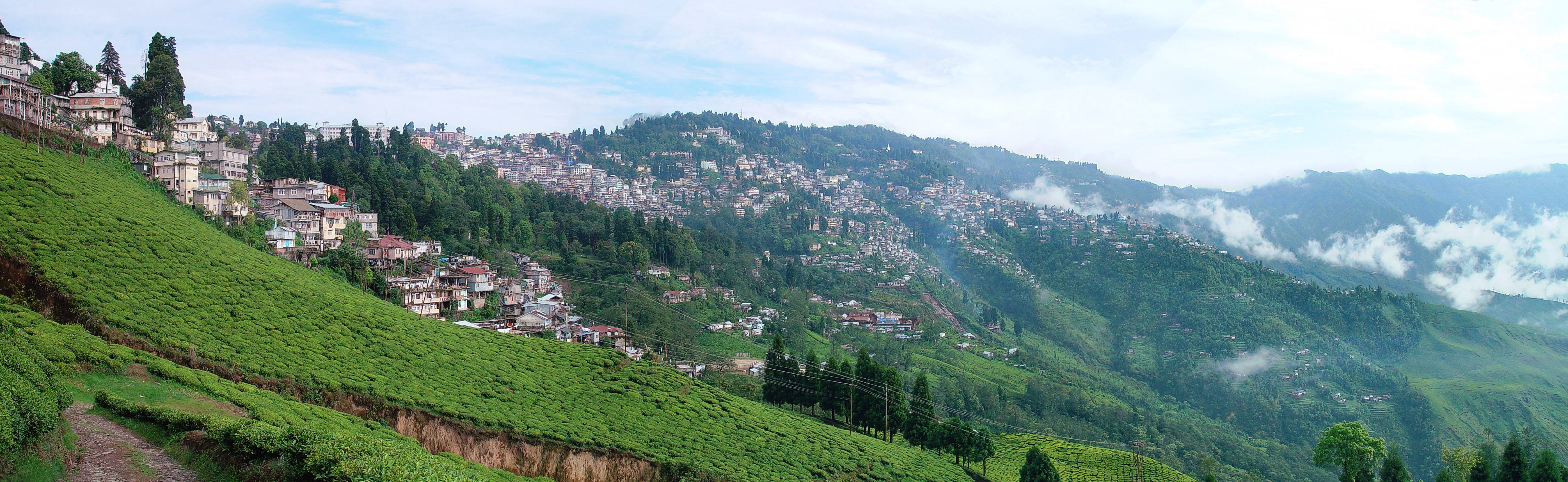
Darjeeling — city — A view of Darjeeling from the Happy Valley Tea Estate.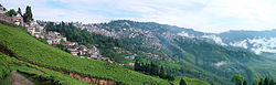
Coordinates 27°3′N 88°16′E / 27.05°N 88.267°ECoordinates: 27°3′N 88°16′E / 27.05°N 88.267°E Country India State West Bengal District(s) Darjeeling Parliamentary constituency Darjeeling Assembly constituency Darjeeling Population
• Density
132,016 (2011[update])
• 12,490 /km2 (32,349 /sq mi)
Time zone IST (UTC+05:30) Area
10.57 square kilometres (4.08 sq mi)
• 2,050 metres (6,730 ft)[1]
Darjeeling (Nepali:
 दार्जीलिंग (help·info), Bengali: দার্জিলিং) is a Himalayan city in the Indian state of West Bengal. It is internationally renowned as a tourist destination, along with its tea industry and the Darjeeling Himalayan Railway, a UNESCO World Heritage Site. It is "hill town headquarters" of Darjeeling district with a partially autonomous status within the state of West Bengal. The town is located in the Mahabharat Range or Lesser Himalaya at an average elevation of 6,710 ft (2,050 m).
The development of the town dates back to the mid-19th century, when the British set up a sanatorium and a military depot. Subsequently, extensive tea plantation was done in the region, and tea growers developed distinctive hybrids of black tea and created new fermenting techniques. The resultant distinctive Darjeeling tea is internationally recognised and ranks among the most popular of the black teas.[2] The Darjeeling Himalayan Railway connects the town with the plains and has one of the few steam locomotives still in service in India. Darjeeling also has several British-style public schools, which attract students from throughout India and neighbouring countries. The town, with its neighbouring town of Kalimpong, was a center for the demand of the Gorkhaland movement in the 1980s. The present movement for a separate state of Gorkhaland is also centered in Darjeeling town. In recent years, the town's fragile ecology has been threatened by a rising demand for environmental resources, stemming from growing tourist traffic and poorly planned urbanisation.
Contents
History
 Darjeeling to Ghoom Heritage Narrow Gauge Train :: Photograph by : Vikramjit Kakati
 Main article: History of Darjeeling
The history of Darjeeling is intertwined with that of Bengal, Sikkim and Nepal. Until the early 19th century, the hilly area around Darjeeling was historically controlled by the kingdom of Sikkim, while the plains around Siliguri were intermittently occupied by the kingdom of Nepal,[3] with settlement consisting of a few Villages of Lepcha & Kirati people.[4] It is also known that Nepal once expanded its kingdom up to the Teesta River. In 1828, a delegation of British East India Company officials on its way to Nepal-Sikkim border stayed in Darjeeling and decided that the region was a suitable site for a sanatorium for British soldiers.[5][6] The company negotiated a lease of the area west of the Mahananda River from the Chogyal of Sikkim in 1835.[7] In 1849, the British East India Company (BEIC) director Arthur Campbell and the explorer and botanist Joseph Dalton Hooker were imprisoned in the region by the Sikkim Chogyal. The East India Company sent a force to free them. Continued friction between the BEIC and the Sikkim authorities resulted in the annexation of 640 square miles (1,700 km2) of territory in 1850. In 1864, the Bhutanese rulers and the British signed the Treaty of Sinchula that ceded the passes leading through the hills and Kalimpong to the British.[8] The continuing discord between Sikkim and the British resulted in a war, culminating in the signing of a treaty and the annexation by the British of the area east of the Teesta River in 1865.[9] By 1866, Darjeeling district had assumed its current shape and size, covering an area of 1,234 square miles (3,200 km2).[8]
 Darjeeling 2011
During the British Raj, Darjeeling's temperate climate led to its development as a hill station for British residents seeking to escape the summer heat of the plains, and its becoming the informal summer capital of the Bengal Presidency in 1840,[10] a practice that was formalised after 1864.[11]
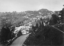 Darjeeling view, 1880
The development of Darjeeling as a sanatorium and health resort proceeded briskly.[4] Arthur Campbell, a surgeon with the Company, and Lieutenant Robert Napier were responsible for establishing a hill station there. Campbell's efforts to develop the station, attract immigrants to cultivate the slopes and stimulate trade resulted in a hundredfold increase in the population of Darjeeling between 1835 and 1849.[8][12] The first road connecting the town with the plains was constructed between 1839 and 1842.[4][12] In 1848, a military depot was set up for British soldiers, and the town became a municipality in 1850.[12] Commercial cultivation of tea in the district began in 1856, and induced a number of British planters to settle there.[5] Scottish missionaries undertook the construction of schools and welfare centres for the British residents, laying the foundation for Darjeeling's notability as a centre of education. The opening of the Darjeeling Himalayan Railway in 1881 further hastened the development of the region.[13] In 1899, Darjeeling was rocked by major landslides that caused severe damage to the town and the native population.[14]
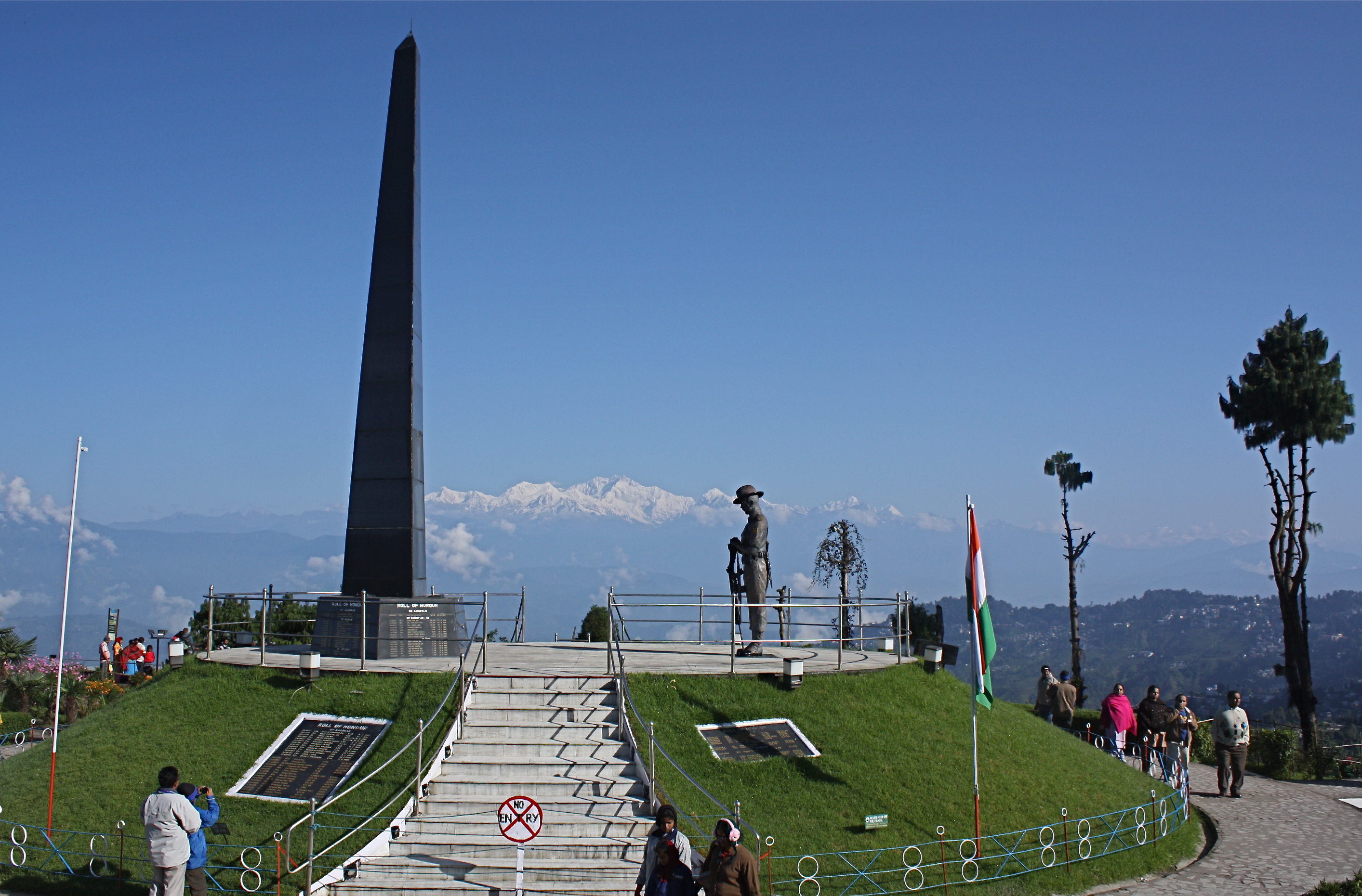
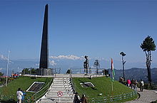 Darjeeling War Memorial
Under British rule, the Darjeeling area was initially a Non-Regulation District, a scheme of administration applicable to economically less advanced districts in the British Raj, and acts and regulations of the British Raj did not automatically apply to the district in line with rest of the country. In 1919, the area was declared a "backward tract".[15] During the Indian independence movement, the Non-cooperation Movement spread through the tea estates of Darjeeling.[16] There was also a failed assassination attempt by revolutionaries on Sir John Anderson, the Governor of Bengal in 1934.[17] Subsequently, during the 1940s, Communist activists continued the nationalist movement against the British by mobilising the plantation workers and the peasants of the district.[18]
 Bringing in the Darjeeling tea harvest, circa 1890.
Socio-economic problems of the region that had not been addressed during British rule continued to linger and were reflected in a representation made to the Constituent Assembly of India in 1947, which highlighted the issues of regional autonomy and Nepali nationality in Darjeeling and adjacent areas.[18] After the independence of India in 1947, Darjeeling was merged with the state of West Bengal. A separate district of Darjeeling was established consisting of the hill towns of Darjeeling, Kurseong, Kalimpong and some parts of the Terai region. While the hill population included mainly of ethnic Nepalis who had migrated there during British rule, the plains harboured a large ethnic Bengali population who were refugees from the Partition of India.[19] A cautious and non-receptive response by the West Bengal government to most demands of the ethnic Nepali population led to increased calls, in the 1950s and 1960s, for Darjeeling's autonomy and for the recognition of the Nepali language; the state government acceded to the latter demand in 1961.[20]
The creation of a new state of Sikkim in 1975, along with the reluctance of the Government of India to recognise Nepali as an official language under the Constitution of India, brought the issue of a separate state of Gorkhaland to the forefront.[21] Agitation for a separate state continued through the 1980s,[22] included violent protests during the 1986–88 period. The agitation ceased only after an agreement between the government and the Gorkha National Liberation Front (GNLF), resulting in the establishment of an elected body in 1988 called the Darjeeling Gorkha Hill Council (DGHC), which received autonomy to govern the district. Though Darjeeling became peaceful, the issue of a separate state lingered, fueled in part by the lack of comprehensive economic development in the region even after the formation of the DGHC.[23] New protests erupted in 2008–09, but both the Union and State governments rejected Gorkha Janmukti Morcha's demand for a separate state.[24] In July 2011, a pact was signed between Gorkha Janmukti Morcha (GJM), the Government of West Bengal and the Government of India which includes the formation of a new autonomous, elected Gorkhaland Territorial Administration (GTA), a hill council armed with more powers than its predecessor Darjeeling Gorkha Hill Council.[25]
Geography
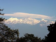
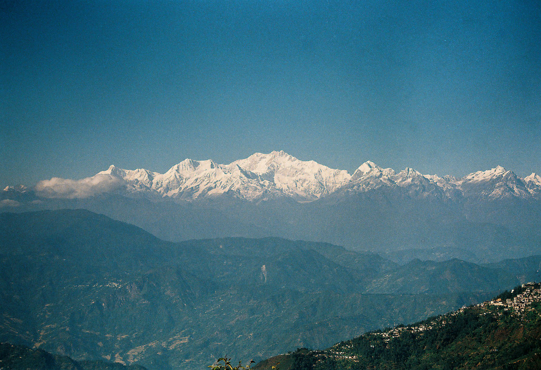
 Mt. Kanchendzonga as seen from Darjeeling
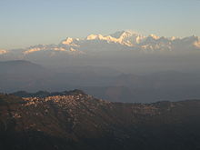 Kanchenjunga and Darjeeling seen from Tiger Hill
Darjeeling is the main town of the Sadar subdivision and also the headquarters of the district. It is located at an average elevation of 6,710 ft (2,050 m)[1] in the Darjeeling Himalayan hill region on the Darjeeling-Jalapahar range that originates in the south from Ghum. The range is Y-shaped with the base resting at Katapahar and Jalapahar and two arms diverging north of the Observatory Hill. The north-eastern arm dips suddenly and ends in the Lebong spur, while the north-western arm passes through North Point and ends in the valley near Tukver Tea Estate.[26] The hills are nestled within higher peaks and the snow-clad Himalayan ranges tower over the town in the distance. Kanchenjunga, the world's third-highest peak, 8,598 m (28,209 ft) high, is the most prominent mountain visible. In days clear of clouds, Nepal's Mount Everest, 29,035 ft (8,850 m) high, can be seen.[27]
The hills of Darjeeling are part of the Mahabharat Range or Lesser Himalaya. The soil is chiefly composed of sandstone and conglomerate formations, which are the solidified and upheaved detritus of the great range of Himalaya. However, the soil is often poorly consolidated (the permeable sediments of the region do not retain water between rains) and is not considered suitable for agriculture. The area has steep slopes and loose topsoil, leading to frequent landslides during the monsoons. According to the Bureau of Indian Standards, the town falls under seismic zone-IV, (on a scale of I to V, in order of increasing proneness to earthquakes) near the convergent boundary of the Indian and the Eurasian tectonic plates and is subject to frequent earthquakes.[27]
Flora and fauna
 Mount Kanchanjangha as viewed from Darjeeling
Darjeeling is a part of the Eastern Himalayan zoo-geographic zone.[28] Flora around Darjeeling comprises sal, oak, semi-evergreen, temperate and alpine forests.[29] Dense evergreen forests of sal and oak lie around the town, where a wide variety of rare orchids are found. The Lloyd's Botanical Garden preserves common and rare species of plants, while the Padmaja Naidu Himalayan Zoological Park specialises in conserving and breeding endangered Himalayan species.[30] The town of Darjeeling and surrounding region face deforestation due to increasing demand for wood fuel and timber, as well as air pollution from increasing vehicular traffic.[31]
Wildlife in the district is protected by the wildlife wing of the West Bengal Forest Department.[28] The fauna found in Darjeeling includes several species of ducks, teals, plovers and gulls that pass Darjeeling while migrating to and from Tibet.[32] Small mammals found in the region include civets, mongooses and badgers.[33] The nearby Jaldapara Wildlife Sanctuary consists of semi-evergreen and sal forests. Animals found here include the one-horned rhinoceros, elephant, tiger, leopard and hog deer, while the main bird species include the Bengal florican and herons.[28] As of 2009[update], work was in progress for setting up a conservation centre for red pandas in Darjeeling.[34]
Climate
Climate data for Darjeeling Month Jan Feb Mar Apr May Jun Jul Aug Sep Oct Nov Dec Year Record high °C (°F) 16
(61)17
(63)23
(73)24
(75)25
(77)24
(75)25
(77)25
(77)25
(77)23
(73)19
(66)17
(63)25
(77)Average high °C (°F) 8
(46)9
(48)14
(57)17
(63)18
(64)18
(64)19
(66)18
(64)18
(64)16
(61)12
(54)9
(48)14.7
(58.4)Average low °C (°F) 2
(36)2
(36)6
(43)9
(48)12
(54)13
(55)14
(57)14
(57)13
(55)10
(50)6
(43)3
(37)8.7
(47.6)Record low °C (°F) −3
(27)−2
(28)−1
(30)1
(34)6
(43)8
(46)9
(48)11
(52)10
(50)4
(39)2
(36)−1
(30)−3
(27)Precipitation mm (inches) 13
(0.51)28
(1.1)43
(1.69)104
(4.09)216
(8.5)589
(23.19)798
(31.42)638
(25.12)447
(17.6)130
(5.12)23
(0.91)8
(0.31)3,037
(119.57)Source: http://www.bbc.co.uk/weather/world/city_guides/results.shtml?tt=TT004930 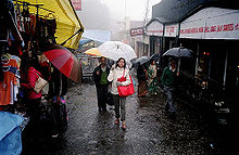 A Darjeeling street during heavy rain
Darjeeling's temperate climate (Koppen Cwb) has five distinct seasons: spring, summer, autumn, winter, and the monsoons. The annual mean maximum temperature is 14.9 °C (58.8 °F) while the mean minimum temperature is 8.9 °C (48.0 °F),[1] with monthly mean temperatures range from 5–17 °C (41–63 °F).[35] The lowest temperature recorded was −5 °C (23 °F) on 11 February 1905.[1] The average annual precipitation is 309.2 cm (121.7 in), with an average of 126 days of rain in a year.[1] The highest rainfall occurs in July.[35] The heavy and concentrated rainfall that is experienced in the region, aggravated by deforestation and haphazard planning, often causes devastating landslides, leading to loss of life and property.[36][37]
Civic administration
 Flag of the Gorkha National Liberation Front
The Darjeeling urban agglomeration consists of Darjeeling Municipality and the Pattabong Tea Garden.[38] Established in 1850, the Darjeeling municipality maintains the civic administration of the town, covering an area of 10.57 km2 (4.08 sq mi).[38] The municipality consists of a board of councillors elected from each of the 32 wards of Darjeeling town as well as a few members nominated by the state government. The board of councillors elects a chairman from among its elected members;[26] the chairman is the executive head of the municipality. The Gorkha Janmukti Morcha (GJMM) holds power in the municipality as of 2010[update].
The Gorkha-dominated hill areas of the whole Darjeeling district is under the jurisdiction of the Darjeeling Gorkha Hill Council since its formation in 1988. The DGHC's elected councillors are authorised to manage certain affairs of the hills, including education, health and tourism. Law and order in Darjeeling town comes under the jurisdiction of the district police force, which is a part of the West Bengal Police; a Deputy Superintendent of Police oversees the town's security and law affairs. Darjeeling municipality area has two police stations at Darjeeling and Jorebungalow.[39] Since 2005, there has been no elections to the DGHC and from March 2008 the West Bengal government directly runs the DGHC through an administrative officer.[40]
Utilities
Natural springs in the Senchal Range provide most of Darjeeling's water supply. Water collected is routed through stone conduits to two lakes that were constructed in 1910 and 1932, from where it is piped to the town after purification at the Jorebungalow filtration plant.[41] During the dry season, when water supplied by springs is insufficient, water is pumped from Khong Khola, a nearby small perennial stream. There is a steadily widening gap between water supply and demand; just over 50% of the town's households are connected to the municipal water supply system.[26] Various efforts made to augment the water supply, including the construction of a third storage reservoir in 1984, have failed to yield desired results.[41]
The town has an underground sewage system, covering about 40% of the town area, that collects domestic waste and conveys it to septic tanks for disposal.[42] Solid waste is disposed of in a nearby dumping ground, which also houses the town's crematorium.[42] Doorstep collection of garbage and segregation of biodegradable and non-biodegradable waste have been implemented since 2003.[43] Vermicomposting of vegetable waste is carried out with the help of non-governmental organisations.[44] In June 2009, in order to reduce waste, the municipality proposed the ban of plastic carry bags and sachets in the town.[45]
Electricity is supplied by the West Bengal State Electricity Board, and the West Bengal Fire Service provides emergency services for the town. The town often suffers from power outages and the electrical supply voltage is unstable, making voltage stabilisers popular with many households. Almost all of the primary schools are now maintained by Darjeeling Gorkha Autonomous Hill Council. The total length of all types of roads within the municipal area is around 134 km (83 mi).[46]
 Darjeeling at dusk, Photo By Vikramjit Kakati, Kakati(at)gmail.com
Economy
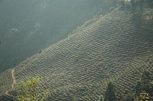 A tea plantation in Darjeeling
The two most significant contributors to Darjeeling's economy are tourism and the tea industry. Darjeeling tea, due to the unique agro-climatic conditions of Darjeeling, has a distinctive natural flavour, is internationally reputed and recognised as a geographical indicator.[2] Darjeeling produces 7% of India's tea output, approximately 9,000,000 kilograms (20,000,000 lb) every year.[24] The tea industry has faced competition in recent years from tea produced in other parts of India as well as other countries like Nepal.[47] Widespread concerns about labour disputes, worker layoffs and closing of estates have affected investment and production.[48] Several tea estates are being run on a workers' cooperative model, while others are being planned for conversion into tourist resorts.[48] More than 60% of workers in the tea gardens are women.[38] Besides tea, the most widely cultivated crops include maize, millets, paddy, cardamom, potato and ginger.[49]
Darjeeling had become an important tourist destination as early as 1860.[12] It is reported to be the only location in eastern India that witnesses large numbers of foreign tourists.[24] It is also a popular filming destination for Bollywood and Bengali cinema. Satyajit Ray shot his film Kanchenjungha (1962) here, and his Feluda series story, Darjeeling Jomjomaat was also set in the town. Bollywood movies Aradhana (1969), and more recently Main Hoon Na (2004) have been filmed here.[50][51] Tourist inflow into Darjeeling has been affected by the political instability in the region, and agitations in the 1980s and 2000s have hit the tourism industry hard.[24][52]
Transport
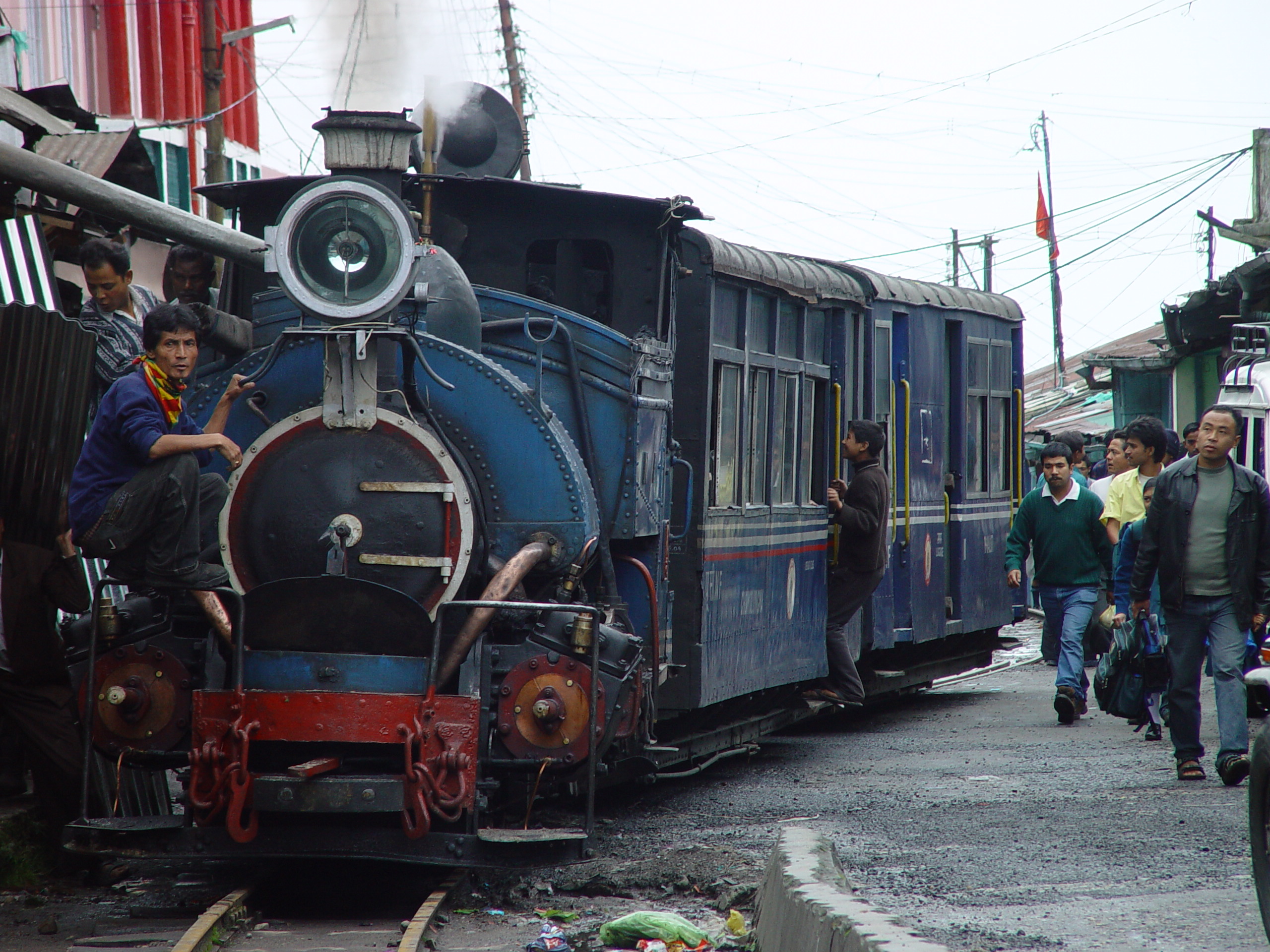
Main article: Transport in Darjeeling The "Toy Train" approaching Darjeeling
Darjeeling can be reached by the 88 km (55 mi) long Darjeeling Himalayan Railway from New Jalpaiguri, or by National Highway 55, from Siliguri, 77 km (48 mi) away.[53][54] The Darjeeling Himalayan Railway is a 60 cm (24 in) narrow-gauge railway that was declared a World Heritage Site by UNESCO in 1999 for being "an outstanding example of the influence of an innovative transportation system on the social and economic development of a multi-cultural region, which was to serve as a model for similar developments in many parts of the world",[55] becoming only the second railway in the world to have this honour.[13][50] Bus services and hired vehicles connect Darjeeling with Siliguri and Darjeeling has road connections with Bagdogra, Gangtok and Kathmandu and the neighbouring towns of Kurseong and Kalimpong.[53] However, road and railway communications often get disrupted in the monsoons because of landslides. The nearest airport is in Bagdogra, located 90 km (56 mi) from Darjeeling.[53] Within the town, people usually traverse by walking. Residents also use bicycles, two-wheelers and hired taxis for travelling short distances. The Darjeeling Ropeway, functional since 1968, was closed in 2003 after an accident killed four tourists.[56] It was proposed to be reopened in 2007,[57] but remained closed as of November 2009[update] due to absence of patronage as a result of the development of the road network in the region.[58] Reserve cars also available from Kings Travels, dial-098304-28401/ 093319-39486 for tour purpose in Darjeeling.
 Batasia Loop,Indian Railway, Photo By Vikramjit Kakati, Kakati(at)gmail.com
Demographics
Main article: Demographics of DarjeelingIn the 2011 census, Darjeeling Urban Agglomeration had a population of 132,016, out of which 65,839 were males and 66,177 were females. The 0–6 years population was 7,382. Effective literacy rate for the 7+ population was 93.17 per cent.[59]
See also: List of cities in West BengalAccording to the 2001 census, the Darjeeling urban agglomeration, with an area of 12.77 km2 (4.93 sq mi) has a population of 109,163, while the municipal area has a population of 107,530.[38] The population density of the municipal area is 10,173 per km2. The sex ratio is 1,017 females per 1,000 males,[38] which is higher than the national average of 933 females per 1000 males.[60] The three largest religions are Hinduism, Buddhism and Christianity, in that order.[61] The majority of the populace are Gorkhas of ethnic Nepali background. Indigenous ethnic groups include the Limbu, Rai, Tamangs, Lepchas, Gurung, Bhutias, Sherpas and Newars. Other communities that inhabit Darjeeling include the Bengali, Anglo-Indians, Chinese, Bihari and Tibetans. The most commonly spoken languages are Nepali, Bengali, English and Tibetan.[62]
Darjeeling has seen a significant growth in its population, which grew 44.6% between 1991 and 2001.[38] The colonial town had been designed for a population of only 10,000 and so subsequent growth has created extensive infrastructural and environmental problems. The district's forests and other natural resources have been adversely affected by an ever-growing population. Environmental degradation, including denudation of the surrounding hills, has adversely affected Darjeeling's appeal as a tourist destination.[31]
Culture
Main article: Culture of Darjeeling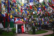 Colourful Buddhist prayer flags around Mahakal Temple at Observatory Hill, Darjeeling.
 St. Andrew's Church, Darjeeling. Built- 1843, Rebuilt- 1873
Apart from the major religious festivals of Dashain (Durga puja), Tihar (Diwali) and Christmas the diverse ethnic populace of the town celebrates several local festivals. The Lepchas and Bhutias celebrate new year in January, while Tibetans celebrate their new year, Losar, in February–March. The birthday of the Dalai Lama is celebrated in mid-June with processions.[62] Darjeeling Carnival, initiated by a civil society movement known as The Darjeeling Initiative, is a ten day carnival held every year during the winter with portrayal of the Darjeeling Hill's musical and cultural heritage as its central theme.[63]
 Japanese Temple, Darjeeling
A popular food in Darjeeling is the Tibetan momo, a steamed dumpling containing meat cooked in a doughy wrapping and served with clear soup and achar. A form of Tibetan noodle called thukpa, served in soup form is also popular. Other commonly eaten dishes include alu dum, a potato preparation, and shaphalay, Tibetan bread stuffed with meat.[62] Fermented foods and beverages are consumed by a large percentage of the population.[64] Fermented foods include preparations of soyabean, bamboo shoots, milk and Sel roti, which is made from rice.[65] Tea is the most popular beverage, the Tibetan version is also drunk.[62] Alcoholic beverages include Tongba, Jnaard and Chhaang, variations of a local beer made from fermenting finger millet.[62][66][67]
Colonial architecture characterises many buildings in Darjeeling, exemplified by several mock Tudor residences, Gothic churches, the Raj Bhawan, Planters' Club and various educational institutions. Buddhist monasteries showcase the pagoda style architecture. Darjeeling is regarded as a centre of music and a niche for musicians and music admirers. Singing and playing musical instruments is a common pastime among the resident population, who take pride in the traditions and role of music in cultural life.[68]
Education
There are 52 primary schools, 21 high schools and 4 colleges in the town.[42] Darjeeling's schools are either run by the state government or by private and religious organisations. Schools mainly use English and Nepali as their media of instruction, although there is the option to learn the national language Hindi and the official state language Bengali. The schools are either affiliated with the ICSE, the CBSE, or the West Bengal Board of Secondary Education. Having been a summer retreat for the British in India, Darjeeling became the place of choice for the establishment of public schools on the model of Eton, Harrow and Rugby, allowing the children of British officials to obtain an exclusive education.[69] Institutions such as Mount Hermon School, St. Joseph's College (School Dept.), Loreto Convent,and St. Paul's School are renowned as centres of educational excellence.[70] Darjeeling has four colleges — St. Joseph's College, Southfield College (earlier known as Loreto College), Darjeeling Government College and Sri Ramakrishna B.T. College — all affiliated to the University of North Bengal in Siliguri.
Notes
- ^ a b c d e "District Profile". Official webpage. Darjeeling district. http://www.darjeeling.gov.in/dist-prof.html. Retrieved 2011-06-15.
- ^ a b Srivastava 2003, p. 4024.
- ^ Dasgupta 1999, pp. 47–48.
- ^ a b c Dasgupta 1999, p. 51.
- ^ a b Dasgupta 1999, p. 50.
- ^ Lamb 1986, p. 69.
- ^ Dasgupta 1999, p. 47.
- ^ a b c "History of Darjeeling". Official webpage. Darjeeling district. http://www.darjeeling.gov.in/darj-hist.html. Retrieved 2011-06-15.
- ^ Dasgupta 1999, p. 48.
- ^ Palit 2006, p. 16.
- ^ Kenny 1995, p. 700.
- ^ a b c d Lamb 1986, p. 71.
- ^ a b "Mountain Railways of India". UNESCO World Heritage Centre. UNESCO. http://whc.unesco.org/en/list/944. Retrieved 2011-06-15.
- ^ Gerard 1990, p. 258.
- ^ Borbara, Sanjoy (2003). "Autonomy for Darjeeling: History and Practice". Experiences on Autonomy in East and North East: A Report on the Third Civil Society Dialogue on Human Rights and Peace. Mahanirban Calcutta Research Group. http://www.mcrg.ac.in/civilsocietydialogue3.htm. Retrieved 2011-06-15.
- ^ Dasgupta 1999, p. 60.
- ^ "Darjeeling Hills plunges into the Independence Movement". Official webpage. Darjeeling district. http://www.darjeeling.gov.in/independence.html. Retrieved 2011-06-15.
- ^ a b Dasgupta 1999, p. 61.
- ^ Dasgupta 1999, p. 55.
- ^ Dasgupta 1999, pp. 61–62.
- ^ Dasgupta 1999, p. 62.
- ^ Dasgupta 1999, pp. 63–64.
- ^ Dasgupta 1999, p. 65.
- ^ a b c d Sujoy Dhar (2009-07-14). "Darjeeling protests hit tea and tourism". Livemint. http://www.livemint.com/2009/07/14124608/Darjeeling-protests-hit-tea-an.html. Retrieved 2009-11-25.
- ^ "Darjeeling tripartite pact signed for Gorkhaland Territorial Administration". Times of India. 18 July 2011. http://articles.timesofindia.indiatimes.com/2011-07-18/india/29786729_1_gjm-general-secretary-darjeeling-and-siliguri-gjm-leadership. Retrieved 29 July 2011.
- ^ a b c Khawas, Vimal (2003). "Urban Management in Darjeeling Himalaya: A Case Study of Darjeeling Municipality". The Mountain Forum. http://www.mtnforum.org/resources/library/khawv03e.htm. Retrieved 2006-05-01.[dead link] Now available in the Internet Archive in this URL . Retrieved 7 June 2006.
- ^ a b "Darjeeling". Encyclopædia Britannica. Encyclopædia Britannica Premium Service. http://www.britannica.com/eb/article-9028781. Retrieved 2006-07-26.
- ^ a b c Negi 1992, p. 185.
- ^ Negi 1992, pp. 28–29.
- ^ "Himalayan Tahrs, Blue sheep for Darjeeling Zoo arrive from Japan". The Hindu. 2009-10-29. http://www.hindu.com/2009/10/29/stories/2009102957821300.htm. Retrieved 2009-11-10.
- ^ a b TERI (2001). "Sustainable Development in the Darjeeling Hill Area" (PDF). Tata Energy Research Institute, New Delhi. (TERI Project No.2000UT64). p. 20. http://static.teriin.org/reports/rep17/rep17.pdf. Retrieved 2006-05-01.
- ^ Mackintosh 2009, p. 2.
- ^ Negi 1992, pp. 43–48.
- ^ Dam, Mohana (2009-07-06). "New centres to help endangered panda and dolphin thrive". Express India. The Indian Express. http://www.expressindia.com/latest-news/new-centres-to-help-endangered-panda-and-dolphin-thrive/485586/. Retrieved 2011-06-15.
- ^ a b "Weatherbase entry for Darjeeling". Canty and Associates LLC. http://www.weatherbase.com/weather/weather.php3?s=422950&refer==&units=metric. Retrieved 2006-04-30.
- ^ Sarkar 1999, p. 299.
- ^ Malabi Gupta (2009-11-26). "Brewtal climate: Droughts, storms cracking Darjeeling’s teacup". Hindustan Times. http://www.hindustantimes.com/special-news-report/News-Feed/Brewtal-climate-Droughts-storms-cracking-Darjeeling-s-teacup/Article1-480534.aspx. Retrieved 2009-12-03.
- ^ a b c d e f "Table-4 Population, Decadal Growth Rate, Density and General Sex Ratio by Residence and Sex, West Bengal/ District/ Sub District, 1991 and 2001". Directorate of Census Operations, West Bengal. 2003. Archived from the original on 2005-08-27. http://web.archive.org/web/20050827091947/http://www.wbcensus.gov.in/DataTables/02/FrameTable4_1.htm. Retrieved 2006-04-30.
- ^ "Table-3 District Wise List of Statutory Towns (Municipal Corporation, Municipality, Notified Area and Cantonment Board), Census Towns and Outgrowths, West Bengal, 2001". Directorate of Census Operations, West Bengal. 2003. http://web.cmc.net.in/wbcensus/DataTables/01/Table-3.htm. Retrieved 2006-04-30.
- ^ Express news service (2008-03-11). "Ghisingh gone, Morcha ‘closer’ to Gorkhaland". Express India. The Indian Express. http://www.expressindia.com/latest-news/Ghisingh-gone-Morcha-closer-to-Gorkhaland/282846/. Retrieved 2011-06-15.
- ^ a b "Water Supply". Official webpage. Darjeeling municipality. http://www.darjeelingmunicipality.com/water.html. Retrieved 2009-12-03.
- ^ a b c "General Information". Official webpage. Darjeeling municipality. http://www.darjeelingmunicipality.com/general.html. Retrieved 2010-01-08.
- ^ Aftab 2005, p. 186.
- ^ Aftab 2005, p. 187.
- ^ Dam, Mohana (2009-06-11). "Darjeeling to ban plastic altogether". Express India. The Indian Express. http://www.expressindia.com/latest-news/darjeeling-to-ban-plastic-altogether/474728/. Retrieved 2011-06-15.
- ^ "Roads". Official webpage. Darjeeling municipality. http://www.darjeelingmunicipality.com/roads.html. Retrieved 2010-01-08.
- ^ "Darjeeling tea growers at risk". BBC News. 2001-07-27. http://news.bbc.co.uk/2/hi/business/1456988.stm. Retrieved 2011-06-15.
- ^ a b Haber, Daniel B. (2004-01-14). "Economy-India: Famed Darjeeling Tea Growers Eye Tourism for Survival". Inter Press Service News Agency. http://www.ipsnews.net/africa/interna.asp?idnews=21909. Retrieved 2006-05-08.
- ^ "Agriculture". Official webpage. Darjeeling district. http://www.darjeeling.gov.in/agriculture.html. Retrieved 2011-06-15.
- ^ a b Sudha Mahalingam (March 2001). "Darjeeling: Where the journey is the destination". Outlook Traveller. Outlook Publishing (India) Private Limited. Archived from the original on 2007-04-15. http://web.archive.org/web/20070415015159/http://www.outlooktraveller.com/aspscripts/travelogue.asp?dest=Darjeeling. Retrieved 2007-03-09.
- ^ "Darjeeling Toy Train". Theme India: Train Tourism in India. IndiaLine. http://www.indialine.com/travel/trains/darjeeling-toy-train.html. Retrieved 2009-12-05.
- ^ Dasgupta 1999, p. 66.
- ^ a b c de Bruyn 2008, p. 578.
- ^ "NH wise Details of NH in respect of Stretches entrusted to NHAI". National Highways Authority of India. http://www.nhai.org/Doc/project-offer/Highways.pdf. Retrieved 2011-01-07.
- ^ "World Heritage Committee: Report of the 23rd Session, Marrakesh, 1999". UNESCO. 1999. Darjeeling Himalayan Railway. http://whc.unesco.org/archive/repcom99.htm#944. Retrieved 2011-06-15.
- ^ "Darjeeling ropeway mishap kills four". The Statesman. 2003-10-20. Archived from the original on September 29, 2007. http://web.archive.org/web/20070929102947/http://www.thestatesman.net/page.arcview.php?clid=1&id=53912&usrsess=1. Retrieved 2007-06-30.
- ^ Soma Mookerjee (2007-06-22). "Darjeeling Ropeway to open again". The Statesman. Archived from the original on 2008-04-18. http://web.archive.org/web/20080418002244/http://www.thestatesman.net/page.arcview.php?clid=6&id=187778&usrsess=1. Retrieved 2009-12-02.
- ^ Mohan Prasad (2009-11-30). "Time, neglect apply brakes on ropeways". The Statesman. http://www.darjeelingtimes.com/news/News/ABGL-explores-court-option-for-meet.html. Retrieved 2011-01-07.
- ^ "Urban Agglomerations/Cities having population 1 lakh and above". Provisional Population Totals, Census of India 2011. http://www.censusindia.gov.in/2011-prov-results/paper2/data_files/India2/Table_3_PR_UA_Citiees_1Lakh_and_Above.pdf. Retrieved 2011-10-21.
- ^ "India at a Glance: Sex Ratio". Census of India, 2001. http://www.censusindia.gov.in/Census_Data_2001/India_at_glance/fsex.aspx. Retrieved 2009-11-19.
- ^ "Basic data sheet, District Darjiling". Census of India, 2001. http://www.censusindia.gov.in/Dist_File/datasheet-1901.pdf. Retrieved 2009-11-19.
- ^ a b c d e "People & Culture". Official webpage. Darjeeling district. http://www.darjeeling.gov.in/people.html. Retrieved 2011-06-15.
- ^ S.S. Chattopadhyay (December 2003). "The spirit of Darjeeling". Frontline 20 (25). http://www.hinduonnet.com/fline/fl2025/stories/20031219000306600.htm. Retrieved 2006-05-01.[dead link]
- ^ Tamang 1988, p. 376.
- ^ Tamang 1988, p. 375.
- ^ Tamang 1988, p. 382.
- ^ H. Ä. Jaschke (1881). A Tibetan-English Dictionary (1987 reprint ed.). Delhi: Motilal Banarsidas. p. 341. ISBN 81-208-0321-3.
- ^ D.P. Rasaily, R.P. Lama. "The Nature-centric Culture of the Nepalese". The Cultural Dimension of Ecology. Indira Gandhi National Centre for the Arts, New Delhi. http://ignca.nic.in/cd_07011.htm. Retrieved 2006-07-31.
- ^ Lal, Vinay. ""Hill Stations: Pinnacles of the Raj." Review article on Dale Kennedy, The Magic Mountains: Hill Stations and the British Raj". UCLA Social Sciences Computing. http://www.sscnet.ucla.edu/southasia/History/British/HillStations.html. Retrieved 2001-07-30.
- ^ "Educational Institutes". Official webpage. Darjeeling district. http://www.darjeeling.gov.in/edu-institute.html. Retrieved 2011-06-15.
References
- Aftab, Aaris (2005). Are the Third World cities sustainable?. Allied Publishers. p. 201. ISBN 978-81-7764-869-0. http://books.google.com/?id=R1HV6aoINaQC.
- Bhattacharya, Anima (1995). Planning in the Perspective of Development. M.D. Publications. p. 231. ISBN 978-81-85880-62-4. http://books.google.com/?id=Znwg_xDfx80C.
- Dasgupta, Atis (1999). "Ethnic Problems and Movements for Autonomy in Darjeeling". Social Scientist 27 (11–12): 47–68. doi:10.2307/3518047. JSTOR 3518047.
- de Bruyn, Pippa; Keith Bain, Niloufer Venkatraman, Shonar Joshi (2008). Frommer's India. Frommer's. ISBN 978-0-470-16908-7. http://books.google.com/?id=qMqBvtL_nI0C&pg=PA578&dq=how+to+get+to+darjeeling#v=onepage&q=how%20to%20get%20to%20darjeeling&f=false. Retrieved 2011-01-08.
- Froehlich, W. (1990). "Thresholds in the Transformation of Slopes and River Channels in the Darjeeling Himalaya, India". Annals of the Association of American Geographers 10 (4): 301–312. JSTOR 3673492.
- Gerard, John (1990). Mountain environments: an examination of the physical geography of mountains. MIT Press. p. 317. ISBN 0-262-07128-2.
- Kenny, Judith (1995). "Climate, Race, and Imperial Authority: The Symbolic Landscape of the British Hill Station in India". Annals of the Association of American Geographers 85 (4): 694–714. doi:10.1111/j.1467-8306.1995.tb01821.x. JSTOR 2564433.
- Lamb, Alastair (1986). British India and Tibet, 1766–1910 (2nd ed.). Taylor & Francis. p. 353. ISBN 978-0-7102-0872-9. http://books.google.com/?id=MY4OAAAAQAAJ.
- Mackintosh, L.J. (2009). Birds of Darjeeling and India (2nd ed.). BiblioBazaar, LLC. p. 322. ISBN 978-1-116-11396-9. http://books.google.com/?id=xY6nB640PKkC.
- Negi, Sharad Singh (1992). Himalayan wildlife, habitat and conservation. Indus Publishing. p. 207. ISBN 978-81-85182-68-1. http://books.google.com/?id=W88pkms1dXEC.
- Palit, Chittabrata (2006). Scientific Bengal: science, technology, medicine, and environment under the Raj. Gyan Books. p. 270. ISBN 978-81-7835-496-5. http://books.google.com/?id=YmmBZwI8RTYC.
- Sarkar, S. (1999). "Landslides in Darjeeling Himalayas, India". Transactions of the Japanese Geomorphological Union 20 (3): pp. 299–315. ISSN 0389-1755.
- Srivastava, Suresh C. (2003). "Geographical Indications and Legal Framework in India". Economic and Political Weekly 38 (38): 4022–4033. JSTOR 4414050.
- Subba, Tanka Bahadur (2009). Indian Nepalis: issues and perspectives. Concept Publishing Company. p. 398. ISBN 978-81-8069-446-2. http://books.google.com/?id=rBDcenRzHJAC&printsec=frontcover&q=.
- Tamang, Jyoti P; Sarkar, Prabir (1988). "Traditional Fermented Foods and Beverages of Darjeeling". Journal of the science of food and agriculture 44 (4): 375–385. doi:10.1002/jsfa.2740440410. http://ddr.nal.usda.gov/dspace/bitstream/10113/23778/1/IND88052735.pdf.
- Waterhouse, David M. (2004). The origins of Himalayan studies: Brian Houghton Hodgson in Nepal and Darjeeling, 1820–1858. Routledge. p. 280. ISBN 978-0-415-31215-8. http://books.google.com/?id=_rhgqGA2nKoC.
Further reading
- Bradnock, R; Bradnock, R (2004). Footprint India Handbook (13th ed.). Footprint Handbooks. ISBN 1-904777-00-7.
- Brown, Percy (1917). Tours in Sikhim and the Darjeeling District (3rd (1934) ed.). Calcutta: W. Newman & Co.. p. 223. ISBN ASIN: B0008B2MIY.
- Kennedy, Dane (1996). Magic Mountains: Hill Stations and the British Raj. University of California Press. p. 265. ISBN 0-520-20188-4. http://content.cdlib.org:8088/xtf/view?docId=ft396nb1sf&chunk.id=0&doc.view=printThe.
- Lee, Ada (1971). The Darjeeling disaster: Triumph through sorrow: the triumph of the six Lee children. Lee Memorial Mission. ISBN ASIN: B0007AUX00.
- Newman's Guide to Darjeeling and Its Surroundings, Historical & Descriptive, with Some Account of the Manners and Customs of the Neighbouring Hill Tribes, and a Chapter on Thibet and the Thibetans. W. Newman and Co.. 1900.
- Ronaldshay, The Earl of (1923). Lands of the Thunderbolt. Sikhim, Chumbi & Bhutan. London: Constable & Co.. ISBN 81-206-1504-2 (Reprint).
- Roy, Barun (2003). Fallen Cicada (2003 ed.). Beacon Publication. p. 223. ISBN 0732193121X.
- Saraswati, Baidyanath (Ed) (1998). Cultural Dimension of Ecology. DK Print World Pvt. Ltd, India. ISBN 81-246-0102-X.
- Singh, S. (2005). Lonely Planet India (11th ed.). Lonely Planet Publications. ISBN 1-74059-694-3.
- Waddell, L. A. (2004). Among the Himalayas. Kessinger Publishing. ISBN 0-7661-8918-X.
External links
- Darjeeling at the Open Directory Project
- Darjeeling travel guide from Wikitravel
- Darjeeling Himalayan Railway
Darjeeling related topics History and Government Darjeeling District, History of Sikkim, History of Bengal, History of Nepal, British Raj, Gorkha National Liberation Front, Gorkhaland, Darjeeling Gorkha Autonomous Hill Council, Darjeeling Municipality, Darjeeling (Lok Sabha Constituency)Geography Kanchenjunga, Darjeeling Himalayan hill region, Jore Pokhri Wildlife Sanctuary, Katapahar, Jalapahar, Observatory Hill, Siwalik Hills, Tiger Hill, Darjeeling Sadar, Mahananda Wildlife Sanctuary, Padmaja Naidu Himalayan Zoological Park, Manebhanjang, Sandakfu, Falut, Rock Garden, Senchal Wildlife Sanctuary, Singalila National Park, Demographics of DarjeelingEducation Economy and Transport Culture Sherpa, Rai, Lepcha, Bhutia, Yamloo, Damai, Kamai, Newar, Limbu, Gorkha, Bengali, Nepali, Hinduism, Buddhism, Wai-wai, Churpee, Thukpa, Momo, Chhang, Devil Dance, Tendong Lho Rumfaat, Maghe sankranti, Chotrul Duchen, Tibetan Refugee Self Help Center, Ghum Monastery, Bhutia Busty monastery, Mag-Dhog Yolmowa Monastery, Peace PagodaCommunity development blocks Darjeeling Sadar subdivision Darjeeling Pulbazar, Jorebunglow Sukhiapokhri, Rangli Rangliot Kalimpong subdivision Kalimpong I, Kalimpong II, Gorubathan Kurseong subdivision Mirik, Kurseong Siliguri subdivision Matigara, Naxalbari, Phansidewa, KharibariVidhan Sabha constituencies Kalimpong, Darjeeling, Kurseong, Matigara-Naxalbari, Siliguri, PhansidewaTemplate Categories Darjeeling, Cities and towns in Darjeeling district, Himalayas, Hill stations in India, People from Darjeeling district, Villages in Darjeeling districtCities and towns in Darjeeling District Darjeeling Sadar subdivision Bijanbari · Darjeeling · Ghum · Happy Valley Tea Estate · Pattabong Tea Garden · Sonada · Sukhiapokhri · Tukver Tea EstateKalimpong subdivision Kurseong subdivision Siliguri subdivision See also Darjeeling related topics · People from Darjeeling district · Bagdogra Airport · Villages in Darjeeling districtCities and towns
in other districtsBankura · Bardhaman · Birbhum · Cooch Behar · Dakshin Dinajpur · Hooghly · Howrah · Jalpaiguri · Malda · Murshidabad · Nadia · North 24 Parganas · Paschim Medinipur · Purba Medinipur · Purulia · South 24 Parganas · Uttar DinajpurMountains and Plateaus Himalayas · Western Ghats · Eastern Ghats · Aravalli Range · The Nilgiris · Vindhya Range · Satpura Range · Garo Hills · Shivalik Hills · Mahabharat Range · Khasi Hills · Annamalai Hills · Cardamom Hills · Sulaiman Mountains · Toba Kakar Range · Karakoram · Hindu Kush · Chittagong Hill Tracts · Deccan Plateau · Thar Desert · Makran · Chota Nagpur · Naga Hills · Mysore Plateau · Ladakh Plateau · Gandhamardan HillsLowlands and Islands Indo-Gangetic plain · Indus River Delta · Ganges Basin · Ganges Delta · Terai · Atolls of Maldives · Coromandel Coast · Konkan · Lakshadweep · Andaman and Nicobar Islands · Sundarbans · Greater Rann of Kutch · Little Rann of Kutch · Protected areas in Tamil NaduCountries Municipalities & CD blocks of West Bengal Municipal
CorporationsMunicipalities Alipurduar · Arambagh · Ashoknagar Kalyangarh · Baduria · Baidyabati · Bally · Balurghat · Bangaon · Bankura · Bansberia · Baranagar · Barasat · Bardhaman · Barrackpore · Baruipur · Basirhat · Beldanga · Berhampore · Bhadreswar · Bhatpara · Bidhannagar · Birnagar · Bishnupur · Bolpur · Budge Budge · Chakdaha · Champdani · Chandrakona · Contai · Cooch Behar · Dainhat · Dalkhola · Darjeeling · Dhulian · Dhupguri · Diamond Harbour · Dinhata · Dubrajpur · Dum Dum · Egra · English Bazar · Gangarampur · Garulia · Gayespur · Ghatal · Gobardanga · Guskara · Habra · Haldia · Haldibari · Halisahar · Hugli-Chuchura · Islampur · Jalpaiguri · Jamuria · Jangipur · Jhalda · Jhargram · Jiaganj Azimganj · Jaynagar Mazilpur · Kaliaganj · Kalimpong · Kalna · Kalyani · Kamarhati · Kanchrapara · Kandi · Katwa · Kharagpur · Kharar · Khardaha · Kshirpai · Konnagar · Krishnanagar · Kulti · Kurseong · Madhyamgram · Maheshtala · Mal · Mathabhanga · Mekhliganj · Memari · Midnapore · Murshidabad · Nabadwip · Naihati · Nalhati · New Barrackpur · North Barrackpur · North Dumdum · Old Maldah · Panihati · Panskura · Pujali · Purulia · Raghunathpur · Raiganj · Rajarhat · Rajpur Sonarpur · Ramjibanpur · Rampurhat · Ranaghat · Raniganj · Rishra · Sainthia · Shantipur · Serampore · Sonamukhi · South Dumdum · Suri · Taki · Tamluk · Tarakeswar · Titagarh · Tufanganj · Uluberia · Uttarpara Kotrung
Community
development
blocks*A Alipuduar I · Alipurduar II · Amdanga · Amta I · Amta II · Andal · Arambagh · Arsha · Ausgram I · Ausgram II B Baduria · Bagdah · Baghmundi · Bagnan I · Bagnan II · Balagarh · Balarampur · Balurghat · Bally Jagachha · Bamangola · Bandwan · Bangaon · Bankura I · Bankura II · Barjora · Bansihari · Barabani · Barabazar · Barrackpore I · Barrackpore II · Barasat I · Barasat II · Baruipur · Basanti · Basirhat I · Basirhat II · Beldanga I · Beldanga II · Berhampore · Bhagawangola I · Bhagawangola II · Bhagabanpur I · Bhagabanpur II · Bhangore I · Bhangore II · Bharatpur I · Bharatpur II · Bhatar · Binpur I · Binpur II · Bishnupur, Bankura · Bishnupur I, South 24 Parganas · Bishnupur II, South 24 Parganas · Bolpur Sriniketan · Budge Budge I · Budge Budge II · Burdwan I · Burdwan II · Burwan C Canning I · Canning II · Chakdaha · Chanchal I · Chanchal II · Chandipur · Chanditala I · Chanditala II · Chapra · Chandrakona I · Chandrakona II · Chhatna · Chinsurah-Mogra · Chopra · Contai I · Contai II · Contai III · Cooch Behar I · Cooch Behar II D Darjeeling Pulbazar · Dantan I · Dantan II · Daspur I · Daspur II · Debra · Deganga · Diamond Harbour I · Diamond Harbour II · Deshapran · Dhaniakhali · Dhupguri · Dinhata I · Dinhata II · Domjur · Domkal · Dubrajpur E Egra I · Egra II · English Bazar F Falakata · Falta · Farakka · Faridpur-Durgapur G Gaighata · Galsi I · Galsi II · Gangajalghati · Gangarampur · Garhbeta I · Garhbeta II · Garhbeta III · Gazole · Ghatal · Goalpokhar I · Goalpokhar II · Goghat I · Goghat II · Gopiballavpur I · Gopiballavpur II · Gorubathan · Gosaba H Habibpur · Habra I · Habra II · Haldia · Haldibari · Hanskhali · Hariharpara · Haringhata · Haripal · Harirampur · Harishchandrapur I · Harishchandrapur II · Haroa · Hasnabad · Hemtabad · Hili · Hingalganj · Hirbandh · Hura I Ilambazar · Indas · Indpur · Islampur · Itahar J Jagatballavpur · Jalangi · Jalpaiguri · Jamalpur · Jamboni · Jamuria · Jangipara · Jaynagar I · Jaynagar II · Jhalda I · Jhalda II · Jhargram · Jorebunglow Sukhiapokhri · Joypur, Bankura · Joypur, Purulia · K Kakdwip · Kalchini · Kaliachak I · Kaliachak II · Kaliachak III · Kaliaganj · Kaliganj · Kalimpong I · Kalimpong II · Kalna I · Kalna II · Kandi · Kanksa · Karandighi · Karimpur I · Karimpur II · Kashipur · Katwa I · Katwa II · Keshiari · Keshpur · Ketugram I · Ketugram II · Khanakul I · Khanakul II · Khandaghosh · Kharagpur I · Kharagpur II · Khargram · Kharibari · Khatra · Khejuri I · Khejuri II · Khoyrasole · Kotulpur · Krishnaganj · Krishnanagar I · Krishnanagar II · Kulpi · Kultali · Kumarganj · Kumargram · Kurseong · Kushmandi L Labpur · Lalgola M Madarihat-Birpara · Magrahat I · Magrahat II · Mahisadal · Mal · Manbazar I · Manbazar II · Mandirbazar · Manikchak · Manteswar · Mathabhanga I · Mathabhanga II · Mathurapur I · Mathurapur II · Matiali · Matigara · Maynaguri · Mayureswar I · Mayureswar II · Mejia · Mekhliganj · Memari I · Memari II · Midnapore Sadar · Minakhan · Mirik · Mohammad Bazar · Mohanpur · Mongalkote · Moyna · Murarai I · Murarai II · Murshidabad-Jiaganj N Nabadwip · Nabagram · Nagrakata · Nakashipara · Nalhati I · Nalhati II · Namkhana · Nandakumar · Nandigram I · Nandigram II · Nanoor · Naoda · Narayangarh · Naxalbari · Nayagram · Neturia O Old Malda · Onda · P Panchla · Pandabeswar · Pandua · Panskura I · Panskura II · Para · Patashpur I · Patashpur II · Patharpratima · Patrasayer · Phansidewa · Pingla · Polba-Dadpur · Puncha · Purbasthali I · Purbasthali II · Pursurah · Purulia I · Purulia II R Raghunathganj I · Raghunathganj II · Raghunathpur I · Raghunathpur II · Raiganj · Raina I · Raina II · Raipur · Rajarhat · Rajganj · Rajnagar · Ramnagar I · Ramnagar II · Rampurhat I · Rampurhat II · Ranaghat I · Ranaghat II · Rangli Rangliot · Ranibandh · Raniganj · Raninagar I · Raninagar II · Ratua I · Ratua II S Sabang · Sagar · Sagardighi · Sahid Matangini · Sainthia · Salanpur · Salboni · Saltora · Samserganj · Sandeshkhali I · Sandeshkhali II · Sankrail, Howrah · Sankrail, Paschim Medinipur · Santipur · Santuri · Sarenga · Shyampur I · Shyampur II · Simlapal · Singur · Sitai · Sitalkuchi · Sonamukhi · Sonarpur · Sreerampur-Uttarpara · Suri I · Suri II · Sutahata · Suti I · Suti II · Swarupnagar T Taldangra · Tamluk · Tapan · Tarakeswar · Tehatta I · Tehatta II · Thakurpukur Mahestala · Tufanganj I · Tufanganj II U Udaynarayanpur · Uluberia I · Uluberia II
- Similar to Tehsils in many states of India
Categories:- Cities and towns in Darjeeling district
- Darjeeling
- Hill stations in India


Wikimedia Foundation. 2010.