- Nantwich
-
Coordinates: 53°04′01″N 2°31′19″W / 53.067°N 2.522°W
Nantwich 
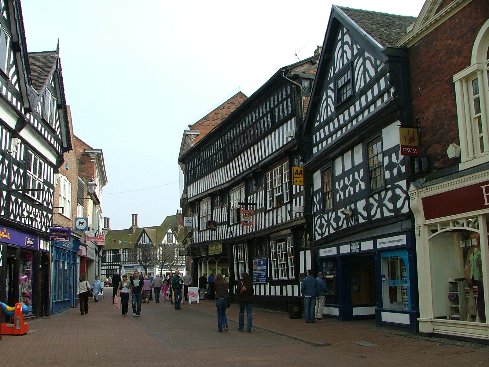
High Street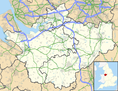
 Nantwich
Nantwich shown within CheshirePopulation 12,515 (2001) OS grid reference SJ652523 Parish Nantwich Unitary authority Cheshire East Ceremonial county Cheshire Region North West Country England Sovereign state United Kingdom Post town NANTWICH Postcode district CW5 Dialling code 01270 Police Cheshire Fire Cheshire Ambulance North West EU Parliament North West England UK Parliament Crewe and Nantwich List of places: UK • England • Cheshire Nantwich is a market town and civil parish in the Borough of Cheshire East and the ceremonial county of Cheshire, England. The town gives its name to the parliamentary constituency of Crewe and Nantwich. In 2001 Nantwich had a population of 12,515.[1]
Contents
History
The origins of the settlement date to Roman times[citation needed] when salt from Nantwich was used by the Roman garrisons at Chester (Deva Victrix) and Stoke-on-Trent as both a preservative and a condiment. Salt has been used in the production of Cheshire cheese and in the tanning industry, both products of the dairy industry based in the Cheshire Plain around the town. Wich and wych are names used to denote brine springs or wells. In 1194 there is a reference to the town as being called Nametwihc, which would indicate it was once the site of a pre-Roman Celtic nemeton or sacred grove.[2]
In the Domesday Book, Nantwich is recorded as having eight salt houses. It had a castle and was the capital of a barony of the earls of Chester, and of a hundred (one of the seven sub-divisions of medieval Cheshire). Nantwich is one of the few places in Cheshire to be marked on the Gough Map, which dates from 1355–66.[3] It was first recorded as an urban area at the time of the Norman conquest – the Normans burned the town to the ground[4] leaving only one building standing.
The town is believed to have been a salt-producing centre from the 10th century or earlier.[5] The Norman castle was built at the crossing of the Weaver before 1180, probably near where the Crown Inn now stands. Although nothing remains of the castle above ground, it affected the town's layout.[6][7] During the medieval period, Nantwich was the most important salt town and probably the second most important settlement in the county after Chester.[8][9] By the 14th century, the town held a weekly cattle market at the end of Beam Street, and was also important for its tanning industry centred on Barker Street.[10]
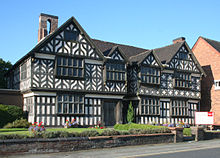 Churche's Mansion, one of the few buildings in Nantwich to survive the fire of 1583
A fire destroyed most of the town to the east of the Weaver in 1583.[11][12] Elizabeth I personally contributed to the town's rebuilding, which occurred rapidly and followed the plan of the destroyed town.[13] Beam Street, one of the main streets of Nantwich, was re-named to reflect the fact that the timber to rebuild the town was transported along it.
During the English Civil War Nantwich declared for Parliament, and consequently it was besieged several times by Royalist forces. The final, six-week long, siege was lifted following the victory of the Parliamentary forces in the Battle of Nantwich on 26 January 1644, which has been re-enacted as Holly Holy Day on its anniversary every year since 1973 by the Sealed Knot, a registered charity devoted to re-enacting English civil war battles for educational purposes. The name comes from the sprigs of holly worn by the townsfolk in their caps or clothing in the years after the battle, in its commemoration.[14]
The salt industry peaked in the mid-16th century, with around 400 salt houses in 1530, and had almost died out by the end of the 18th century; the last salt house closed in the mid-19th century.[15][16][17] Nikolaus Pevsner considers the decline in the salt industry to have been the critical factor in preserving the town's historic buildings.[15] The last tannery closed in 1974. The town's location on the London to Chester road meant that Nantwich served the needs of travellers from the medieval era.[8][18] This trade declined in the 19th century, however, with the opening of Telford's road from London to Holyhead, which offered a faster route to Wales, and later when the Grand Junction Railway bypassed the town.[16]
Governance
The Borough Council of Crewe and Nantwich was abolished on 1 April 2009; the civil parish is now administered by the new unitary authority of Cheshire East.[19] Nantwich falls in the parliamentary constituency of Crewe and Nantwich,[20]
Places of interest
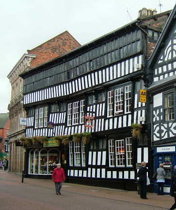
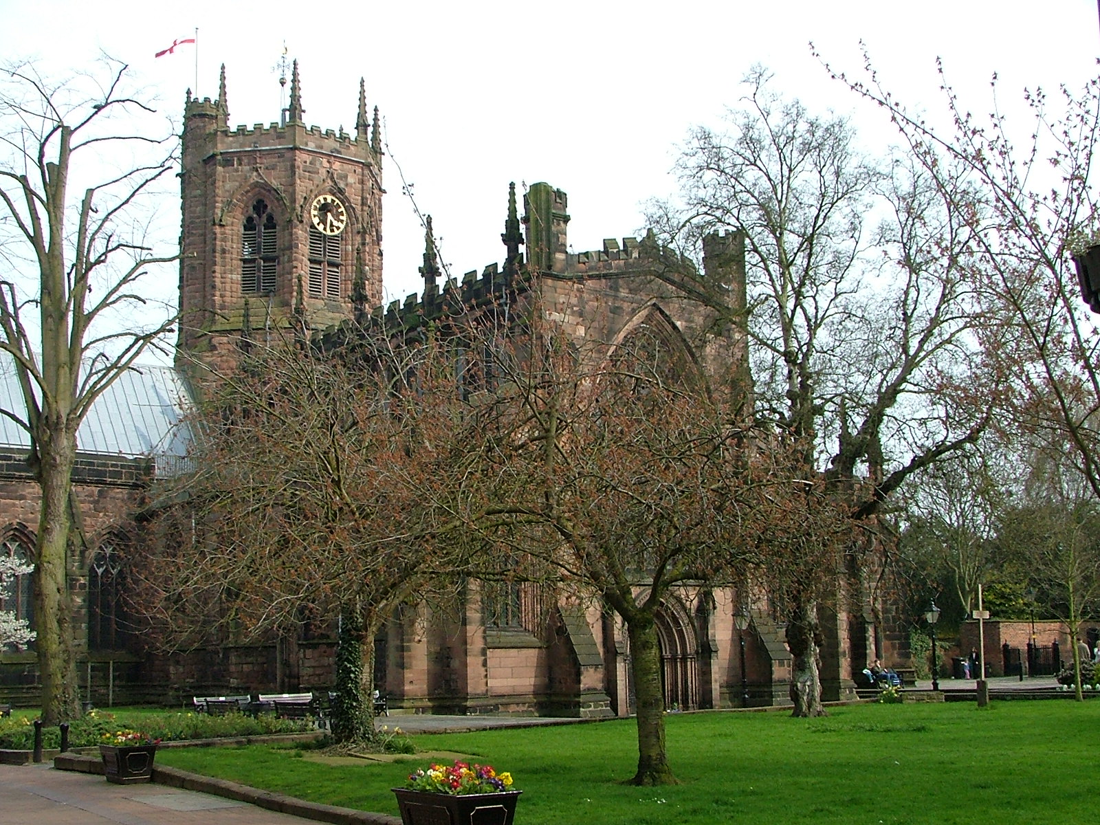
Nantwich has the largest collection of historic buildings outside Chester in the county.[21] The listed buildings are clustered particularly in the town centre on Barker Street, Beam Street, Churchyard Side, High Street and Hospital Street, and extending across the Weaver on Welsh Row. The great majority are located within the 38 hectares (94 acres) of conservation area, which broadly follows the boundaries of the late medieval and early post-medieval town.[9][22] The oldest listed building is St Mary's Church, which dates from the 14th century and is listed at grade I. Two other listed buildings are known to pre-date the fire of 1583: Sweetbriar Hall and the grade-I-listed Churche's Mansion are both timber-framed, "black and white" Elizabethan mansion houses. A few years after the fire, William Camden described Nantwich as the "best built town in the county",[23] and particularly fine examples of timber-framed buildings constructed during the town's rebuilding include 46 High Street and the grade-I-listed Crown coaching inn. Many half-timbered buildings, such as 140–142 Hospital Street, have been concealed behind brick or render. The town contains many Georgian town houses; good examples include Dysart Buildings, 9 Mill Street, Townwell House and 83 Welsh Row. Several examples of Victorian corporate architecture are listed, including the former District Bank by Alfred Waterhouse. The most recent listed building is 1–5 Pillory Street, a curved corner block in 17th-century French style which dates from 1911. The majority of the town's listed buildings were originally residential; churches, chapels, public houses, schools, banks, almshouses and workhouses are also well represented. Unusual listed structures include a mounting block, twelve cast-iron bollards, a stone gateway, two garden walls and a summerhouse.
Dorfold Hall is a Jacobean mansion in the nearby village of Acton. It is listed at grade I,[24] and was considered by Pevsner to be one of the two finest Jacobean houses in Cheshire.[25] Nantwich Show, including the International Cheese Awards, takes place in the hall's grounds each summer.
Nantwich Museum is based in the Town Square. It has galleries on the history of the town, including Roman salt making, Tudor Nantwich's Great Fire, the Civil War Battle of Nantwich (1644) and the more recent shoe and clothing industries. There's also a section on the local cheese-making industry. Hack Green Secret Nuclear Bunker, based a few miles outside the town, is a former government-owned nuclear bunker located in the village of Hack Green. It is now a museum.
The 82-seat Nantwich Players Theatre is on Pillory Street in the centre of town. It puts on around five plays each year.[26]
Geography and transport
Nantwich is on the Cheshire Plain, on the banks of the River Weaver. The Shropshire Union Canal runs through the town and makes a junction with the Llangollen Canal at Hurleston to the north. The town is approximately four miles south-west of Crewe and 20 miles south-east of Chester. It is a major road junction, being the meeting point of the A51, A500, A529, A530 and A534 roads. The stretch of the A534 from Nantwich to the Welsh border is regarded as one of the ten worst stretches of road in England for road safety.[27]
Nantwich railway station is on the line from Crewe to Whitchurch, Shrewsbury and other towns along the Welsh border. The station is currently served mainly by stopping trains between Crewe and Shrewsbury.
GHA Coaches now operate the majority of local routes with funding from Cheshire East council. Arriva, D&G Bus and a few smaller companies also operate routes in and around Nantwich.
Education
The town has seven primary schools – Highfields Community, Millfields, Pear Tree, St Anne's (Catholic), Stapeley Broad Lane (Church of England), The Weaver and The Wyche, two secondary schools Brine Leas School and Malbank School and Sixth Form College, as well as Reaseheath College which runs both Further Education and Higher Education courses (in conjunction with Harper Adams University College and the University of Chester). A new Sixth Form at Brine Leas opened in September 2010.
Sport
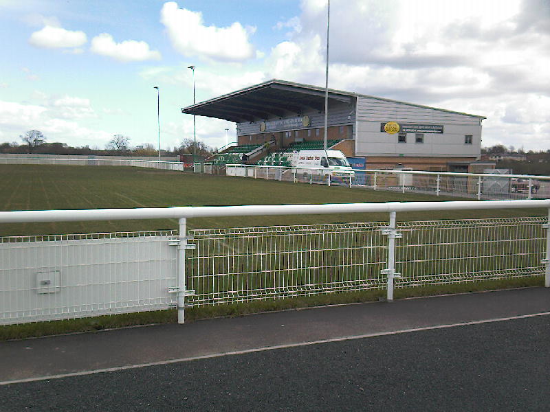
 The Weaver Stadium
The town's football club, Nantwich Town F.C., won the 2006 FA Vase. The club plays at the Weaver Stadium.
The town's Rugby Football Club, Acton Nomads RFC, was founded in 2009 and won the 2010 RFU Presidents XV "This is Rugby" Award.[28] .[29] The club operates two senior sides, and is recognised by both the RFU and Cheshire RFU.
In Rugby League, Crewe & Nantwich Steamers play at the Barony Park, Nantwich - which is also the home ground for Acton Nomads RFC. Both the Steamers and the Nomads share a clubhouse at the Red Lion Hotel on Barony Road, Nantwich.
The area's other local rugby club is Crewe and Nantwich RUFC, founded in 1922 in Crewe. The club is now based at Vagrants Sports Club on Newcastle Road, Willaston and runs four senior teams; the first XV play in the Northern Division: South Lancs/Cheshire Division Three. The club, which holds Club Mark and RFU Seal of Approval accreditations, has an active mini and junior section with over 250 young people aged 5–18 taking part every Sunday.
Notable people
- David Beatty, 1st Earl Beatty (1871–1936), Admiral of the Fleet, was born in Nantwich.
- Sir William Bowman (1816–1892), surgeon, was born in Nantwich.
- Sir William Brereton, 1st Baronet established his headquarters in Nantwich during the English Civil War in 1643.
- Walter Cartwright (1871–19??), footballer, was born in Nantwich.
- Matt Coyle (b. 1971), graphic novelist, was born in Nantwich.
- Sir Randolph Crewe (1559–1646), Lord Chief Justice, was born in Nantwich.
- John Gerard (1545 – c.1611), botanist was born in Willaston near Nantwich.
- Dario Gradi, Crewe Alexandra manager, lives in Willaston.
- Simon Heartfield (b. 1962), DJ, musician and record producer, was born in Nantwich.
- George Latham (d. 1871), architect was born in Nantwich.
- Elizabeth Minshull (1630–1727), third wife of poet John Milton was born in nearby Wistaston and lived as a widow in Nantwich until her death in 1727. She was reputedly buried at the Baptist Chapel in Barker Street.
- Joseph Priestley (1733–1804), who co-discovered oxygen, was a Non-conformist minister and teacher at a school in Nantwich during the late 18th century.
- Sophie Reade (b. 1989), winner of Big Brother 2009 (UK), was born in Nantwich.
See also
- Listed buildings in Nantwich
- Commons gallery for Nantwich
References
- ^ Office for National Statistics : Census 2001 : Parish Headcounts : Crewe and Nantwich. Retrieved 2009-11-30.
- ^ E.Ekwall, Concise Oxford Dictionary of Place-Names (Oxford) 1936:320 col. a.
- ^ The Gough Map (interactive version) (accessed 21 April 2008)
- ^ Holly Holy Day Society website
- ^ Lake, 1983, p. 1
- ^ McNeil Sale R et al. (1978), Archaeology in Nantwich: Crown Car Park Excavations, Bemrose Press
- ^ Phillips & Phillips, eds, 2002, p. 32
- ^ a b Hewitt, 1967, p. 67
- ^ a b Borough of Crewe & Nantwich: Nantwich Conservation Area: Conservation Area Character Appraisal and Review (January 2006)
- ^ Lake, 1983, pp. 3, 30
- ^ Lake, 1983, p. 67
- ^ Beck, pp. 34–35, 75–76
- ^ Lake, 1983, pp. 76, 91
- ^ Battle of Nantwich... and Holly Holy Day, Nantwich Museum, UK.
- ^ a b Pevsner & Hubbard, 1971, p. 12
- ^ a b Lake, 1983, pp. 131–32
- ^ Phillips & Phillips, eds, 2002, p. 66
- ^ Lake, 1983, pp. 30–31, 35
- ^ Cheshire (Structural Changes) Order 2008
- ^ Cheshire County Council: Interactive Mapping: Crewe and Nantwich (accessed 27 January 2009)
- ^ Take a Closer Look at Nantwich (booklet), Crewe & Nantwich Borough Council
- ^ Borough of Crewe & Nantwich: Replacement Local Plan 2011: Insets: Nantwich Town Centre, Acton, Aston, Audlem, Bridgemere School, Buerton, Hankelow, Marbury, Sound School, Worleston School, Wrenbury (downloaded from [1]; 4 June 2010)
- ^ Hall, 1883, p. 255
- ^ Images of England: Dorfold Hall (accessed 21 February 2008)
- ^ Pevsner, p. 22
- ^ About Us, Nantwich Players (accessed 17 November 2010).
- ^ Darroch, Gordon (18 February 2002). "Remote Highland highway 'most dangerous road'". The Independent (London). http://www.independent.co.uk/news/uk/home-news/remote-highland-highway-most-dangerous-road-661095.html. Retrieved 19 May 2010.
- ^ http://www.cheshirerfu.co.uk/SinglePosting.php?ArticleID=1080
- ^ http://www.rfu.com/ManagingRugby/ClubDevelopment/Volunteers/Recognition/PresidentsXV/CategoriesPrevWinners/ThisIsRugbyPW.aspx
External links
- History and charitable projects in Nantwich
- Social guide to Nantwich
- Cheshire East Council
- Nantwich Web Directory
- Nantwich history
- A Dabber's Nantwich
- A local's guide to Nantwich
- Acton Nomads RFC
- I Visit Nantwich
- Cheshire Market Towns
Ceremonial county of Cheshire Unitary authorities Major settlements Rivers Topics - History
- Museums
Categories:- Nantwich
- Market towns in Cheshire
- Civil parishes in Cheshire
- Towns in Cheshire


Wikimedia Foundation. 2010.