- Curtin, Australian Capital Territory
-
Curtin
Canberra, Australian Capital Territory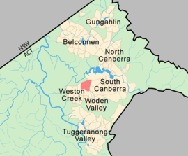
Population: 5,133 (2006 census)[1] Established: 1962 Postcode: 2605 District: Woden Valley Assembly Electorate: Molonglo Federal Division: Canberra Suburbs around Curtin: Yarralumla Deakin Weston Curtin Hughes Weston Lyons Phillip Curtin is a suburb in the Canberra, Australia district of Woden. The postcode is 2605.
It is next to the suburbs of Yarralumla, Deakin, Hughes, Lyons and Weston. It is bounded by the Cotter road, Tuggeranong Parkway and Yarra Glen.
Curtin shopping centre offers the following services: Coles supermarket, post office, newsagent, bank, real estate agent, TAB, video rental shop and numerous restaurants and eateries. Of note is the Curtin Milk Bar which is the longest running cafe in the area. Its style and format has not changed since the 1970s and is still very popular [2]
The Canberra bushfires of 2003 destroyed about 4 Curtin homes. Curtin was a suburb that received a small amount of damage in the fires. The Emergency Services Bureau, based in Curtin, which was the centre of command for the firefighting operation, came under threat itself.
Contents
Geology
Curtin is full of Mount Painter Volcanics dark grey to grey green crystal tuff. Some cream rhyolite is found in the far east along Yarralumla creek, which runs through the edge of the suburb. Sediments such as shale and sandstone are found in the far north east corner north of Yarralumla creek. To the west of Curtin there are horse paddocks that contain sequence of rocks getting younger as you head west. First a band of Mount Painter Volcanics cream rhyolite, followed by a band of Yarralumla Formation calcareous shale, followed by Deakin Volcanics purple and green tuff, and lastly Deakin Volcanics green-grey and purple rhyolite. All of these rock types are from the Silurian age.
Features
Primary Schools
- Curtin Primary School[3]
- Holy Trinity Primary School
 Curtin shopping centre
Pre Schools
- Teddybears Childcare Preschool
- North Curtin Pre School
- South Curtin Pre School
Housing
- Brindabella Gardens retirement village
Parks
- South Curtin neighbourhood oval
- Illoura Community Horse Holding Paddocks
- North Curtin Horse Paddocks
- North Curtin Oval
Services
- ACT Emergency Services Bureau
- QEII Family Centre
References
- ^ Australian Bureau of Statistics (25 October 2007). "Curtin (State Suburb)". 2006 Census QuickStats. http://www.censusdata.abs.gov.au/ABSNavigation/prenav/LocationSearch?collection=Census&period=2006&areacode=SSC81106&producttype=QuickStats&breadcrumb=PL&action=401. Retrieved 1 June 2009.
- ^ "Legislative Assembly for the ACT: 2003 Week 9 Hansard (26 August) Page 3219". Hansard.act.gov.au. http://www.hansard.act.gov.au/hansard/2003/week09/3219.htm. Retrieved 2011-11-15.
- ^ curtinps.act.edu.au
Coordinates: 35°19′30″S 149°04′40″E / 35.325°S 149.07778°E
Categories:


Wikimedia Foundation. 2010.