- Majorstuen (station)
-
Majorstuen 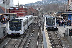
Two MX3000 at the station Location Place Majorstuen Municipality Oslo Coordinates 59°55′47″N 10°42′53″E / 59.92972°N 10.71472°E Line Common Tunnel Distance 2.7 km (1.7 mi) Elevation 47.7 m (156 ft) Service Opened 1898 Type At-grade Line(s) 


Connections Tram 


Bus 22, 25, 45 and 46 Majorstuen is a subway station on the Oslo Metro and a light rail station on the Briskeby Line of the Oslo Tramway. It is located in the Majorstuen neighborhood in the Frogner borough.
Majorstuen is shared by all the subway lines, and, being located just after the tunnel entrance, it is the only such station not located underground. Majorstuen was originally the end station for Holmenkollbanen, and remained so until the tunnel to Nationaltheatret Station was completed.
After Majorstuen the subway lines split up in three directions. Sognsvannsbanen runs northwards, Holmenkollbanen runs to the northwest while Røabanen and Kolsåsbanen are on a shared track to the west.
The station has three platforms. There are two main platforms facing each other. Opposite the platform for outbound trains is a side platform, used for the trains on the west side of Oslo which terminate at Majorstuen. Such trains are not common, they are usually early-morning trains or trains which are retiring for the evening. Between 2002 and 2004 however, Holmenkollbanen terminated at Majorstuen and all these trains used this platform. Also located on the outbound platform is a kiosk, the only such kiosk on the Oslo Metro behind the ticket barriers.
Majorstuen itself is largely a residential area, although there is a great deal of commercial business as well. It also serves the MF Norwegian School of Theology, the Norwegian Academy of Music, the Norwegian Police University College, Chateau Neuf and the movie theatre Colosseum. It is a node for public transportation, outside the subway station are bus stops for several bus lines and a tram stop serving the Frogner and Briskeby Lines on Oslo Tramway.
References
TERMINUS NEXT STATION
← WESTMajorstuen NEXT STATION
EAST→TERMINUS Frognerseteren Frøen Line 1 Nationaltheatret Ellingsrudåsen Østerås Borgen Line 2 Ellingsrudåsen Sognsvann Blindern Line 3 Mortensrud Ringen Line 4 Bergkrystallen Storo Line 5 Vestli Jar Borgen Line 6 Ringen Majorstuen terminus Line 11 Schultz gate
Valkyrie plassKjelsås Majorstuen terminus Line 12 Frogner stadion Kjelsås Majorstuen terminus Line 19 Schultz gate
Valkyrie plassLjabru Categories:- Oslo Metro stations in Oslo
- Railway stations opened in 1898
- Railway stations serving campuses in Norway
- 1898 establishments in Norway

Wikimedia Foundation. 2010.