- Darling Point, New South Wales
-
Darling Point
Sydney, New South Wales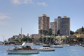
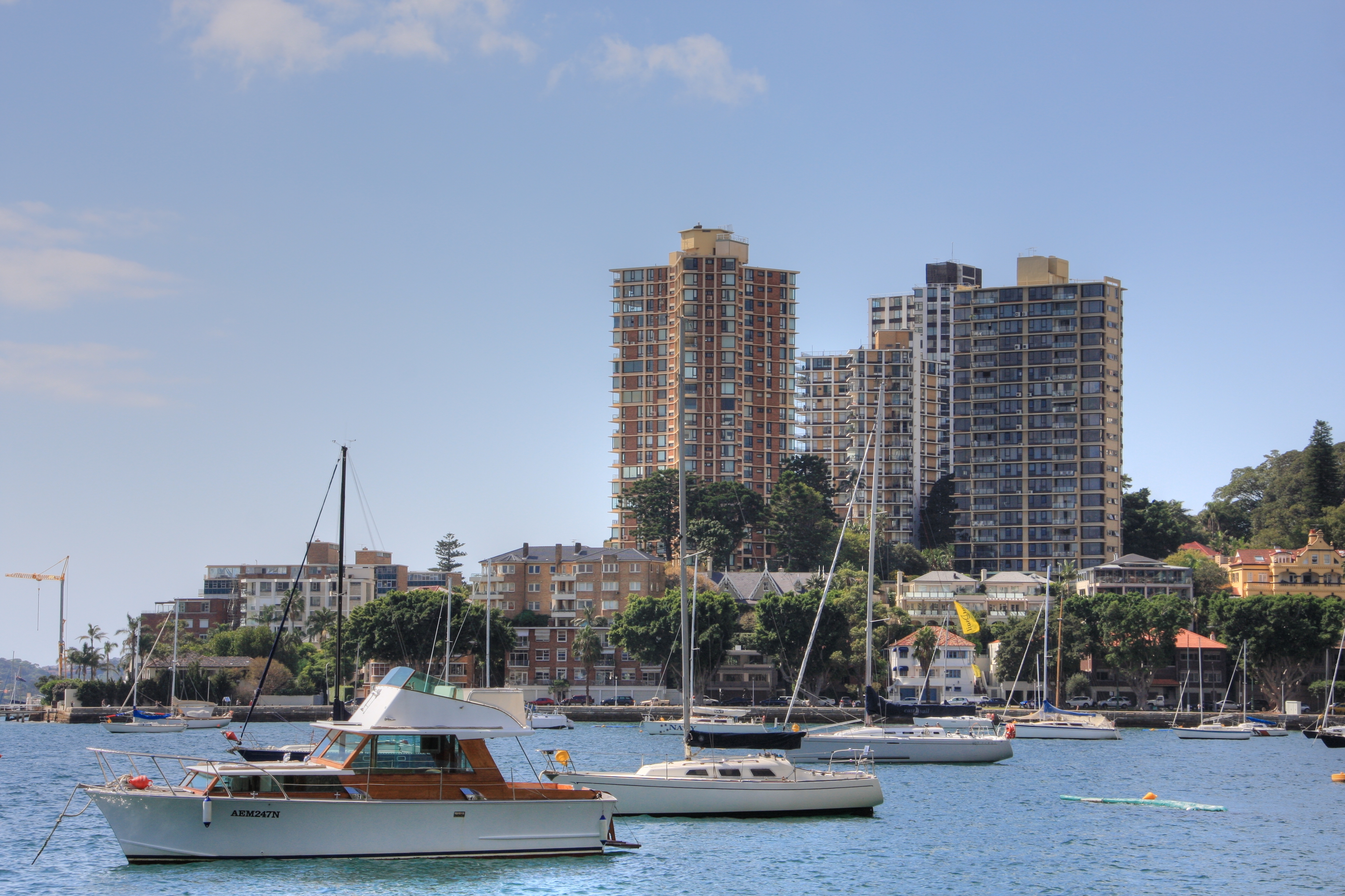
Darling PointPopulation: 3,844[1] Established: 1833 Postcode: 2027 Location: 4 km (2 mi) east of Sydney CBD LGA: Woollahra Council State District: Vaucluse Federal Division: Wentworth Suburbs around Darling Point: Port Jackson Elizabeth Bay Darling Point Double Bay Rushcutters Bay Edgecliff Woollahra  Cruising Yacht Club of Australia
Darling Point is a harbourside, eastern suburb of Sydney, in the state of New South Wales, Australia. Darling Point is located 4 kilometres east of the Sydney central business district and is part of the local government area of Woollahra Council.[2]
Darling Point is bounded by Sydney Harbour to the north, Double Bay to the east, Edgecliff to the south and Rushcutters Bay to the west. Darling Point, renowned for its desirable and expensive real estate, is mostly residential and regarded as one of the most exclusive and prestigious suburbs in Australia.
Contents
History
The area was originally known variously as Eurambi, Yarranabbi, Yarrandabbi and Yaranabe by the local Aboriginal people. It was named Darling Point, in recognition of Elizabeth Darling, the wife of NSW Governor Ralph Darling.[3]
During the Sydney 2000 Olympics, Darling Point hosted the sailing events.
Transport
Darling Point Road follows the ridge of the headland that is Darling Point. Mona Road and Greenoaks Avenue act as two other main access roads to the suburb. New Beach Road runs between the western boundary of the suburb and Rushcutters Bay Park. The 327 is the bus which goes through Darling Point. Darling Point ferry wharf provides access to Eastern Suburbs ferry services.
Parks
McKell Park was originally the site of the now-demolished Canonbury House, but is now a public park. Situated at the northern end of Darling Point Road, it has panoramic views of Sydney Harbour and is a popular location for picnics and weddings. It also provides access to Darling Point's ferry stop.
'The Drill Hall' forms part of the Sir David Martin Reserve and was previously part of the Royal Australian Navy base, HMAS Rushcutters. The Drill Hall is one of the oldest surviving Australian military buildings and was originally located on Bennelong Point, now the location of the Sydney Opera House.
Churches
Designed by Edmund Blacket in 1852, St Marks Anglican Church has become a popular wedding venue hosting such famous weddings as Elton John's first marriage and the fictional wedding in the film Muriel's Wedding.
Landmarks
 Carthona, Carthona Avenue
Craigend
Situated close to McKell Park, Craigend is a mansion constructed in the Moorish and Art Deco styles in 1935 including a pair of doors from an ancient mosque in Zanzibar and a traditional Japanese garden. In 1948, the property was acquired by the United States Government as the official residence of the Consul General. It has since returned to the private sector. In 1975 it served as the villain's lair in the Hong Kong/Australian co-produced movie The Man from Hong Kong.
Carthona
Built in 1841 for the Surveyor-General Sir Thomas Mitchell, Carthona is a magnificent harbourside sandstone mansion located at the end of Carthona Avenue. With its panoramic water views across Double Bay, to Point Piper, and north toward Manly, it is considered one of Sydney's most valuable properties. It is currently held by descendants of Philip Bushell, the famed tea merchant who died at the home in 1954.
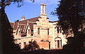
Heritage
 Cloncorrick, designed by John Horbury Hunt
The following buildings are on the Register of the National Estate.[4]
- Cloncorrick, Annandale Street
- Callooa and garden, Bennett Avenue
- Lindesay, Carthona Avenue
- Carthona, Carthona Avenue
- Swifts, Darling Point Road
- Bishopscourt, Greenoaks Avenue
- Mona, Mona Road
- Babworth House, Mount Adelaide Road
Clubs
The Cruising Yacht Club of Australia, Australia's premier yacht club is situated near Rushcutters Bay Park and runs the annual Sydney to Hobart Yacht Race.
Notable residents
- Ita Buttrose
- Nicole Kidman, Australian actress
- Tom Lewis, Former Premier of New South Wales
- The Hon. Roderick Meagher, Former New South Wales Court of Appeal judge
- Helen Reddy
- Charles Kingsford Smith resided in Darling Point in the 1930s
- Gough Whitlam
- Lara Bingle
- Dion Davi
- Rachel Griffiths
- Tom Cruise resided in Darling Point when married to Nicole Kidman
Gallery
-

Craigend
-

Swifts, Darling Point Road
-

Lindsay, Carthona Avenue
-
Bishopscourt, official residence of the Anglican Archbishop of Sydney
-

St Marks Church
-

St Mark's Church Rectory
References
- ^ Australian Bureau of Statistics (25 October 2007). "Darling Point (State Suburb)". 2006 Census QuickStats. http://www.censusdata.abs.gov.au/ABSNavigation/prenav/LocationSearch?collection=Census&period=2006&areacode=SSC11279&producttype=QuickStats&breadcrumb=PL&action=401. Retrieved 2009-09-04.
- ^ Gregory's Sydney Street Directory, Gregory's Publishing Company, 2007
- ^ The Book of Sydney Suburbs, Compiled by Frances Pollen, Angus & Robertson Publishers, 1990, Published in Australia ISBN 0-207-14495-8, page 79
- ^ The Heritage of Australia, Macmillan Company, 1981
External links
- Darling Point, New South Wales is at coordinates 33°52′13″S 151°14′15″E / 33.87021°S 151.23746°ECoordinates: 33°52′13″S 151°14′15″E / 33.87021°S 151.23746°E
Suburbs and localities within the Municipality of Woollahra · Eastern Suburbs · Sydney Bellevue Hill · Darling Point · Double Bay · Edgecliff · Paddington · Point Piper · Rose Bay · Vaucluse · Watsons Bay · Woollahra
List of Sydney suburbs Categories:- Suburbs of Sydney


Wikimedia Foundation. 2010.