- Codorus State Park
-
Codorus State Park Pennsylvania State Park Natural Monument (IUCN III)  Lake Marburg and Codorus State Park in Autumn
Named for: Codorus Creek Country United States State Pennsylvania County York Townships Heidelberg, Manheim, Penn, West Manheim Location [1] - coordinates 39°46′12″N 76°56′12″W / 39.77°N 76.93667°WCoordinates: 39°46′12″N 76°56′12″W / 39.77°N 76.93667°W - elevation 679 ft (207 m) [1] Area 3,329 acres (1,347 ha) Founded 1966 Managed by Pennsylvania Department of Conservation and Natural Resources 
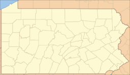 Location of Codorus State Park in Pennsylvania
Website : Codorus State Park Codorus State Park is a 3,329-acre (1,347 ha) Pennsylvania state park in Heidelberg, Manheim, Penn, and West Manheim Townships in southwestern York County, Pennsylvania in the United States. The park was created around Lake Marburg, an artificial lake covering 1,275 acres (516 ha), and is named for Codorus Creek, which forms the lake. Codorus State Park is located on Pennsylvania Route 216, 3 miles (4.8 km) from the borough of Hanover.
Contents
History
The history of Codorus State Park is tied to a co-operative effort between private enterprise and state and local government. The borough of Spring Grove and the P.H. Glatfelter Company worked together to dam Codorus Creek. The purpose of the dam was to provide drinking water for Spring Grove and to meet the industrial needs of the paper plant owned by the P.H. Glatfelter Company in the borough. The construction of this dam was also beneficial to the people of Pennsylvania when a park was created on the shores of the newly made Lake Marburg.[2]
Lake Marburg gets its name from the small community of Marburg that was flooded in December 1966, when Codorus Creek was dammed. The dam is 109 feet (33 m) high, 1,690 feet (520 m) wide and 750 feet (230 m) thick. It is not owned by the Commonwealth of Pennsylvania, but is instead owned by and on the property of the P.H. Glatfelter Company.[2]
The land for the park was acquired as part of the Project 70 Land Acquisition and Borrowing Act, with the governor approving the acquisition on December 10, 1964. The park officially opened in 1970.[3] It was originally named "Codorus Creek State Park".[2]
Recreation
The park is open for fishing, boating, and camping. It also has a swimming pool and an 54 hole disc golf course. Lake Marburg has 26 miles (42 km) of coastline.[2]
Lake Marburg holds many different species of fish. Fishermen will find largemouth bass, yellow perch, crappie, muskellunge, catfish, northern pike, and bluegill in the warm waters of Lake Marburg. Cold water fishing is available in the east branch of Codorus Creek where anglers will find rainbow trout and brown trout that have been stocked for sport fishing by the Pennsylvania Fish and Boat Commission.[2]
Canoes, kayaks, sailboats and motor boats are all permitted on Lake Marburg, provided they are registered properly with the state.[2]
 Kayaking at Codorus State Park
Codorus State Park has modern and rustic camp site available. There are 198 camp sites that are suitable for RV's (up to 50 feet (15 m) in length) and tents. There are eight campsites with electricity or accommodate campers with disabilities. Codorus State Park also has 13 walk-in campsites for those interested in camping in tents only.[2]
Picnic tables are scattered throughout the park, and two pavilions may be reserved for use by large groups.[2]
There are 5 miles (8.0 km) of hiking trails with Codorus State Park. The Mary Ann Furnace trail is 3.5 miles (5.6 km) long. It is a loop trail that winds through pine plantations, hardwood forests and some wetlands. The LaHo trail is 1.5 miles (2.4 km) long and follows the lakeshore of Lake Marburg through hardwoods and wetlands. Hiking is also possible on the 7 miles (11 km) horse trail on the west side of the park.[2]
There are two 18 hole disc golf courses, and two 9 hole extra courses at Codorus State Park. There is also a 9-hole minis course. The blue course is a more technical 18 holes mostly through wooded areas. The red course is more open, but has some longer holes. There is a bonus course with 9 holes and a cross country course with 9 holes.
 The marina at Codorus State Park
Hunting is permitted in Codorus State Park. The most common game species are Ruffed Grouse, Eastern Gray Squirrel, Wild Turkey and White-tailed deer. Hunters are expected to follow the rules and regulations of the Pennsylvania State Game Commission. Hunters are limited to using shotguns, muzzleloaders and bows.[2]
Codorus State Park does not close in winter. Snowmobiling, cross country skiing, sledding, ice skating, ice fishing and ice sailing are all popular winter activities, when the weather permits.[2]
Nearby state parks
The following state parks are within 30 miles (48 km) of Codorus State Park:[4][5][6]
- Cunningham Falls State Park (Maryland)
- Gifford Pinchot State Park (York County)
- Gunpowder Falls State Park (Maryland)
- Kings Gap Environmental Education and Training Center (Cumberland County)
- Pine Grove Furnace State Park (Cumberland County)
- Rocks State Park (Maryland)
- Samuel S. Lewis State Park (York County)
References
- ^ a b "Codorus State Park". Geographic Names Information System. United States Geological Survey. August 30, 1990. http://geonames.usgs.gov/pls/gnispublic/f?p=gnispq:3:::NO::P3_FID:1196513. Retrieved 2008-02-10.
- ^ a b c d e f g h i j k "Codorus State Park". Pennsylvania Department of Conservation and Natural Resources. http://www.dcnr.state.pa.us/stateparks/findapark/codorus/index.htm. Retrieved 2006-10-16.
- ^ Forrey, William C. (1984). History of Pennsylvania's State Parks. Harrisburg, Pennsylvania: Bureau of State Parks, Office of Resources Management, Department of Environmental Resources, Commonwealth of Pennsylvania. pp. 43–44, 102–103. OCLC 17824084.
- ^ Pennsylvania Department of Transportation, Bureau of Planning and Research, Geographic Information Division. 2007 General Highway Map York County Pennsylvania (Map). 1:65,000. ftp://ftp.dot.state.pa.us/public/pdf/BPR_pdf_files/Maps/GHS/Roadnames/york_GHSN.PDF. Retrieved 2007-07-28. Note: shows Codorus State Park
- ^ Michels, Chris (1997). "Latitude/Longitude Distance Calculation". Northern Arizona University. http://www2.nau.edu/~cvm/latlongdist.html. Retrieved 2008-04-20.
- ^ "Find a Park by Region (interactive map)". Pennsylvania Department of Conservation and Natural Resources. http://www.dcnr.state.pa.us/stateparks/findapark/where/index.htm. Retrieved November 18, 2011.
External links
- Codorus State Park official mapPDF (884 KB)
Categories:- Pennsylvania state parks
- Protected areas established in 1966
- Disc golf courses
- Parks in York County, Pennsylvania


Wikimedia Foundation. 2010.