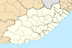
- Mthatha
-
Mthatha
Umtata— Town — Panoramic view of Mthatha and the Drakensberg mountains (1913)
by Caesar Carl Hans HenkelCoordinates: 31°34′00″S 28°46′00″E / 31.5666667°S 28.7666667°ECoordinates: 31°34′00″S 28°46′00″E / 31.5666667°S 28.7666667°E Country South Africa Province Eastern Cape District municipality OR Tambo Local municipality King Sabata Dalindyebo Time zone SAST (UTC+2) Mthatha (English pronunciation: /uːmˈtɑːtɑː/, formerly Umtata[1]) is the main town of the King Sabata Dalindyebo Local Municipality in Eastern Cape province of South Africa. The town has an airport, previously known by the name K. D. Matanzima Airport[2] after former leader Kaiser Matanzima.
It was a military post for the colonial forces in 1882, and the town itself was founded in 1883, along the banks of the Mthatha River. The Mthatha Dam was constructed about eight kilometers upstream of the town.[3] Mthatha became the leading administrative center of the area, having both Anglican and Catholic cathedrals. It also became the seat of the traditional authorities and a parliament building for this purpose known as the Bunga, was erected.
A branch of the University of Fort Hare was established in the town, and after the "independence" of the Transkei in 1977 it became the University of Transkei, which has since been integrated into the Walter Sisulu University for Technology and Science. The campus was the base for the region's first community radio station, UCRFM, which started in 1996 and has become a significant community broadcaster.
From 1976 to 1994, Mthatha served as the capital of the Transkei bantustan, under the name of Umtata.[4]
After the end of apartheid, some sections of the African business and professional community migrated to traditionally white areas of economic activity, and this has been widely posited as a cause of economic recession in the municipality, but a number of construction projects offer some hope for renewal.[5] Many of South Africa's black leaders — including Walter Sisulu; Bantu Holomisa; Buyisiwe Yonela Mhlana and Nelson Mandela — come from this area, and the retired Mandela still visits his home village of Qunu some miles south of Mthatha[citation needed]. Mthatha is the home of one of the three Nelson Mandela Museums: Spread across three sites, it collects, interprets and exhibits key aspects of the story of the life and times of Nelson Mandela in context. The three historical sites of the museum are all in the locality at Mvezo, Qunu and the Bunga Building in Mthatha itself. In the Bunga Building is the story of the Long Walk to Freedom and an exhibition of the many gifts received by Nelson Mandela on behalf of the South African people.
On the 2nd March 2004 Umtata was officially renamed to its current name Mthatha.
Climate
Climate data for Mthatha Month Jan Feb Mar Apr May Jun Jul Aug Sep Oct Nov Dec Year Record high °C (°F) 42
(108)40
(104)40
(104)36
(97)34
(93)30
(86)30
(86)33
(91)44
(111)38
(100)41
(106)41
(106)44
(111)Average high °C (°F) 27
(81)27
(81)26
(79)25
(77)23
(73)21
(70)21
(70)22
(72)23
(73)23
(73)25
(77)27
(81)24 Average low °C (°F) 16
(61)16
(61)15
(59)12
(54)8
(46)4
(39)4
(39)7
(45)9
(48)11
(52)13
(55)15
(59)11 Record low °C (°F) 9
(48)9
(48)7
(45)1
(34)−1
(30)−3
(27)−3
(27)−1
(30)1
(34)2
(36)4
(39)7
(45)−3
(27)Precipitation mm (inches) 87
(3.43)89
(3.5)83
(3.27)58
(2.28)18
(0.71)11
(0.43)18
(0.71)15
(0.59)35
(1.38)73
(2.87)75
(2.95)88
(3.46)650
(25.59)Avg. precipitation days (≥ 1mm) 15 14 13 8 5 3 3 5 8 13 13 14 113 Source: South African Weather Service, 1961-1990 [6] References
- ^ Jenkins, Elwyn (2007), Falling into place: the story of modern South African place names, David Philip Publishers, p. 75
- ^ K D Matanzima Airport
- ^ Fatoki, OS, Muyima, NYO and Lujiza, M (October 2001). "Situation analysis of water quality in the Umtata River catchment" (PDF). Water SA 27 (4). http://www.wrc.org.za/archives/watersa%20archive/2001/October/1372.pdf.
- ^ "Constitution of the Republic of Transkei, Chapter 1, 1(2)". http://www.worldstatesmen.org/Transkei_Constitution.pdf.
- ^ Mgibisa, Mbuyisi (25 October 2006). "Mthatha in dire straits". Mail & Guardian. http://www.mg.co.za/articledirect.aspx?articleid=287703.
- ^ "Climate data: Umtata: standard normal 1961 to 1990". South African Weather Service. http://old.weathersa.co.za/Climat/Climstats/UmtataStats.jsp. Retrieved 2010-07-16.
External links
- http://www.mthatha.co.za Mthatha town website
Province of Eastern Cape, South Africa Provincial Capital: Bhisho Metropolitan
MunicipalitiesBuffalo City · Nelson Mandela BayDistrict
and Local
MunicipalitiesCamdeboo · Blue Crane Route · Ikwezi · Makana · Ndlambe · Sunday's River Valley · Baviaans · Kouga · Kou-KammaInxuba Yethemba · Tsolwana · Inkwanca · Lukhanji · Intsika · Emalahleni · Engcobo · SakhisizweElundini · Senqu · Maletswai · GariepCategories:- Populated places in the Eastern Cape
- Transkei
Wikimedia Foundation. 2010.


