- Dowanhill
-
Coordinates: 55°52′38″N 4°18′06″W / 55.877299°N 4.301732°W
Dowanhill 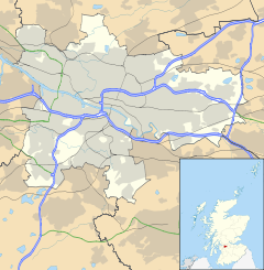
 Dowanhill
Dowanhill shown within GlasgowOS grid reference NS561673 Council area Glasgow City Council Lieutenancy area Glasgow Country Scotland Sovereign state United Kingdom Post town GLASGOW Postcode district G12 Dialling code 0141 Police Strathclyde Fire Strathclyde Ambulance Scottish EU Parliament Scotland UK Parliament Glasgow North Scottish Parliament Glasgow Glasgow Kelvin List of places: UK • Scotland • Glasgow Dowanhill is a district of Glasgow, Scotland, occupying the area west of Hillhead, south of Kelvinside and east of Hyndland.
A residential district the area generally contains a mixture of terraced townhouses with private communal gardens, detached villas with private grounds and a number of four-storey tenement buildings. Originally constructed from the middle of the 19th century onwards many of the buildings have now had their original interiors reconstructed to convert them into multiple-flatted dwelling houses, this type of redevelopment continues to the present day.
The area is seen as being desirable due to its location in Glasgow's West End, situated adjacent to Glasgow's Botanic Gardens and also the popular Byres Road area with its many bars, restaurants and shops.
In common with many areas of the West End continual development causes concern for many residents who fear the area becoming over-developed, this concern is highlighted in the bitter dispute over the proposed redevelopment of Dowanhill Tennis Club [1].
In 2005/06 due to increased traffic levels and to discourage rat running Glasgow City Council introduced traffic calming measures and converted a number of streets into one-way traffic systems.
In 1869 Jefferson Davis, the only President of the Confederate States of America, stayed in Dowanhill while visiting the Glasgow merchant James Smith [2].
The earliest known registered scout troop in the world, the 1st Glasgow Scout Troop, is still active in Dowanhill. Captain 'Boss' Young established the troop in 1907 and the group was registered with Scout HQ, London on 16 January 1908 [3].
References
- ^ http://scotlandonsunday.scotsman.com/glasgow/Tennis-clubs-game-set-and.2583648.jp
- ^ Urquhart, Gordon R. (2000). Along Great Western Road. Stenlake. ISBN 1-84033-115-1.
- ^ http://www.1st-glasgow.org.uk/history.asp
External links
- Friends of Glasgow West
- Glasgow West End Festival
- Scotland on Sunday article relating to the dispute over Dowanhill Tennis Club
- 1st Glasgow Scout Troop
- Byres Road : A Short Guide
Categories:- Districts of Glasgow
- Glasgow geography stubs

Wikimedia Foundation. 2010.