- Merrylee
-
Coordinates: 55°48′40″N 4°17′29″W / 55.810984°N 4.291431°W
Merrylee 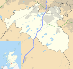
 Merrylee
Merrylee shown within East RenfrewshireOS grid reference NS577604 Council area East Renfrewshire Lieutenancy area Glasgow Country Scotland Sovereign state United Kingdom Post town GLASGOW Postcode district G46 Dialling code 0141 Police Strathclyde Fire Strathclyde Ambulance Scottish EU Parliament Scotland UK Parliament East Renfrewshire Scottish Parliament Eastwood West of Scotland List of places: UK • Scotland • Merrylee is a district in the Scottish city of Glasgow. It is situated south of the River Clyde. It is surrounded by Newlands, Cathcart and Muirend. Merrylee is a housing scheme consisting of mostly council or ex-council houses. Recent developments in the scheme have seen the council football pitches being developed into a primary school. Another development has seen luxury flats being erected on the site of the former Newlands Lawn Tennis Club car park.
The area was the subject of controversy when, in 1952, the Glasgow Corporation housing department attempted to sell some of its council houses on the Merrylee estate. This triggered protests and in response, the left wing amateur 'Dawn Cine Group' made a film about the Glasgow housing crisis entitled 'Let Glasgow Flourish'. The film illustrated the continued problems of overcrowding and poverty in the inner city and recorded the protests calling for more new houses. The film shows scenes of rundown housing, children playing on the streets, shipyard workers on the Clyde, as well as a dramatised road accident, and protest marches. ‘Let Glasgow Flourish’ was made to offer a contrasting view of the housing situation to that provided by the Glasgow Corporation Housing Department.
Scenes from the 1996 film 'Small Faces (movie)' were also shot in Merrylee.
Categories:- Districts of Glasgow
- Glasgow geography stubs

Wikimedia Foundation. 2010.