- Municipalities of Puerto Rico
-
Puerto Rico 
This article is part of the series:
Politics and government of
Puerto RicoConstitutionLegislatureExecutiveJudiciaryElectionsDivisionsFederal Relations
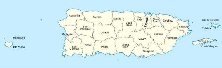
The Municipalities of Puerto Rico number 78 and they make up the smallest electoral division of the Commonwealth. Each municipality is divided into barrios, though the latter are not vested with political authority.
Contents
Administrative divisions
See also: Puerto Rico census statistical areasThere are no first-order administrative divisions as defined by the United States Government, but Puerto Rico has 78 municipalities or "municipios" at the secondary order. For U.S. Census purposes, the municipalities are equivalent to a county.[1] They are conveniently grouped into eight electoral districts, which do not possess administrative functions. In 1991, the Autonomous Municipalities of the Commonwealth of Puerto Rico Act was passed as a strategy for the decentralizing control and for improving government services to the people.
Municipal politics
The municipalities elect a Mayor and a legislative assembly in the general elections every four years.
 Municipalities of Puerto Rico
List of municipalities
The following is an alphabetical list of the municipalities in Puerto Rico
Municipality FIPS code[2] Founded Population (2010)[3] Area[4] Adjuntas 001 1815 19,143 66.69 sq mi (172.73 sq km) Aguada 003 1508 42,042 30.85 sq mi (79.90 sq km) Aguadilla 005 1780 64,685 36.53 sq mi (94.61 sq km) Aguas Buenas 007 1838 29,032 30.09 sq mi (77.92 sq km) Aibonito 009 1824 26,493 31.31 sq mi (81.10 sq km) Añasco 011 1733 28,348 39.29 sq mi (101.75 sq km) Arecibo 013 1616 100,131 125.95 sq mi (326.20 sq km) Arroyo 015 1855 19,117 15.01 sq mi (38.87 sq km) Barceloneta 017 1881 22,322 18.69 sq mi (48.41 sq km) Barranquitas 019 1803 28,909 34.25 sq mi (88.71 sq km) Bayamón 021 1772 208,116 44.32 sq mi (114.80 sq km) Cabo Rojo 023 1771 50,917 70.37 sq mi (182.27 sq km) Caguas 025 1775 142,893 58.60 sq mi (151.77 sq km) Camuy 027 1807 35,159 46.36 sq mi (120.06 sq km) Canóvanas 029 1909 47,648 32.87 sq mi (85.12 sq km) Carolina 031 1816 176,762 45.32 sq mi (117.38 sq km) Cataño 033 1927 28,140 4.85 sq mi (12.55 sq km) Cayey 035 1773 48,119 51.93 sq mi (134.51 sq km) Ceiba 037 1838 13,631 29.04 sq mi (75.20 sq km) Ciales 039 1820 18,782 66.53 sq mi (172.31 sq km) Cidra 041 1809 43,480 36.02 sq mi (93.29 sq km) Coamo 043 1579 43,480 36.02 sq mi (93.29 sq km) Comerío 045 1826 43,480 36.02 sq mi (93.29 sq km) Corozal 047 1795 43,480 36.02 sq mi (93.29 sq km) Culebra 049 1880 43,480 36.02 sq mi (93.29 sq km) Dorado 051 1842 43,480 36.02 sq mi (93.29 sq km) Fajardo 053 1772 43,480 36.02 sq mi (93.29 sq km) Florida 054 1971 43,480 36.02 sq mi (93.29 sq km) Guánica 055 1508 43,480 36.02 sq mi (93.29 sq km) Guayama 057 1736 43,480 36.02 sq mi (93.29 sq km) Guayanilla 059 1833 43,480 36.02 sq mi (93.29 sq km) Guaynabo 061 1769 43,480 36.02 sq mi (93.29 sq km) Gurabo 063 1815 43,480 36.02 sq mi (93.29 sq km) Hatillo 065 1823 43,480 36.02 sq mi (93.29 sq km) Hormigueros 067 1874 43,480 36.02 sq mi (93.29 sq km) Humacao 069 1722 43,480 36.02 sq mi (93.29 sq km) Isabela 071 1819 43,480 36.02 sq mi (93.29 sq km) Jayuya 073 1911 43,480 36.02 sq mi (93.29 sq km) Juana Díaz 075 1798 43,480 36.02 sq mi (93.29 sq km) Juncos 077 1797 43,480 36.02 sq mi (93.29 sq km) Lajas 079 1883 43,480 36.02 sq mi (93.29 sq km) Lares 081 1827 43,480 36.02 sq mi (93.29 sq km) Las Marías 083 1871 43,480 36.02 sq mi (93.29 sq km) Las Piedras 085 1773 43,480 36.02 sq mi (93.29 sq km) Loíza 087 1719 43,480 36.02 sq mi (93.29 sq km) Luquillo 089 1797 43,480 36.02 sq mi (93.29 sq km) Manatí 091 1738 43,480 36.02 sq mi (93.29 sq km) Maricao 093 1874 43,480 36.02 sq mi (93.29 sq km) Maunabo 095 1799 43,480 36.02 sq mi (93.29 sq km) Mayagüez 097 1760 43,480 36.02 sq mi (93.29 sq km) Moca 099 1772 43,480 36.02 sq mi (93.29 sq km) Morovis 101 1818 43,480 36.02 sq mi (93.29 sq km) Naguabo 103 1821 43,480 36.02 sq mi (93.29 sq km) Naranjito 105 1824 43,480 36.02 sq mi (93.29 sq km) Orocovis 107 1772 43,480 36.02 sq mi (93.29 sq km) Patillas 109 1811 43,480 36.02 sq mi (93.29 sq km) Peñuelas 111 1793 43,480 36.02 sq mi (93.29 sq km) Ponce 113 1692 43,480 36.02 sq mi (93.29 sq km) Quebradillas 115 1823 43,480 36.02 sq mi (93.29 sq km) Rincón 117 1771 43,480 36.02 sq mi (93.29 sq km) Río Grande 119 1840 43,480 36.02 sq mi (93.29 sq km) Sabana Grande 121 1813 43,480 36.02 sq mi (93.29 sq km) Salinas 123 1851 43,480 36.02 sq mi (93.29 sq km) San Germán 0125 1573 43,480 36.02 sq mi (93.29 sq km) San Juan 127 1509 43,480 36.02 sq mi (93.29 sq km) San Lorenzo 129 1811 43,480 36.02 sq mi (93.29 sq km) San Sebastián 131 1752 43,480 36.02 sq mi (93.29 sq km) Santa Isabel 133 1842 43,480 36.02 sq mi (93.29 sq km) Toa Alta 135 1751 43,480 36.02 sq mi (93.29 sq km) Toa Baja 137 1745 43,480 36.02 sq mi (93.29 sq km) Trujillo Alto 139 1801 43,480 36.02 sq mi (93.29 sq km) Utuado 141 1739 43,480 36.02 sq mi (93.29 sq km) Vega Alta 143 1775 43,480 36.02 sq mi (93.29 sq km) Vega Baja 145 1776 43,480 36.02 sq mi (93.29 sq km) Vieques 147 1852 43,480 36.02 sq mi (93.29 sq km) Villalba 149 1917 43,480 36.02 sq mi (93.29 sq km) Yabucoa 151 1793 43,480 36.02 sq mi (93.29 sq km) Yauco 153 1756 43,480 36.02 sq mi (93.29 sq km) The municipal amalgamation proposal
In October 2009, a Puerto Rican legislator proposed a bill that would reduce to 20 the 78 municipalities currently making up the Island. The bill called for a referendum to take place on June 13, 2010, and which would let the people decide on the matter.[5] The bill never made into law.
It was not the first time that an attempt to consolidate municipalities had failed. In 1902 the Puerto Rico legislature, under pressure from the US.-appointed governor of the Island, passed a law consolidating the then-76 municipalities of Puerto Rico into 46.[6] The law was repealed three years later.[7][8]
 A legislator's proposal of Puerto Rico's future set of municipalities and their boundaries
The proposed twenty new municipalities (in bold) and the existing municipalities that would have made them up:
San Juan
- San Juan
- Trujillo Alto
Bayamón
- Bayamón
- Cataño
- Guaynabo
Toa Baja
- Toa Baja
- Dorado
- Naranjito
- Toa Alta
Vega Baja
- Vega Baja
- Corozal
- Morovis
- Orocovis
- Vega Alta
Manatí
- Manatí
- Barceloneta
- Ciales
- Florida
Arecibo
- Arecibo
- Camuy
- Hatillo
- Quebradillas
Aguadilla
- Aguadilla
- Aguada
- Isabela
- Moca
- Rincón
San Sebastián
- San Sebastián
- Las Marías
- Lares
Mayagüez
- Mayagüez
- Añasco
- Hormigueros
San Germán
- San Germán
- Cabo Rojo
- Lajas
Yauco
- Yauco
- Guánica
- Maricao
- Sabana Grande
Utuado
- Utuado
- Adjuntas
- Jayuya
Ponce
- Ponce
- Guayanilla
- Peñuelas
Juana Díaz
- Juana Díaz
- Coamo
- Santa Isabel
- Villalba
Cayey
- Cayey
- Aibonito
- Barranquitas
- Cidra
- Comerío
Guayama
- Guayama
- Arroyo
- Patillas
- Salinas
Caguas
- Caguas
- Aguas Buenas
- Gurabo
- Juncos
- San Lorenzo
Humacao
- Humacao
- Las Piedras
- Maunabo
- Naguabo
- Yabucoa
Fajardo
- Fajardo
- Ceiba
- Culebra
- Luquillo
- Vieques
Carolina
- Carolina
- Canóvanas
- Loíza
- Río Grande
References
- ^ county equivalent
- ^ "EPA County FIPS Code Listing". EPA.gov. http://www.epa.gov/enviro/html/codes/pr.html. Retrieved 2008-02-23.
- ^ "U.S. Census Bureau municipality information". http://factfinder2.census.gov/faces/nav/jsf/pages/index.xhtml. Retrieved August 31, 2011.
- ^ "U.S. Census Bureau geography". http://factfinder2.census.gov/faces/nav/jsf/pages/searchresults.xhtml?ref=geo&refresh=t#. Retrieved August 31, 2011.
- ^ Legislador propone reducir a 20 los 78 municipios de Puerto Rico en PrimeraHora.com (In Spanish)
- ^ Historia de Nuestros Barrios: Barrio Lapa, Salinas. Page 4. Retrieved 13 February 2011.
- ^ Guayanilla. Encyclopedia Puerto Rico. Retrieved April 28, 2010.
- ^ Historia de Nuestros Barrios: Lapa, Salinas. Accessed February 13, 2011.
External links
Lists of settlements in the United States States Alabama · Alaska · Arizona · Arkansas · California · Colorado · Connecticut · Delaware · Florida · Georgia · Hawaii · Idaho · Illinois · Indiana · Iowa · Kansas · Kentucky · Louisiana · Maine · Maryland · Massachusetts · Michigan · Minnesota · Mississippi · Missouri · Montana · Nebraska · Nevada · New Hampshire · New Jersey · New Mexico · New York · North Carolina · North Dakota · Ohio · Oklahoma · Oregon · Pennsylvania · Rhode Island · South Carolina · South Dakota · Tennessee · Texas · Utah · Vermont · Virginia · Washington · West Virginia · Wisconsin · WyomingD.C. Insular areas List of cities in North America Sovereign states - Antigua and Barbuda
- Bahamas
- Barbados
- Belize
- Canada
- Costa Rica
- Cuba
- Dominica
- Dominican Republic
- El Salvador
- Grenada
- Guatemala
- Haiti
- Honduras
- Jamaica
- Mexico
- Nicaragua
- Panama
- Saint Kitts and Nevis
- Saint Lucia
- Saint Vincent and the Grenadines
- Trinidad and Tobago
- United States
Dependencies and
other territories- Anguilla
- Aruba
- Bermuda
- Bonaire
- British Virgin Islands
- Cayman Islands
- Curaçao
- Greenland
- Guadeloupe
- Martinique
- Montserrat
- Puerto Rico
- Saint Barthélemy
- Saint Martin
- Saint Pierre and Miquelon
- Saba
- Sint Eustatius
- Sint Maarten
- Turks and Caicos Islands
- United States Virgin Islands
Categories:- Municipalities of Puerto Rico
- Puerto Rico-related lists
- Lists of municipalities
- Country subdivisions of the Americas


Wikimedia Foundation. 2010.