- Chiswick, New South Wales
-
Chiswick
Sydney, New South Wales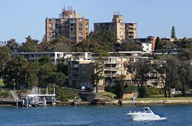
Chiswick Ferry Wharf and apartmentsPostcode: 2046 Location: 9 km (6 mi) west of Sydney CBD LGA: City of Canada Bay State District: Drummoyne Federal Division: Reid Suburbs around Chiswick: Henley Huntleys Point Drummoyne Abbotsford Chiswick Drummoyne Abbotsford Wareemba Russell Lea  Chiswick Ferry Wharf
Chiswick is a suburb in the inner-west region of Sydney, in the state of New South Wales, Australia. It is located 9 kilometres west of the Sydney central business district in the local government area of the City of Canada Bay. Chiswick sits on the peninsula between Abbotsford Bay and Five Dock Bay, on the Parramatta River. It is surrounded by the suburbs of Abbotsford, Russell Lea and Drummoyne.
History
The area around Chiswick was first known by its Aboriginal name Bigi Bigi. The suburb was originally part of Five Dock Farm. In 1850s a Dr Fortescue owned an estate in this area which he named Chiswick after the village on the Thames, west of London. Parramatta River had been known as the 'Thames of the Antipodes' and other nearby suburbs were also named after Thames localities of Greenwich, Woolwich, Henley and Putney.[1]
More recently it has been subjected to an increase in the building of many modern apartment blocks, which has seen the population rise to around 2400[2].
Transport and commercial area
The Chiswick ferry wharf is used by Parramatta River ferry services. Sydney Buses operate a terminus nearby, with buses running to Circular Quay either via Drummoyne and Victoria Road, or via Leichhardt and Parramatta Road. The bus terminus also has a route running to Campsie Station via Burwood Station. Chiswick has a small group of shops in Blackwell Point Road, close to the ferry wharf.
-

Chiswick Ferry Wharf
-

Chambers Park
-

Restored shopfront Blackwall Point Road
-

Blackwall Point Road
References
- ^ The Book of Sydney Suburbs, Compiled by Frances Pollon, Angus & Robertson Publishers, 1990, Published in Australia ISBN 0-207-14495-8, page 61
- ^ http://www.australian-post-codes.com/australian-population/state/new-south-wales/suburb/chiswick/postcode/2046
Coordinates: 33°51′07″S 151°08′10″E / 33.85192°S 151.13605°E
Suburbs and localities within the City of Canada Bay · Inner West · Sydney Abbotsford · Breakfast Point · Cabarita · Canada Bay · Chiswick · Concord · Concord West · Drummoyne · Five Dock · Liberty Grove · Mortlake · North Strathfield · Rhodes · Rodd Point · Russell Lea · Strathfield · Wareemba
List of Sydney suburbs Categories:- Suburbs of Sydney
- Sydney geography stubs
-


Wikimedia Foundation. 2010.