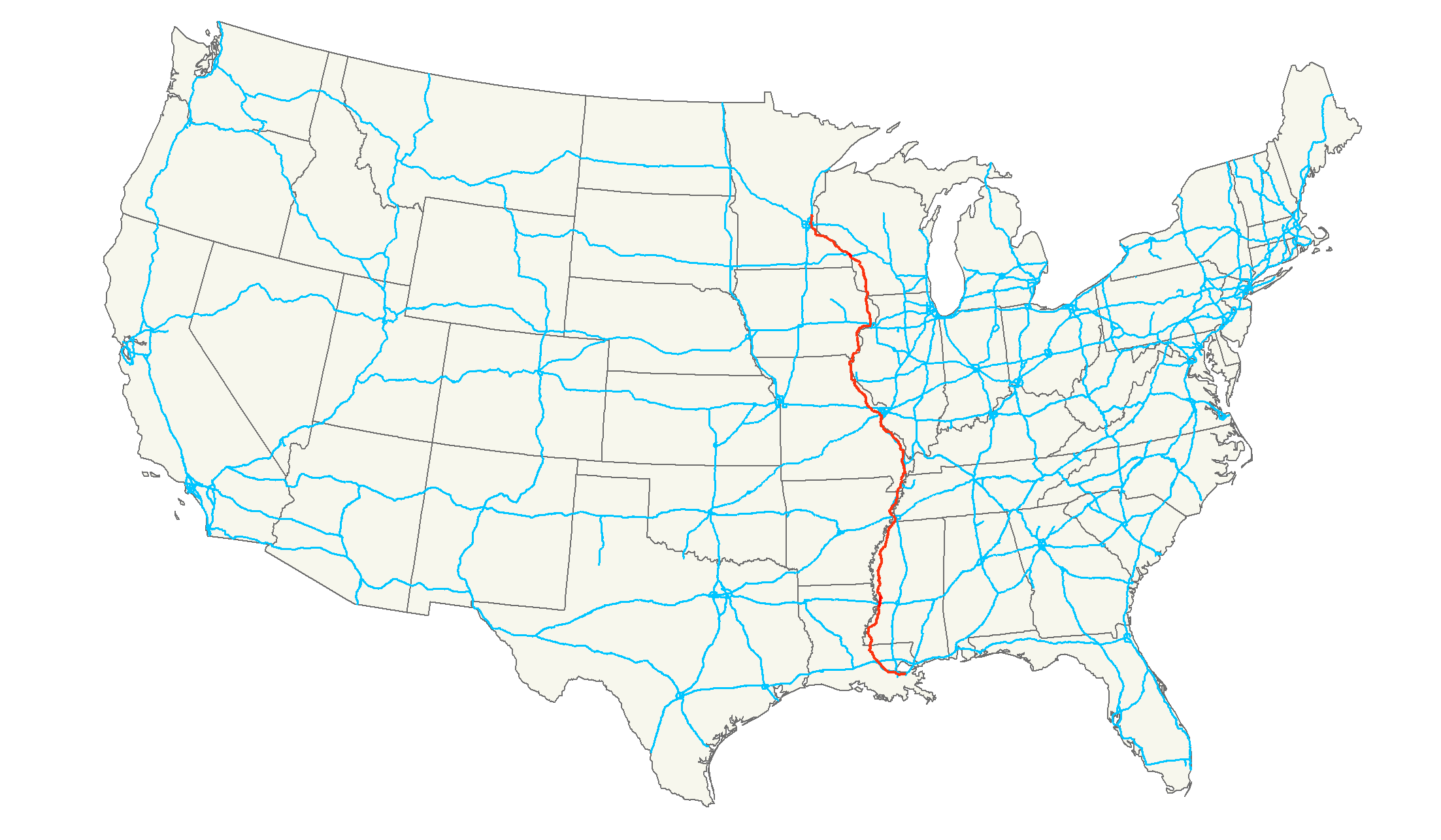
- U.S. Route 61
-
"Blues Highway" redirects here. For the 1994 documentary film, see Blues Highway (film).
U.S. Route 61

Route information Length: 1,400 mi[1] (2,253 km) Existed: 1926[1] – present Major junctions South end:  US 90 in New Orleans, LA
 I-10 in New Orleans, LA
 I-20 in Vicksburg, MS
 I-55 in Memphis, TN
 I-40 in West Memphis, AR
 I-44 in St. Louis, MO
 I-70 in Wentzville, MO
 I-72 in Hannibal, MO
 I-80 in Davenport, IA
 I-90 in La Crescent, MN
 I-94 in Saint Paul, MN
North end:  I-35 in Wyoming, MN
Highway system United States Numbered Highways
List • Bannered • Divided • ReplacedU.S. Route 61 is the official designation for a United States highway that runs 1,400 miles (2,300 km) from New Orleans, Louisiana, to the city of Wyoming, Minnesota. The highway generally follows the course of the Mississippi River, and is designated the Great River Road for much of its route. As of 2004, the highway's northern terminus in Wyoming, Minnesota is at an intersection with Interstate 35. Prior to 1991, the highway extended north on what is now MN 61 through Duluth to the United States-Canada border near Grand Portage. Its southern terminus in New Orleans is at an intersection with Tulane Avenue at South Broad Street. The highway is often called "The Blues Highway", because of the course it takes from Minnesota, through Memphis, Tennessee, and into Louisiana (through Baton Rouge and into New Orleans).
The route was an important north–south connection in the days before the interstate highway system. Many southerners traveled north along Highway 61 while going to St. Louis, Missouri and Saint Paul, Minnesota. The highway was also used in the title of Minnesota native Bob Dylan's album Highway 61 Revisited, and in the song of the same name, which imagines all sorts of fantastical events (including World War III) occurring alongside Highway 61.
Contents
Route description
Louisiana
See also: Airline HighwayU.S. 61 in Louisiana is four-laned from its southern terminus in New Orleans to the Mississippi state line, where the highway continues to Natchez as a four-lane highway.
The section of U.S. 61 from New Orleans to Baton Rouge is known as the Airline Highway. Although the road fronts the Louis Armstrong New Orleans International Airport and passes near Baton Rouge Metropolitan Airport, the name originally referred to the highway's straight route which contrasted to that of the winding Jefferson Highway, which often paralleled the Mississippi River. Legend has it former Louisiana Gov. Huey P. Long advocated the building of the "airline" highway to provide a quick means from the capitol building in Baton Rouge to the bars and establishments in New Orleans so he could quickly travel between the two. On Airline Highway in Jefferson Parish in 1987, Baton Rouge televangelist Jimmy Swaggart was confronted by rival preacher Marvin Gorman as Swaggart exited the Texas Motel with a prostitute. This incident increased the area's reputation as a locale of 'seedy motels'. Partly because of that reputation, the section in Jefferson Parish was later renamed Airline Drive.
Mississippi

U.S. 61 is divided from the Tennessee state line to U.S. Highway 82 in Leland. The highway south of Vicksburg to Natchez is mostly divided and four-lane; only short sections through Port Gibson need to be upgraded. From Natchez to the Louisiana state line, Highway 61 is now divided and four lanes. The Mississippi Department of Transportation is now upgrading the highway between Vicksburg and Leland to four lanes, beginning with replacement of the dangerously narrow Yazoo River bridge at Redwood in Warren County.
The road is also known as the Blues Highway [1] because it runs through the Mississippi Delta country, which was an important source of blues music. U.S. 61 has been referenced in music by various artists with roots in the region.
The junction of Highway 61 and Highway 49 in Clarksdale is designated as the famous crossroads where, according to legend, Robert Johnson supposedly sold his soul to the Devil in exchange for mastery of the blues. A 30-mile (48 km) section of Highway 61 between Clarksdale and Tunica is the longest segment of highway in the world with no horizontal or vertical curves. It was on this stretch of highway that blues singer Bessie Smith died in a car accident on September 26, 1937.
Like Route 66 in the Western U.S., the iconic Highway 61 sign [2] is so strongly identified with the Clarksdale area that it is used to market different products and services. U.S. Highway 61 is defined in Mississippi Code Annotated § 65-3-3.
Tennessee
Highway 61 enters Memphis from Walls, Mississippi as South 3rd St in the southern Memphis area, and then joins I-55 as they cross the Mississippi River to West Memphis, Arkansas, a distance of about 15 miles (24 km).
Arkansas
Highway 61 runs through the state for 76 miles (122 km) from West Memphis to just north of Blytheville, near the Missouri border.
The route enters Arkansas in a concurrency with Interstate 55 and US Routes 64, 70, and 79 near West Memphis. The route skirts the northwest edge of the city, briefly meeting Interstate 40 before continuing north with I-55, US 63, and US 64. US 61 concurrs with I-55 until an area near Turrell, when US 61 branches east but still parallels I-55. The route runs through many small towns in Mississippi County, and becomes a city street in Osceola. Continuing north, the route crosses over I-55 south of Blytheville. In the city, US 61 becomes Division St. until crossing Main Street (AR 18). The route runs north through the rest of Blytheville and beyond until a junction with AR 150 near Yarbro. After this junction, the route continues due north to Missouri.
Missouri
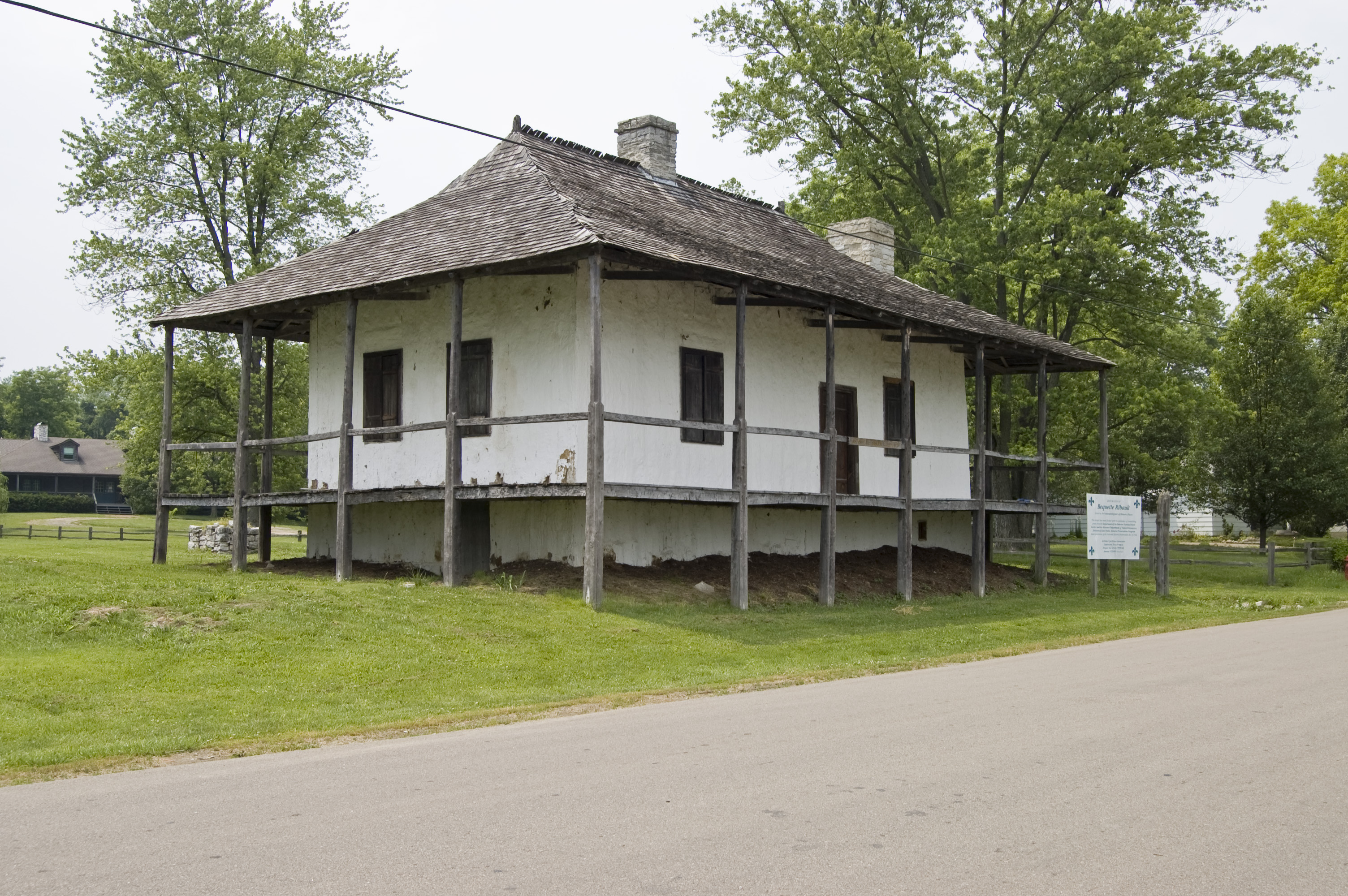
See also: Avenue of the Saints Bequette-Ribault Historic House
c1789, in Ste. Genevieve, MOU.S. Route 61 enters Missouri south of Steele, passing under a concrete arch that was constructed by the Mississippi County, Arkansas highway department in 1924. The alignment of the highway is closely followed by Interstate 55 between there and the St. Louis area, with portions of the two highways overlapping. Between Howardville and Sikeston, U.S. 61 overlaps with U.S. Route 62. At Sikeston, U.S. 61 also meets U.S. Route 60. Crossing MO Route 32 at the 'one of the oldest French Colonial settlements west of the Mississippi River (1735)', Ste. Genevieve, the road continues through Cape Girardeau. The highway then turns northwest and meets U.S. Route 67. The two highways overlap until separating in the St. Louis area at Ladue, where U.S. 61 meets Interstate 64 and U.S. Route 40, just north of the junction of Highway 61 and Old Route 66 (now Route 100), located in Kirkwood, which is referred to locally as "the rock 'n roll crossroads of America". While in the St. Louis area, U.S. 61 is on Lindbergh Boulevard.
After meeting I-64 and U.S. 40, U.S. 61 turns west with them and its overlap with the Avenue of the Saints begins. At Wentzville, the overlap with I-64 and U.S. 40 ends when it meets Interstate 70. It continues in a general northwesterly route, meeting U.S. Route 54 at Bowling Green and U.S. Route 36 and Interstate 72 at Hannibal, an intersection which is I-72's western terminus. Northwest of Hannibal, US 61 meets U.S. Route 24 and the two overlap until they separate at Taylor. U.S. 61 continues north until near Wayland, where the highway turns east at Route 27 and the overlap with the Avenue of the Saints ends. Shortly before leaving Missouri, U.S. 61 meets U.S. Route 136 and the two overlap until entering Iowa.
Route 61 runs along the western side of the Mississippi River between Memphis, Tennessee and Dubuque, Iowa, and therefore never enters the State of Illinois.
Iowa
U.S. Route 61 enters Iowa overlapped with U.S. Route 136 near Keokuk. They separate in Keokuk and U.S. 61 turns north there and meets U.S. Route 218 in northwestern Keokuk. They overlap for 6 miles (9.7 km), then U.S. 218 turns northwest. U.S. 61 goes north until meeting Iowa Highway 2, then turns east with Iowa 2 to Fort Madison. U.S. 61 then turns northeast and meets U.S. Route 34 in Burlington. The highway goes north and overlaps Iowa Highway 92 from Grandview to Muscatine. At Muscatine, the highway turns east to go towards the Quad Cities. At Davenport, U.S. 61 follows I-280 and I-80 around Davenport and meets up with Business 61.
After I-80, the highway turns back north as a freeway until De Witt, which is where it meets U.S. Route 30. It continues north from there to Dubuque as an expressway except for a freeway section in the Maquoketa area. The highway joins with U.S. Highway 151 about six miles (10 km) south of Dubuque. U.S. 61 and U.S. 151 are joined in Dubuque by U.S. Route 52, which separates in downtown Dubuque. Also in Dubuque, a short connecting highway links U.S. 61, U.S. 151, and U.S. 52 with U.S. Route 20. Together, U.S. 61 and U.S. 151 continue through Dubuque, where they cross the Mississippi River and enter Wisconsin via the Dubuque-Wisconsin Bridge.
The 61 Drive In, one of the few drive-in theaters left in the nation, is located along Highway 61. The theater is located about five miles (8 km) south of Maquoketa, near exit 153 (the Delmar/Lost Nation exit).
Future plans include a four-lane freeway bypass of Fort Madison, scheduled for completion by the end of 2011. There are also plans to upgrade the segment between the Louisa–Muscatine County Line near Letts and the South Junction of Iowa Highway 92 near Grandview to a four-lane expressway by 2016. The remaining segments between Hwy 92 and Burlington, and between the north end of the Keokuk Bypass and the Missouri State Line have not been programmed yet by the Iowa D.O.T.
Wisconsin
On the opposite bank of the Mississippi, U.S. 61 and U.S. 151 enter Grant County, Wisconsin, with U.S. 61 going north through Wisconsin about 120 miles (190 km) to LaCrosse. U.S. 151 separates from U.S. 61 at Dickeyville, with U.S. 61 proceeding through Fennimore, Lancaster, and Boscobel. At Readstown U.S. 61 and U.S. 14 join and proceed together to LaCrosse.
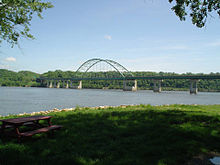
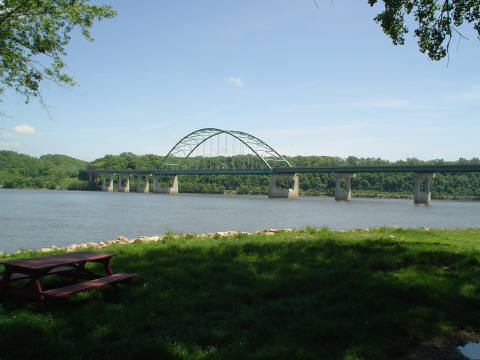
In 2004, a new 2-lane Mississippi River Bridge opened in La Crosse, creating a 4-lane highway from downtown La Crosse to the Minnesota state line. The new bridge brings traffic into La Crosse, and is located just south of the old Cass Street Bridge which continues to be used by traffic heading towards Minnesota.
Minnesota
Main article: U.S. Route 61 in MinnesotaThe four-lane highway continues north to La Crescent. U.S. 61 follows the Mississippi River through Southeast Minnesota through the cities of Winona, Lake City, and Red Wing. It crosses the river at Hastings using the Hastings High Bridge and joins U.S. Route 10 before entering St. Paul. Within the city, the route follows I-94 for a short distance, and then follows Mounds Boulevard, East 7th Street, and Arcade Street through the East Side of St. Paul.
120 miles (190 km) of U.S. 61 from La Crescent to Cottage Grove is officially designated the Disabled American Veterans Highway.
The portion of Highway 61 north of Duluth, Minnesota is now part of the Minnesota State Highway system, bearing the designation Minnesota State Highway 61 since 1991. Between Wyoming, Minnesota and Duluth, the highway has been turned back to local jurisdiction or supplanted by Interstate 35.
History
U.S. 61 once ran 1,714 miles (2,758 km) from New Orleans through Duluth, Minnesota all the way to the Canadian border. The road has been shortened to 1,400 miles (2,300 km) ending now in the city of Wyoming, Minnesota at an intersection with I-35.
The northern section of U.S. 61 in Minnesota was separated when I-35 was constructed, and decommissioned in 1991.
Mississippi
The section of U.S. Highway 61 in northwestern Mississippi, between the state line and Clarksdale, has received considerable upgrades since 1990, when casinos were legalized by the state. The resulting boom in casino development in Tunica County, coupled with dramatic population and development growth in DeSoto County, has led to relocating portions of the highway and expanding it to a divided four-lane highway.
Missouri
When it was designated in 1926, U.S. 61 replaced most of Route 9, which had been established in 1922 between Arkansas and Iowa. The only part that did not become part of U.S. 61 was north of Wayland, where U.S. 61 turned east on Route 4, and Route 9 became Route 4B (now Route 81) to the state line. Since then, U.S. 61 has been moved to a shorter route between Jackson and Festus, replacing much of Route 25; the old alignment is now Route 72 and U.S. 67.
Iowa
Prior to 1958, U.S. Highway 61 followed the route now known as Iowa Highway 22 between Davenport and Muscatine. U.S. Highway 61 was then rerouted onto the old Iowa 22 which passed through Blue Grass.
Starting in the early 1980s, U.S. Highway 61 between Davenport and Dubuque was rebuilt as a four-lane highway. The first link, a 19-mile (31 km) stretch between Davenport and De Witt, was finished in 1982; a bypass around De Witt, which overlapped U.S. Highway 30, was in use starting in November 1975. Subsequent links were completed to Maquoketa (in 1996) and finally to Dubuque in 1999. When the final link was completed, Dubuque finally had a direct four-lane connection to Interstate 80.
In 1983, two multi-lane one-way routes were designated through Davenport starting at the northern city limits. Southbound traffic used the newly constructed Welcome Way until it merges with Harrison Street just north of 35th Street; northbound traffic use Brady Street (which had been a two-way, four-lane street). Other two-way stretches of the highway through Davenport have four (or more) lanes. Because of a bridge with a low clearance in downtown Davenport, commercial truck drivers are encouraged to take Interstates 80, 74, or 280 to bypass the Quad Cities.
A 7.5-mile (12.1 km) bypass around Muscatine, Iowa was opened in 1984, but other upgrades on the stretch south of Davenport would not happen for another decade. The changes came as follows:
- 1996 – The completion of a 4-mile (6.4 km), four-lane stretch between Blue Grass and Interstate 280 in Davenport.
- November 2000 — A 14-mile (23 km) stretch between Blue Grass and the Muscatine bypass was opened.
- May 2001 — A 3-mile (4.8 km) bypass around Blue Grass.
- July 2002 — A 71⁄2-mile (12 km) stretch, from the Muscatine bypass to the southern tip of Muscatine County, just north of Letts.
The final stretch completed a continuous multi-laned link between Dickeyville, Wisconsin south to Letts, Iowa.
Illinois
Prior to the construction of the Dubuque-Wisconsin Bridge, Highway 61 passed through a short distance through Jo Daviess County, Illinois between Dubuque and Wisconsin concurrent with US Route 151. Now both highways cross the Mississippi on the Dubuque-Wisconsin Bridge, which directly connects Wisconsin and Iowa, with neither US 61 nor US 151 passing through Illinois.
Minnesota
Highway 61 follows the west bank of the Mississippi River from the Wisconsin border, past the tiny town of Rollingstone, Minnesota, and through St. Paul. North from the city of Wyoming, Old Highway 61 continues as "Forest Boulevard" in Chisago County, and then either as "County 61" or as Highway 361 through Pine and Carlton counties before ending at Highway 210. The original U.S. 61 had continued east along Highway 210 to Carlton and north on present-day Highway 45 to Scanlon before turning northeast on what is now "County 61 / Old Highway 61" through Esko.
I-35 has replaced the original U.S. 61 descending Thompson Hill into West Duluth, from which most of the city of Duluth can be seen entering town, including the Aerial Lift Bridge and the waterfront. The original U.S. 61 in the city of Duluth had previously followed Cody Street, Grand Avenue, Superior Street, Second Street, Third Street, and London Road.
The original U.S. 61 between Duluth and the Canadian border was designated as Minnesota State Highway 61 in 1991. Minnesota 61, part of the Lake Superior Circle Tour route, follows the North Shore of Lake Superior, where it becomes Ontario Highway 61 upon entering Canada. Highway 61 continues to the city of Thunder Bay, where it ends at an intersection with the Trans-Canada Highway.
Future
Missouri
There is ongoing construction to upgrade U.S. 61 (where it overlaps U.S. 40) to a controlled-access freeway.[2] The current freeway ends at Route K just west of Weldon Spring, Missouri and the construction will upgrade U.S. 61 to a freeway to Interstate 70 at Wentzville. When construction is finished, this freeway also will be signed as Interstate 64.[3] It is unclear whether the entire length will ever be upgraded to freeway status. As of 2006, the route is expected only to be a freeway as bypasses around towns. [4]
Major intersections
- U.S. Route 90 in New Orleans, Louisiana
- Interstate 10 in New Orleans
- Interstate 310 near St. Rose, Louisiana
- Interstate 10 near Gonzales, Louisiana
- Interstate 12 in Baton Rouge, Louisiana
- Interstate 110 in Baton Rouge
- Interstate 20 concurrency at Vicksburg, Mississippi
- Interstate 55 concurrency between Memphis, Tennessee, and Turrell, Arkansas
- Interstate 40 concurrency at West Memphis, Arkansas
- Interstate 55 south of Blytheville, Arkansas
- Interstate 55 concurrency between Steele and Portageville, Missouri
- Interstate 155 and U.S. Route 412 at Hayti, Missouri
- Interstate 55 concurrency between Scott City and Cape Girardeau, Missouri
- Interstate 255 in Mehlville, Missouri
- Interstate 44 in Kirkwood, Missouri
- Interstate 64 and U.S. Route 40 concurrency between Frontenac and Wentzville, Missouri
- Interstate 270 in Westwood, Missouri
- Interstate 70 in Wentzville
- Interstate 72 in Hannibal, Missouri
- Interstate 280 concurrency at Davenport, Iowa
- Interstate 80 concurrency at Davenport
- U.S. Route 14 concurrency between Readstown, Wisconsin, and Winona, Minnesota
- Interstate 90 concurrency from north of La Crescent to Dakota, Minnesota
- Interstate 494 in Newport, Minnesota
- Interstate 94 concurrency in St. Paul, Minnesota
- Interstate 694 in Maplewood, Minnesota
- Interstate 35 in Wyoming, Minnesota
See also
- Avenue of the Saints
- Highway 61 Revisited, a 1965 album by Bob Dylan
- Highway 61, a 1991 film by Bruce McDonald
Bannered routes
Main article: Bannered routes of U.S. Route 61- U.S. Route 61 Business - Keokuk, Iowa
- U.S. Route 61 Business - Muscatine, Iowa
- U.S. Route 61 Business - Davenport, Iowa
- U.S. Route 61 Business - Saint Francisville, Louisiana
- U.S. Route 61 Business - Vicksburg, Mississippi
- U.S. Route 61 Business - Natchez, Mississippi Decommissioned
Related routes
References
- ^ a b Droz, Robert V. U.S. Highways : From US 1 to (US 830). URL accessed 02:55, 4 July 2006 (UTC).
- ^ http://www.modot.org/stlouis/road_construction/docs/2006_cobr2.pdf
- ^ Route 40/61 Project
- ^ Route 61/27 Avenue of the Saints
- Endpoints of US highways
- Adam Froehlig (December 20, 2002). Minnesota Highway 61. (http://www.ajfroggie.com/roadpics/mn-ends/mn061.htm) MN Highway Endings. Accessed August 27, 2004.
- Steve Riner (December 27, 2003). Details of Routes 51-75. (http://www.steve-riner.com/mnhighways/r51-75.htm) Unofficial Minnesota Highways Page. Accessed August 27, 2004.
- The Iowa Highways Page
- MEMPHIS TO NEW ORLEANS: More than just Graceland by Scott Stanton
External links
- The Blues Highway Association, at The Delta Center for Culture and Learning at Delta State University
- Felix Vallé State Historic Site Missouri Department of Natural Resources
- Ste. Genevieve Tourism
- Foundation for Restoration of Ste. Genevieve, Inc. La Maison de Guibourd Historical House
 Main U.S. Routes
1 2 3 4 5 6 7 8 9 10 11 12 13 14 15 16 17 18 19 20 21 22 23 24 25 26 27 28 29 30 31 32 33 34 35 36 37 38 40 41 42 43 44 45 46 48 49 50 51 52 53 54 55 56 57 58 59 60 61 62 63 64 65 66 67 68 69 70 71 72 73 74 75 76 77 78 79 80 81 82 83 84 85 87 89 90 91 92 93 94 95 96 97 98 99 101 163 400 412 425 Lists U.S. Routes • Bannered • Divided • Bypassed Browse numbered routes ←  Hwy. 60
AR U.S. 62  →
→←  I-59
I-59MS MS 63  →
→←  SR-60
SR-60TN SR-61  →
→←  US 60
US 60MO US 62  →
→←  Iowa 60
IA Iowa 62  →
→←  WIS 60
WI WIS 62  →
→←  MN 60
MN 60MN MN 61  →Categories:
- Roads in Greater St. Louis
- Roads in Jefferson County, Missouri
- U.S. Highway System
- U.S. Highways in Arkansas
- U.S. Highways in Iowa
- U.S. Highways in Louisiana
- U.S. Highways in Minnesota
- U.S. Highways in Mississippi
- U.S. Highways in Missouri
- U.S. Highways in Tennessee
- U.S. Highways in Wisconsin
- Great River Road
- Interstate 10
- Interstate 55
- U.S. Route 61


Wikimedia Foundation. 2010.