- Morborne
-
Coordinates: 52°30′00″N 0°19′01″W / 52.5°N 0.317°W
Morborne 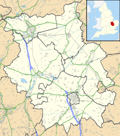
 Morborne
Morborne shown within CambridgeshireOS grid reference TL143905 District Huntingdonshire Shire county Cambridgeshire Region East Country England Sovereign state United Kingdom EU Parliament East of England List of places: UK • England • Cambridgeshire Morborne – in Huntingdonshire (now part of Cambridgeshire), England – is a village west of Yaxley. Morborne is a very small village occupying 1205 acres, of which most is arable farmland. The population in 1991 was 43, down from a peak of 122 people in 1851.[1] Local landmarks include Manor Farm, which opens annually each Spring for "Lambing Sunday"[2], and the Church of All Saints.[3]
- ^ "UK & Ireland Genealogy - Morborne". http://www.genuki.org.uk/big/eng/HUN/Morborne/.
- ^ "Farm open for Lambing Sunday". Peterborough Evening Telegraph. 27 February 2009. http://www.peterboroughtoday.co.uk/news/environment_2_17112/farm_open_for_lambing_sunday_1_125975.
- ^ "Church of All Saints, Morborne". Parish Churches In And Around Peterborough. http://www.robschurches.moonfruit.com/#/morborne/4531428417.
External links
 Media related to Morborne at Wikimedia CommonsCategories:
- Villages in Cambridgeshire
- Huntingdonshire
- Civil parishes in Cambridgeshire
- Cambridgeshire geography stubs

Wikimedia Foundation. 2010.