- Needingworth
-
 Signpost in Holywell cum Needingworth
Coordinates: 52°19′12″N 0°01′01″W / 52.32°N 0.017°W
Needingworth 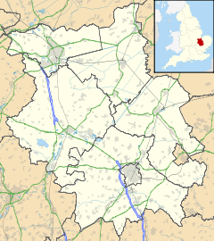
 Needingworth
Needingworth shown within CambridgeshireOS grid reference TL351706 District Huntingdonshire Shire county Cambridgeshire Region East Country England Sovereign state United Kingdom EU Parliament East of England List of places: UK • England • Cambridgeshire Needingworth – in Huntingdonshire (now part of Cambridgeshire), England – is a village east of St Ives and just west of the Prime Meridian.
The village is attached to Holywell by a single road, connecting the two villages.
There is only one shop, currently a 'One Stop', which is also a Post Office on the Needingworth high street. There are also two pubs in Needingworth, The Pike and Eel and The Queen's Head.
There is a Church-of-England primary school, a village hall with bowls club and various good walks in the area. Also tennis courts.
The Villager is the local newsletter of the area, a copy of which is delivered free to every household in the parish of Holywell-cum-Needingworth.
Contents
The quarry
There is a significant aggregate extraction operation based just to the east of Needingworth. The quarry will be turned into wetland with the co-operation of the RSPB. The resulting 600 hectares (1,483 acres) wetland will constitute 50% of the UK's reedbed target.[1]
Bus services
There are two bus routes serving the village;
- 21 (Stagecoach in Huntingdonshire) to St Ives or Somersham/Chatteris
- 21 (Go Whippet) to St Ives or Somersham/Ramsey
References
- ^ Hanson Aggregates, 2007
External links
- History of Hollywell cum Needingworth
- Quarry and wetland information
- The newsletter of Holywell-cum-Needingworth
- Local bus times
Categories:- Villages in Cambridgeshire
- Huntingdonshire
- Cambridgeshire geography stubs


Wikimedia Foundation. 2010.