- Namibia
-
Republic of Namibia 

Flag Coat of arms Motto: Unity, Liberty, Justice Anthem: "Namibia, Land of the Brave" 
Capital
(and largest city)Windhoek
22°34.2′S 17°5.167′E / 22.57°S 17.086117°EOfficial language(s) English Recognised regional languages German, Rukwangali, Silozi, Setswana, Damara/Nama, Afrikaans, Herero, Oshiwambo Demonym Namibian Government Presidential republic - President Hifikepunye Pohamba - Prime Minister Nahas Angula - Chairperson of the National Council Asser Kuveri Kapere - Speaker of the National Assembly Theo-Ben Gurirab - Chief Justice Peter Shivute Legislature Parliament - Upper House National Council - Lower House National Assembly Independence - from South Africa 21 March 1990 Area - Total 825,418 km2 (34th)
318,696 sq mi- Water (%) Negligible Population - 2009 estimate 2,108,665[1] (142nd) - 2008 census 2,088,669 - Density 2.5/km2 (235th)
6.6/sq miGDP (PPP) 2010 estimate - Total $14.596 billion[2] - Per capita $6,952[2] GDP (nominal) 2010 estimate - Total $11.865 billion[2] - Per capita $5,651[2] Gini (2003) 70.7[1] (very high) (1st) HDI (2010)  0.606[3] (medium) (105th)
Currency Namibian dollar ( NAD)Time zone WAT (UTC+1) - Summer (DST) WAST (UTC+2) Drives on the Left ISO 3166 code NA Internet TLD .na Calling code +264  Map of Namibia, based on radar images from The Map Library
Namibia, officially the Republic of Namibia (Afrikaans: Republiek van Namibië, German: Republik Namibia), is a country in southern Africa whose western border is the Atlantic Ocean. It shares land borders with Angola and Zambia to the north, Botswana to the east and South Africa to the south and east. It gained independence from South Africa on 21 March 1990, following the Namibian War of Independence. Its capital and largest city is Windhoek. Namibia is a member state of the United Nations (UN), the Southern African Development Community (SADC), the African Union (AU), and the Commonwealth of Nations.
The dry lands of Namibia were inhabited since early times by Bushmen, Damara, and Namaqua, and since about the 14th century AD by immigrating Bantu who came with the Bantu expansion. It became a German Imperial protectorate in 1884 and remained a German colony until the end of World War I. In 1920, the League of Nations mandated the country to South Africa, which imposed its laws and, from 1948, its apartheid policy.
In 1966, uprisings and demands by African leaders led the UN to assume direct responsibility over the territory. It recognized the South West Africa People’s Organization (SWAPO) as the official representative of the Namibian people in 1973. Namibia, however, remained under South African administration during this time. Following internal violence, South Africa installed an interim administration in Namibia in 1985. Namibia obtained full independence from South Africa in 1990, with the exception of Walvis Bay and the Penguin Islands, which remained under South African control until 1994.
Namibia has a population of 2.1 million people and a stable multi-party parliamentary democracy. Agriculture, herding, tourism and the mining industry – including mining for gem diamonds, uranium, gold, silver, and base metals – form the backbone of Namibia's economy. After Mongolia it is the second least densely populated country in the world. Approximately half the population live below the international poverty line, and the nation has suffered heavily from the effects of HIV/AIDS, with 15% of the adult population infected with HIV in 2007.
Contents
History
Main article: History of NamibiaThe name of the country is derived from the Namib Desert, considered to be the oldest desert in the world.[4] Before its independence in 1990, the area was known first as German South-West Africa (Deutsch-Südwestafrika), then as South-West Africa, reflecting the colonial occupation by the Germans and the South Africans (technically on behalf of the British crown reflecting South Africa's dominion status within the British Empire).
Pre-colonial period
The dry lands of Namibia were inhabited since early times by Bushmen, Damara, Nama, and since about the 14th century AD, by immigrating Bantu who came with the Bantu expansion from central Africa. From the late 18th century onwards, Orlam clans from the Cape Colony crossed the Orange River and moved into the area that today is southern Namibia.[5] Their encounters with the nomadic Nama tribes were largely peaceful. The missionaries accompanying the Orlams were well–received by them,[6] the right to use waterholes and grazing was granted against an annual payment.[7] On their way further northwards, however, the Orlams encountered clans of the Herero tribe at Windhoek, Gobabis, and Okahandja which were less accommodating. The Nama-Herero War broke out in 1880, hostilities ebbed only when Imperial Germany deployed troops to the contested places and cementing the status quo between Nama, Orlams, and Herero.[8]
The first Europeans to disembark and explore the region were the Portuguese navigators Diogo Cão in 1485 and Bartolomeu Dias in 1486; still the region was not claimed by the Portuguese crown. However, like most of Sub-Saharan Africa, Namibia was not extensively explored by Europeans until the 19th century, when traders and settlers arrived, principally from Germany and Sweden. In the late 19th century Dorsland trekkers crossed the area on their way from the Transvaal to Angola. Some of them settled in Namibia instead of continuing their journey, even more returned to South-West African territory after the Portuguese tried to convert them to Catholicism and forbade their language at schools.[9]
German rule
Namibia became a German colony in 1884 to forestall British encroachment and was known as German South-West Africa (Deutsch-Südwestafrika).[10] However, the Palgrave mission by the British governor in Cape Town had determined that only the natural deep-water harbour of Walvis Bay (Walfisch in German, Walvis in Afrikaans, Whale in English) was worth occupying – and this was annexed to the Cape province of British South Africa. From 1904 to 1907, the Herero and the Namaqua took up arms against the Germans and in the subsequent Herero and Namaqua genocide, 10,000 Nama (half the population) and approximately 65,000 Hereros (about 80% of the population) were killed.[11][12] The survivors, when finally released from detention, were subjected to a policy of dispossession, deportation, forced labor, racial segregation and discrimination in a system that in many ways anticipated apartheid. Most Africans were confined to so-called native territories, which later under South African rule post-1949 were turned into "homelands" (Bantustans). Indeed, some historians have speculated that the German genocide in Namibia was a model used by Nazis in the Holocaust,[13] but most scholars say that episode was not especially influential for the Nazis, who were children at the time[citation needed]. However, the father of Luftwaffe commander Hermann Göring was a one-time German colonial governor of Namibia and has a street named after him in Swakopmund.[14] The memory of genocide remains relevant to ethnic identity in independent Namibia and to relations with Germany.[15]
South African rule and the struggle for independence
South Africa occupied the colony in 1915 after defeating the German force during World War I and administered it as a League of Nations mandate territory from 1919. Although the South African government desired to incorporate 'South-West Africa' into its territory, it never officially did so, although it was administered as the de facto 'fifth province', with the white minority having representation in the whites-only Parliament of South Africa, as well as electing their own local administration the SWA Legislative Assembly. The South African government also appointed the SWA administrator, who had extensive powers.
Following the League's supersession by the United Nations in 1946, South Africa refused to surrender its earlier mandate to be replaced by a United Nations Trusteeship agreement, requiring closer international monitoring of the territory's administration (along with a definite independence schedule). The Herero Chief's Council submitted a number of petitions to the UN calling for it to grant Namibia independence during the 1950s. During the 1960s, when European powers granted independence to their colonies and trust territories in Africa, pressure mounted on South Africa to do so in Namibia. In 1966 the International Court of Justice dismissed a complaint brought by Ethiopia and Liberia against South Africa's continued presence in the territory, but the U.N. General Assembly subsequently revoked South Africa's mandate, while in 1971 the International Court of Justice issued an "advisory opinion" declaring South Africa's continued administration to be illegal.[16]
In response to the 1966 ruling by the International Court of Justice, South-West Africa People's Organisation (SWAPO) military wing, People's Liberation Army of Namibia, a guerrilla group began their armed struggle for independence,[17] but it was not until 1988 that South Africa agreed to end its occupation[18] of Namibia, in accordance with a UN peace plan for the entire region. During the South African occupation of Namibia, white commercial farmers, most of whom came as settlers from South Africa and represented 0.2% of the national population, owned 74% of arable land.[19] Outside the central-southern area of Namibia (known as the "Police Zone" since the German era and which contained the main towns, industries, mines and best arable land), the country was divided into "homelands", the version of South African bantustan applied to Namibia, although only a few were actually established due to non-cooperation by most indigenous Namibians.
After many unsuccessful attempts by the UN to persuade South Africa to agree to the implementation of UN Resolution 435, which had been adopted by the UN Security Council in 1978 as the internationally-agreed decolonisation plan for Namibia, transition to independence finally started in 1988 under the tripartite diplomatic agreement between South Africa, Angola and Cuba, with the USSR and the USA as observers, under which South Africa agreed to withdraw and demobilise its forces in Namibia and Cuba agreed to pull back its troops in southern Angola sent to support the MPLA in its war for control of Angola with UNITA. A combined UN civilian and peace-keeping force under Finnish diplomat Martti Ahtisaari supervised the military withdrawals, return of SWAPO exiles and the holding of Namibia's first-ever one-person one-vote election for a constituent assembly in October 1989. This was won by SWAPO although it did not gain the two-thirds majority it had hoped for; the South African-backed Democratic Turnhalle Alliance (DTA) became the official opposition.
Following the adoption of the Namibian Constitution, including entrenched protection for human rights, compensation for state expropriations of private property, an independent judiciary and an executive presidency (the constituent assembly became the national assembly), the country officially became independent on 21 March 1990. Sam Nujoma was sworn in as the first President of Namibia watched by Nelson Mandela (who had been released from prison shortly beforehand) and representatives from 147 countries, including 20 heads of state.[20] Walvis Bay was ceded to Namibia in 1994 upon the end of Apartheid in South Africa.
After independence
Since independence Namibia has successfully completed the transition from white minority apartheid rule to parliamentary democracy. Multiparty democracy was introduced and has been maintained, with local, regional and national elections held regularly. Several registered political parties are active and represented in the National Assembly, although Swapo Party has won every election since independence.[21] The transition from the 15-year rule of President Sam Nujoma to his successor, Hifikepunye Pohamba in 2005 went smoothly.[22]
Namibian government has promoted a policy of national reconciliation and issued an amnesty for those who had fought on either side during the liberation war. The civil war in Angola had a limited impact on Namibians living in the north of the country. In 1998, Namibia Defence Force (NDF) troops were sent to the Democratic Republic of the Congo as part of a Southern African Development Community (SADC) contingent. In August 1999, a secessionist attempt in the northeastern Caprivi region was successfully quashed.[22]
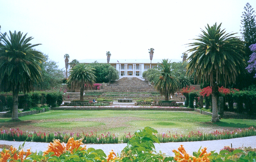
Politics and government

Tintenpalast, the center of Namibia's government Main article: Politics of NamibiaThe politics of Namibia takes place in a framework of a presidential representative democratic republic, whereby the president of Namibia is elected to a five-year term and is both the head of state and the head of government, and of a multi-party system. Executive power is exercised by the government. Legislative power is vested in both the government and the bicameral Parliament, the National Assembly and the National Council. The judiciary is independent of the executive and the legislature. The management of the rule of law and the observance of basic human rights in Namibia are constantly scrutinized.[23]
Namibia held Presidential and the National Assembly elections on 27 and 28 November 2009. The Electoral Commission of Namibia published a "Handbook for Election Observers in Namibia" to enable observers (and party agents) to professionally observe the Presidential and National Assembly Elections 2009, the Regional Councils and Local Authorities Elections 2010 and subsequent By-Elections.[23]
Foreign relations
Main article: Foreign relations of NamibiaNamibia follows a largely independent foreign policy, with lingering affiliations with states that aided the independence struggle, including Libya and Cuba. With a small army and a fragile economy, the Namibian Government's principal foreign policy concern is developing strengthened ties within the Southern African region. A dynamic member of the Southern African Development Community, Namibia is a vocal advocate for greater regional integration. Namibia became the 160th member of the UN on 23 April 1990. On its independence it became the fiftieth member of the Commonwealth of Nations.[citation needed]
Military
Main article: Military of NamibiaThe constitution of Namibia defined the role of the military as "defending the territory and national interests." Namibia formed the Namibian Defence Force (NDF), comprising former enemies in a 23-year bush war: the People's Liberation Army of Namibia (PLAN) and South West African Territorial Force (SWATF). The British formulated the plan for integrating these forces and began training the NDF, which consists of a small headquarters and five battalions.
The United Nations Transitional Assistance Group (UNTAG)'s Kenyan infantry battalion remained in Namibia for three months after independence to help train the NDF and to stabilize the north. According to the Namibian Defence Ministry, enlistments of both men and women will number no more than 7,500. Defence and security account for approximately 3.7% of government spending.
Geography and climate
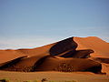
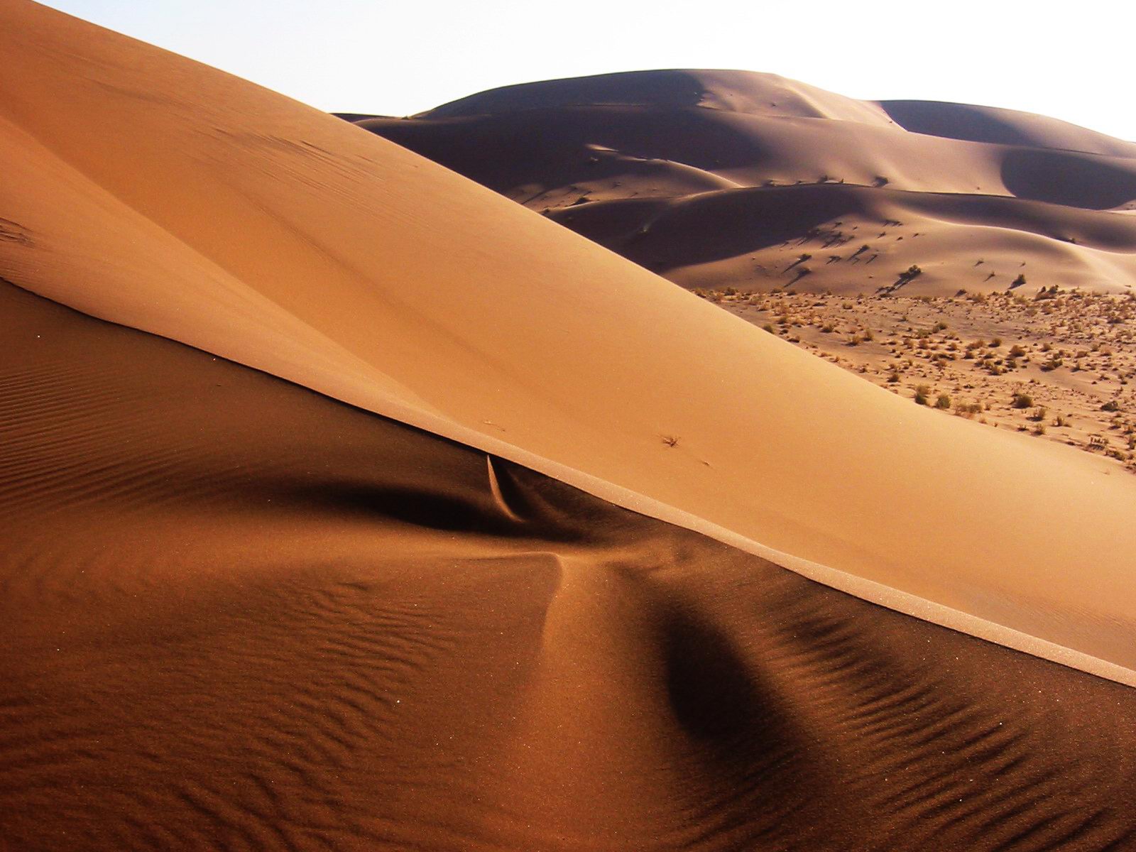
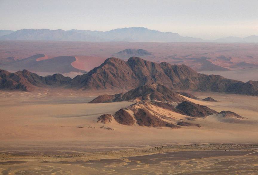
 Sand dunes in the Namib Desert, NamibiaMain article: Geography of Namibia
At 825,418 km2 (318,696 sq mi),[24] Namibia is the world's thirty-fourth largest country (after Venezuela). It lies mostly between latitudes 17° and 29°S (a small area is north of 17°), and longitudes 11° and 26°E.
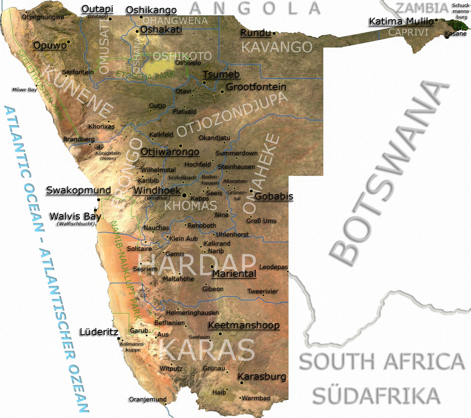
Administrative division
 Main articles: Regions of Namibia and Constituencies of Namibia
Namibia is divided into 13 regions and subdivided into 107 constituencies. The administrative division of Namibia is tabled by Delimitation Commissions and accepted or declined by the National Assembly. Since state foundation three Delimitation Commissions have been formed, the last one in 2002 under the chairmanship of Peter Shivute.[25] Regional councillors are directly elected through secret ballots (regional elections) by the inhabitants of their constituencies.[26]
Geographical areas
The Namibian landscape consists generally of five geographical areas, each with characteristic abiotic conditions and vegetation with some variation within and overlap between them: the Central Plateau, the Namib Desert, the Great Escarpment, the Bushveld, and the Kalahari Desert.
Central Plateau
 Namib Escarpment
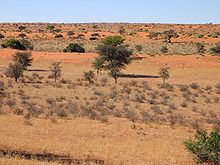 The Kalahari Desert
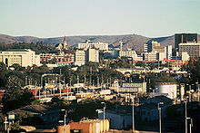 Windhoek skyline
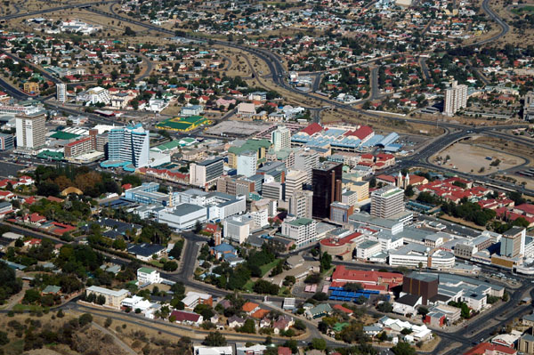
The Central Plateau runs from north to south, bordered by the Skeleton Coast to the northwest, the Namib Desert and its coastal plains to the southwest, the Orange River to the south, and the Kalahari Desert to the east. The Central Plateau is home to the highest point in Namibia at Königstein elevation 2,606 meters (8,550 ft).[27] Within the wide, flat Central Plateau is the majority of Namibia’s population and economic activity. Windhoek, the nation’s capital, is located here, as well as most of the arable land. Although arable land accounts for only 1% of Namibia, nearly half of the population is employed in agriculture.[28]
The abiotic conditions here are similar to those found along the Escarpment; however the topographic complexity is reduced. Summer temperatures in the area can reach 40 °C (104 °F), and frosts are common in the winter.
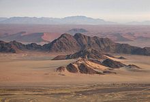
Namib Desert
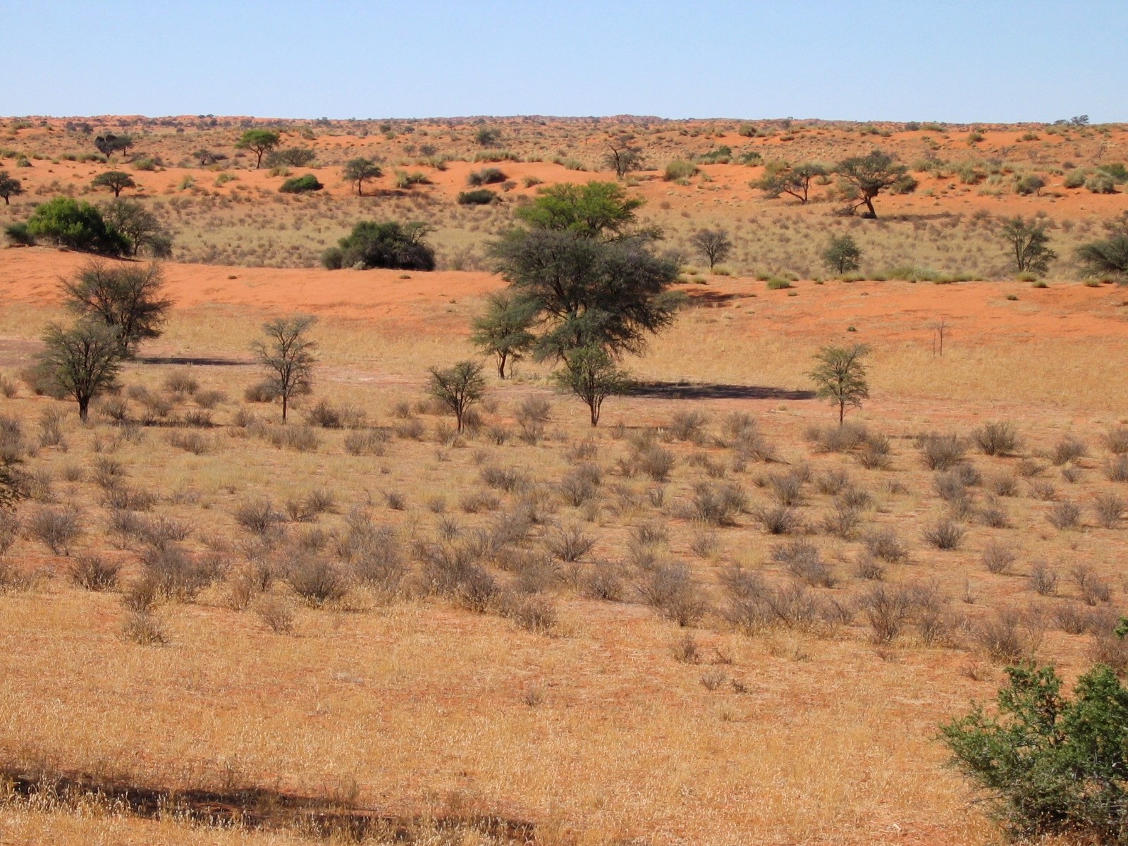
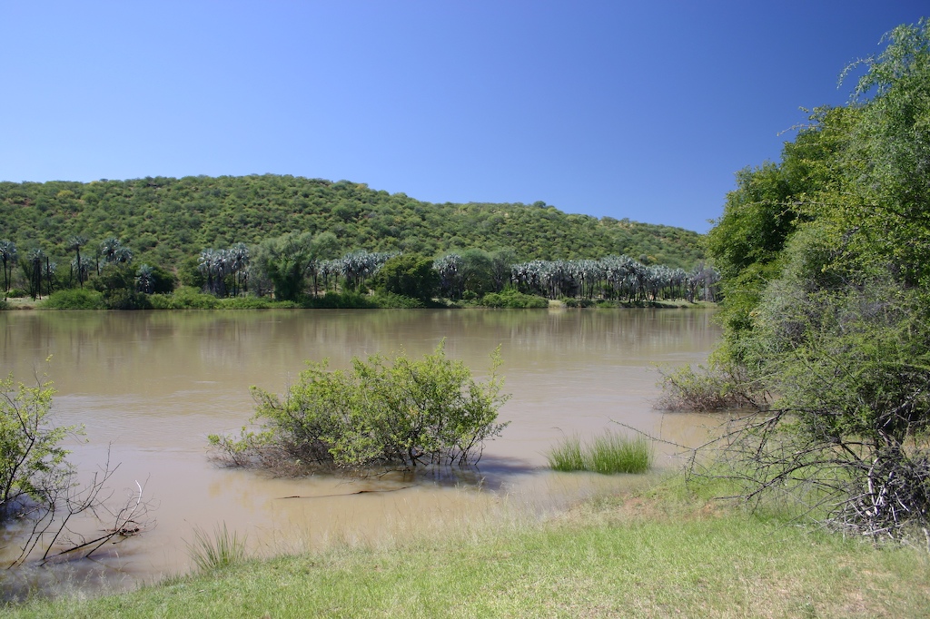
The Namib Desert is a broad expanse of hyper-arid gravel plains and dunes that stretches along Namibia's entire coastline. It varies between 100 to many hundreds of kilometres in width. Areas within the Namib include the Skeleton Coast and the Kaokoveld in the north and the extensive Namib Sand Sea along the central coast.[29] The sands that make up the sand sea result from processes of erosion that take place in the Orange River valley and areas further to the south. As sand-laden waters drop their suspended loads into the Atlantic, onshore currents deposit them along the shore. The prevailing south west winds then pick up and redeposit the sand in the form of massive dunes in the widespread sand sea, forming the largest sand dunes in the world. In areas where the supply of sand is reduced because of the inability of the sand to cross riverbeds, the winds also scour the land to form large gravel plains. In many areas of the Namib Desert there is little vegetation aside from lichens found in the gravel plains and in dry river beds where plants can access subterranean water.
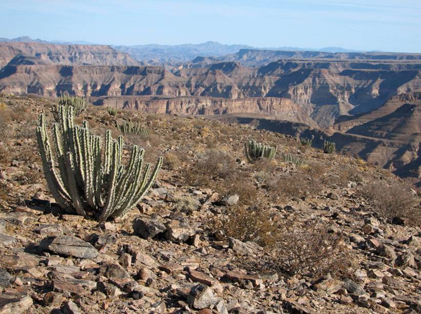
Great Escarpment
The Great Escarpment swiftly rises to over 2,000 meters (6,562 ft). Average temperatures and temperature ranges increase further inland from the cold Atlantic waters, while the lingering coastal fogs slowly diminish. Although the area is rocky with poorly developed soils, it is nonetheless significantly more productive than the Namib Desert. As summer winds are forced over the Escarpment, moisture is extracted as precipitation.[30] The water, along with rapidly changing topography, is responsible for the creation of microhabitats which offer a wide range of organisms, many of them endemic. Vegetation along the escarpment varies in both form and density, with community structure ranging from dense woodlands to more shrubby areas with scattered trees. A number of Acacia species are found here, as well as grasses and other shrubby vegetation.
Bushveld
The Bushveld is found in north eastern Namibia along the Angolan border and in the Caprivi Strip which is the vestige of a narrow corridor demarcated for the German Empire to access the Zambezi River. The area receives a significantly greater amount of precipitation than the rest of the country, averaging around 400 mm (15.7 in) per year. Temperatures are also cooler and more moderate, with approximate seasonal variations of between 10 and 30 °C (50 and 86 °F). The area is generally flat and the soils sandy, limiting their ability to retain water.[31] Located adjacent to the Bushveld in north-central Namibia is one of nature’s most spectacular features: the Etosha Pan. For most of the year it is a dry, saline wasteland, but during the wet season, it forms a shallow lake covering more than 6,000 square kilometres (2,317 sq mi). The area is ecologically important and vital to the huge numbers of birds and animals from the surrounding savannah that gather in the region as summer drought forces them to the scattered waterholes that ring the pan. The Bushveld area has been demarcated by the World Wildlife Fund as part of the Angolan Mopane woodlands ecoregion, which extends north across the Cunene River into neighbouring Angola.
Kalahari Desert
The Kalahari Desert is perhaps Namibia’s best known geographical feature. Shared with South Africa and Botswana, it has a variety of localized environments ranging from hyper-arid sandy desert, to areas that seem to defy the common definition of desert. One of these areas, known as the Succulent Karoo, is home to over 5,000 species of plants, nearly half of them endemic; fully one third of the world’s succulents are found in the Karoo.
The reason behind this high productivity and endemism may be the relatively stable nature of precipitation.[32] The Karoo apparently does not experience drought on a regular basis, so even though the area is technically desert, regular winter rains provide enough moisture to support the region’s interesting plant community. Another feature of the Kalahari, indeed many parts of Namibia, are inselbergs, isolated mountains that create microclimates and habitat for organisms not adapted to life in the surrounding desert matrix.
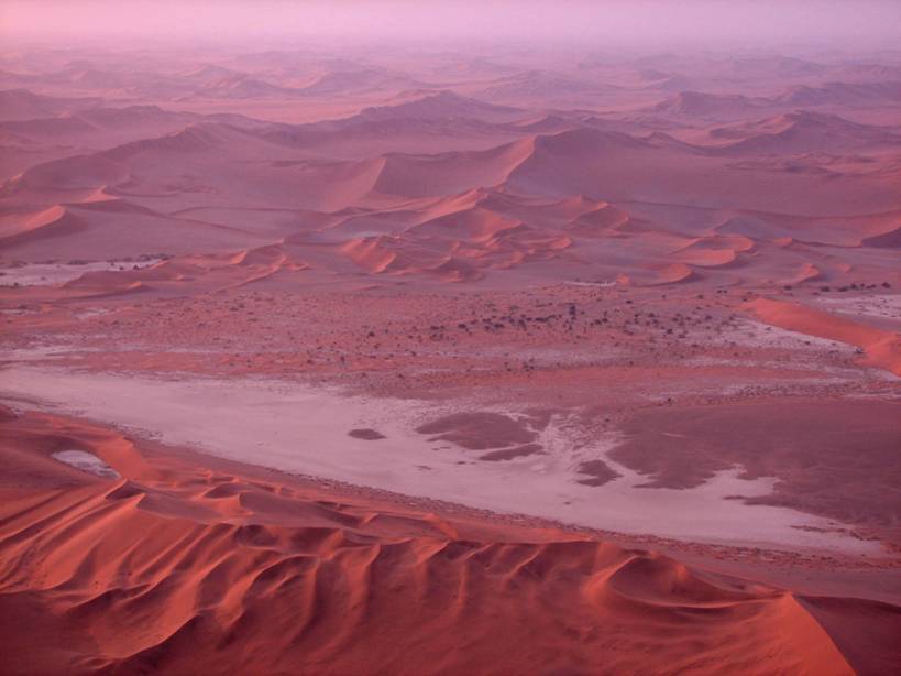
Coastal Desert
Namibia’s Coastal Desert is one of the oldest deserts in the world. Its sand dunes, created by the strong onshore winds, are the highest in the world.[33]
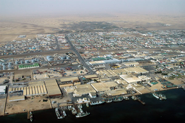
The Namib Desert and the Namib-Naukluft National Park are located here. The Namibian coastal deserts are one of the richest sources of diamonds on earth. The area is divided into the northern Skeleton Coast and the southern Diamond Coast. Because of the location of the shoreline— at the point where the Atlantic's cold water reach Africa— there is often extremely dense fog.[34]
Sandy beach comprises 54% of the shoreline, and mixed sand and rock form another 28%. Only 16% of the total length is rocky shoreline. The coastal plains are "dune fields", gravel plains covered with lichen and some scattered salt pans. Near the coast there are areas where the dunes are vegetated with hammocks.[35] Namibia has rich coastal and marine resources that remain largely unexplored.[36]
Weather and climate
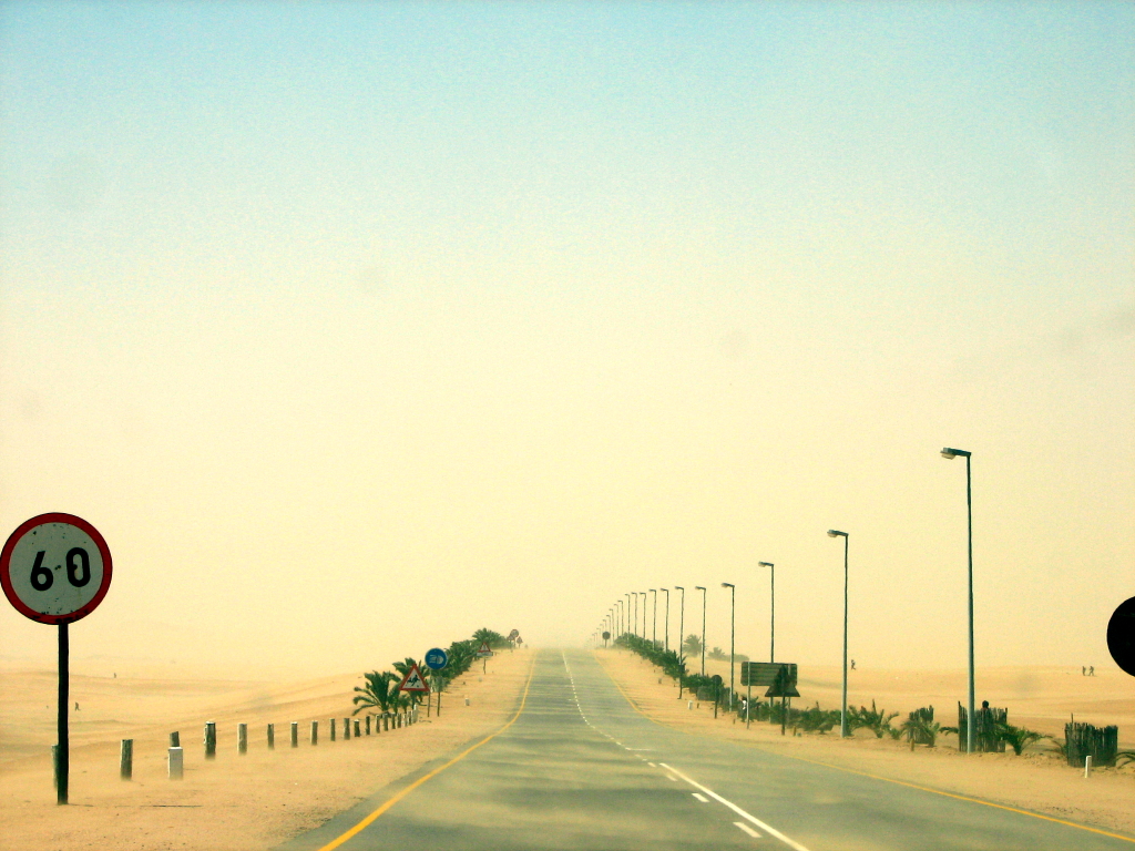
Namibia has more than 300 days of sunshine per year. It is situated at the southern edge of the tropics; the Tropic of Capricorn cuts the country about in half. The winter (June – August) is generally dry, both rainy seasons occur in summer, the small rainy season between September and November, the big one between February and April.[37] Humidity is low, and average rainfall varies from almost zero in the coastal desert to more than 600 mm in the Caprivi Strip. Rainfall is however highly variable, and droughts are common.[38] The last[update] bad rainy season with rainfall far below the annual average occurred in summer 2006/07.[39]
Weather and climate in the coastal area are dominated by the cold, north-flowing Benguela current of the Atlantic Ocean which accounts for very low precipitation (50 mm per year or less), frequent dense fog, and overall lower temperatures than in the rest of the country.[38] In Winter, occasionally a condition known as Bergwind or Oosweer (Afrikaans: East weather) occurs, a hot dry wind blowing from the inland to the coast. As the area behind the coast is a desert, these winds can develop into sand storms with sand deposits in the Atlantic Ocean visible on satellite images.[40]
The Central Plateau and Kalahari areas have wide diurnal temperature ranges of up to 30C.[38]
Economy
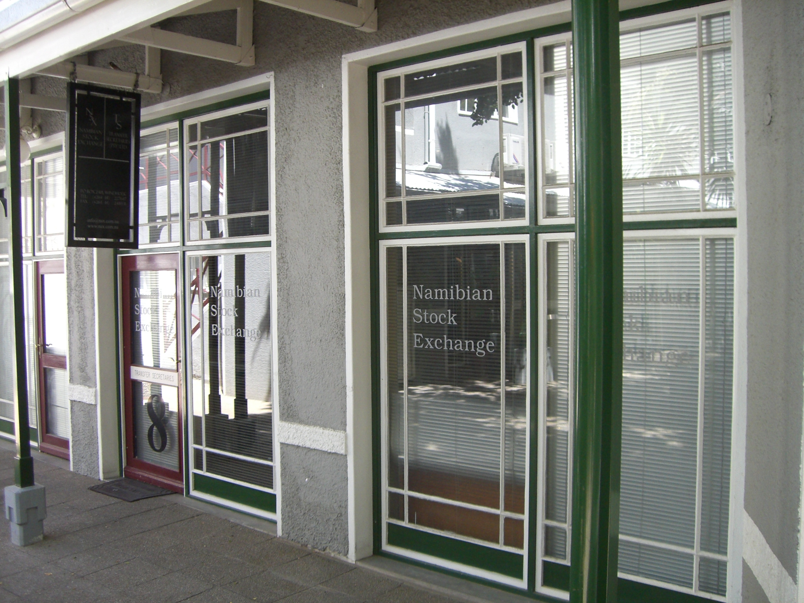
Main article: Economy of Namibia The Namibian Stock Exchange in Windhoek
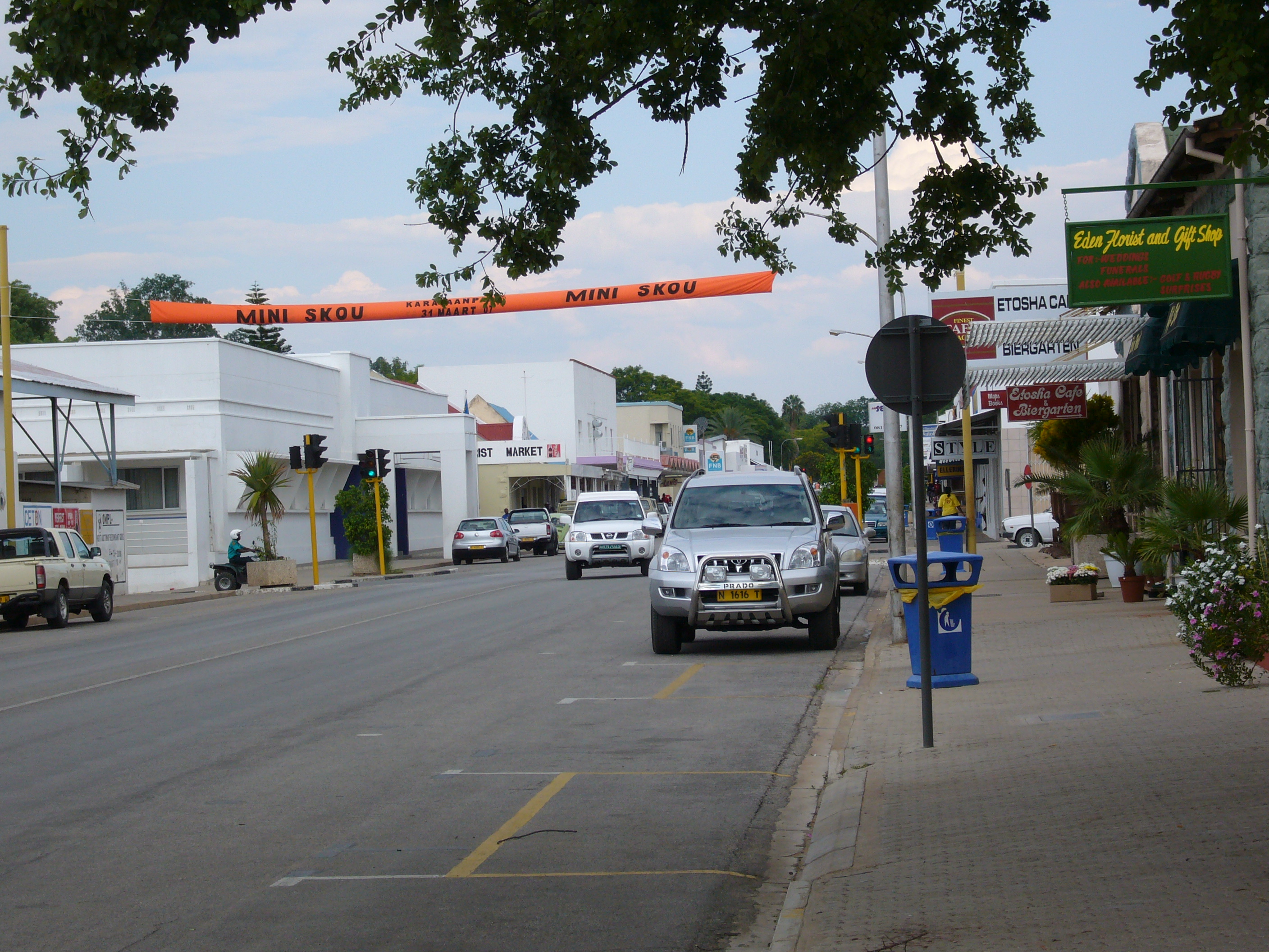
 Tsumeb's main road
Namibia’s economy is tied closely to South Africa’s due to their shared history.[41][42] The largest economic sectors are mining (10.4% of the gross domestic product in 2009), agriculture (5.0%), manufacturing (13.5%), and tourism.[43]
Namibia has a highly developed banking sector with modern infrastructure, such as Online Banking, Cellphone Banking etc. The Bank of Namibia (BoN) is the central bank of Namibia responsible to perform all other functions ordinarily performed by a central bank. There are four BoN authorised commercial banks in Namibia: Bank Windhoek, First National Bank, Nedbank & Standard Bank.[44]
Namibia has a high unemployment rate. "Strict unemployment" (people actively seeking a full time job) stood at 20.2% in 2000, 21.9% in 2004 and spiraled to 29.4 per cent in 2008. Under a broader definition (including people that have given up searching for employment) unemployment rose from 36.7% in 2004 to 51.2% in 2008. This estimate considers people in the informal economy as employed. The study that arrived at these results has been hailed "by far superior in scope and quality to any that has been available previously" by Labour and Social Welfare Minister Immanuel Ngatjizeko.[45]
Approximately half the population live below the international poverty line of U.S.$1.25 a day.[46] There is a number of legislative measures in place to alleviate poverty and unemployment. In 2004 a labour act was passed to protect people from job discrimination stemming from pregnancy and HIV/AIDS status. In early 2010 the Government tender board announced that "henceforth 100 per cent of all unskilled and semi-skilled labour must be sourced, without exception, from within Namibia".[47]
Transportation
Main article: Transport in Namibia
Despite the remote nature of much of the country, Namibia has seaports, airports, highways, and railways (narrow-gauge). The country seeks to become a regional transportation hub; it has an important seaport and several landlocked neighbors. The Central Plateau already serves as a transportation corridor from the more densely populated north to South Africa, the source of four-fifths of Namibia’s imports.[28]
Agriculture
Main article: Agriculture in Namibia Welcoming sign of the Burgsdorf-farm in Hardap.
About half of the population depends on agriculture (largely subsistence agriculture) for its livelihood, but Namibia must still import some of its food. Although per capita GDP is five times the per capita GDP of Africa's poorest countries, the majority of Namibia's people live in rural areas and exist on a subsistence way of life. Namibia has one of the highest rates of income inequality in the world, due in part to the fact that there is an urban economy and a more rural cash-less economy. The inequality figures thus take into account people who do not actually rely on the formal economy for their survival.
About 4,000, mostly white, commercial farmers own almost half of Namibia's arable land.[48] The governments of Germany and Britain will finance Namibia's land reform process, as Namibia plans to start expropriating land from white farmers to resettle landless black Namibians.[49]
Agreement has been reached on the privatisation of several more enterprises in coming years, with hopes that this will stimulate much needed foreign investment. However, reinvestment of environmentally derived capital has hobbled Namibian per capita income.[50] One of the fastest growing areas of economic development in Namibia is the growth of wildlife conservancies. These conservancies are particularly important to the rural generally unemployed population.
Mining and electricity
Main article: Mining in NamibiaProviding 25% of Namibia's revenue, mining is the single most important contributor to the economy.[51] Namibia is the fourth largest exporter of non-fuel minerals in Africa and the world's fourth largest producer of uranium. There has been significant investment in uranium mining and Namibia is set to become the largest exporter of uranium by 2015.[52] Rich alluvial diamond deposits make Namibia a primary source for gem-quality diamonds.[53] While Namibia is known predominantly for its gem diamond and uranium deposits, a number of other minerals are extracted industrially such as lead, tungsten, gold, tin, fluorspar, manganese, marble, copper and zinc. There are offshore gas deposits in the Atlantic Ocean that are planned to be extracted in the future.[43] According to "The Diamond Investigation", a book about the global diamond market, from 1978, De Beers, the largest diamond company, bought most of the Namibian diamonds, and would continue to do so, because "whatever government eventually comes to power they will need this revenue to survive".[54]
Domestic supply voltage is 220V AC. Electricity is generated mainly by thermal and hydroelectric power plants. Non-conventional methods of electricity generation also play some role. Encouraged by the rich uranium deposits the Namibian government plans to erect its first nuclear power station by 2018, also uranium enrichment is envisaged to happen locally.[55]
Tourism
 An example of Namibian wildlife, the Plains Zebra, one focus of tourismMain article: Tourism in Namibia
Tourism is a major contributor (14.5%) to Namibia's GDP, creating tens of thousands of jobs (18.2% of all employment) directly or indirectly and servicing over a million tourists per annum.[56] The country is among the prime destinations in Africa and is known for ecotourism which features Namibia's extensive wildlife.[57]
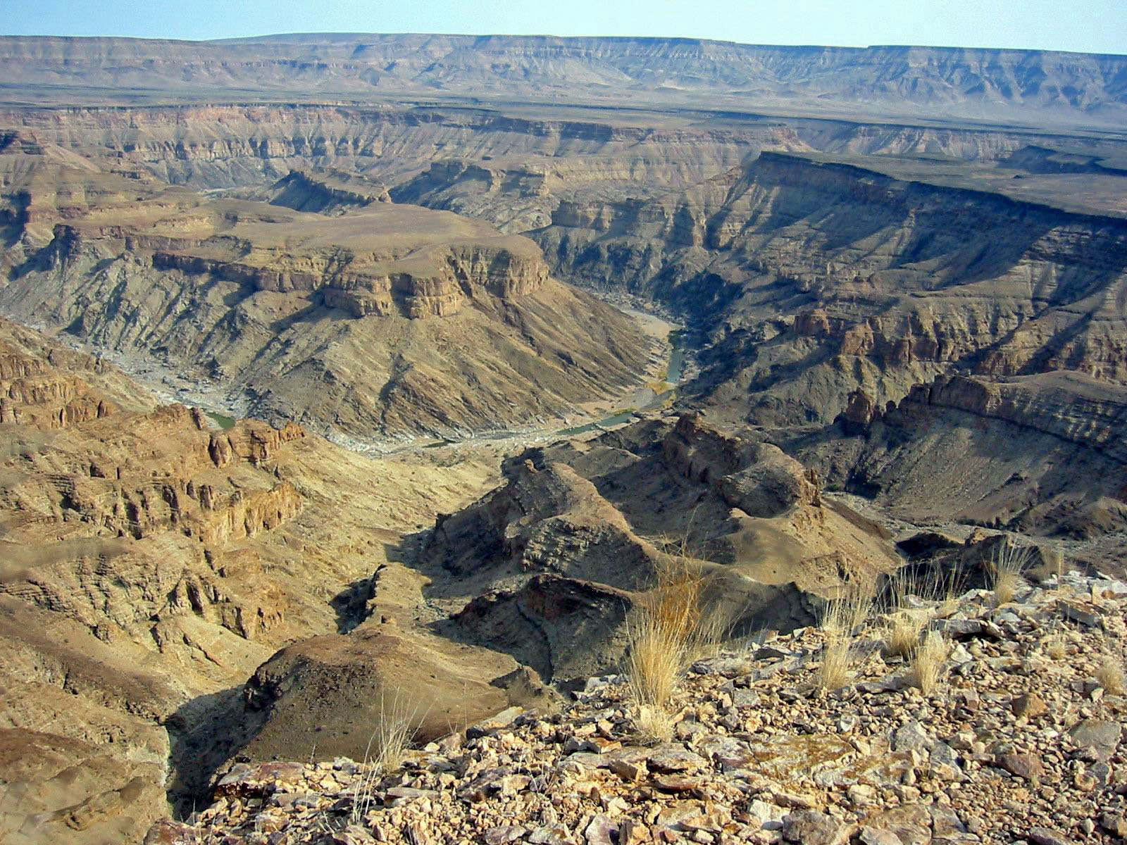
There are many lodges and reserves to accommodate eco-tourists. Sport Hunting is also a large, and growing component of the Namibian economy, accounting for 14% of total tourism in the year 2000, or $19.6 million US dollars, with Namibia boasting numerous species sought after by international sport hunters.[58] In addition, extreme sports such as sandboarding and 4x4ing have become popular, and many cities have companies that provide tours. The most visited places include the Caprivi Strip, Fish River Canyon, Sossusvlei, the Skeleton Coast Park, Sesriem, Etosha Pan and the coastal towns of Swakopmund, Walvis Bay and Lüderitz.[citation needed]
Taxation & Cost of Living in Namibia
Main article: Cost of Living in NamibiaCost of living in Namibia is relatively high because most of the goods including cereals need to be imported. Business monopoly in some sectors causes higher profit bookings and further raising of prices. Its capital city, Windhoek is currently ranked as the 150th most expensive place in the world for expatriates to live.[59]
Personal income tax is applicable to total taxable income of an Individual and all individuals are taxed at progressive marginal rates over a series of income brackets. While the Value added tax (VAT) is applicable to most of the commodities and services.[60]
Population
Demographics
Main article: Demographics of NamibiaNamibia has the second-lowest population density of any sovereign country, after Mongolia.[61] The majority of the Namibian population is black African – mostly of the Ovambo ethnicity, which forms about half of the population – residing mainly in the north of the country, although many are now resident in towns throughout Namibia. Other ethnic groups are the Herero and Himba people, who speak a similar language, and the Damara, who speak the same "click" language as the Nama.
In addition to the Bantu majority, there are large groups of Khoisan (such as Nama and Bushmen), who are descendants of the original inhabitants of Southern Africa. The country also contains some descendants of refugees from Angola. There are also two smaller groups of people with mixed racial origins, called "Coloureds" and "Basters", who together make up 6.5% (with the Coloureds outnumbering the Basters two to one). There is a large Chinese minority in Namibia.[62]
Whites of Portuguese, Dutch, German, British and French ancestry make up about 7% of the population; they form the second-largest population of European ancestry, both in terms of percentage and actual numbers, in Sub-Saharan Africa after South Africa.[1] Most Namibian whites and nearly all those of mixed race speak Afrikaans and share similar origins, culture, and religion as the white and coloured populations of South Africa. A smaller proportion of whites (around 30,000) trace their family origins directly back to German colonial settlers and maintain German cultural and educational institutions. Nearly all Portuguese settlers came to the country from the former Portuguese colony of Angola.[63] The 1960 census reported 526,004 persons in the South West Africa, including 73,464 whites (14 percent).[64]
Religion
Main article: Religion in NamibiaThe Christian community makes up 80%-90% of the population of Namibia, with at least 50% of these Lutheran. 10%-20% of the population hold indigenous beliefs.[1]
Missionary work during the 1800s drew many Namibians to Christianity. While most Namibian Christians are Lutheran, there also are Roman Catholic, Methodist, Anglican, African Methodist Episcopal, Dutch Reformed Christians and Mormon (Latter-Day Saints) represented, as well as some Jewish people.[65]
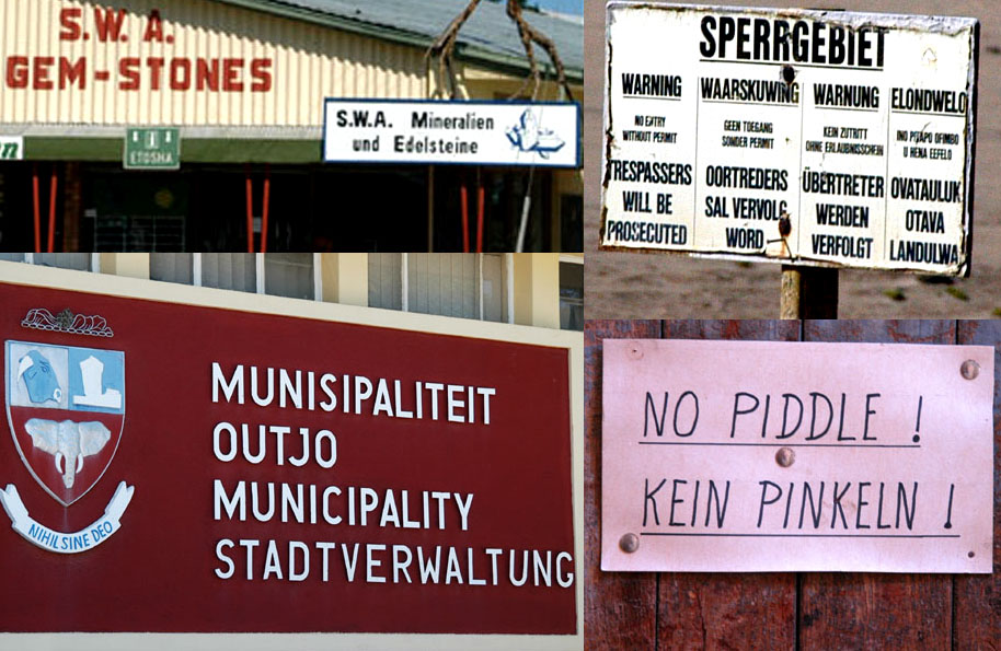
Language
Main article: Languages of NamibiaThe official language is English. Until 1990, German and Afrikaans were also official languages. Long before Namibia's independence from South Africa, SWAPO had decided that the country should become officially monolingual, consciously choosing this approach in contrast to that of its neighbour, which was regarded as "a deliberate policy of ethnolinguistic fragmentation."[66] Consequently, English became the sole official language of Namibia. Some other languages have received semi-official recognition by being allowed as medium of instruction in primary schools.
The northen majority of Namibians speak Oshiwambo as their first language, whereas the most widely understood and spoken language is Afrikaans. Among the younger generation, the most widely understood language is English and Afrikaans. Both Afrikaans and English are used primarily as a second language reserved for public communication, but small first-language groups exist throughout the country.
While the official language is English, most of the white population speaks either German or Afrikaans. Even today, 90 years after the end of the German colonial era, the German language plays a leading role as a commercial language. Afrikaans is spoken by 60% of the white community, German is spoken by 32%, English is spoken by 7% and Portuguese by 1%.[1] Geographical proximity to Portuguese-speaking Angola explains the relatively high number of lusophones.
Health
Main article: Health care in NamibiaSee also: HIV/AIDS in NamibiaThe AIDS epidemic is a large problem in Namibia. Though its rate of infection is substantially lower than that of its eastern neighbor, Botswana, approximately 15% of the adult population is[update] infected with HIV.[67] In 2001, there were an estimated 210,000 people living with HIV/AIDS, and the estimated death toll in 2003 was 16,000. The HIV/AIDS epidemic is considered as a killer disease and as it has reduced the number of working class people, the number of orphans has increased. It falls to the government to provide education, food, shelter and clothing for these orphans.[68]
The malaria problem seems to be compounded by the AIDS epidemic. Research has shown that in Namibia the risk of contracting malaria is 14.5% greater if a person is also infected with HIV. The risk of death from malaria is also raised by approximately 50% with a concurrent HIV infection.[69] Given infection rates this large, as well as a looming malaria problem, it may be very difficult for the government to deal with both the medical and economic impacts of this epidemic. The country had only 598 physicians in 2002. [70]
Culture
Education
 Secondary school studentsMain article: Education in NamibiaSee also: List of schools in Namibia
Namibia has compulsory free education for 10 years between the ages of 6 and 16. Grades 1–7 are primary level, grades 8–12 secondary. In 1998, there were 400,325 Namibian students in primary school and 115,237 students in secondary schools. The pupil-teacher ratio in 1999 was estimated at 32:1, with about 8% of the GDP being spent on education.[71]
Most schools in Namibia are state-run, but a few private schools are also part of the country's education system. Among these are St. Pauls College, Windhoek Afrikaanse Privaatskool, Deutsche Höhere Privatschule, Windhoek International School and Windhoek Gymnasium. Curriculum development, educational research, and professional development of teachers is centrally organised by the National Institute for Educational Development (NIED) in Okahandja.[72]
There are four teacher training colleges, three colleges of agriculture, a police training college, a Polytechnic at university level, and a National University.
Communal Wildlife Conservancies
 Quivertree Forest, BushveldMain article: Communal Wildlife Conservancies in Namibia
Namibia is one of few countries in the world to specifically address conservation and protection of natural resources in its constitution.[73] Article 95 states, “The State shall actively promote and maintain the welfare of the people by adopting international policies aimed at the following: maintenance of ecosystems, essential ecological processes, and biological diversity of Namibia, and utilization of living natural resources on a sustainable basis for the benefit of all Namibians, both present and future.”[73]
 The Namibia rugby team.
In 1993, the newly formed government of Namibia received funding from the United States Agency for International Development (USAID) through its Living in a Finite Environment (LIFE) Project.[74] The Ministry of Environment and Tourism with the financial support from organizations such as USAID, Endangered Wildlife Trust, WWF, and Canadian Ambassador’s Fund, together form a Community Based Natural Resource Management (CBNRM) support structure. The main goal of this project is promote sustainable natural resource management by giving local communities rights to wildlife management and tourism.[75]
Sport
Main articles: Sport in Namibia and Rugby union in NamibiaThe most popular sport in Namibia is football. The Namibia national football team qualified for the 2008 Africa Cup of Nations but has yet to qualify for any World Cups. However, the most successful national team is the Namibian rugby team, having competed in four separate World Cups. Namibia were participants in the 1999, 2003, 2007 and 2011 Rugby World Cups. Cricket is also popular, with the national side having played in the 2003 Cricket World Cup.
Inline Hockey was first played in 1995 and has also become more and more popular in the last years. The Women's Inline Hockey National Team participated in the 2008 FIRS World Championships. Namibia is the home for one of the toughest footraces in the world, the Namibian ultra marathon. The most famous athlete from Namibia is certainly Frankie Fredericks, sprinter (100 and 200 m). He won four Olympic silver medals (1992, 1996) and also has medals from several World Athletics Championships. He is also known for humanitarian activities in Namibia and further.
Media
Although Namibia's population is comparably small, the country has a diverse choice of media: Two TV stations, 19 radio stations (without counting community stations), 5 daily newspapers, several weeklies and special publications compete for the attention of the audience. Additionally, a mentionable amount of foreign media, especially South African, is available. Online media are mostly based on print publication contents. Namibia has a state-owned Press Agency, called NAMPA.[76].
History
The first newspaper in Namibia was the Windhoeker Anzeiger, founded 1898. Radio was introduced in 1969, TV in 1981. During German rule, the newspapers mainly reflected the living reality and the view of the white German-speaking minority. The black majority was ignored or depicted as a threat. During South-African rule, the white bias continued, with mentionable influence of the Pretoria government on the "South West African" media system. Independent newspapers were seen as a menance to the existing order, critical journalists threatend.[77] [76] [78]
Print
The daily newspapers include the private publications The Namibian, Die Republikein, Allgemeine Zeitung and Namibian Sun as well as the state-owned New Era. Except for the largest newspaper, The Namibian, which is owned by a trust, the other mentioned private newspapers are part of the Democratic Media Holdings.[76]
Other mentionable newspapers are the tabloid Informanté owned by TrustCo, the weekly Windhoek Observer, the weekly Namibia Economist, as well as the regional Namib Times. Current affairs magazines include Insight Namibia and the comparably new Prime Focus. Sister Namibia Magazine stands out as the longest running NGO magazine in Namibia, while Namibia Sport is the only national sport magazine. Furthermore, the print market is complemented with party publications, student newspapers and PR publications.[76]
Broadcasting
The broadcasting sector is dominated by the state-run Namibian Broadcasting Corporation (nbc). The public broadcaster offers a TV station as well as a "National Radio" in English and nine language services in locally spoken languages. The nine private radio stations in the country are mainly English language channels, except for Radio Omulunga (Oshiwambo) and Kosmos 94.1 (Afrikaans). When it comes to TV, the nbc only got its first competitor in 2003, the private One Africa TV.[76]
Freedom
Compared to neighbouring countries, Namibia has a large degree of media freedom. Over the last years, the country usually ranked in the upper quarter of the Reporters without Borders statistics, reaching position 21 in 2010.[79]. Thus, the country is on par with Canada - as well as the best positioned African country. The Press Freedom Index as well as the African Media Barometer show similarly positive results. However, as in other countries, there is still mentionable influence of representatives of state and economy on media in Namibia.[76] Some of these problems were also reflected in a drop to position 44 on the Reporters without Borders list in 2009. [80]
Organisations
Media and journalists in Namibia are represented by the Namibian chapter of the Media Institute of Southern Africa and the Editor's Forum of Namibia. An independent media ombudsman was appointed in 2009 to prevent a state-controlled media council.[76]
Gallery
-
Dune in Namibia.
-
SAC Namibia-petroglyph.jpg
Petroglyphs near Twyfelfontein.
-

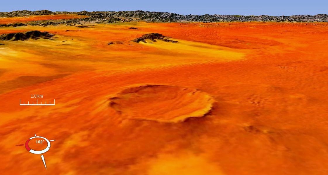
Roter Kamm crater, in the Namib Desert (Landsat image)
-

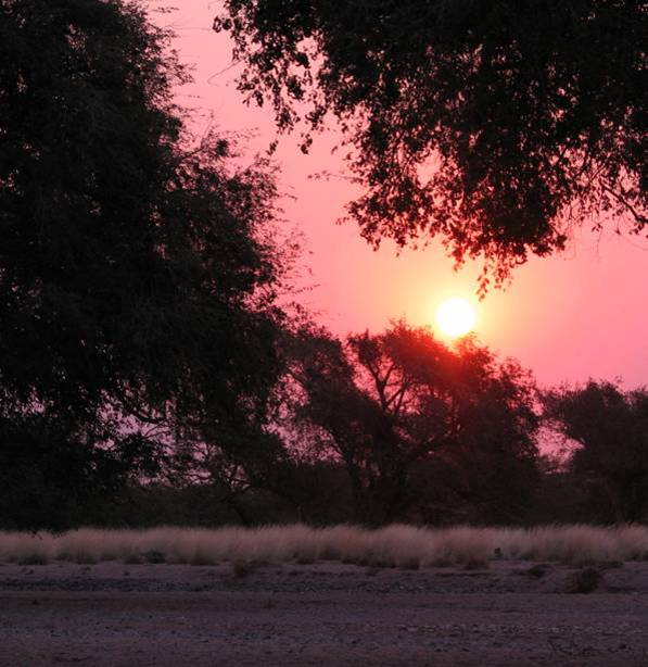
Namibian sunset.
-

Cape Ground Squirrels (Xerus inauris), close to Solitaire, Namibia.
-

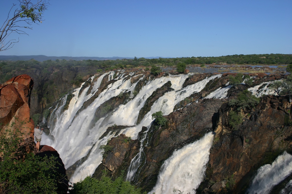
Ruacana Falls, Namibia
-

The Kunene River near Swartbooisdrift
-

Aerial photo of Central Windhoek
-

Fish River Canyon, Namibia
-

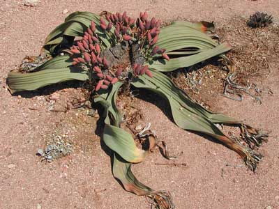
A Welwitschia mirabilis (female) in Namibia
-

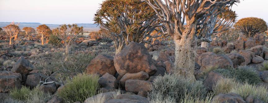
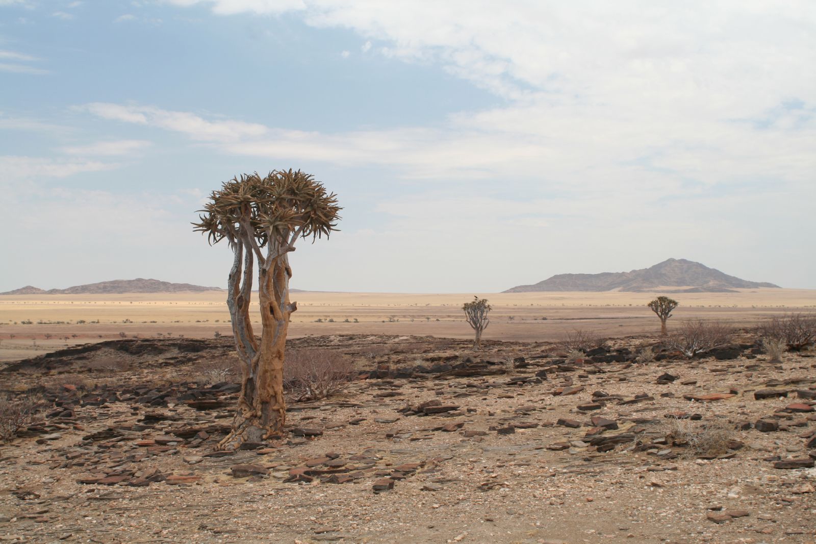
Quiver trees in the Skeleton Coast Park, Namibia
-

Aerial photo of Mercury Island, Namibia
See also
- Outline of Namibia
- Index of Namibia-related articles
Sport
- Namibian cricket team
- Namibia Football Association
- Rugby union in Namibia
Lists
- List of cities and towns in Namibia
- List of villages and settlements in Namibia
- List of Namibians
- List of national parks of Namibia
- List of South-African Administrators-General in South West Africa
References
Footnotes
- ^ a b c d e Central Intelligence Agency (2009). "Namibia". The World Factbook. https://www.cia.gov/library/publications/the-world-factbook/geos/wa.html. Retrieved 23 January 2010.
- ^ a b c d "Namibia". International Monetary Fund. http://www.imf.org/external/pubs/ft/weo/2011/01/weodata/weorept.aspx?sy=2008&ey=2011&scsm=1&ssd=1&sort=country&ds=.&br=1&c=728&s=NGDPD%2CNGDPDPC%2CPPPGDP%2CPPPPC%2CLP&grp=0&a=&pr.x=24&pr.y=13. Retrieved 21 April 2011.
- ^ "Human Development Report 2010". United Nations. 2010. http://hdr.undp.org/en/media/HDR_2010_EN_Table1.pdf. Retrieved 5 November 2010.
- ^ Namib desert (AT1315) World Wide Fund for Nature site on the Namib Desert
- ^ Dierks, Klaus. "Biographies of Namibian Personalities, A". http://www.klausdierks.com/Biographies/Biographies_A.htm. Retrieved 24 June 2010.
- ^ Dierks, Klaus. "Warmbad becomes two hundred years". http://www.klausdierks.com/Warm_Bath/index.htm. Retrieved 22 June 2010.
- ^ Vedder 1997, p. 177.
- ^ Vedder 1997, p. 659.
- ^ Joubert, Bruce. "An historical perspective on animal power use in South Africa". Animal Traction Network for Eastern and Southern Africa. http://www.atnesa.org/sanat/Joubert-95-HistoryanimalpowerSouthAfrica.pdf.
- ^ "German South West Africa". Encyclopædia Britannica. http://www.britannica.com/eb/article-9036573/German-South-West-Africa. Retrieved 15 April 2008.
- ^ Drechsler, Horst (1980). The actual number of deaths in the limited number of battles with the Germany Schutztruppe (expeditionary force) were limited, most of the deaths occurred after fighting had ended due to the extermination order issued by the German military governor Lotha von Trotha. A substantial minority of Herero crossed the Kalahari desert into the British colony of Bechuanaland (modern-day Botswana) where a small community continues to live in western Botswana near to border with Namibia Let us die fighting, originally published (1966) under the title "Südwestafrika unter deutsche Kolonialherrschaft". Berlin: Akademie-Verlag.
- ^ Mohamed Adhikari, "'Streams Of Blood And Streams Of Money': New Perspectives on the Annihilation of the Herero and Nama Peoples Of Namibia, 1904–1908," Kronos: Journal Of Cape History 2008 34: 303–320
- ^ Benjamin Madley, "From Africa to Auschwitz: How German South West Africa Incubated Ideas and Methods Adopted and Developed by the Nazis in Eastern Europe," European History Quarterly 2005 35(3): 429–464 says it influenced Nazis.
- ^ Robert Gerwarth, et al. "L'Antichambre de l'Holocauste? A propos du Debat sur les Violences Coloniales et la Guerre d'Extermination Nazie" ("The Antechamber of the Holocaust? The Debate on Colonial Violence and the Nazi War of Extermination") Vingtième Siècle 2008 (99): 143–159 says most scholars think it did not influence the Nazis.
- ^ Reinhart Kössler, and Henning Melber, "Völkermord und Gedenken: Der Genozid an den Herero und Nama in Deutsch-Südwestafrika 1904–1908," ("Genocide and memory: the genocide of the Herero and Nama in German South-West Africa, 1904–08") Jahrbuch zur Geschichte und Wirkung des Holocaust 2004: 37–75
- ^ "Namibian War of Independence 1966–1988". Armed Conflict Events Database. http://www.onwar.com/aced/data/november/namibia1966.htm. Retrieved 30 November 2009.
- ^ Petronella Sibeene (17 April 2009). "Swapo Party Turns 49". New Era. http://www.newera.com.na/article.php?articleid=3769.
- ^ Klaus Dierks Chronology of Namibian History, 1977
- ^ Land reform in Namibia: Why not? Southern African Report, January 1994
- ^ "Chronology of Namibian Independence". Klausdierks.com. http://www.klausdierks.com/Chronology/132.htm. Retrieved 26 June 2010.
- ^ "Country report: Spotlight on Namibia". Commonwealth Secretariat. http://www.thecommonwealth.org/news/34580/34581/224187/250510spotlightonnamibia.htm. Retrieved 12 July 2010.
- ^ a b "IRIN country profile Namibia". IRIN. http://www.irinnews.org/country.aspx?CountryCode=NA&RegionCode=SAF. Retrieved 12 July 2010.
- ^ a b Bösl, Anton (2008). Bösl, Anton; Horn, Nico. eds. The Independence of the Judiciary in Namibia (pdf). Publications sponsored by Konrad Adenauer Stiftung. Macmillan Education Namibia. ISBN 978-99916-0-807-5. http://www.kas.de/wf/doc/kas_15058-544-2-30.pdf. Retrieved 26 June 2010.
- ^ "Rank Order – Area". CIA World Fact Book. https://www.cia.gov/library/publications/the-world-factbook/rankorder/2147rank.html. Retrieved 12 April 2008.
- ^ Matundu-Tjiparuro, Mae (28 February 2011). "Khomas Region, a constitutional, political and geographical hybrid". Focus on: Khomas Region. supplement to New Era. p. 3.
- ^ "Namibia National Council". Inter-Parliamentary Union. http://www.ipu.org/parline/reports/2226.htm. Retrieved 14 July 2010.
- ^ "Landsat.usgs.gov". Landsat.usgs.gov. http://landsat.usgs.gov/gallery/detail/367/. Retrieved 26 June 2010.
- ^ a b World Almanac. 2004.
- ^ Spriggs, A. 2001.(AT1315)
- ^ Spriggs, A. 2001.(AT1316)
- ^ Cowling, S. 2001.
- ^ Spriggs, A. 2001.(AT0709)
- ^ "NASA – Namibia’s Coastal Desert". www.nasa.gov. http://www.nasa.gov/multimedia/imagegallery/image_feature_540.html. Retrieved 9 October 2009.
- ^ "An Introduction to Namibia". www.geographia.com. http://www.geographia.com/namibia/. Retrieved 9 October 2009.
- ^ "NACOMA – Namibian Coast Conservation and Management Project". www.nacoma.org.na. http://www.nacoma.org.na/Our_Coast/WalkOnOurCoastline.htm. Retrieved 9 October 2009.
- ^ Sparks, Donald L.. "Namibia's Coastal and Marine Development Potential – Sparks 83 (333): 477 – African Affairs". afraf.oxfordjournals.org. http://afraf.oxfordjournals.org/cgi/pdf_extract/83/333/477. Retrieved 9 October 2009.
- ^ "The Rainy Season". Real Namibia. http://www.realnamibia.com/rn_028rainyseason.htm. Retrieved 28 July 2010.
- ^ a b c "Namibia". Encyclopedia Britannica. http://www.britannica.com/EBchecked/topic/402283/Namibia/43996. Retrieved 28 July 2010.
- ^ Olszewski, John (28 May 2009). "Climate change forces us to recognise new normals". Namibia Economist. http://www.economist.com.na/index.php?option=com_content&view=article&catid=531:weather&id=14308:climate-change-forces-us-to-recognise-new-normals&Itemid=54.
- ^ Olszewski, John (25 June 2010). "Understanding Weather – not predicting it". Namibia Economist. http://www.economist.com.na/index.php?option=com_content&view=category&layout=blog&id=575&Itemid=54&limitstart=5.
- ^ (United States Central Intelligence Agency, 2007)
- ^ (United States State Department, 2007)
- ^ a b "Background Note:Namibia". US Department of State. 26 October 2010. http://www.state.gov/r/pa/ei/bgn/5472.htm.
- ^ "Bank of Namibia (BoN)". https://www.bon.com.na. Retrieved 3 April 2011.
- ^ The Namibian 4 February 2010 "Half of all Namibians unemployed" by Jo-Mare Duddy
- ^ Human Development Indices, Table 3: Human and income poverty, p. 35. Retrieved on 1 June 2009
- ^ The Namibian 3 Feb 2010 "Tender Board tightens rules to protect jobs", by Tileni Mongudhi
- ^ "Tensions Simmer as Namibia Divides Its Farmland", The New York Times, 25 December 2004
- ^ "NAMIBIA: Key step in land reform completed", IRIN Africa
- ^ (Lange, 2004)
- ^ "Mining in Namibia.doc" (PDF). NIED. http://www.nied.edu.na/divisions/projects/SEEN/SEEN%20Publications/Environmental%20Information%20Sheets/Development%20and%20Environment/4.%20Mining%20in%20Namibia.pdf. Retrieved 26 June 2010.
- ^ Dan Oancea: Mining Uranium at Namibia's Langer Heinrich Mine http://www.infomine.com/publications/docs/Mining.com/Feb2008e.pdf
- ^ Dan Oancea: Deep-Sea Mining and Exploration http://technology.infomine.com/articles/1/99/deep-sea-mining.undersea-miners.black-smoker/deep-sea.mining.and.aspx
- ^ The Diamond Investigation, chapter 1 by Edward Jay Epstein, in an interview with Harry Frederick Oppenheimer owner of De Beers.
- ^ Weidlich, Brigitte (7 January 2011). "Uranium: Saving or sinking Namibia?". The Namibian. http://www.namibian.com.na/news/full-story/archive/2011/january/article/uranium-saving-or-sinking-namibia/.
- ^ "A Framework/Model to Benchmark Tourism GDP in South Africa". Pan African Research & Investment Services. March 2010. p. 34. http://www.southafrica.net/sat/action/media/downloadFile?media_fileid=29571.
- ^ Hartman, Adam (30 September 2009). "Tourism in good shape – Minister". The Namibian. http://www.namibian.com.na/index.php?id=28&tx_ttnews%5Btt_news%5D=51487&no_cache=1.
- ^ Humavindu, Michael N., Barnes, Jonothan I. Trophy Hunting in the Namibian Economy: An Assessment. Environmental Economics Unit, Directorate of Environmental Affairs, Ministry of Environment and Tourism, Namibia. South African Journal of Wildlife Research 33(2): 65–70 October 2003
- ^ "Namibia, Windhoek Cost of Living". http://www.xpatulator.com/outside.cfm?lid=142.
- ^ PAYE12 Volume 18 published by The Ministry of Finance in Namibia
- ^ Department of Economic and Social Affairs Population Division (2009) (.PDF). World Population Prospects, Table A.1. 2008 revision. United Nations. http://www.un.org/esa/population/publications/wpp2008/wpp2008_text_tables.pdf. Retrieved 12 March 2009.
- ^ China and Africa: Stronger Economic Ties Mean More Migration, By Malia Politzer, Migration Information Source, August 2008
- ^ Flight from Angola, The Economist , 16 August 1975
- ^ Lalita Prasad Singh (1980). The United Nations and Namibia. East African Publishing House.
- ^ "U.S. Department of State". State.gov. 10 June 2010. http://www.state.gov/r/pa/ei/bgn/5472.htm. Retrieved 26 June 2010.
- ^ Pütz, Martin. Official Monolingualism in Africa: A sociolinguistic assessment of linguistic and cultural pluralism in Africa. in: Discrimination through language in Africa? Perspectives on the Namibian Experience. Mouton de Gruyter. Berlin: 1995. p.155.
- ^ Hivinsight.com, HIV InSite Knowledge Base, Comprehensive, up-to-date information on HIV/AIDS treatment, prevention, and policy from the University of California San Francisco
- ^ (aidsinafrica.net, 2007)
- ^ (Korenromp, et al. 2005)
- ^ "Who.int". Afro.who.int. http://www.afro.who.int/home/countries/fact_sheets/namibia.pdf. Retrieved 26 June 2010.
- ^ Encyclopedia of Nations Namibia- Education
- ^ "National Institute for Educational Development". Nied.edu.na. http://www.nied.edu.na/. Retrieved 26 June 2010.
- ^ a b (Stefanova 2005)
- ^ (Community Based Natural Resource Management, date unknown)
- ^ (UNEP et al. 2005)
- ^ a b c d e f g Rothe, Andreas (2010): Media System and News Selection in Namibia. p. 14-96
- ^ von Nahmen, Carsten (2001): Deutschsprachige Medien in Namibia
- ^ Links, Frederico (2006): We write what we like: The role of independent print media and independent reporting in Namibia
- ^ http://en.rsf.org/press-freedom-index-2010,1034.html
- ^ http://en.rsf.org/spip.php?page=classement&id_rubrique=1001
Literature
- Vedder, Heinrich (1997) (in German). Das alte Südwestafrika. Südwestafrikas Geschichte bis zum Tode Mahareros 1890 [The old South-West Africa. South-West Africa's history until Maharero's death 1890] (7th ed.). Windhoek: Namibia Scientific Society. ISBN 0 949995 33 9.
General references
- AIDSinAfrica.net Web Publication (2007), Retrieved 20 May 2007. From Aidsinafrica.net
- Christy, S.A. (2007) Namibian Travel Photography
- Community Based Natural Resource Management (CBNRM) Programme Details (n.d.). Met.gov.na
- Cowling, S. 2001. Succulent Karoo (AT 1322) World Wildlife Fund Website: Worldwildlife.org
- Horn, N/Bösl, A (eds), Human rights and the rule of law in Namibia, Macmillan Namibia 2008.
- Horn, N/Bösl, A (eds), The independence of the judiciary in Namibia, Macmillan Namibia 2008.
- KAS Factbook Namibia, Facts and figures about the status and development of Namibia, Ed. Konrad-Adenauer-Stiftung e.V.
- Korenromp, E.L., Williams, B.G., de Vlas, S.J., Gouws, E., Gilks, C.F., Ghys, P.D., Nahlen, B.L. (2005). Malaria Attributable to the HIV-1 Epidemic, Sub-Saharan Africa. Emerging Infectious Diseases, 11, 9, 1410–1419.
- Lange, Glenn-marie. Wealth, Natural Capital, and Sustainable Development: Contrasting Examples from Botswana and Namibia. Environmental & Resource Economics; Nov 2004, Vol. 29 Issue 3, pp. 257–83, 27 p.
- Fritz, Jean-Claude . La Namibie indépendante. Les coûts d'une décolonisation retardée, Paris, L'Harmattan, 1991.
- Spriggs, A. 2001. Namib Desert (AT1315) World Wildlife Fund Website: Worldwildlife.org
- Spriggs, A. 2001. Namibian Savannah Woodlands (AT1316) World Wildlife Fund Website: Worldwildlife.org
- Spriggs, A. 2001. Namibian Savannah Woodlands (AT0709) World Wildlife Fund Website: Worldwildlife.org
- Stefanova K. 2005. Protecting Namibia’s Natural Resources. EjournalUSA.
- UNEP, UNDP, WRI, and World Bank. 2005. Nature in Local Hands: The Case for Namibia’s Conservancies. Wri.org
- World Almanac. 2004. World Almanac Books. New York, NY
External links
Listen to this article (info/dl)
 This audio file was created from a revision of Namibia dated 2009-08-31, and does not reflect subsequent edits to the article. (Audio help)More spoken articles
- Namibia entry at The World Factbook
- Namibia from UCB Libraries GovPubs
- Namibia at the Open Directory Project
- Wikimedia Atlas of Namibia
- Government
- Republic of Namibia Government Portal
- Chief of State and Cabinet Members
- Education

 Angola
 Zambia /
  Zimbabwe
Atlantic Ocean 
 Botswana
 Namibia

 South Africa
Articles Related to Namibia Countries and territories of Africa Sovereign states Algeria · Angola · Benin · Botswana · Burkina Faso · Burundi · Cameroon · Cape Verde · Central African Republic · Chad · Comoros · Democratic Republic of the Congo · Republic of the Congo · Côte d'Ivoire (Ivory Coast) · Djibouti · Egypt · Equatorial Guinea · Eritrea · Ethiopia · France (Mayotte · Réunion) · Gabon · The Gambia · Ghana · Guinea · Guinea-Bissau · Italy (Pantelleria) · Kenya · Lesotho · Liberia · Libya · Madagascar · Malawi · Mali · Mauritania · Mauritius · Morocco · Mozambique · Namibia · Niger · Nigeria · Portugal (Madeira) · Rwanda · São Tomé and Príncipe · Senegal · Seychelles · Sierra Leone · Somalia · South Africa · South Sudan · Spain (Canary Islands · Ceuta · Melilla · Plazas de soberanía) · Sudan · Swaziland · Tanzania · Togo · Tunisia · Uganda · Yemen (Socotra) · Zambia · Zimbabwe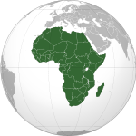
States with
limited recognitionDependencies Îles Éparses (France) · Saint Helena, Ascension and Tristan da Cunha (United Kingdom)Unclear sovereignty Former German colonies and protectorates Colonies AfricaWituland · German East Africa (Tanganyika · Rwanda · Burundi · Kionga Triangle) · Togoland · German South-West Africa (Namibia) · German West Africa (Kamerun · Neukamerun)PacificNorth AmericaGerman Caribbean

Concessions ChinaUnrecognised Antarctica Geographic locale
South Atlantic Peace and Cooperation Zone Members Angola • Argentina • Benin • Brazil • Cameroon • Cape Verde • Republic of the Congo • Democratic Republic of the Congo • Côte d'Ivoire • Equatorial Guinea • Gabon • The Gambia • Ghana • Guinea • Guinea-Bissau • Liberia • Namibia • Nigeria • São Tomé and Príncipe • Senegal • Sierra Leone • South Africa • Togo • UruguayMinisterial Meetings 2nd (1993) · 3rd (1994) · 4th (1996) · 5th (1998) · 6th (2007)Southern African Development Community Member states Angola · Botswana · Democratic Republic of the Congo · Lesotho · Madagascar · Malawi · Mauritius · Mozambique · Namibia · Seychelles · South Africa · Swaziland · Tanzania · Zambia · ZimbabweLeaders Chairpersons: Levy Mwanawasa · Kgalema Motlanthe
Secretaries-General: Kaire Mbuende · Prega Ramsamy · Tomaz SalomãoSee also Member states of the African Union (AU) - Algeria
- Angola
- Benin
- Botswana
- Burkina Faso
- Burundi
- Cameroon
- Cape Verde
- Central African Republic
- Chad
- Comoros
- Democratic Republic of the Congo
- Republic of the Congo
- Côte d'Ivoire
- Djibouti
- Egypt
- Equatorial Guinea
- Eritrea
- Ethiopia
- Gabon
- The Gambia
- Ghana
- Guinea
- Guinea-Bissau
- Kenya
- Lesotho
- Liberia
- Libya
- Madagascar
- Malawi
- Mali
- Mauritania
- Mauritius
- Mozambique
- Namibia
- Niger
- Nigeria
- Rwanda
- Sahrawi Arab Democratic Republic
- São Tomé and Príncipe
- Senegal
- Seychelles
- Sierra Leone
- Somalia
- South Africa
- South Sudan
- Sudan
- Swaziland
- Tanzania
- Togo
- Tunisia
- Uganda
- Zambia
- Zimbabwe
Languages Mande Atlantic Savanna (other branches) Benue–Congo
CAR = Central African Republic • DRC = Democratic Republic of the CongoEnglish-speaking world Click on a coloured region to get related article:
Countries and territories where English is the national language or the native language of the majority.
Africa Americas Anguilla · Antigua and Barbuda · The Bahamas · Barbados · Bermuda · British Virgin Islands · Canada · Cayman Islands · Dominica · Falkland Islands · Grenada · Guyana · Jamaica · Montserrat · Saba · Saint Kitts and Nevis · Saint Lucia · Saint Vincent and the Grenadines · Sint Eustatius · Sint Maarten · South Georgia and the South Sandwich Islands · Trinidad and Tobago · Turks and Caicos Islands · United States · United States Virgin IslandsEurope Oceania Countries and territories where English is an official language, but not the majority language.
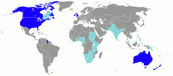
Africa Americas Asia Europe Oceania American Samoa · Christmas Island · Cocos (Keeling) Islands · Cook Islands · Fiji · Guam · Kiribati · Marshall Islands · Micronesia · Nauru · Niue · Northern Mariana Islands · Palau · Papua New Guinea · Pitcairn Islands · Samoa · Solomon Islands · Tokelau · Tuvalu · VanuatuMembers of the Commonwealth of Nations Sovereign states - Antigua and Barbuda
- Australia
- Bahamas
- Bangladesh
- Barbados
- Belize
- Botswana
- Brunei
- Cameroon
- Canada
- Cyprus
- Dominica
- Fiji (suspended)
- The Gambia
- Ghana
- Grenada
- Guyana
- India
- Jamaica
- Kenya
- Kiribati
- Lesotho
- Malawi
- Malaysia
- Maldives
- Malta
- Mauritius
- Mozambique
- Namibia
- Nauru
- New Zealand
- Nigeria
- Pakistan
- Papua New Guinea
- Rwanda
- St. Kitts and Nevis
- St. Lucia
- St. Vincent and the Grenadines
- Samoa
- Seychelles
- Sierra Leone
- Singapore
- Solomon Islands
- South Africa
- Sri Lanka
- Swaziland
- Tanzania
- Tonga
- Trinidad and Tobago
- Tuvalu
- Uganda
- United Kingdom
- Vanuatu
- Zambia
Dependencies AustraliaNew ZealandUnited Kingdom- Akrotiri and Dhekelia
- Anguilla
- Bermuda
- British Antarctic Territory
- British Indian Ocean Territory
- British Virgin Islands
- Cayman Islands
- Falkland Islands
- Gibraltar
- Guernsey
- Isle of Man
- Jersey
- Montserrat
- Pitcairn Islands
- St. Helena, Ascension and Tristan da Cunha
- South Georgia and the South Sandwich Islands
- Turks and Caicos Islands
Categories:- Namibia
- African countries
- Member states of the African Union
- Countries bordering the Atlantic Ocean
- English-speaking countries and territories
- German-speaking countries
- Liberal democracies
- Member states of the Commonwealth of Nations
- Republics
- States and territories established in 1990
- Member states of the United Nations
- Bantu countries and territories
-


Wikimedia Foundation. 2010.