- U.S. Route 49
Infobox U.S. Route
article_route=49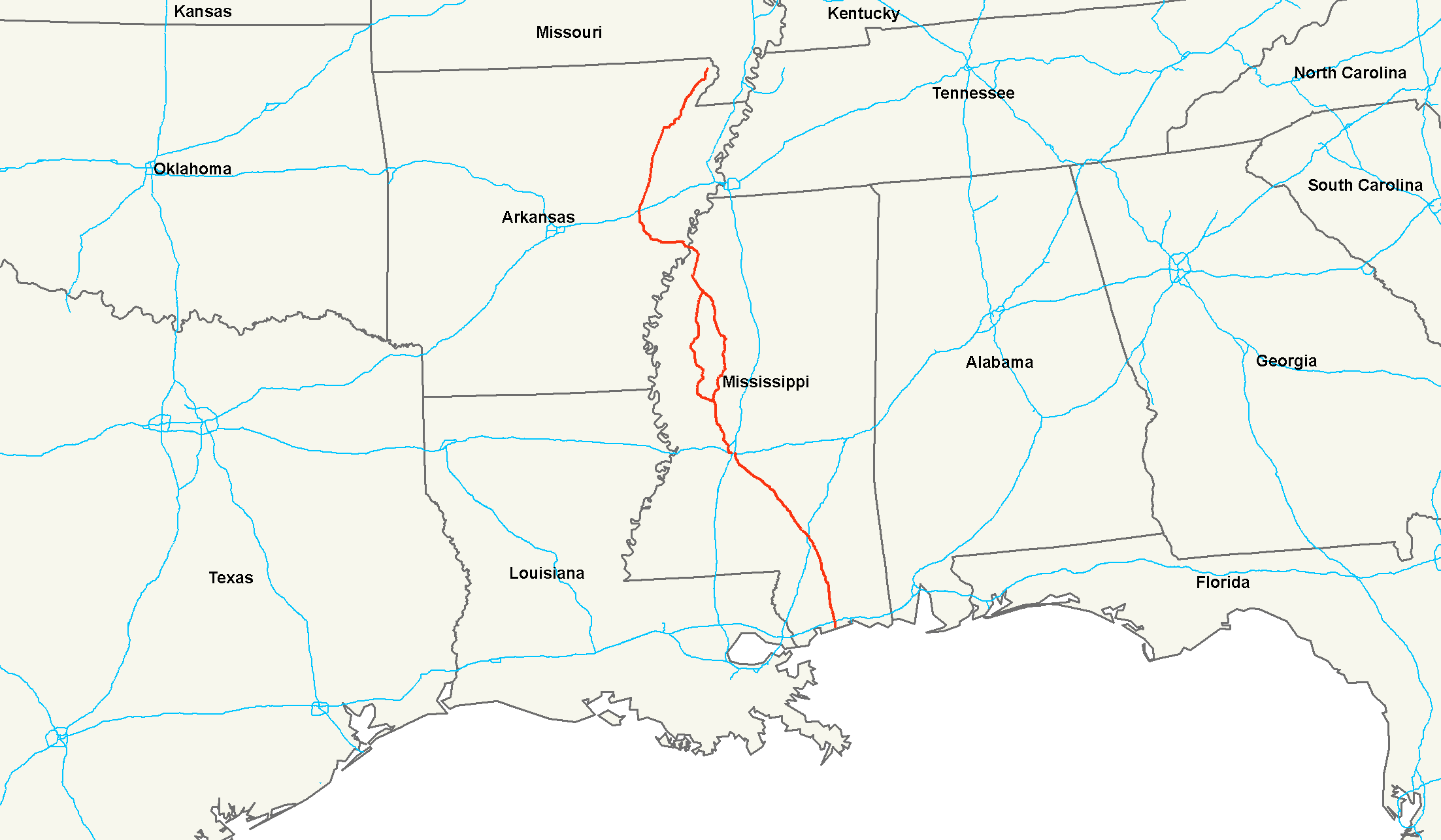
length_mi=516Droz, Robert V. [http://www.us-highways.com/usbt.htm U.S. Highways : From US 1 to (US 830)] . URL accessed 02:55, 4 July 2006 (UTC).]
length_km=830
yrcom=1926
direction_a=South
direction_b=North
from=Jct|state=MS|US|90 at Gulfport, MS
junction=Jct|state=MS|I|10 at Gulfport, MS
Jct|state=MS|I|59 at Hattiesburg, MS
Jct|state=MS|I|20|I|55 at Jackson, MS
Jct|state=AR|I|40 at Brinkley, AR
Jct|state=AR|US|63 at Jonesboro, AR
to=Jct|state=AR|US|62 at Piggott, ARU.S. Route 49 is a north-south
United States highway . The highway's northern terminus is inPiggott, Arkansas , at an intersection withU.S. Route 62 . Its southern terminus is inGulfport, Mississippi , at an intersection withU.S. Route 90 . US 49 is approximately 516 miles (830 km) in length.It was at the junction of US 49 and
U.S. Route 61 thatblues singer Robert Johnson is said to have sold hissoul to theDevil . The highway is also the subject of a song byHowlin' Wolf .Route description
Mississippi
As of
2005 , U.S. 49 splits into U.S. Route 49E and U.S. Route 49W inYazoo City, Mississippi . Continuing northward, these two highways rejoin as US 49 atTutwiler, Mississippi . US 49W (the western branch) passes through Indianola and Belzoni, while US 49E veers to the east to serve Greenwood. US 49W is considered to be the main thoroughfare through the Mississippi Delta.A recent reconstruction project completed in 2005 relocated the route of US 49W and its southern terminus in the Yazoo City area. Originally running from Silver City to Yazoo City via Midnight and Louise into the heart of Yazoo City, the route has now been shifted eastward. US 49W now runs from Silver City through the small town of Carter to the northern part of Yazoo City, where the highway meets US 49E and becomes US 49 again, cutting more than 10 miles off the old route. The original route is now numbered
Mississippi Highway 149 and is paired withMississippi Highway 16 .U.S. Highway 49 in Mississippi is a designated hurricane evacuation route. It is four-laned and divided from the Gulf Coast to the intersection with U.S. Highway 82 in Indianola.
;Legal definition The Mississippi section of U.S. 49 and the routes of U.S. 49E and 49W are defined at Mississippi Code Annotated § 65-3-3.
Arkansas
US 49 crosses the Mississippi River just south of
Helena-West Helena , in Phillips County, Arkansas and proceeds northwest into Monroe County and then north thru Woodruff, Cross and Poinsett Counties to Jonesboro, in Craighead County. From there it runs northeast thru Greene County to Piggott in Clay County, ending just north of there at US 62. The Arkansas portion of US 49 is mainly two-lane undivided.ee also
Related Routes
*
Mississippi Highway 149 Bannered routes
*U.S. Route 49 Business in
Brookland, Arkansas
*U.S. Route 49 Business inHelena-West Helena, Arkansas
*U.S. Route 49 Business inJonesboro, Arkansas (decommissioned)
*U.S. Route 49 Business inParagould, Arkansas
*U.S. Route 49E Business inGreenwood, Mississippi (decommissioned)
*U.S. Route 49 Business inHattiesburg, Mississippi (decommissioned)References
###@@@KEYEND@@@###
Wikimedia Foundation. 2010.