- Woolloongabba, Queensland
-
Woolloongabba
Brisbane, Queensland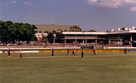
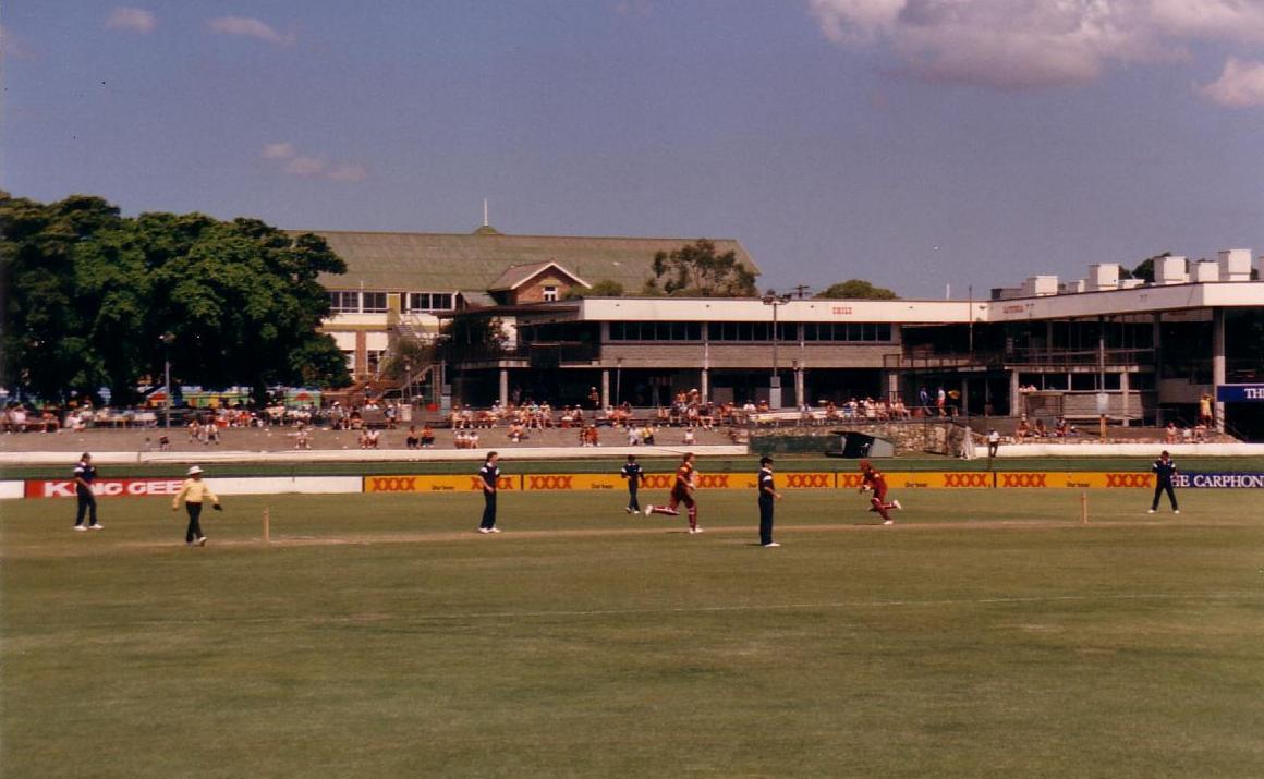
Queensland versus Victoria in a one-day cricket match at the Brisbane Cricket Ground (The Gabba), during the mid-1980sPopulation: 3,832 (2004) [1] Postcode: 4102 Coordinates: 27°29′08″S 153°01′45″E / 27.4856°S 153.0291°ECoordinates: 27°29′08″S 153°01′45″E / 27.4856°S 153.0291°E Area: 2.4 km² (0.9 sq mi) Location: 4 km (2 mi) from Brisbane LGA: City of Brisbane,
East Brisbane WardState District: South Brisbane Federal Division: Griffith Suburbs around Woolloongabba: West End Brisbane City Kangaroo Point Highgate Hill Woolloongabba East Brisbane Dutton Park Annerley Coorparoo Woolloongabba is an inner suburb of Brisbane, Australia located 4 km south of the Brisbane CBD. Experts are divided regarding the Aboriginal meaning of the name, preferring either 'whirling waters' (woolloon and capemm) or 'fight talk place' (woolloon and gabba).[2] The locals refer to the suburb as The Gabba.[2]
Contents
History
Because the area was low-lying and swampy, it was known as the One Mile Swamp. Although this name appears to be unofficial, it was in common use until the early 1890s.[3]
The suburb has a significant link to the history of transport in Brisbane. Between 1884 and 1969 the main railway locomotive depot for lines south of the Brisbane River was beside Stanley St. It was reached via a line that ran beside Stanley St, then crossing it, Logan Road and Ipswich Road to the main line at Dutton Park. By the 1960s services from the depot were causing significant delays to traffic as they crossed these three major roads.
The suburb was served by horse-drawn trams from 1885 to 1897, which were replaced by electric trams, which in turn ceased operation on 13 April 1969. All but one of Brisbane's trolleybus routes traversed the suburb, from 1953 to 1969. The Gabba Fiveways (the intersection of Stanley St, Main St, Logan Rd and Ipswich Rd) was a complex junction with tram and railway lines, and tram and trolleybus overhead. Trams were controlled by a signalman, who operated the points (or switches) from a signal cabin near the eastern side of the junction. Trains were escorted across the junction by a flagman. Curiously, the Queensland Railways always referred to the branch line as the Wooloongabba Branch, i.e. only one 'l'.[4]
From 1927 until 1969 the largest of the Brisbane City Council's tram depots was on Ipswich Road, opposite the Princess Alexandra Hospital. It was also used by the council's buses.
Attractions
 Main entrance to the Princess Alexandra Hospital
The suburb is home to the Brisbane Cricket Ground (known as "The Gabba") and the Princess Alexandra Hospital. Woolloongabba has many apartment buildings due to river views, and the suburbs proximity to the Brisbane central business district and South Bank Parklands. The Norman Hotel is a local landmark that has served customers since 1890.[5]
Demographics
In 2006, Woolloongabba had 39.4% of residents born overseas and 30.0% of residents speaking a language other than English. The most common languages other than English spoken at home were Vietnamese 2.3%, Cantonese 1.6%, Greek 1.6%, Mandarin 1.5% and Italian 1.3%.[6]
Transport
 The Pacific Motorway in Woolloongabba
Park Road railway station and Mater Hill and Woolloongabba Busway Station provide access to public transport. The Pacific Motorway cuts through the suburb with an exit south into Vulture Street and a Stanley Street exit for vehicles heading north.
References
- ^ ABS Statistics
- ^ a b Our Brisbane History
- ^ "A SOUTH BRISBANE REMINISCENCE.". The Brisbane Courier (Qld. : 1864-1933) (Qld.: National Library of Australia): p. 3. 16 February 1907. http://nla.gov.au/nla.news-article19504500. Retrieved 6 March 2011.
- ^ The Wooloongabba Branch Milne, Rod Australian Railway History, August, 2004 pp283-301
- ^ Tony Moore (5 June 2010). "Hotel with a past". Brisbane Times (Fairfax Media). http://www.brisbanetimes.com.au/queensland/hotel-with-a-past-20090605-bybu.html. Retrieved 10 July 2010.
- ^ 2006 Census QuickStats: Woolloongabba (Statistical Local Area)
Sources
- Clark, H. and Keenan D6, "Brisbane Tramways - The Last Decade", Transit Press, 1977 (Reprinted 1985). ISBN 0-909338-01-9
- Cole J., "Shaping a City: Greater Brisbane 1925-1985", Brisbane 1984
- Deskins R., Hyde P. and Struble C., "Slow at Frog - A Short History of the Brisbane Trolleybus System", Brisbane Tramway Museum Society, 2006. ISBN 0-9597322-2-5
- Kerr J. and Armstrong J., "Destination South Brisbane", Australian Railway Historical Society, second edition 1984. ISBN 0-909937-09-5
External links
- University of Queensland: Queensland Places: Woolloongabba
- Boggo Road Gaol Historical Society
- Friends of South Brisbane Cemetery
Categories:- Suburbs of Brisbane
- Australian Aboriginal placenames


Wikimedia Foundation. 2010.