- Mainpuri district
-
This article is about the district. For its eponymous headquarters, see Mainpuri.
Mainpuri district
मैनपुरी ज़िला
میںپوری ضلع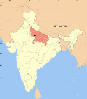
Location of Mainpuri district in Uttar PradeshState Uttar Pradesh,  India
IndiaAdministrative division Agra Headquarters Mainpuri Area 2,745 km2 (1,060 sq mi) Population 1,311,492 (1991) Literacy 66.51 per cent[1] Tehsils 3 Lok Sabha Constituencies Mainpuri Official website Mainpuri district (Urdu: मैनपुरी ज़िला, Urdu: میںپوری ضلع) is one of the districts of Uttar Pradesh state of India, and Mainpuri town is the district headquarters. Mainpuri district is a part of Agra division.
Demographics
According to the 2011 census Mainpuri district has a population of 1,847,194,[2] roughly equal to the nation of Kosovo[3] or the US state of West Virginia.[4] This gives it a ranking of 255th in India (out of a total of 640).[2] The district has a population density of 670 inhabitants per square kilometre (1,700 /sq mi) .[2] Its population growth rate over the decade 2001-2011 was 15.69 %.[2] Mainpuri has a sex ratio of 876 females for every 1000 males,[2] and a literacy rate of 78.26 %.[2]
References
- ^ "District-specific Literates and Literacy Rates, 2001". Registrar General, India, Ministry of Home Affairs. http://www.educationforallinindia.com/page157.html. Retrieved 2010-10-10.
- ^ a b c d e f "District Census 2011". Census2011.co.in. 2011. http://www.census2011.co.in/district.php. Retrieved 2011-09-30.
- ^ US Directorate of Intelligence. "Country Comparison:Population". https://www.cia.gov/library/publications/the-world-factbook/rankorder/2119rank.html. Retrieved 2011-10-01. "Kosovo 1,825,632 July 2011 est."
- ^ "2010 Resident Population Data". U. S. Census Bureau. http://2010.census.gov/2010census/data/apportionment-pop-text.php. Retrieved 2011-09-30. " West Virginia 1,852,994"

Etah district Farrukhabad district Firozabad district 
Kannauj district  Mainpuri district

Etawah district Cities and towns in Mainpuri district Mainpuri Cities and towns
in other districtsAgra · Aligarh · Allahabad · Ambedkar Nagar · Auraiya · Azamgarh · Badaun · Bagpat · Bahraich · Ballia · Balrampur · Banda · Barabanki · Bareilly · Basti · Bhimnagar · Bijnor · Bulandshahr · Chandauli · Chitrakoot · Deoria · Etah · Etawah · Faizabad · Farrukhabad · Fatehpur · Firozabad · Gautam Buddha Nagar · Ghaziabad · Ghazipur · Gonda · Gorakhpur · Hamirpur · Hardoi · Jalaun · Jaunpur · Jhansi · Jyotiba Phule Nagar · Kannauj · Kanpur Nagar · Kanshi Ram Nagar · Kaushambi · Kushinagar · Lakhimpur Kheri · Lalitpur · Lucknow · Mahamaya Nagar · Maharajganj · Mahoba · Mathura · Mau · Meerut · Mirzapur · Moradabad · Muzaffarnagar · Panchsheel Nagar · Pilibhit · Prabuddhanagar · Pratapgarh · Raebareli · Ramabai Nagar · Rampur · Saharanpur · Sant Kabir Nagar · Sant Ravidas Nagar · Shahjahanpur · Shravasti · Siddharthnagar · Sitapur · Sonbhadra · Sultanpur · Unnao · Varanasi
Divisions and Districts of Uttar Pradesh, India Agra division Aligarh division Aligarh · Etah · Mahamaya Nagar · Kanshi Ram Nagar
Allahabad division Azamgarh division Bareilly division Badaun · Bareilly · Pilibhit · Shahjahanpur
Basti division Chitrakoot division Banda · Chitrakoot · Hamirpur · Mahoba
Devipatan division Faizabad division Gorakhpur division Deoria · Gorakhpur · Kushinagar · Maharajganj
Jhansi division Kanpur division Auraiya · Etawah · Farrukhabad · Kannauj · Kanpur Nagar · Ramabai Nagar
Lucknow division Meerut division Bagpat · Bulandshahr · Gautam Buddha Nagar · Ghaziabad · Meerut · Panchsheel Nagar
Mirzapur division Moradabad division Bhimnagar · Bijnor · Jyotiba Phule Nagar · Moradabad · Rampur
Saharanpur division Prabuddhanagar · Muzaffarnagar · Saharanpur
Varanasi division Agra division topics General Mythology, history Places of tourist interest - Taj Mahal
- Agra Fort • Fatehpur Sikri
- Buland Darwaza
- Tomb of Akbar the Great
- I'timād-ud-Daulah's Tomb
- Chini Ka Rauza
- Tomb of Mariam Zamani
- Gyarah Sidi
- Jama Masjid
- Moti Masjid
- Mankameshwar Temple
- Guru ka Tal
- Ram Bagh
- Mehtab Bagh
- Paliwal Park
- Taj Mahotsav
- Tourist attractions in Agra
- Kesava Deo Temple
- Banke Bihari Temple
- Krishna Balaram Mandir
Districts Rivers, dams, lakes, canals - Yamuna
- Keetham Lake
- Agra Canal
Languages, people - Hindi
- Braj Bhasa
- Hindi-Urdu
- Khariboli
- Standard Hindi
- Urdu
- Jatav
Transport Lok Sabha constituencies See also - Agra district topics
- Cities and towns in Firozabad district
- Cities and towns in Mainpuri district
- Cities and towns in Mathura district
- Villages in Agra district
- Villages in Firozabad district
- Villages in Mathura district
- People from Agra
- People from Firozabad
- People from Mainpuri
- People from Mathura
Other Divisions - Aligarh
- Allahabad
- Azamgarh
- Bareilly
- Basti
- Chitrakoot
- Devipatan
- Faizabad
- Gorakhpur
- Jhansi
- Kanpur
- Lucknow
- Meerut
- Mirzapur
- Moradabad
- Saharanpur
- Varanasi
Coordinates: 27°10′N 79°00′E / 27.167°N 79°E
Categories:- Districts of Uttar Pradesh
- Agra division
- Mainpuri district
- Agra division geography stubs

Wikimedia Foundation. 2010.