- Prince George, British Columbia
Infobox Settlement
official_name = Prince George, British Columbia
other_name =
native_name =
nickname =
settlement_type =
motto =
imagesize =
image_caption =
imagesize =
image_caption =
flag_size =
image_
seal_size =
image_shield =
shield_size =Pgcoatofarms.png
citylogo_size =
mapsize =
map_caption =
mapsize1 =
map_caption1 =
image_dot_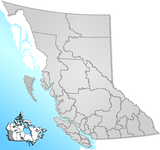
dot_mapsize =
dot_map_caption =Location of Prince George within the Fraser-Fort George District in British Columbia
dot_x = 103|dot_y = 89
subdivision_type = Country
subdivision_name = Canada
subdivision_type1 = Province
subdivision_name1 =British Columbia
subdivision_type2 = Regional District
subdivision_name2 = Fraser-Fort George
subdivision_type3 =
subdivision_name3 =
subdivision_type4 =
subdivision_name4 =
government_footnotes =
government_type =
leader_title =Mayor
leader_name =Colin Kinsley
leader_title1 = Governing body
leader_name1 =Prince George City Council
leader_title2 =MPs
leader_name2 =Dick Harris Jay Hill
leader_title3 =MLAs
leader_name3 =Shirley Bond Pat Bell John Rustad
leader_title4 =
leader_name4 =
established_title = Established
established_date = 1807
established_title2 = Incorporated
established_date2 = March 6, 1915
established_title3 =
established_date3 =
area_magnitude =
unit_pref =
area_footnotes =
area_total_km2 = 316
area_land_km2 =
area_water_km2 =
area_total_sq_mi =
area_land_sq_mi =
area_water_sq_mi =
area_water_percent =
area_urban_km2 =
area_urban_sq_mi =
area_metro_km2 =
area_metro_sq_mi =
population_as_of =2006
population_footnotes =
population_note =
population_total = 70,981
population_density_km2 = 229.1
population_density_sq_mi =
population_metro =
population_density_metro_km2 =
population_density_metro_sq_mi =
population_urban =
population_density_urban_km2 =
population_density_urban_sq_mi =
population_blank1_title =
population_blank1 =
population_density_blank1_km2 = |population_density_blank1_sq_mi =
timezone = PST
utc_offset = −8
timezone_DST = PDT
utc_offset_DST = −7
latd= |latm= |lats= |latNS=
longd= |longm= |longs= |longEW=
elevation_footnotes =
elevation_m = 575
elevation_ft =
postal_code_type = Postal code span
postal_code =V2K to V2N
area_code =250
blank_name =
blank_info =
blank1_name =
blank1_info =
website = [http://www.city.pg.bc.ca/ City of Prince George]
footnotes =Prince George, with a population of 70,981 (census agglomeration of 83,225),
Statistics Canada 2006 Census (March 29, 2007) [http://www12.statcan.ca/english/census06/data/profiles/community/Details/Page.cfm?Lang=E&Geo1=CSD&Code1=5953023&Geo2=PR&Code2=59&Data=Count&SearchText=prince%20george&SearchType=Begins&SearchPR=01&B1=All&Custom=Calgary 2006 Community Profile] . Retrieved on 29 March 2007] is the largest city in northernBritish Columbia and is known as "BC's Northern Capital". Situated at the confluence of the Fraser and Nechako Rivers, and the crossroads of Highway 16 and Highway 97, the city plays an important role in the province's economy and culture.History
The origins of Prince George can be traced to the
North West Company fur trading post of Fort George, which was established in 1807 by Simon Fraser and named in honour of King George III. [Runnalls (1946:23)] The post was centred in the centuries-old homeland of theLheidli T'enneh First Nation, whose very name means "people of the confluence".1800s
[
Hudson's Bay Company post at Fort George (1880)] Throughout the 1800s Fort George remained unchanged, whileFort St. James reigned as the main trading post and capital of New Caledonia. Even during theCariboo Gold Rush , Fort George was isolated, although Quesnel prospered as theCariboo Road was built to its doorstep, making it the main staging area for the miners going to the goldfields atBarkerville . Then, when the Collins Overland Telegraph Trail was built in 1865-67, it bypassed Fort George, following the Blackwater Trail from Quesnel and continuing northwest towards Hazelton.Grand Trunk Pacific Railway
Finally in 1903, Fort George's fortune began to change when it was announced that the
Grand Trunk Pacific Railway (laterCN Rail ) would pass near the fur post. In 1906, agricultural settlement began around Fort George and then in 1909, development of the town began as two rival land speculation companies built the communities ofSouth Fort George and Central Fort George. South Fort George was built on the Fraser River near theHudson's Bay Company ’s trading post and Central Fort George was built two miles (3 km) to the northwest on the Nechako River. Both communities flourished due to the marketing strategies of the land promoter for Central Fort George, George Hammond, who advertised the community all over Canada and Britain, describing Fort George in glowing terms as being the future hub of British Columbia, having mild winters and being suitable for any agricultural endeavor (except for the growing of peaches). Tenpaddle steamer sternwheelers serviced the area, coming up on the Fraser River fromSoda Creek . [Downs (1971:47-59)] Properties were sold in both of the main townsites and many others nearby, such as Birmingham, Fort Salmon, [cite book |last=Ramsey |first=Bruce |title=Ghost Towns of British Columbia|year=1963|publisher=Mitchell Press|isbn=Unknown|pages=212] Nechako Heights and Willow City. By 1913, South and Central Fort George each had a population of 1500 and were booming as thousands of rail construction workers came to town for supplies and entertainment. [West (1985:34)] Both communities believed that the Grand Trunk Pacific station and townsite would be built in their town, and both were disappointed when the railway purchased the convert|1366|acre|km2 of land in between them from the Lhiedli T'enneh instead, even thoughCharles Vance Millar , then the owner of the BC Express Company, was well into negotiations to purchase that property himself. [Christensen (1989:36)] The railway compensated Millar by giving him convert|200|acre|km2 of the property and, by 1914, when the railway was completed, there were four major communities in Fort George: South, Central,Millar Addition and the railway's townsite, Prince George, where the station was built. And, although George Hammond fought a series of bitter legal battles for a station for Central and for the right to incorporate, the railway won in the end and the City of Prince George was incorporated on 6 March 1915. The actual history of where the city's name is derived from is under dispute, but it is likely that the most obvious name of Fort George wasn't chosen because the Grand Trunk Pacific wanted to take credence away from the two rival townsites. Prince George could simply have been named after the ruling King George V or forPrince George, Duke of Kent the fourth son of King George V. [ [http://www.city.pg.bc.ca/pages/ourcity/ City of Prince George - Our City! ] ]War Years
With the onset of the
Great War in 1914, the local economy was devastated as many local men enlisted and the construction of thePacific Great Eastern Railway was halted, creating a massive drop in population, a problem that was exacerbated by the ensuingSpanish Flu epidemic of 1918. [Christensen (1989:77-79)] Prince George persevered through the 1920s and theGreat Depression of the 1930s and did not experience any significant growth untilWorld War II when an army camp for 6,000 soldiers was built at the foot of Cranbrook Hill, bringing new life to the struggling businesses and service industries. After the war, as the ravaged European cities rebuilt, the demand for lumber skyrocketed and Prince George, with its abundance ofsawmills and spruce trees, prospered. [Christensen (1989:88)] Finally, in 1952, after 40 years of construction, the Pacific Great Eastern was completed and joined with the CN line at Prince George, and with the completion of Highways 16 and 97, Prince George finally fulfilled George Hammond’s long ago promise of being the hub of British Columbia.Modern history
In 1964 the first
pulp mill , Prince George Pulp and Paper was built, followed by two more in 1966, Northwood Pulp and Intercontinental Pulp. [Christensen (1989:114)] . New schools and more housing were needed and the new subdivisions of Spruceland, Lakeland, Perry and Highglen were built. Then, in 1975, Prince George amalgamated and extended its borders to include the Hart area to the north, Pineview to the south and the old town of South Fort George to the east. In 1981, Prince George was the second largest city in British Columbia with a population of 67,559, narrowly edging Victoria out of the honor, whose population was then 64,379. [Christensen (1989:116)]Due to its low-lying location at a confluence of rivers that can freeze, Prince George has suffered flooding on many occasions. [cite news
last=Davison
first=George
title=It’s all happened before
publisher=Prince George Citizen (Letter to the Editor)
date=2008-01-09
url=http://www.princegeorgecitizen.com/index.php?option=com_content&task=view&id=111813&Itemid=264
accessdate=2008-01-11] In late 2007 anice jam formed on the Nechako River and soon grew to a length of more than 6 kilometres, causing widespread flooding in the town. Faster runoff due to devastation of nearbylodgepole pine forests by themountain pine beetle was identified as a contributing factor. A state of emergency was declared on December 11. On January 14, 2008, with the ice jam still present, the Provincial Emergency Program approved an unprecedented plan to melt the ice by piping water from a pulp mill steam plant 2.7 km to the jam area where it would be mixed with well water and poured into the river at a temperature of 15°C. In the interim an amphibious excavator was used for 10 days to move some of the ice.Costing C$400,000 to build and C$3,000 per day to run, the "Warm Water System" was completed on January 29, by which time the ice jam had grown to 25 km long. [cite news
title=Prince George considers melting ice jam with hot water
publisher=CBC News
url=http://www.cbc.ca/canada/british-columbia/story/2008/01/08/bc-icejam.html
date=2008-01-08
accessdate=2008-01-11] [cite news
title=Prince George to send warm water into river to ease ice jam
publisher=Globe and Mail
last=Atkinson
first=Cathryn
date=2008-01-15
url=http://www.theglobeandmail.com/servlet/story/LAC.20080115.BCFLOOD15/TPStory/National
accessdate=2008-01-17] [cite news
title=Amphibex on its way, city hall says
publisher=Prince George Citizen
date=2008-01-15
url=http://www.princegeorgecitizen.com/index.php?option=com_content&task=view&id=112647&Itemid=597
accessdate=2008-01-17] [cite news
title=Nechako Levels Continue to Drop
publisher=250 News
date=2008-01-17
url=http://www.opinion250.com/blog/view/8107/1/nechako+levels+continue+to+drop
accessdate=2008-01-17] [cite news
title=Fire won't snuff out plans to clear ice jam
last=Atkinson
first=Cathryn
publisher=Globe and Mail
url=http://www.theglobeandmail.com/servlet/story/LAC.20080117.BCFLOOD17/TPStory/National
date=2008-01-17
accessdate=2008-01-17] [cite news
title=Prince George removes floating digger as ice jam stretches 25 km
publisher=CBC News
date=2008-01-29
accessdate=2008-01-31
url=http://www.cbc.ca/canada/british-columbia/story/2008/01/29/bc-pg-parks-floating-digger.html] [cite news
title=Part Two In Flood Efforts: The Warm Water System
last=Cyr-Whiting
first=Michelle
publisher=250 News
date=2008-01-30
accessdate=2008-01-31
url=http://www.opinion250.com/blog/view/8262/1/part+two+in+flood+efforts:+the+warm+water+system]Geography
Prince George is located in the Fraser-Fort George Regional District near the transition between the northern and southern portions of the
Rocky Mountain Trench . Prince George proper contains several areas: South Fort George, the Hart, the residential and light industrial neighbourhoods north of theNechako River ; College Heights, the western part of the city used mostly for residence, and the Bowl, the valley that includes most of the city and the downtown. There are also a number of outlying areas that are also part of Prince George. Prince George encompasses three provincial electoral districts:Prince George North ;Prince George-Mount Robson , and;Prince George-Omineca . The cutbanks of the Nechako River are Prince George's interesting geological feature.Local wild edible fruit include bunchberries, rose hips, blueberries, huckleberries, cranberries, chokecherries, strawberries, raspberries, saskatoons, currants, gooseberries, and soapberries (from which "
Indian ice-cream " is made).Morel mushroom s are also native to this area.Demographics
style="width: 150px" |Conservative
style="width: 90px" |Dick Harris
align="right"|7452
style="width: 65px" align="right"|41%
style="width: 65px" align="right"|45%
Liberal
Simon Yu
align="right"|5005
align="right"|28%
align="right"|24%
NDP
Alfred Trudeau
align="right"|4287
align="right"|24%
align="right"|23%
Green
Alex Bracewell
align="right"|933
align="right"|5.2%
align="right"|5.5%
Christian Heritage
Chris Kempling
align="right"|133
align="right"|0.7%
align="right"|1.2%
Canadian Action
Bev Collins
align="right"|117
align="right"|0.7%
align="right"|0.6%
style="width: 160px"|First Peoples
Don Roberts
align="right"|40
align="right"|0.2%
align="right"|0.2%
Marxist-Leninist
Carol Lee Chapman
align="right"|35
align="right"|0.2%
align="right"|0.2%Election city polls FPTP end
votes=18002
locale%=57%
riding%=60%
style="width: 150px" |Conservative
style="width: 90px" |Jay Hill
align="right"|4441
style="width: 65px" align="right"|46%
style="width: 65px" align="right"|60%
NDP
Malcolm Crockett
align="right"|2170
align="right"|23%
align="right"|17%
Liberal
Nathan Bauder
align="right"|2120
align="right"|22%
align="right"|16%
Green
Hilary Crowley
align="right"|748
align="right"|7.8%
align="right"|6.4%
Independent
Donna Young
align="right"|76
align="right"|0.8%
align="right"|0.9%Election city polls FPTP end
votes=9575
locale%=56%
riding%=53%Bibliography
*
*
*
* cite book|last=Poser|first=William|title=Lheidli T'enneh Hubughunek (Lheidli T'enneh Carrier Dictionary)|year=1999|publisher=Lheidli T'enneh|location=Prince George
*cite book|last=Runnalls|first=Reverend Francis Edwin|title = A History of Prince George|year=1946|publisher=the author|location=Prince George
*
*
*ee also
*
Simon Fraser (explorer)
* Weather radar in Prince George
* Monarchy in British ColumbiaReferences
External links
* [http://www.city.pg.bc.ca City of Prince George homepage]
* [http://www.downtownpg.com/ Downtown Prince George]
* [http://www.sd57.bc.ca/ School District 57]
* [http://www.pg-x.com Prince George Exhibition]Canadian City Geographic Location (8-way)
Centre = Prince George
Northwest = Fort St. James
North = Mackenzie
Northeast = Chetwynd
East = McBride
Southeast = Barkerville
South = Quesnel
Southwest =Finger-Tatuk Provincial Park
West = Vanderhoof

Wikimedia Foundation. 2010.