- Oneida County Airport
-
Oneida County Airport 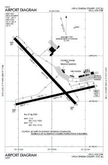
FAA diagram of Oneida County Airport IATA: UCA – ICAO: KUCA – FAA LID: UCA Summary Airport type Public Owner Oneida County Serves Utica, New York Location Whitestown, New York Elevation AMSL 742 ft / 226 m Coordinates 43°08′42″N 075°23′02″W / 43.145°N 75.38389°W Runways Direction Length Surface ft m 9/27 5,399 1,646 Asphalt 15/33 6,002 1,829 Asphalt Source: Federal Aviation Administration[1] Oneida County Airport (IATA: UCA, ICAO: KUCA, FAA LID: UCA) was a public airport located in the Town of Whitestown in Oneida County, New York,[2][3] six miles (10 km) northwest of the central business district of Utica. The airport covered 1,800 acres (7.3 km2) and had two runways.[1]
Oneida County closed the airport in January 2007 and transferred operations to Griffiss International Airport, (formerly Griffiss Air Force Base) located about five miles (8 km) to the north in Rome, New York.
As per Federal Aviation Administration records, the airport had 2,122 passenger boardings (enplanements) in calendar year 2004 and 1,951 enplanements in 2005.[4] According to the FAA's National Plan of Integrated Airport Systems for 2007–2011, Oneida County was classified as a general aviation airport.[5]
History
Mohawk Airlines in the 1960s and Empire Airlines in the 1980s each had hubs at UCA. Both would eventually become part of USAir, which maintained a presence and several facilities at UCA. In 1995, USAir ended its jet service at UCA, and closed its heavy maintenance base and reservations center.
UCA has not had commercial service since Continental Connection carrier CommutAir ended service on June 30, 2002. In its final years, UCA had been receiving its service though the EAS program; declining ridership led the required subsidy to breach the $200 per passenger statutory cap.
Service was transferred to nearby Griffiss International Airport following the closure of Oneida.
References
- ^ a b FAA Airport Master Record for UCA (Form 5010 PDF)
- ^ Oneida County Airport (official site). Oneida County. January 27, 2004. Retrieved on January 21, 2010.
- ^ "Zoning Map." Town of Whitestown. Retrieved on January 21, 2010.
- ^ FAA Passenger Boarding and All-Cargo Data: 2005
- ^ FAA National Plan of Integrated Airport Systems: 2007-2011
External links
- Griffo Names Panel to Outline Future For Oneida County Airport, 2005-04-07
- New York State DOT Airport DiagramPDF
- Resources for this airport:
- AirNav airport information for KUCA
- ASN accident history for UCA
- FlightAware airport information and live flight tracker
- NOAA/NWS latest weather observations
- SkyVector aeronautical chart, Terminal Procedures for KUCA
Categories:- Defunct airports in New York
- Buildings and structures in Oneida County, New York
- Northeastern United States airport stubs
- New York building and structure stubs

Wikimedia Foundation. 2010.