- Malad
-
For the city in the US state of Idaho, see Malad City, Idaho.
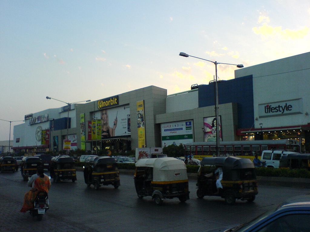
Malad — suburb — Inorbit Mall, Malad
Coordinates 19°11′10″N 72°50′55″E / 19.186111°N 72.848611°ECoordinates: 19°11′10″N 72°50′55″E / 19.186111°N 72.848611°E Country India State Maharashtra District(s) Mumbai Suburban Parliamentary constituency Mumbai North West Zone D.C.P, Zone IX Ward P/N Time zone IST (UTC+05:30) Codes-
• Pincode • 400095
Malad (Marathi: मालाड) is a suburb of Mumbai, India. It is also the name of the railway station on the Mumbai suburban railway on the Western Railway (India) railway line, located in the Malad suburb.
Contents
History
In the 19th century, the Orlem (also known as Valnai) was a hamlet of just about 12 families in Malad.[citation needed] In 1880, Fr. Joseph Maria Braz de Souza built a private chapel dedicated to our Lady of Lourdes at Orlem. In 1882, the chapel was officially declared a part of the Apostolate of Bombay and affiliated to the church of Our Lady of Assumption, Kandivali. Later, Fr. Justin built the first school, the St Anne's High School, in 1915. Through his efforts, Orlem was constituted a separate parish, in a decree dated July 2, 1916. Other traditionally ancient settlements in Malad were villages occupied by the local East-Indian Community who are known to be the original native inhabitants of Mumbai. These villages include Kharodi, Rathodi, Malwani, Marve and so on. All of these above villages are recognised as integral part of St. Anthony's Church/Parish which is way more older than the history of Our Lady of Lourdes Church/Parish. This can also be seen by noticing the ancient architectural structure of St. Anthony's Church, Malwani. Often the term 'Malwani' is mistaken to be the area which is the stretch between BMC Colony Gate No. 1 to Gate No. 8 and further extending to Mhada but factually it is only supposed to be BMC Colony which was populated recently on the outskirts of ancient Malwani area which used to have mangroves, salt-pans and Agricultural land belonging to the local east-Indians of Kharodi Village. Whereas the real Malwani Village is till date located at the place we now call as Malwani Church on Marve Road. Many families like Koli, Vaity,Bhandari, Keni are old residents.[citation needed] In 1934, Bombay Talkies, the first movie company to be founded in India, was established in Malad by Himanshu Rai and Devika Rani. In 1955, St.Joseph's School was established by Ms. Bertha Pereira. Originally, much of the land in the west was owned by East Indian Catholic families and was used primarily for agriculture. In the 1970s many of them sold their lands to real estate developers. One of the school famous since 18th century in middle of Malwani village area which is located in between malwani colony & Marve named St. Anthonys High School. The area is located with all fisherman and East Indian community.[citation needed]
Demographics
The approximate population is 1,561,938 with an additional day-time floating population of 100,000.[citation needed] Malad, in keeping with the diverse nature of Mumbai, has a mix of people from all over India. The original Inhabitants are the Koli community, which thrived in pockets, such as Marve, Malwani, Madh and Manori Island. Apart from the Koli community the suburban town has a large East Indian Community. Following Christianity's arrival large numbers of the residents were converted to Christianity. During the late 1960s influxes of immigrants, mainly South Indians, Gujaratis and Mainland Marathis diversified the demographics of the region. The 80's and 90's saw major population growth. The Malwani Colony supposedly is home to one of Mumbai's largest Muslim populations. It was heavily polarised during the 1992 riots. The latest immigrants have been from UP, Bihar and many from Orissa and W. Bengal.
Localities
Major localities in Malad are Chincholi Bunder Road, Mind Space complex, Marve Road (INS Hamla - Navy catering training establishment), Liberty Garden, Navy Nagar, Orlem, Jankalyan Nagar, Malwani Village, Kharodi Village and so on. Sunder Nagar is on border of Malad and Goregaon. Some of the major localities in Malad (West) are Chincholi Village, Orlem (originally called Valnai in Marathi) and Evershine Nagar. Chincholi Bunder Road or Chincholi Village is the oldest natives of Malad since 1845. There, the fisherman (Koli community) have had their homes, until now.
The whole of Malad Creek, where now Mindspace (BPO industrial park), Land of Malad Creek belonging to the FE Dinshaw Trust given to the C.L. Raheja Group of Companies (Raheja Corp) on lease for development- In 2008 legal dispute between the two parties due to end use not as per original agreement. The Malad Creek was used by this Koli community for fishing. The Malad Creek used to be a nice and beautiful place, but all ruined due to modern construction. In summer and monsoon lots of foreign birds visit the creek.[citation needed]
The Chincholi Bunder Road has 6 Schools (St. Mary High School, Infant Jesus High School, Municipal School, Balaji International School, Dr. S .Radhakrishna Vidyalaya, D.G. Khetan International School) and 1 College (Smt. K.G. Mittal College). 3 Malls (Inorbit, Evershine Mall , Infinity ). Chincholi Bunder Road is on west of Swami Vivekanand Road (S.V. Road), it connect S.V. Road and Link Road and ends up at the Malad Creek.
Adjacent to Chincholi Bunder there is a market called Somwar (Monday) Bazaar, located in the Chincholi area. As the name suggests, this bazaar is active only on Mondays. The locality is named after the Somwar bazaar. Unique products are sold at this bazaar by sellers from various parts of the state of Maharashtra. Pathanwadi is a locality in Malad East that is on the other side of the National Highway No. 8, away from Malad Railway Station. The Brihanmumbai Electric Supply and Transport undertaking provides a bus service to the station with a mini-bus because of the narrow road. Pathanwadi is famous for its multiple Masjids. To the west, bordering it, is Dindoshi Nagar, a residential locality. Recently these localities have seen major infrastructure development, for example Dindoshi Fire Station and many malls such as the Oberoi Mall and Shagun Mall, to name a few. Sunder Nagar is a locality in Malad that lies along the west side of Swami Vivekanand Road. The area was built up in the 1970s and is primarily composed of many housing complexes, typically two bedroom apartments. There are two schools, (Umedbhai Patel English School,and Dr. S. Radhakrishnan Vidyalaya), one college (Prahldrai Dalmia's Lions College) and a large garden in the limited area. The housing blocks are typically named alphabetically, starting from A up to V. It borders Mandlik Nagar on the North and some defunct factories on the south.
Malad East has many popular housing colonies like Raheja Township, Govind Nagar, Mahindra Nagar,squaters colony and Pratap Nagar. Mahindra Nagar is a clean and green society, which was nominated as the second most pollution-free area in Mumbai by Eureka Forbes after Aarey Colony in Goregaon. Malad East has Daftary Road, which runs across from station on East up till Mumbai-Ahmedabad highway and this is one of the most congested roads in Mumbai's suburbs. Malad East also boasts of quite a few old running schools such as Fatimadevi, Children's Academy, Nutan Vidyalay, Utkarsh Mandir, Velani Vidyalaya High School, St. Francis English Medium High School, High Sanskar Vidyalay. Fatimadevi English School established in 1953 is, one of the oldest educational institution in the Malad Suburb of Mumbai. Lots of great minds passed out from this institution. Children's Academy school has track record of maintaining 100% passing success at SSC board results and is also among the Top 10 best schools in the north - Hindustan Times.[1]
 Residential area
Malad is fast becoming IT HUB with many BPOs opening shop. There are at least 7 malls and largest of them is Infinity Mall.[citation needed] There is a rare holy relic of Mother Mary that is on display at St Peter's Jacobite Church, also called the Soonoro Church at Mith Chowky near Orlem. The relic, a piece of fabric believed to be part of the girdle worn by Mother Mary, is on view between September 1 and 8. The relic draw thousands of worshippers. The relic, also called a Soonoro or belt, was brought to Kerala from Syria in 1982 by the head of the Orthodox faith, Ignatius Zakka I. The Malad relic is a piece of that Soonoro.[citation needed]
The main artery of Malad Western side is the Marve Road that starts from SV road is intersected by the linking road and finishes up to Madh Island Lands End. From this end you just need to cross by Ferry to reach Versova in minutes. You can find famous places that are on this road like the beautiful Laxmi Narayan Temple built by Dongre Maharaj, Orlem Church, D'souza Market porpularly known as Orlem Market, Link Road, Malvani intersection, Mith Chowki, St. Anthony's Church, INS Hamla of Navy for Training in Bridge building and Radar, this place is also called as an eye of Mumbai, Marve Beach (from here you can ferry to Essel World or Manori Beach), Erangal Beach (famous for film shootings), a 15th Century old Portuguese Church, 5 star Hotel 'The Resort' at Aksa Beach and Madh Island where there is a large fishing village and an old settlement of the Koli community.[citation needed]
Orlem is region of significant Catholic population, and one of the main regions of Catholic dominance in Mumbai. A few prominent schools in the region are St. Anne's High School, Carmel of St. Joseph's High School (a girl's school run by nuns of the convent), St. Joseph's High School, Shree Nutan Vidya Mandir English High School, Children's Academy (Malad East), Ryan's International School and Fatima Devi (Malad East).
Malad also has a significant Sikh population. Most Sikh Families live in the Evershine nagar, second largest population is in Malvani and Jankalyan nagar. There are Gurdwara's(Sikh Temple) at Malad (e), Evershine Nagar and Malvani no 1. Free langar(Meal) is served on Sunday mornings at the Gurdwara's.
The Malvani locality holds a significant Muslim population. It was the worst hit region during the 92-93 riots. It also has a church. On the north side of Malvani there is a huge industrial area called as Charkop. The people living in these areas are mostly Maharashtrians, Christians, Sikhs, Gujaratis and Marwadis. These areas are Adarsh Nagar, Jankalyan Nagar, Evershine Nagar, Orlem Areas (Lourdes Colony and Tank Lane), Mamlatdar Wadi, Liberty Garden, Ramchandra lane.
Liberty Garden is one of the oldest parks in Malad. It is open for the general public and is maintained by Brahma Kumari spiritual organisation which has its headquarters in Mount Abu in Rajasthan. Entrance to Liberty Garden is always packed by small food vendors, usually illegal encroachments. Paani Poori and Sev Poori are few of the special dishes offered by them. There are 2 schools nearby Liberty Garden, viz., Sant Tukaram Salvation English High School and Dayanand school. The famous festivals celebrated in Malad are Navratri, Diwali, Christmas and Ganpathi. SNDT women's college is located near the post office at Ramchandra lane. It offers various courses in various streams. There are regular events at this college and the ground is often leased out for marriages and parties.
Marve Road is also part of malad west. Marve road is large road. On Marve road, there is Nutan school, Great Eastern Heights, Rahul apartment etc.[citation needed] This marve road ends with two beaches Aksa , Erangal and others.[citation needed]
Beaches
The Aksa, Erangal and Marve beaches are within accessible distance from Malad. Aksa Beach, Dana Paani, Erangal Beach, Madh Island & Madh Fort, Manori Beach, Marve Beach - Ferry Service to Manori. Aksa Beach is approx 8 km from Malad Station & Madh is at 14 km. RidhiSidhi Ganesha Temple One of the main temples in Malad is the Ridhi Siddhi Ganesh Mandir. It will be only 15 minute walking distance from Malad Station near N.L.High School (Nahal Lalluchand School was founded in 1942 but was handed over by the British in 1947).[citation needed]
References
Malad Next station south:
GoregaonMumbai Suburban Railway : Western Line Next station north:
KandivaliStop No: 19 KM from starting: 29.32 Platforms: 4 Stations on the Western Line of Mumbai Suburban Railway Churchgate · Marine Lines · Charni Road · Grant Road · Mumbai Central · Mahalaxmi · Lower Parel · Elphinstone Road · Dadar · Matunga Road · Mahim Junction · Bandra · Khar Road · Santacruz · Vile Parle · Andheri · Jogeshwari · Goregaon · Malad · Kandivali · Borivali · Dahisar · Mira Road · Bhayandar · Naigaon · Vasai Road · Nala Sopara · Virar · Vaitarna · Saphale · Kelve Road · Palghar · Umroli · Boisar · Vangaon · Dahanu RoadCategories:- Railway stations in Mumbai
- Suburbs of Mumbai
-


Wikimedia Foundation. 2010.