- Datia District
-
This article is about the district. For its eponymous headquarters, see Datia.
Datia district
दतिया जिला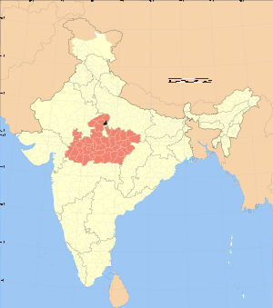
Location of Datia district in Madhya PradeshState Madhya Pradesh,  India
IndiaAdministrative division Gwalior division Headquarters Datia Area 2,038 km2 (787 sq mi) Population 627818 (2001) Official website Datia District (Hindi: दतिया जिला) is in Gwalior Division in the Indian state of Madhya Pradesh. The town of Datia is the district headquarters.
Contents
Geography
The district has an area of 2,038 km², and a population 627,818 (2001 census). The population of Datia District increased by 26% from 1981 to 1991, and by 22% from 1991 to 2001. The district has 445 villages and 3 towns, Datia, Seondha, and Bhander. Each town is the headquarters of its tehsil.[1]
Datia is bounded by the Madhya Pradesh districts of Bhind to the north, Gwalior to the west, and Shivpuri to the south, and by Jhansi District of Uttar Pradesh state to the east. The district is part of Gwalior Division.[1]
Transport
The district is traversed by the West Central Railway line between Jhansi and Gwalior.
Demographics
According to the 2011 census Datia District has a population of 786,375,[2] roughly equal to the nation of Comoros[3] or the US state of South Dakota.[4] This gives it a ranking of 487th in India (out of a total of 640).[2] The district has a population density of 292 inhabitants per square kilometre (760 /sq mi) .[2] Its population growth rate over the decade 2001-2011 was 18.4 %.[2] Datia has a sex ratio of 875 females for every 1000 males,[2] and a literacy rate of 73.5 %.[2]
Languages
Vernaculars include Bharia, a Dravidian language spoken by at least 200 000 members of the Bharia tribe and written in the Devanagari script.[5]
Culture
Datia also has some famous temples. 'Peetambra Peeth' is one such temple which attracts a lot of pilgrims, apart from Hanuman garhi. 'Purana Mahal or Datia Mahal' is one good piece of architecture, visible from the railway line passing from Gwalior to Jhansi and was built to welcome King Jahangir after his coronation but the Emperor never came, fearing he would have to give good reward to king of Datia for his help in getting the Moghul throne.[1]
References
- ^ a b c "Datia district". District Administration. http://datia.nic.in. Retrieved 2010-04-14.
- ^ a b c d e f "District Census 2011". Census2011.co.in. 2011. http://www.census2011.co.in/district.php. Retrieved 2011-09-30.
- ^ US Directorate of Intelligence. "Country Comparison:Population". https://www.cia.gov/library/publications/the-world-factbook/rankorder/2119rank.html. Retrieved 2011-10-01. "Comoros 794,683 July 2011 est."
- ^ "2010 Resident Population Data". U. S. Census Bureau. http://2010.census.gov/2010census/data/apportionment-pop-text.php. Retrieved 2011-09-30. "South Dakota 814,180"
- ^ M. Paul Lewis, ed (2009). "Bharia: A language of India". Ethnologue: Languages of the World (16th edition ed.). Dallas, Texas: SIL International. http://www.ethnologue.com/show_language.asp?code=bha. Retrieved 2011-09-28.
External links

Gwalior district Bhind district 
 Datia district

Shivpuri district Jhansi district, Uttar Pradesh Divisions & Districts of Madhya Pradesh · 
Bhopal Division: Chambal Division: Gwalior Division: Ashoknagar · Datia · Guna · Gwalior · Shivpuri
Indore Division: Jabalpur Division: Narmadapuram Division: Betul · Harda · Hoshangabad
Rewa Division: Sagar Division: Chhatarpur · Damoh · Panna · Sagar · Tikamgarh
Shahdol Division: Ujjain Division: Cities and towns in Gwalior Division Ashoknagar district Datia district Guna district Gwalior district Shivpuri district Related topics Cities and towns
in other DivisionsCategories:- Districts of Madhya Pradesh
- Datia district
- Madhya Pradesh geography stubs

Wikimedia Foundation. 2010.