- Dindori District
-
This article is about the district. For its eponymous headquarters, see Dindori.
Dindori district
दिन्डोरी जिला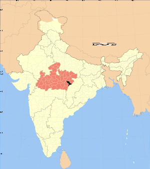
Location of Dindori district in Madhya PradeshState Madhya Pradesh,  India
IndiaAdministrative division Shahdol Headquarters Dindori, Madhya Pradesh Area 6,128 km2 (2,366 sq mi) Population 579,312 (2001) Official website Dindori District is a district of Madhya Pradesh state of central India. The town of Dindori is the district headquarters. The district is part of Shahdol Division.
Contents
Economy
In 2006 the Ministry of Panchayati Raj named Dindori one of the country's 250 most backward districts (out of a total of 640).[1] It is one of the 24 districts in Madhya Pradesh currently receiving funds from the Backward Regions Grant Fund Programme (BRGF).[1]
In dindori district, The Ghughua Fossil National Park of Madhya Pradesh is a unique destination in India, which has been blessed with a priceless treasure trove of plant fossils. Fossils belonging to 31 genera of 18 plant families have been identified.These fossils represent life as it occurred in this area some 65 million years ago.
Well-preserved fossils of woody plants,climbers,leaves,flowers,fruits and seeds have been found here. Palm fossils are particularly numerous.
Demographics
According to the 2011 census Dindori District has a population of 704,218,[2] roughly equal to the nation of Bhutan[3] or the US state of Alaska.[4] This gives it a ranking of 501st in India (out of a total of 640).[2] The district has a population density of 94 inhabitants per square kilometre (240 /sq mi) .[2] Its population growth rate over the decade 2001-2011 was 21.26 %.[2] Dindori has a sex ratio of 1004 females for every 1000 males,[2] and a literacy rate of 65.47 %.[2]
Languages
Dindori's people speak multiple languages, including: Bagheli, which has a lexical similarity of 72-91% with Hindi[5] (compared to 60% for German and English)[6] and is spoken by about 7 800 000 people in Bagelkhand.[5]
References
- ^ a b Ministry of Panchayati Raj (September 8, 2009). "A Note on the Backward Regions Grant Fund Programme". National Institute of Rural Development. http://www.nird.org.in/brgf/doc/brgf_BackgroundNote.pdf. Retrieved September 27, 2011.
- ^ a b c d e f "District Census 2011". Census2011.co.in. 2011. http://www.census2011.co.in/district.php. Retrieved 2011-09-30.
- ^ US Directorate of Intelligence. "Country Comparison:Population". https://www.cia.gov/library/publications/the-world-factbook/rankorder/2119rank.html. Retrieved 2011-10-01. "Bhutan 708,427"
- ^ "2010 Resident Population Data". U. S. Census Bureau. http://2010.census.gov/2010census/data/apportionment-pop-text.php. Retrieved 2011-09-30. " Alaska 710,231"
- ^ a b M. Paul Lewis, ed (2009). "Bagheli: A language of India". Ethnologue: Languages of the World (16th edition ed.). Dallas, Texas: SIL International. http://www.ethnologue.com/show_language.asp?code=bfy. Retrieved 2011-09-28.
- ^ M. Paul Lewis, ed (2009). "English". Ethnologue: Languages of the World (16th edition ed.). Dallas, Texas: SIL International. http://www.ethnologue.com/show_language.asp?code=eng. Retrieved 2011-09-28.
External links

Jabalpur district Umaria district Anuppur district 
 Dindori district

Mandla district Kabirdham district, Chhattisgarh Bilaspur district, Chhattisgarh Divisions & Districts of Madhya Pradesh · 
Bhopal Division: Chambal Division: Gwalior Division: Ashoknagar · Datia · Guna · Gwalior · Shivpuri
Indore Division: Jabalpur Division: Narmadapuram Division: Betul · Harda · Hoshangabad
Rewa Division: Sagar Division: Chhatarpur · Damoh · Panna · Sagar · Tikamgarh
Shahdol Division: Ujjain Division: Cities and towns in Shahdol Division Anuppur district Dindori district Shahdol district Amlai • Badra • Bangawan • Beohari • Burhar • Deori • Devhara • Dhanpuri • Dola • Dumar Kachhar • Jaisinghnagar • Kelhauri (Chachai) • Khand (Bansagar) • Pasan • ShahdolUmaria district Related topics Cities and towns
in other DivisionsCategories:- Districts of Madhya Pradesh
- Dindori district
- Madhya Pradesh geography stubs

Wikimedia Foundation. 2010.