- Mandla District
-
This article is about the district. For its eponymous headquarters, see Mandla.
Mandla district
मंडला जिला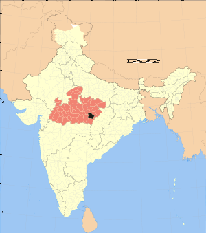
Location of Mandla district in Madhya PradeshState Madhya Pradesh,  India
IndiaAdministrative division Jabalpur Headquarters Mandla Area 8,771 km2 (3,387 sq mi) Population 779,414 (2001) Literacy 59.85 Sex ratio 1002 Tehsils 4 Lok Sabha Constituencies Mandla Assembly Seats 12 Official website Mandla District is a district of Madhya Pradesh state in central India. The town of Mandla is administrative headquarters of the district. It is part of Jabalpur Division.
The district has an area of 8771 km², and a population of 779,414. It has 9 development blocks, 4 tehsils, and 1214 villages. Much of the population are adivasis (tribespeople), including Gonds.
The district lies in the Mahakoshal region, and most of the district lies in the basin of the Narmada River.
The district consistently ranks among the 20 most backward districts in India.
Contents
Economy
In 2006 the Ministry of Panchayati Raj named Mandla one of the country's 250 most backward districts (out of a total of 640).[1] It is one of the 24 districts in Madhya Pradesh currently receiving funds from the Backward Regions Grant Fund Programme (BRGF).[1]
Demographics
According to the 2011 census Mandla District has a population of 1,053,522,[2] roughly equal to the nation of Cyprus[3] or the US state of Rhode Island.[4] This gives it a ranking of 432nd in India (out of a total of 640).[2] The district has a population density of 182 inhabitants per square kilometre (470 /sq mi) .[2] Its population growth rate over the decade 2001-2011 was 17.81 %.[2] Mandla has a sex ratio of 1005 females for every 1000 males,[2] and a literacy rate of 68.28 %.[2]
Languages
Languages spoken include Agariya, an Austro-Asiatic tongue with approximately 72 000 speakers;[5] Bagheli, which has a lexical similarity of 72-91% with Hindi[6] (compared to 60% for German and English)[7] and is spoken by about 7 800 000 people in Bagelkhand;[6] and Bharia, a Dravidian language spoken by at least 200 000 members of the Bharia tribe and written in the Devanagari script.[8]
Ecology
Much of the district is forested, and it is home to Kanha National Park, a Project Tiger sanctuary. Kanha has the largest number of tigers in India. The park has won national awards for good management and infrastructure. The park is open year round except for July and August. The district is also home to Mandla Plant Fossils National Park.
References
- ^ a b Ministry of Panchayati Raj (September 8, 2009). "A Note on the Backward Regions Grant Fund Programme". National Institute of Rural Development. http://www.nird.org.in/brgf/doc/brgf_BackgroundNote.pdf. Retrieved September 27, 2011.
- ^ a b c d e f "District Census 2011". Census2011.co.in. 2011. http://www.census2011.co.in/district.php. Retrieved 2011-09-30.
- ^ US Directorate of Intelligence. "Country Comparison:Population". https://www.cia.gov/library/publications/the-world-factbook/rankorder/2119rank.html. Retrieved 2011-10-01. "Cyprus 1,120,489 July 2011 est."
- ^ "2010 Resident Population Data". U. S. Census Bureau. http://2010.census.gov/2010census/data/apportionment-pop-text.php. Retrieved 2011-09-30. "Rhode Island 1,052,567"
- ^ M. Paul Lewis, ed (2009). "Agariya: A language of India". Ethnologue: Languages of the World (16th edition ed.). Dallas, Texas: SIL International. http://www.ethnologue.com/show_language.asp?code=agi. Retrieved 2011-09-28.
- ^ a b M. Paul Lewis, ed (2009). "Bagheli: A language of India". Ethnologue: Languages of the World (16th edition ed.). Dallas, Texas: SIL International. http://www.ethnologue.com/show_language.asp?code=bfy. Retrieved 2011-09-28.
- ^ M. Paul Lewis, ed (2009). "English". Ethnologue: Languages of the World (16th edition ed.). Dallas, Texas: SIL International. http://www.ethnologue.com/show_language.asp?code=eng. Retrieved 2011-09-28.
- ^ M. Paul Lewis, ed (2009). "Bharia: A language of India". Ethnologue: Languages of the World (16th edition ed.). Dallas, Texas: SIL International. http://www.ethnologue.com/show_language.asp?code=bha. Retrieved 2011-09-28.
External links

Jabalpur district Dindori district Seoni district 
Kabirdham district, Chhattisgarh  Mandla district

Balaghat district Divisions & Districts of Madhya Pradesh · 
Bhopal Division: Chambal Division: Gwalior Division: Ashoknagar · Datia · Guna · Gwalior · Shivpuri
Indore Division: Jabalpur Division: Narmadapuram Division: Betul · Harda · Hoshangabad
Rewa Division: Sagar Division: Chhatarpur · Damoh · Panna · Sagar · Tikamgarh
Shahdol Division: Ujjain Division: Cities and towns in Jabalpur Division Balaghat district Chhindwara district Amarwara • Ambada • Badkuhi • Barkuhi • Bhamodi • Chandameta-Butaria • Chaurai Khas • Chhindwara • Damua • Deogarh • Dighawani • Dongar Parasia • Harrai • Iklehra • Jamai • Jata Chhapar • Kali Chhapar • Lodhikheda • Mohgaon • Neuton Chikhli Kalan • Pal Chourai • Panara • Pandhurna • Patalkot • Sausar • Sethia • SirgoraJabalpur district Barela • Bhedaghat • Bilpura • Gun Carriage Factory Jabalpur • Gwarighat • Jabalpur • Jabalpur Cantonment • Majholi • Manegaon • Ordnance Factory Khamaria • Panagar • Patan • Pipariya • Shahpura • Sihora • Suhagi • Vehicle Fac. JabalpurKatni district Mandla district Narsinghpur district Seoni district Related topics Cities and towns
in other DivisionsCoordinates: 22°42′N 81°00′E / 22.7°N 81°E
Categories:- Districts of Madhya Pradesh
- Mandla district
- Madhya Pradesh geography stubs

Wikimedia Foundation. 2010.