- Metropolitan Borough of Stockport
-
For the main settlement, see Stockport.
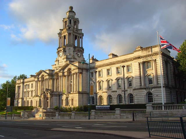
Metropolitan Borough of Stockport — Metropolitan borough — Stockport Town Hall

Coat of Arms of the Borough CouncilMotto: "Animo et Fide" "With Courage and Faith" Stockport shown within England
Coordinates: 53°24′20″N 2°09′33″W / 53.40556°N 2.15917°W Sovereign state United Kingdom Constituent country England Region North West England Ceremonial county Greater Manchester Admin HQ Stockport (Town Hall) Founded 1 April 1974 Borough status 23 November 1973 Government - Type Metropolitan borough - Governing body Stockport Metropolitan Borough Council - Mayor Cllr. Pam King (LD) - MPs: Ann Coffey (L)
Andrew Gwynne (L)
Mark Hunter (LD)
Andrew Stunell (LD)Area - Total 48.7 sq mi (126.06 km2) Elevation 256 ft (78 m) Population (2010 est.) - Total 284,600 (Ranked 34th) - Density 5,765.3/sq mi (2,226/km2) - Ethnicity
(United Kingdom 2005 estimate)94.2% White
3.1% S. Asian or mixed
1.4% Black or mixed
1.0% Chinese or otherTime zone Greenwich Mean Time (UTC+0) Postcode areas SK Area code(s) 0161 / 01457 ISO 3166-2 GB-SKP ONS code 00BS OS grid reference SJ895900 NUTS 3 UKD31 Website www.stockport.gov.uk The Metropolitan Borough of Stockport is a metropolitan borough of Greater Manchester, in north west England, centred around the town of Stockport. It has a population of about 280,600[1] and includes the outyling areas of Cheadle and Cheadle Hulme, Marple, Bredbury, Reddish and Romiley. Stockport Metropolitan Borough Council governs the borough.
Contents
History
The borough was created in 1974, under the Local Government Act 1972 from the former area of the County Borough of Stockport and from the administrative county of Cheshire the urban districts of Bredbury and Romiley, Cheadle and Gatley, Hazel Grove and Bramhall and Marple.
Stockport became a county borough in 1889 and was enlarged by gaining territory from Lancashire, including in 1906 Reddish and in 1913, the Four Heatons.[2] The Marple Urban District of Cheshire, formed in 1894, gained parts of Derbyshire in 1936 including Mellor and Ludworth from Chapel en le Frith Rural District.[3]
Prior to its creation, it was suggested that the metropolitan borough be named "Norchester", but this was rejected as "a concocted name", being beaten by "Stockport" by a vote of 16 to 5.[4]
Geography
- Adswood
- Bramhall, Bredbury, Brinnington
- Cale Green, Cheadle, Cheadle Heath, Cheadle Hulme, Compstall
- Davenport
- Edgeley
- Gatley
- Four Heatons
- Hazel Grove, Heald Green, High Lane
- Marple, Mellor
- Offerton
- Portwood
- Reddish, Romiley
- Woodford, Woodley, Woodsmoor
Governance
Parliamentary constituencies
There are four parliamentary constituencies in the Stockport Metropolitan Borough: Stockport, Cheadle, Hazel Grove, and Denton and Reddish. Stockport has been represented by Ann Coffey (Labour) since 1992. Mark Hunter (Liberal Democrats) has been MP for Cheadle since the 2005 by-election. Andrew Stunell (Liberal Democrats) has been MP for Hazel Grove since 1997. The constituency of Denton and Reddish bridges Stockport and Tameside; the current member is Andrew Gwynne (Labour).
Stockport is part of the North West England constituency in the European Parliament. North West England elects nine MEPs, as at 2008 made up of four Conservatives, three from the Labour Party, one Liberal Democrat, and one member of the United Kingdom Independence Party.[5]
Parishes
Unparished Areas
Showing former status (prior to 1974)
- Bredbury and Romiley (Urban District)
- Cheadle and Gatley (Urban District)
- Hazel Grove and Bramhall (Urban District)
- Marple (Urban District)
- Stockport (County Borough)
Council
Further information: Stockport local electionsThere are 21 electoral wards in Stockport, each with 3 councillors, giving a total of 63 councillors.
As of March 2008, the Liberal Democrats had a controlling majority on the council, having been the ruling party since 2002.[6]
Following the 2011 Local Elections no party has overall control. The Liberal Democrats remained the largest party despite losing six seats, but decided not to form a minority administration and strongly refused any possibility of a coalition with the Conservatives.[7]
Party political make-up of Stockport Council Party Seats Current Council (2008–11) 2007[8] 2008[8] 2010[8] 2011[8] Lib Dems 36 36 36 30 Labour 15 14 13 16 Conservative 9 10 8 11 Ratepayers 3 3 3 3 Demography
Stockport Compared 2001 UK Census Stockport Greater Manchester England Total population 284,528 2,514,757 49,138,831 White 95.7% 91.2% 90.9% Asian 2.1% 5.6% 4.6% Black 0.4% 1.2% 2.3% As of the 2001 UK census, the Metropolitan Borough of Stockport had a total population of 284,528.[9] Of the 120,456 households in Stockport, 38.0% were married couples living together, 30.3% were one-person households, 8.3% were co-habiting couples and 9.4% were lone parents.[10]
The population density is 2,257 /km2 (5,850 /sq mi)[11] and for every 100 females, there were 93.2 males. Of those aged 16–74 in Stockport, 25.7% had no academic qualifications, lower than 28.9% in all of England.[9] 5.0% of Stockport’s residents were born outside the United Kingdom, significantly lower than the national average of 9.2%.[12] The largest minority group was recorded as Asian, at 2.1 of the population.[13]
Population change
The table below details the population change since 1801, including the percentage change since the last available census data. Although the Metropolitan Borough of Stockport has only existed 1974, figures have been generated by combining data from the towns, villages, and civil parishes that would later be constituent parts of the borough.
Population growth in Stockport since 1801 Year 1801 1811 1821 1831 1841 1851 1861 1871 1881 1891 1901 1911 1921 1931 1941 1951 1961 1971 1981 1991 2001 Population 18,901 23,957 29,745 39,027 50,340 51,232 67,034 82,837 98,693 114,252 135,156 159,884 172,025 185,087 204,265 225,433 256,848 292,695 288,977 288,354 284,544 % change – +26.7 +24.3 +31.2 +29.0 +1.8 +30.8 +23.6 +19.1 +15.8 +18.3 +18.3 +7.6 +7.6 +10.4 +10.4 +13.9 +14.0 −1.3 −0.2 −1.3 Source: Vision of Britain[14] Economy
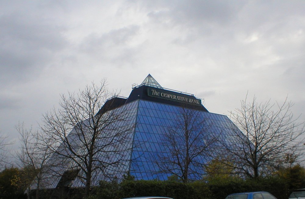
Stockport Compared 2001 UK Census[15] Stockport North West England England Population of working age 204,812 4,839,669 35,532,091 Full time employment 43.3% 38.8% 40.8% Part time employment 12.5% 11.9% 11.8% Self employed 8.4% 7.1% 8.3% Unemployed 2.5% 3.6% 3.3% Retired 14.8% 14.3% 13.5%  The Stockport pyramid, a call centre for The Co-operative Bank
The Co-operative Bank opened a telephone banking centre in the Stockport pyramid in 1994.[16] In 1999, the Stockport pyramid became the administrative home of smile.co.uk, an internet bank owned by the Co-op. The proportion of jobs in the banking and finance sector in Stockport is expected to rise from 21% to 24% by 2010.[17] Experian ranked Stockport fifth in North West England for shopping. The Merseyway Shopping Centre underwent a £15M redevelopment.[17] Other shopping centres in Stockport include the Grand Central Stockport and the Stockport Peel Centre.
Medical equipment and technology, financial and professional services, computer and internet based services, and creative industries have been identified as growth industries in Greater Manchester, all with concentrations in Stockport. With employment at 2.0%, Stockport has the lowest rate of unemployment of all Greater Manchester's boroughs.[18] Average house prices in the Stockport are second out of all the metropolitan boroughs in Greater Manchester, 27.7% higher than the average for the county.[19]
As of the 2001 UK census, Stockport had 204,812 residents aged 16 to 74. 2.4% of these people were students with jobs, 3.3% students without jobs, 5.4% looking after home or family, 5.0% permanently sick or disabled and 2.4% economically inactive for other reasons. These figures were generally inline with the national averages, although the proportion of people looking after home and family and students without jobs was significantly lower than the national average.[15]
In 2001, of 136,059 residents of Stockport in employment, the industry of employment was 17.3% retail and wholesale, 14.7% manufacturing, 13.8% property and business services, 11.7% health and social work, 8.9% education, 7.7% transport and communications, 6.1% construction, 5.3% finance, 4.6% public administration and defence, 4.1% hotels and restaurants, 0.7% energy and water supply, 0.6% agriculture, and 4.3% other. This was roughly in line with national figures, except for the proportion of jobs in agriculture which is less than half the national average, reflecting the city's suburban nature and its proximity to the centre of Manchester.[20]
Culture
Landmarks

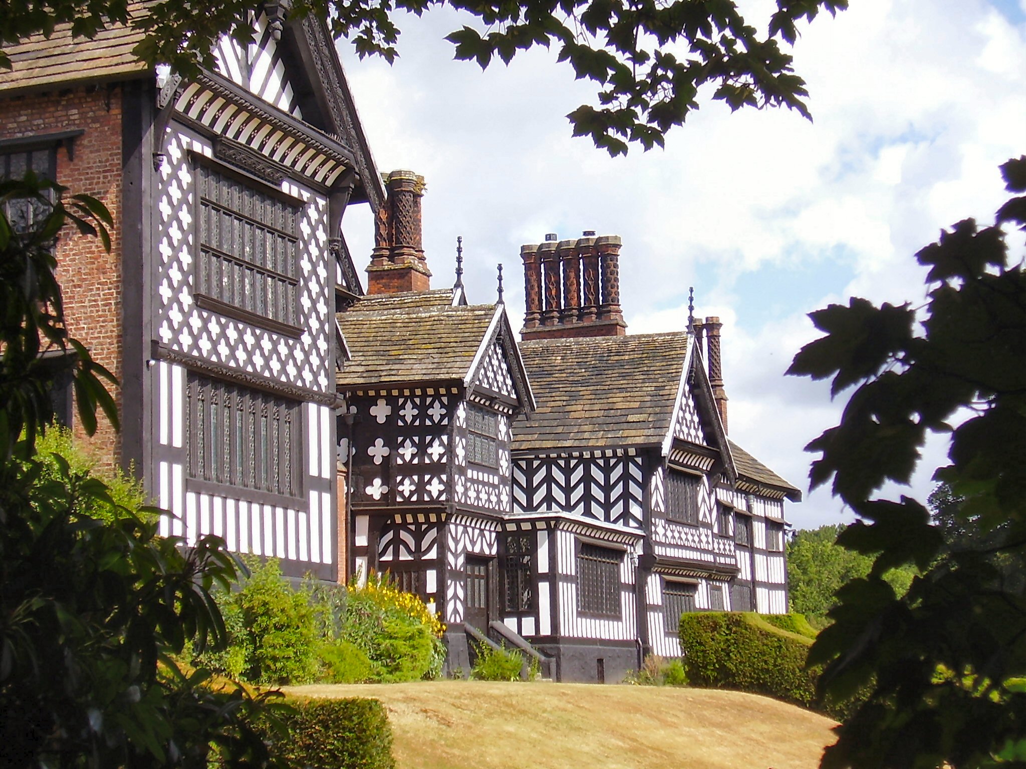
Stockport has 6 Grade I, 24 Grade II*, and 344 Grade II listed buildings.[21] The Grade I listed buildings are Bramall Hall, the Church of St Elisabeth, the Church of St George, the Church of St Thomas, St Mary's Church in the town centre and another St Mary's Church in Cheadle.[21] One of these grade II listed buildings is the Stockport Viaduct, which is the largest brick structure in western Europe.
There are six Scheduled Ancient Monuments in the borough. Two date to the Bronze Age, a cairn in Ludworth and the Brown Low bowl barrow.[22][23] Two related to medieval halls, Peel Hall in Heaton Moor and Torkington Moat.[24][25] The final two were both built at the start of the 19th century, Oldknows Limekilns and the Marple Aqueduct.[26][27]
Education
See also: List of schools in StockportOverall, Stockport was ranked 21st out of the all the Local Education Authoritys in SATs performance – and 2nd in Greater Manchester – in 2006.[28] Authorised absences from and unauthorised absences from Stockport secondary schools in 2006-07 were 6.7% and 1.3% respectively, almost the same as the national average (6.8% and 1.3%).[29] In 2007, the Stockport LEA was ranked 30th out of 148 in the country – and 2nd in Greater Manchester – based on the percentage of pupils attaining at least 5 A*-C grades at GCSE including maths and English (50.0% compared with the national average of 45.8%).[30]
In 2006, Cheadle Hulme School was the most successful school in Stockport at both GCSE and A-level; 99% of the pupils gaining five or more GCSEs at A*-C grade including maths and English. At A-level, it was also the 72nd most successful school in the country.[31][32]
Twin towns
The Borough of Stockport has formal twinning arrangements with two European places:[33] Béziers was originally twinned with the County Borough of Stockport and became twinned with the Metropolitan Borough on its creation in 1974.
Country Place County / District / Region / State Originally twinned with Date 
France 
Béziers 
Languedoc-Roussillon County Borough of Stockport 1972 
Germany 
Heilbronn 
Baden-Württemberg Metropolitan Borough of Stockport 1982 References
- ^ Anon (2007-08-21). "Population estimates 2006 by district". Statistics.gov.uk. http://www.statistics.gov.uk/statbase/ssdataset.asp?vlnk=9666&More=Y. Retrieved 2007-12-21.
- ^ Vision of Britain - Heaton Norris UD
- ^ Vision of Britain - Marple Urban District
- ^ Clark 1973, p. 101..
- ^ "UK MEPs". Europarl.org.uk. Archived from the original on February 21, 2008. http://web.archive.org/web/20080221224239/http://www.europarl.org.uk/uk_meps/MembersMain.htm. Retrieved 2008-02-23.
- ^ "BBC NEWS, Election 2006, Stockport". BBC News. http://news.bbc.co.uk/1/shared/vote2007/councils/html/bs.stm. Retrieved 2010-05-12.
- ^ "Stockport becomes hung council after Lib Dem losses, Election 2011". BBC News. http://www.bbc.co.uk/news/uk-england-manchester-13275294. Retrieved 2011-10-06.
- ^ a b c d "Stockport local elections 2008". BBC Online. 2008-05-02. http://news.bbc.co.uk/1/shared/bsp/hi/elections/local_council/08/html/bs.stm. Retrieved 2008-05-05.
- ^ a b "Stockport Metropolitan Borough key statistics". Statistics.gov.uk. http://neighbourhood.statistics.gov.uk/dissemination/LeadKeyFigures.do?a=3&b=276782&c=Stockport&d=13&e=16&g=354915&i=1001x1003x1004&o=1&m=0&r=1&s=1198230591093&enc=1. Retrieved 2007-12-21.
- ^ "Stockport Metropolitan Borough household data". Statistics.gov.uk. http://neighbourhood.statistics.gov.uk/dissemination/LeadTableView.do?a=3&b=276782&c=Stockport&d=13&e=16&g=354915&i=1001x1003x1004&o=1&m=0&r=1&s=1198230591125&enc=1&dsFamilyId=165. Retrieved 2007-12-21.
- ^ "Stockport Metropolitan Borough population density". Statistics.gov.uk. http://neighbourhood.statistics.gov.uk/dissemination/LeadTableView.do?a=3&b=276782&c=Stockport&d=13&e=16&g=354915&i=1001x1003x1004&o=1&m=0&r=1&s=1198230595125&enc=1&dsFamilyId=789. Retrieved 2007-12-21.
- ^ "Stockport Metropolitan Borough country of birth data". Statistics.gov.uk. http://neighbourhood.statistics.gov.uk/dissemination/LeadTableView.do?a=3&b=276782&c=Stockport&d=13&e=16&g=354915&i=1001x1003x1004&o=1&m=0&r=1&s=1198230591109&enc=1&dsFamilyId=85. Retrieved 2007-12-21.
- ^ "Stockport Metropolitan Borough ethnic group data". Statistics.gov.uk. http://neighbourhood.statistics.gov.uk/dissemination/LeadTableView.do?a=3&b=276782&c=Stockport&d=13&e=16&g=354915&i=1001x1003x1004&o=1&m=0&r=1&s=1198230591109&enc=1&dsFamilyId=87. Retrieved 2007-12-21.
- ^ "Stockport District: total population". Vision of Britain. http://www.visionofbritain.org.uk/data_cube_table_page.jsp?data_theme=T_POP&data_cube=N_TPop&u_id=10076870&c_id=10001043&add=N. Retrieved on 20 December 2008.
- ^ a b "Stockport Local Authority economic activity". Statistics.gov.uk. http://neighbourhood.statistics.gov.uk/dissemination/LeadTableView.do?a=3&b=276782&c=Stockport&d=13&e=16&g=354915&i=1001x1003x1004&o=1&m=0&r=1&s=1215021779554&enc=1&dsFamilyId=107. Retrieved 2008-07-02.
- ^ "The best laid plans have aft gang aglay". Stockport Express. December 1999. http://www.stockportexpress.co.uk/community/nostalgia/s/310/310252_the_best_laid_plans_have_aft_gang_aglay.html. Retrieved 2008-07-02.
- ^ a b "Economic overview". Stockport.gov.uk. Archived from the original on March 13, 2008. http://web.archive.org/web/20080313185005/http://www.stockport.gov.uk/content/business/economicdevelopment/sectorinformation?a=5441. Retrieved 2008-07-02.
- ^ "Promoting a Dynamic Economy". Greater Manchester e-Government Partnership. Archived from the original on 2008-01-12. http://web.archive.org/web/20080112085728/http://www.gmep.org.uk/ccm/content/agma/promoting-a-dynamic-economy.en;jsessionid=64C7688F205BEE012F17A5E3001818D5. Retrieved 2008-04-12.
- ^ "House prices for Greater Manchester Local Authorities". BBC News Online. http://news.bbc.co.uk/1/shared/spl/hi/in_depth/uk_house_prices/counties/html/county38.stm. Retrieved 2008-07-02.
- ^ "Stockport Local Authority industry of employment". Statistics.gov.uk. http://neighbourhood.statistics.gov.uk/dissemination/LeadTableView.do?a=3&b=276782&c=Stockport&d=13&e=16&g=354915&i=1001x1003x1004&o=1&m=0&r=1&s=1215022618783&enc=1&dsFamilyId=119. Retrieved 2008-07-02.
- ^ a b "Listed Buildings in Stockport". Stockport Metropolitan Borough Council. http://www.stockport.gov.uk/content/business/regeneration/historicareasregeneration/Conservation1/listedbuildings. Retrieved 2008-02-29.[dead link]
- ^ "Bronze Age cairn in Ludworth". Pastscape.org.uk. http://www.pastscape.org.uk/hob.aspx?hob_id=890910. Retrieved 2008-01-04.
- ^ "Brown Low". Pastscape.org.uk. http://www.pastscape.org.uk/hob.aspx?hob_id=78554. Retrieved 2008-01-04.
- ^ "Peel Hall, Stockport". Pastscape.org.uk. http://www.pastscape.org.uk/hob.aspx?hob_id=76845. Retrieved 2008-01-04.
- ^ "Torkington Moat". Pastscape.org.uk. http://www.pastscape.org.uk/hob.aspx?hob_id=78351. Retrieved 2008-01-04.
- ^ "Oldknows Limekilns". Pastscape.org.uk. http://www.pastscape.org.uk/hob.aspx?hob_id=78346. Retrieved 2007-12-30.
- ^ "Marple Goyt Aqueduct". Pastscape.org.uk. http://www.pastscape.org.uk/hob.aspx?hob_id=78557. Retrieved 2007-12-30.
- ^ "LEA SATs performance". BBC Online. 2006-12-07. http://news.bbc.co.uk/1/hi/education/6209672.stm. Retrieved 2007-12-18.
- ^ "Stockport schools". BBC Online. 2007-01-11. http://news.bbc.co.uk/1/shared/bsp/hi/education/06/school_tables/secondary_schools/html/356_6019.stm. Retrieved 2007-12-26.
- ^ "How different LEAs performed". BBC Online. 2007-01-17. http://news.bbc.co.uk/1/hi/education/6250433.stm. Retrieved 2007-12-18.
- ^ "Education results in Stockport". BBC Online. 2007-01-11. http://news.bbc.co.uk/1/shared/bsp/hi/education/06/school_tables/secondary_schools/html/356_gcse_lea.stm. Retrieved 2007-12-26.
- ^ "Top A-level results". BBC Online. 2007-01-11. http://news.bbc.co.uk/1/hi/education/6250419.stm. Retrieved 2007-12-18.
- ^ "Twin Towns and Link Areas". Stockport.gov.uk. http://www.stockport.gov.uk/services/communitypeopleliving/ilo/twintowns. Retrieved 5 April 2010.[dead link]
Bibliography
- Clark, David M. (1973). Greater Manchester Votes: A Guide to the New Metropolitan Authorities. Redrose
External links
 Districts of North West England
Cheshire 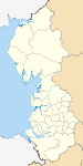
Cumbria Allerdale • Barrow-in-Furness • Carlisle • Copeland • Eden • South Lakeland
Greater Manchester Lancashire Blackburn with Darwen • Blackpool • Burnley • Chorley • Fylde • Hyndburn • Lancaster • Pendle • Preston • Ribble Valley • Rossendale • South Ribble • West Lancashire • Wyre
Merseyside Metropolitan counties and metropolitan districts Greater Manchester 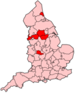
Merseyside South Yorkshire Tyne and Wear West Midlands West Yorkshire Categories:- Metropolitan boroughs
- Stockport
- Local government in Stockport
- Local government districts of North West England
- 1974 establishments in England


Wikimedia Foundation. 2010.