- Dawson City Water Aerodrome
-
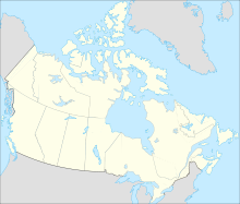
Dawson City Water Aerodrome IATA: none – ICAO: none – TC LID: CEG7 Summary Airport type Public Operator City of Dawson Location Dawson City, Yukon Elevation AMSL 1,050 ft / 320 m Coordinates 64°04′N 139°26′W / 64.067°N 139.433°WCoordinates: 64°04′N 139°26′W / 64.067°N 139.433°W Map Location in Yukon Runways Direction Length Surface ft m N/A N/A N/A Water Source: Canada Flight Supplement[1] Dawson City Water Aerodrome (TC LID: CEG7) is located adjacent to Dawson City, Yukon, Canada and is open from August to September.
The airport is classified as an airport of entry by NAV CANADA and is staffed by the Canada Border Services Agency. CBSA officers at this airport currently can handle aircraft with no more than 30 passengers. It is one of only two water aerodromes in Canada, Dryden Water Aerodrome is the other, that is able to handle aircraft with more than 15 passengers.[1]
See also
References
- ^ a b Canada Flight Supplement's Water Aerodrome Supplement. Effective 0901Z 12 March 2009 to 0901Z 11 March 2010
Airports in Canada By name A–B · C–D · E–G · H–K · L–M · N–Q · R–S · T–ZBy location indicator CA · CB · CC · CD · CE · CF · CG · CH · CI · CJ · CK · CL · CM · CN · CO · CP · CR · CS · CT · CV · CW · CY · CZBy province/territory National Airports System Calgary · Charlottetown · Edmonton · Fredericton · Gander · Halifax · Iqaluit · Kelowna · London · Moncton · Montréal-Mirabel · Montréal-Trudeau · Ottawa · Prince George · Québec · Regina · Saint John · St. John's · Saskatoon · Thunder Bay · Toronto · Vancouver · Victoria · Whitehorse · Winnipeg · YellowknifeRelated List of airports by ICAO code: C · List of defunct airports in Canada · List of heliports in Canada · List of international airports in Canada · National Airports System · Operation Yellow Ribbon Category ·
  Portal ·
  WikiProjectCategories:
- Airports in Yukon
- Dawson City
- Canadian airport stubs
- Yukon geography stubs
Wikimedia Foundation. 2010.

