- Cleveland Metroparks
-

Cleveland Metroparks System 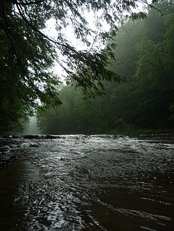
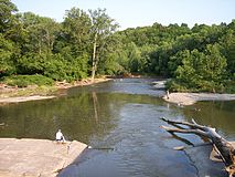
The Chagrin River as viewed from The South Chagrin ReservationType Public park district Location Greater Cleveland, Ohio, United States Area 21,000 acres (85 km2) Created 1917 Operated by Cleveland Metroparks Board of Park Commissioners Open All year Cleveland Metroparks is an extensive system of nature preserves in Greater Cleveland, Ohio. The various reservations, which largely encircle the city of Cleveland, tend to follow the rivers and creeks that flow through the region. Referred to unofficially as the 'Emerald Necklace',[1] the network of parks spans across 21,000+ acres (89 km²) and includes hundreds of miles of walking, bicycle, and horse trails as well as numerous picnic areas, five nature education centers, eight golf courses, and countless fishing spots. In addition, the district includes the zoo in Cleveland. Several of the reservations are adjacent to Cuyahoga Valley National Park.
While the majority of the reservations are in the suburbs of Cuyahoga County, Brookside Reservation is located within the city of Cleveland. Additionally, three of the reservations are either partially or entirely situated outside Cuyahoga County: a portion of North Chagrin Reservation is in Lake County; a small portion of Bradley Woods Reservation is in Lorain County; the Hinckley Reservation is in Hinckley Township in Medina County.[1]
Contents
History
The importance of conserving our natural resources is now well recognized. Cannot it be truly said that these natural wild beautiful valleys and glens which lie adjacent to our rapidly growing urban centers are a kind of 'natural resource' of ever increasing value to the public? - William A. Stinchcomb, (speaking to the Cleveland City Council in 1909)
The genesis of the Cleveland Metropolitan Park System began with a vision by William Albert Stinchcomb in the early 20th century.[2] A self-taught engineer working as a surveyor for the City of Cleveland in 1895, Stinchcomb was appointed chief engineer of the City Parks Department by Mayor Tom Johnson in 1902, and shortly thereafter began to conceptualize an Emerald Necklace for the city.[3] Stinchcomb lobbied the Ohio legislature to amend the state constitution so as to permit the authorization of natural resource conservation at the county level in 1913.[4] However, the Ohio Supreme Court overturned Cuyahoga County's new park law unconstitutional. Unflappable in his pursuit, Stinchcomb then went back to Columbus lobbying for new legislation allowing for the establishment of what was to become the Metropolitan Park District, which is today the oldest metropolitan park district in Ohio.[5]
In 1915, Stinchcomb received the break that would finally launch his ambitious goal. While serving as Cuyahoga County engineer, he was approached by city council and offered an appointment to be a consulting engineer on what was eventually to become the Cleveland Metropolitan Park District board—the same board he'd lobbied for two years prior. Stinchcomb accepted and, at the urging of city council, immediately hired the renowned landscape architectural firm, the Olmsted Brothers. The group immediately went to work drawing up plans for a system of connecting parks as well as the acquisition of land and resources.[3] The proposed Cuyahoga County Park and Boulevard System, which included a parkway encircling the Cleveland area, following various creeks and rivers in the area, was the framework of what would become the Metroparks system today.[6]
Stinchcomb returned to the Statehouse in 1917, this time as an officer of the newly formed Metropolitan Park District board, and proposed a bill that would authorize the Metropolitan Park District board to levy a .1 mill tax to fund the district's operations. This was followed shortly after by the authorization of a second .1 mill tax to fund of property acquisition[3] By 1921, the fledgling Park District had acquired the land that would become the Rocky River and Big Creek reservations, most of which was donated.[3] Between 1920 and 1930, the system grew through the investment of capital from its tax levies. Purchased at the cost of approximately $4 million, land for the Hinckley, Brecksville, Bedford, South Chagrin, North Chagrin and Euclid Creek reservations increased the district's holdings from just over 100 acres to more than 9,000 within the span of a decade.[6]
The Metroparks Today
With free admission and virtually unlimited access during daylight hours, the Metroparks 21,000+ acres are a widely popular destination for hikers, cyclists, boaters and fishermen and nature enthusiasts. A major source of outdoor recreation in the region, official attendance figures recorded 16,855,908 recreational visitors to the system's 16 reservations and the zoo in 2010, making the system one of the most visited attractions in the state of Ohio.[7] Metroparks golf courses, one of the few amenities that do incur a fee, attract over 400,000 golfers annually. With varying amenities, terrains and geographical features, each park is unique. Some amenities, such as the toboggan chutes at Mill Stream Run reservation's Chalet, are found nowhere else in the entire State of Ohio.[8]
Reservations
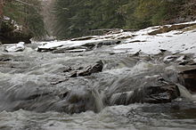
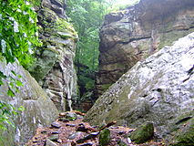
Reservation Acreage (Hectares) Notes Park Amenities Park Map Bedford 2,206 acres (893 ha) Located in Bedford and Valley View, along Tinker's Creek. Features include Shawnee Hills Golf Course and Tinker's Gorge, which has been named a National Natural Landmark.[9] Trails, cross country skiing, and National Audubon Society's Bird Area Program.[9] map Big Creek 781 acres (316 ha) Located in five Cleveland Suburbs, running from Brookpark Road, near Hauseman Road and I-480, south to Whitney Road and Pearl, below the Ohio Turnpike/I-80. Highlights include Lake Isaac and Beyer's Pond wildlife sanctuaries in Middleburg Hts.[9] Trails, cross country skiing, sledding.[9] map Bradley Woods 795 acres (322 ha) located in North Olmsted and Westlake Bradley Woods is situated on what was originally a quarry for Berea Sandstone. Today, the area has become a forest of red maples, sour gums, tulip trees, yellow birches and pin oaks.[9] Trails, cross country skiing, fishing.[9] map Brecksville 3,494 acres (1,414 ha) Located in Brecksville, the reservation includes the Sleepy Hollow Golf Course and seven distinct gorges, of which the Chippewa Creek Gorge is the most notable. The Squire Rich Historical Museum is located on the western edge of the park, managed by the Brecksville Historical Society.[9] Golf, Hiking and cross country skiing trails, outdoor education facility, sledding, stables, and a National Audubon Society Bird Area Program.[9] map Brookside 145 acres (59 ha) Originally a neighborhood park in the City of Cleveland, it became part of the Metroparks in 1993. It is immediately adjacent to fellow Metropark installation, the Cleveland Metroparks Zoo. Brookside hosts numerous baseball and football fields and a wildlife area. Big Creek, the largest tributary of the Cuyahoga River, flows through the northern border of the park. Trails, cross country skiing.[9] map Cleveland Metroparks Zoo 165 acres (67 ha) Main article: Cleveland Metroparks ZooOver a million visitors annually, it is Ohio's largest Zoo.[10] map Euclid Creek 345 acres (140 ha) Located in Euclid, South Euclid and Richmond Heights, was originally the site of a massive Bluestone quarry. Today it is a sanctuary for wildlife and provides a wooded passage from the Heights area down into Euclid. Trails for hiking, horseback riding, cross country skiing and sledding hills.[9] map Garfield Park 213 acres (86 ha) Located in Garfield Heights it was originally named Newburg Park dating back to 1895. In 1986, it was leased to the Metroparks system and was renamed Garfield Park. It's main feature is Mill Creek Trails for hiking and cross country skiing, as well as an outdoor education facility.[9] map Hinckley 2,682 acres (1,085 ha) Located in Hinckley Township in Medina County, the reservation is known for the famous 'Annual Return of the Buzzards' as well as Hinckley Lake and its network of glacial ledges, some of which exceed elevations of 350 feet. Hiking and cross country skiing trails, boating, swimming, fishing, sledding hills, and National Audubon Society's Bird Area Program.[9] map Huntington 103 acres (42 ha) Located in Bay Village on Lake Erie, Huntington is one of two Metroparks with lakefront access (the other being Rocky River). It is also the location for three Metroparks affiliates: The Lake Erie Nature & Science Center and Schuele Planetarium, the Huntington Playhouse and the BAYarts community art campus. Hiking and cross country skiing trails, fishing, outdoor education facility, sledding, swimming, and National Audubon Society's Bird Area Program.[9] map Mill Stream Run 3,189 acres (1,291 ha) Added to the system in 1976, this is the largest reservation in the Emerald Necklace. Mill Stream Run is situated along the east branch of the Rocky River and spanning Berea, Middleburg Heights, North Royalton and Strongsville, . Hiking trails, cross country skiing, fishing, outdoor education facility, sledding, toboggan chutes and National Audubon Society's Bird Area Program.[9] map North Chagrin 2,140 acres (870 ha) Located in Mayfield Village, Gates Mills and Willoughby Hills, the North Chagrin Reservation straddles Cuyahoga and Lake Counties and like it's smaller neighbor to the south, follows a part of the Chagrin River. While it is the home to the historic Manakiki Golf Course, the reservation's arguably most notable man-made attraction is Squire's Castle. Golf, trails, cross country skiing, fishing, golf course, outdoor education facility, sledding, and National Audubon Society's Bird Area Program.[9] map Ohio & Erie Canal 312 acres (126 ha) Opened in 1999 and stretching through Cuyahoga Heights and Valley View, the reservation follows a portion of the historic 309-mile Ohio and Erie Canal, as well as a section of the Cuyahoga River. Observation decks provide a view of myriad wildlife. Trails, boating, cross country skiing, outdoor education facility, and National Audubon Society's Bird Area Program.[9] map Rocky River 2,572 acres (1,041 ha) Located in Rocky River, Berea, Brook Park, Cleveland, Fairview Park, Lakewood, North Olmsted and Olmsted Township, the reservation contains the first parcel of land secured for the establishment of the Metroparks by William A. Stinchcomb—one of the points of interest in the park, in fact, is the Stinchcomb-Grohl memorial.[1] Rocky River reservation boasts three golf courses: Big Met, Little Met and Mastick Woods. Golf, hiking and cross country skiing trails, boating, fishing, sledding hills, horse stables, an outdoor education facility, and a National Audubon Society Bird Area Program.[9] map South Chagrin 1,521 acres (616 ha) Spanning sections of Bentleyville, Solon and Moreland Hills, the reservation follows a portion of the scenic Chagrin River and features an Arboretum, a Polo Field, as well as many trails to hike and bike. Henry Church's 1885 sculpture, Squaw Rock, is one of the park's most striking man-made features as it is carved into a large slab of sandstone adjacent the river.[11] Trails, cross country skiing, fishing, outdoor education facility, sledding.[9] map Washington 59 acres (24 ha) Opened in 2003, this is smallest addition to the Metroparks system. Located in Newburgh Heights, the Washington Golf Learning Center is the most notable feature of the park. Golf, the Horticultural Center and School, athletic fields, hiking trails and fishing.[9] map West Creek 278 acres (113 ha) Opened in 2006, the West Creek Reservation is the newest addition to the Emerald Necklace, and is currently in the process of a $12 million makeover, which is scheduled for completion by 2012.[12] The park, which is home to a wide variety of wildlife, meanders along its namesake, West Creek and is located in Parma. Trails. map Gallery
-
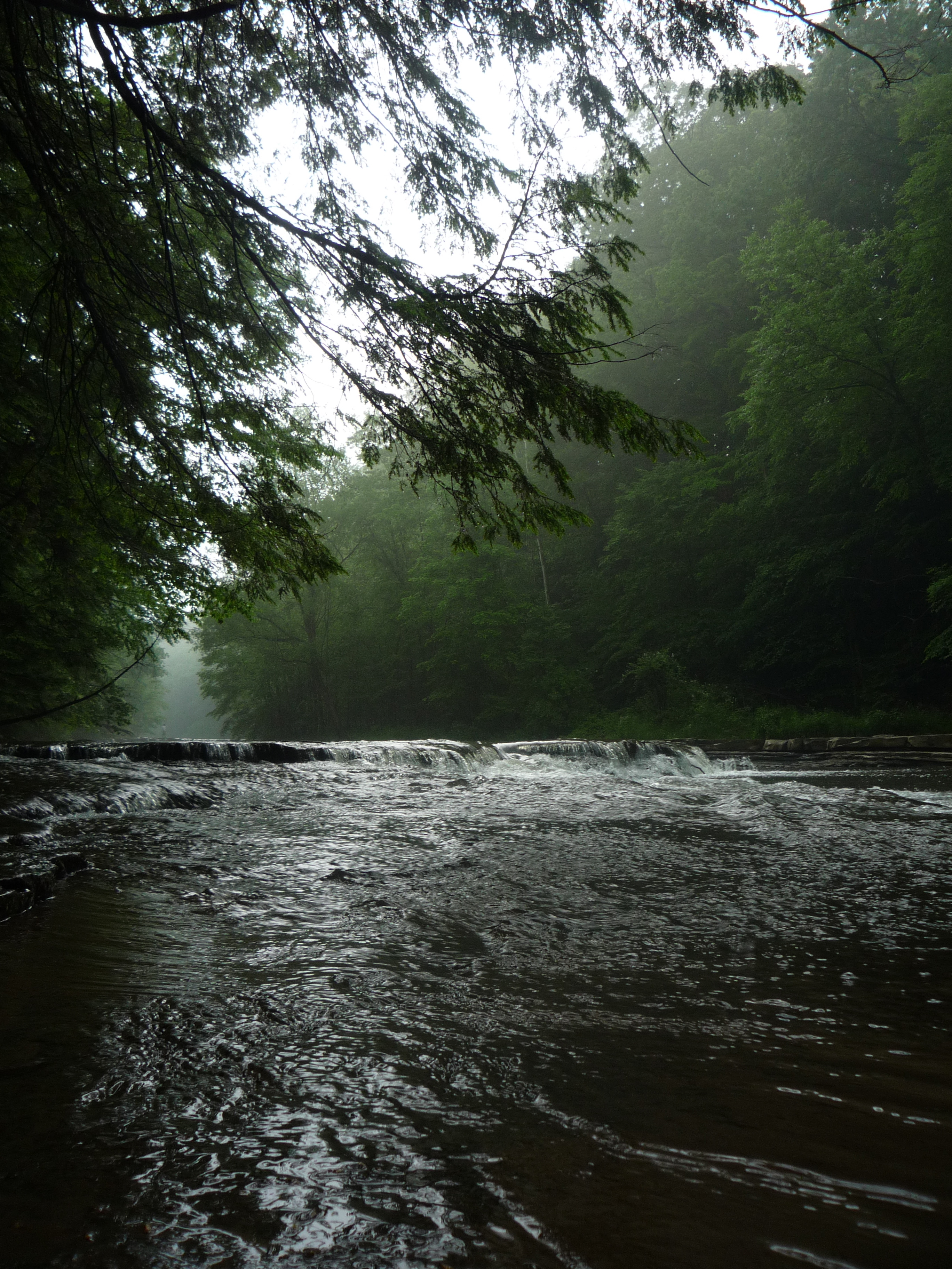
Chippewa Creek in the Brecksville Reservation.
-

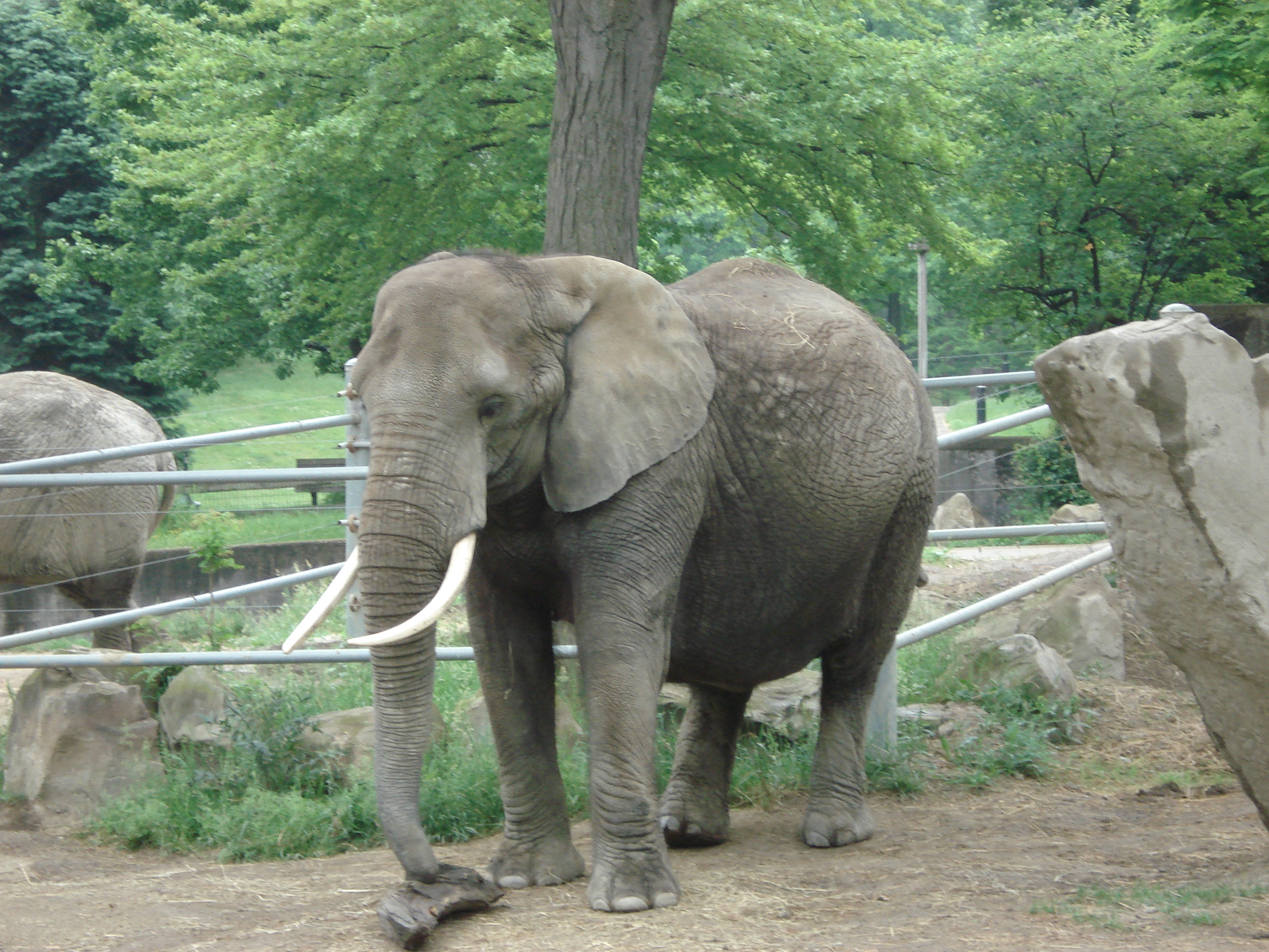
An African Elephant at the Cleveland Metroparks Zoo.
-
Whipps Ledges at Hinckley Reservation.
-
Squire's Castle at the North Chagrin Reservation.
-
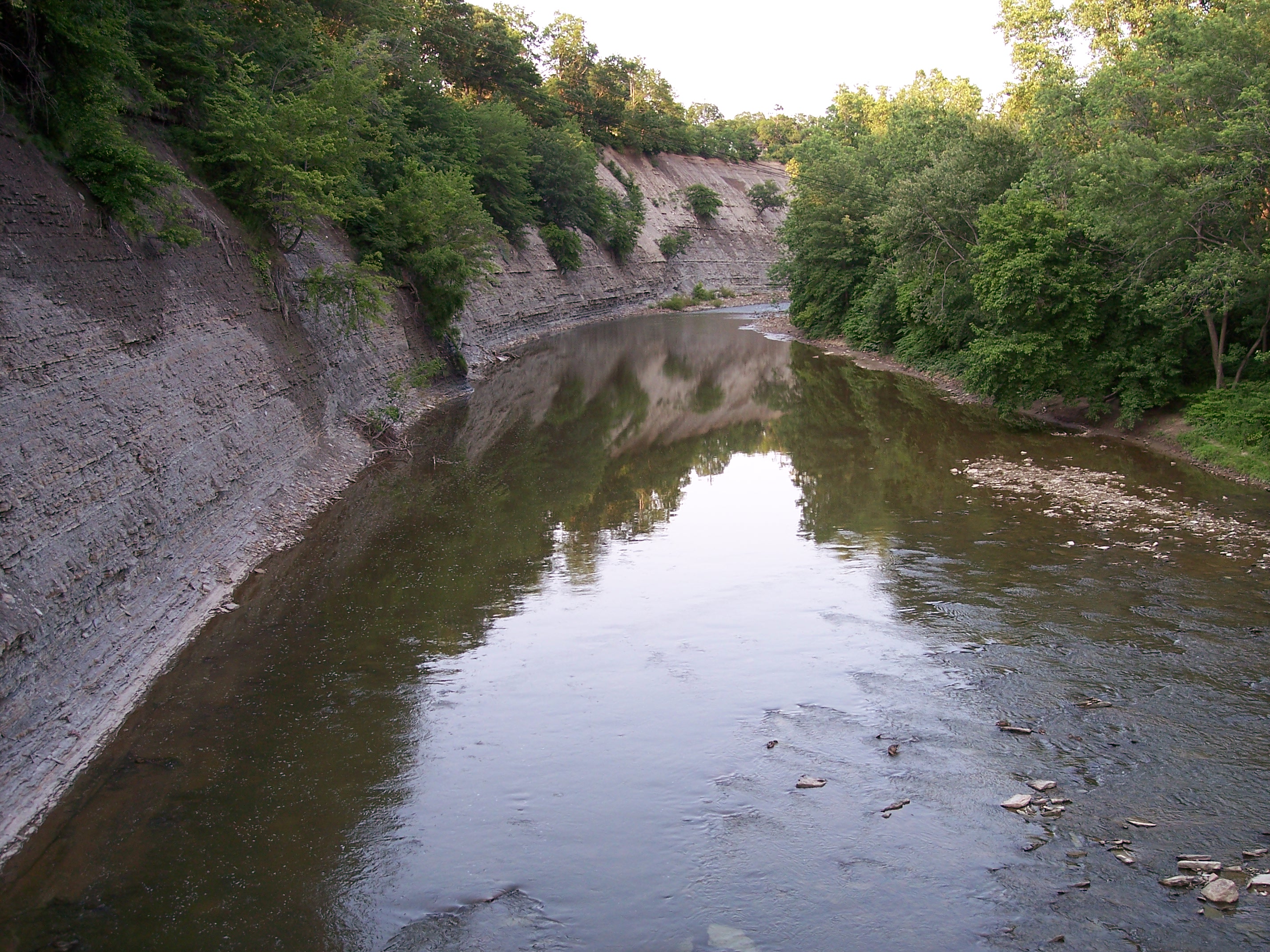
A bend in the Rocky River in the Rocky River Reservation.
-
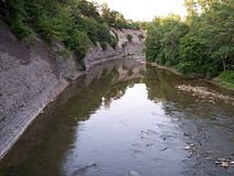
Shale cliffs along the Rocky River in the Rocky River Reservation.
-
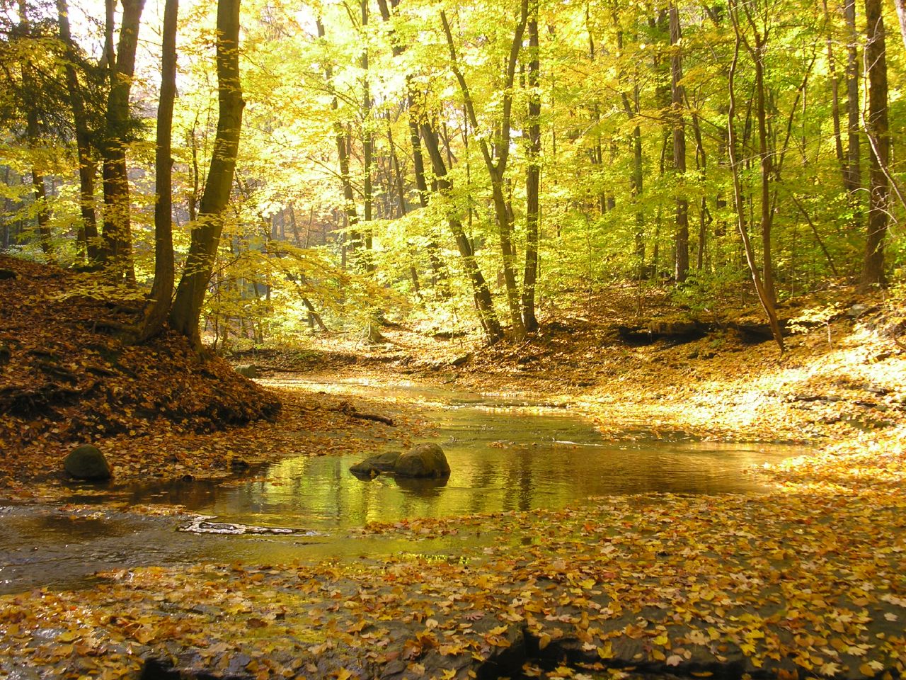
The Chagrin River, taken at the South Chagrin Reservation.
-

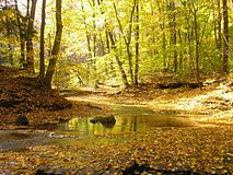
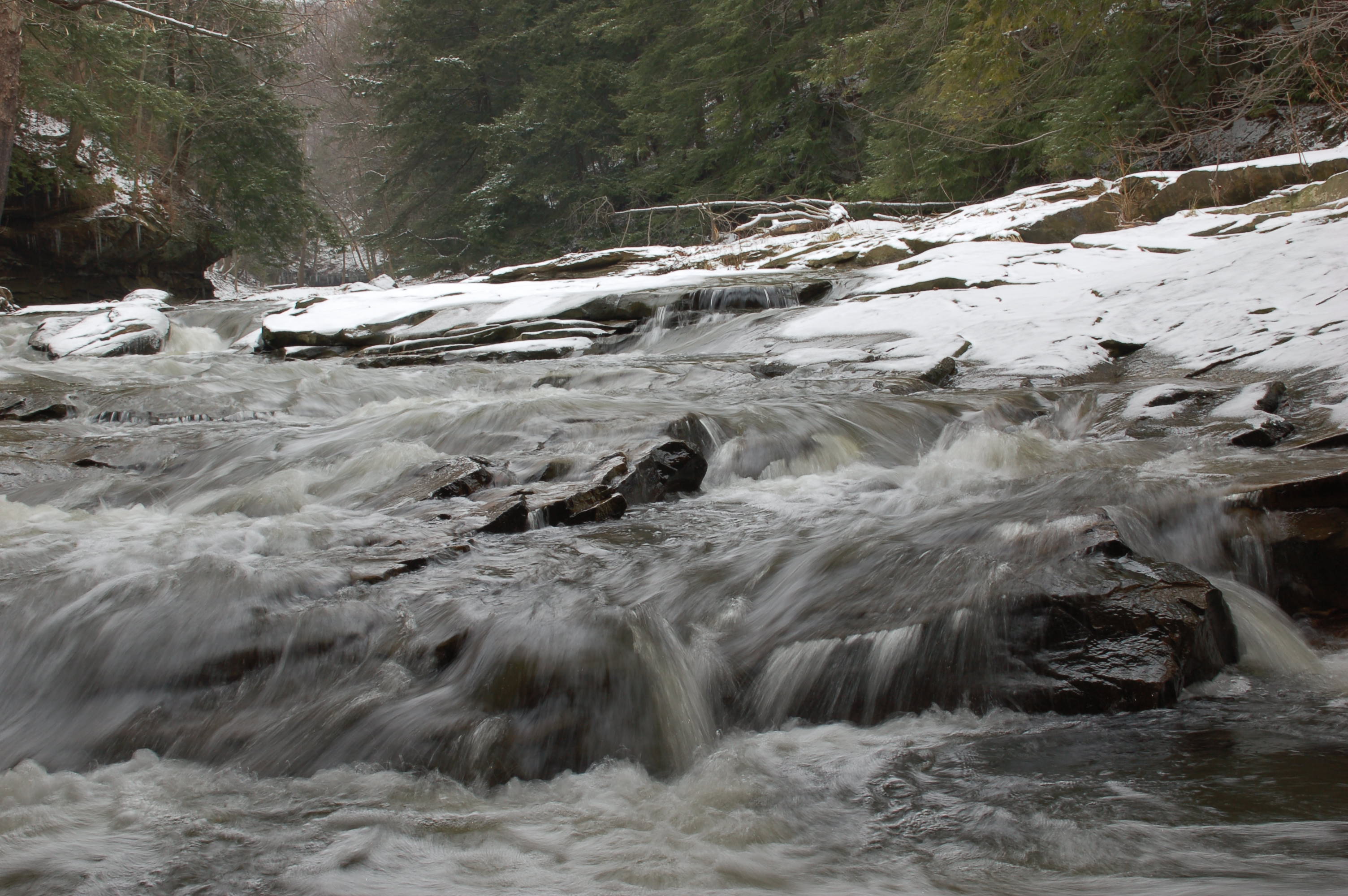
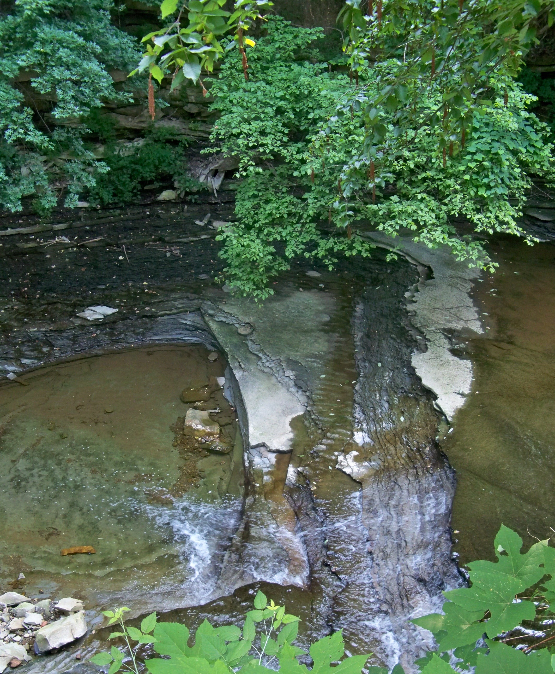
Water falling over the shale creek bed in Euclid Creek Reservation.
See also
- Squire's Castle (North Chagrin Reservation, Willoughby Hills)
References
- ^ a b c Cleveland Metroparks [1](2010). "Visitors Guide", Accessed: July 6, 2011.
- ^ "Case Western Reserve University". College Town Profile. http://www.collegetownprofile.com/ohio/casewestern/24/topic.html. Retrieved 2011-07-06.
- ^ a b c d American Academy for Park and Recreation Administration [2](2010). "William Albert Stinchcomb Cornelius Amory Pugsley Bronze Medal Award, 1940 ", Accessed: July 6, 2011.
- ^ "Encyclopedia of Cleveland History: Stinchcomb, William Albert". Case Western Reserve University. http://ech.case.edu/ech-cgi/article.pl?id=SWA. Retrieved 2011-07-06.
- ^ "Cleveland Metroparks". neo Naturalist.com. http://www.neonaturalist.com/parks/cleveland_metroparks.html. Retrieved 2011-07-06.
- ^ a b Cleveland Metroparks [3](2010). "History", Accessed: July 6, 2011.
- ^ "Cleveland Metroparks 2010 Park District Visitation: Statistics on Visitors Entering Reservations and Program & Facility Attendance" (PDF). Cleveland Metroparks. http://www.clemetparks.com/pdf/Bids/Attachment%205%20%20Attendance%20Report%202010.PDF. Retrieved 2011-07-07.
- ^ http://www.akron.com/pages.asp?aID=4325
- ^ a b c d e f g h i j k l m n o p q r s Pathfinder; A Guide to Cleveland Metroparks; Cleveland Metroparks; Cleveland, Ohio; Sept 2006
- ^ http://www.clemetzoo.com/tour/area.asp?area_id=5
- ^ http://www.trails.com/tcatalog_trail.aspx?trailid=HGM071-050
- ^ http://www.freshwatercleveland.com/devnews/westcreekreservation041411.aspx
External links
Categories:- 1917 establishments in the United States
- Protected areas of Cuyahoga County, Ohio
- Greater Cleveland
- Protected areas of Lake County, Ohio
- Landmarks in Ohio
- Parks in Ohio
- Protected areas of Medina County, Ohio
- Park districts in the United States
-


Wikimedia Foundation. 2010.