- Mundaring Weir
-
 Mundaring Weir.
Mundaring Weir is the name of a dam (and historically the adjoining locality) which are located 39 kilometres (24 mi) from Perth, Western Australia in the Darling Scarp. It is situated in the Mundaring locality. The dam crosses the Helena River.
The town of Mundaring was gazetted in 1898, the same year as the commencement of construction of the dam.[1]
Contents
History
Lake C.Y. O'Connor
Helena River Reservoir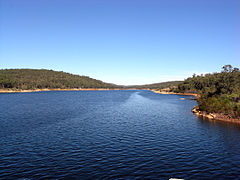
Location Mundaring, Western Australia Coordinates 31°59′S 116°12′E / 31.983°S 116.2°E Lake type reservoir Primary inflows Helena River Primary outflows Helena River Basin countries Australia Surface area 6.76 km² A soldier, Ensign Robert Dale, became the first European to explore the region in 1829.
European populations did not grow significantly until construction of the dam in the late 1890s. This involved the building of a railway line from Mundaring to the Mundaring Weir site. The Irish Australian engineer C. Y. O'Connor was involved the design of a scheme that transported water to the Eastern Goldfields of Coolgardie and Kalgoorlie in the eastern part of Western Australia.
The lake created by the dam was known as the Helena River Reservoir , however it is now known as Lake C.Y. O'Connor.
The owner of the dam, the Water Corporation, refers to the weir as Mundaring Dam on its website, but no other authority, such as Geographic Names, or Geosciences Australia uses this term. The Mundaring Shire uses an image of the Mundaring Weir in its logo.
Work commenced to raise the dam in the late 1940s, which was completed in November 1951.
In the early 1970s the downstream dam from the weir—the 'Lower Helena Pumpback Dam' was constructed.
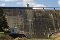
Dam monitoring
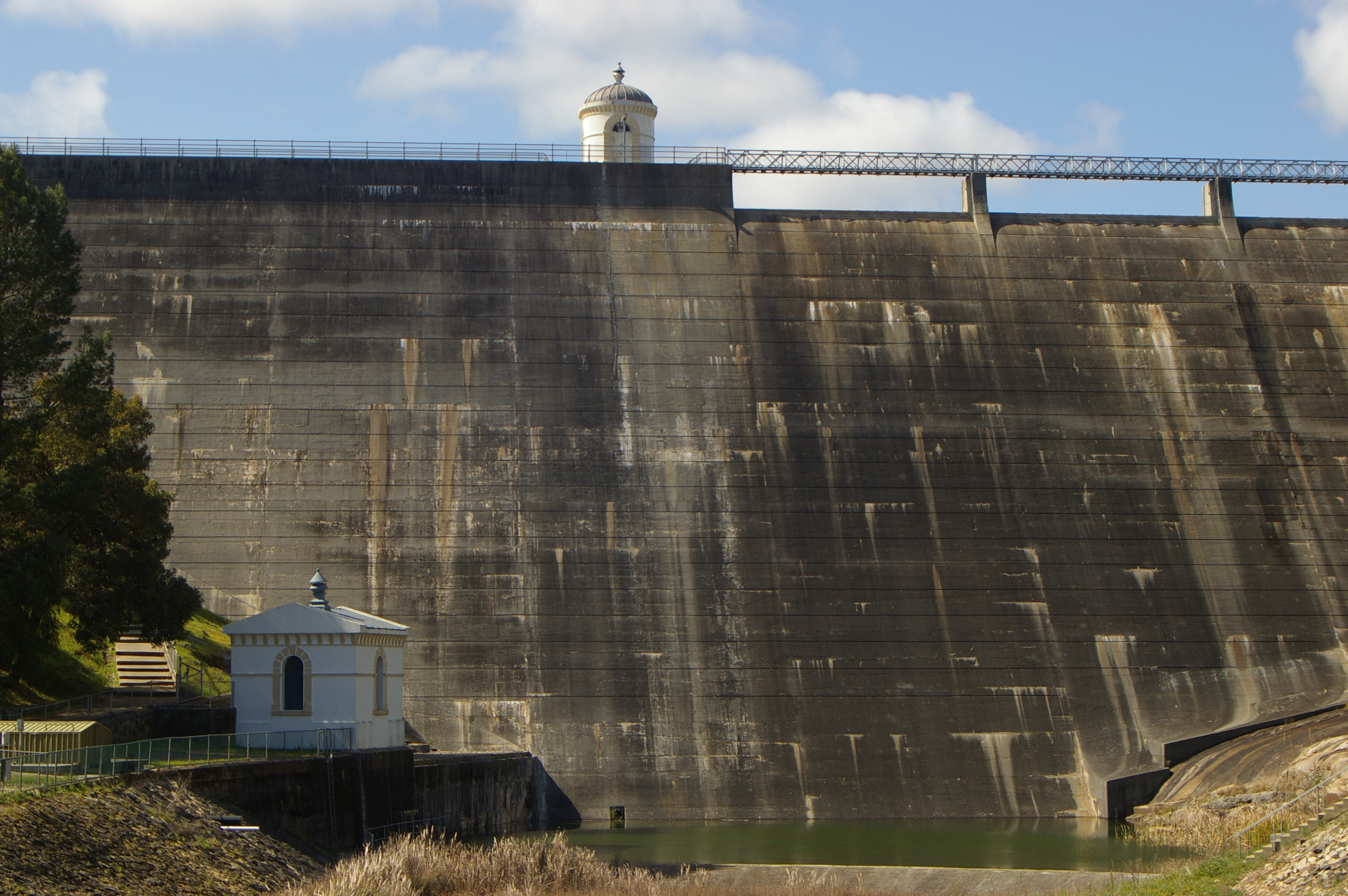
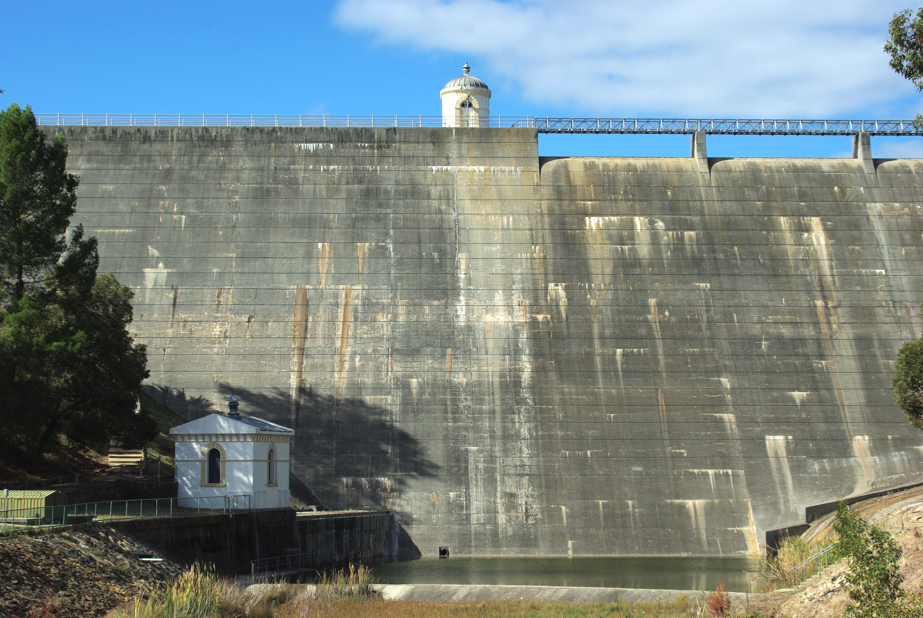
Like any structure of its age and design, the weir requires monitoring and repairs and maintenance. On the original structure the central small building was used for aspects of monitoring the weir's internal status - it was rebuilt on the heightening of the dam, although it was no longer used for its original prurpose.
In 2009 two face wall entrance points were created on either side (north and south) of the face to facilitate access to the monitoring tunnels. The weir leaks, and the two photos following show consistent stain/moisture points between 2008 and 2010 where water moves through the structure:
-
2008
-

2010
Changes 2010-2014
The Mundaring Weir Water Supply improvement project will see considerable changes to pumping stations, water treatment plants and the general amenities around the weir.[2]
Railway
Mundaring Weir was the terminus of the Mundaring Weir Branch Railway, which was originally constructed by the Public Works Department of WA for the transport of materials for the construction of the dam.
It was only after the completion of the weir that the location became popular with picnickers and sightseers, as the project caught the imagination of the public in Perth.
The landscaped grounds of the weir, and the lower zig-zag section of the end of the railway line (which can still be seen when the capacity of the dams falls below approximately 35%) feature prominently in post cards of numerous weekend and special picnic excursion trains that travelled to the weir until the late 1940s.
The steepness of the Mundaring weir railway line restricted the capacity of the railways to conduct the picnic trains, as the Msa Garratt steam engines were the most suitable, but in short supply, at times when the weir was overflowing in the 1940s.
The railway line was closed in 1952.
Additionally, a tramway, using timber rails, was constructed to convey sawn timber from a mill 3 miles to the weir from where it was railed on the above railway line. It opened in 1909 and closed in 1913.[3]
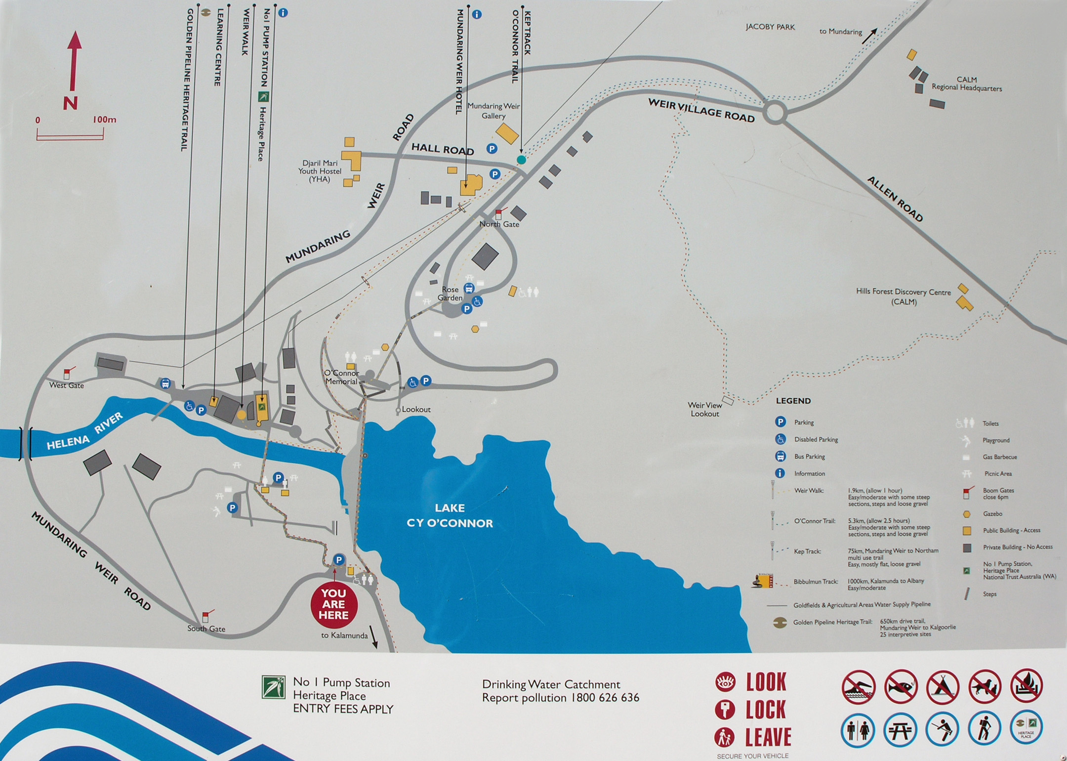
Facilities
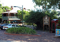 Mundaring Weir Hotel.
Mundaring Weir Hotel, previously known as the Reservoir Hotel, then the Goldfields Weir Hotel [4] has been in the area since 1898. It was a crucial location where O'Connor stayed regularly during the construction of the weir. After a period of decline it has regained popularity in recent years becoming a get-away for Perth residents, due to the current owner, Jens Jorgensen who bought it in 1984. It has been the location of annual concerts which included David Helfgott concerts during and after his recovered career as concert pianist[4]
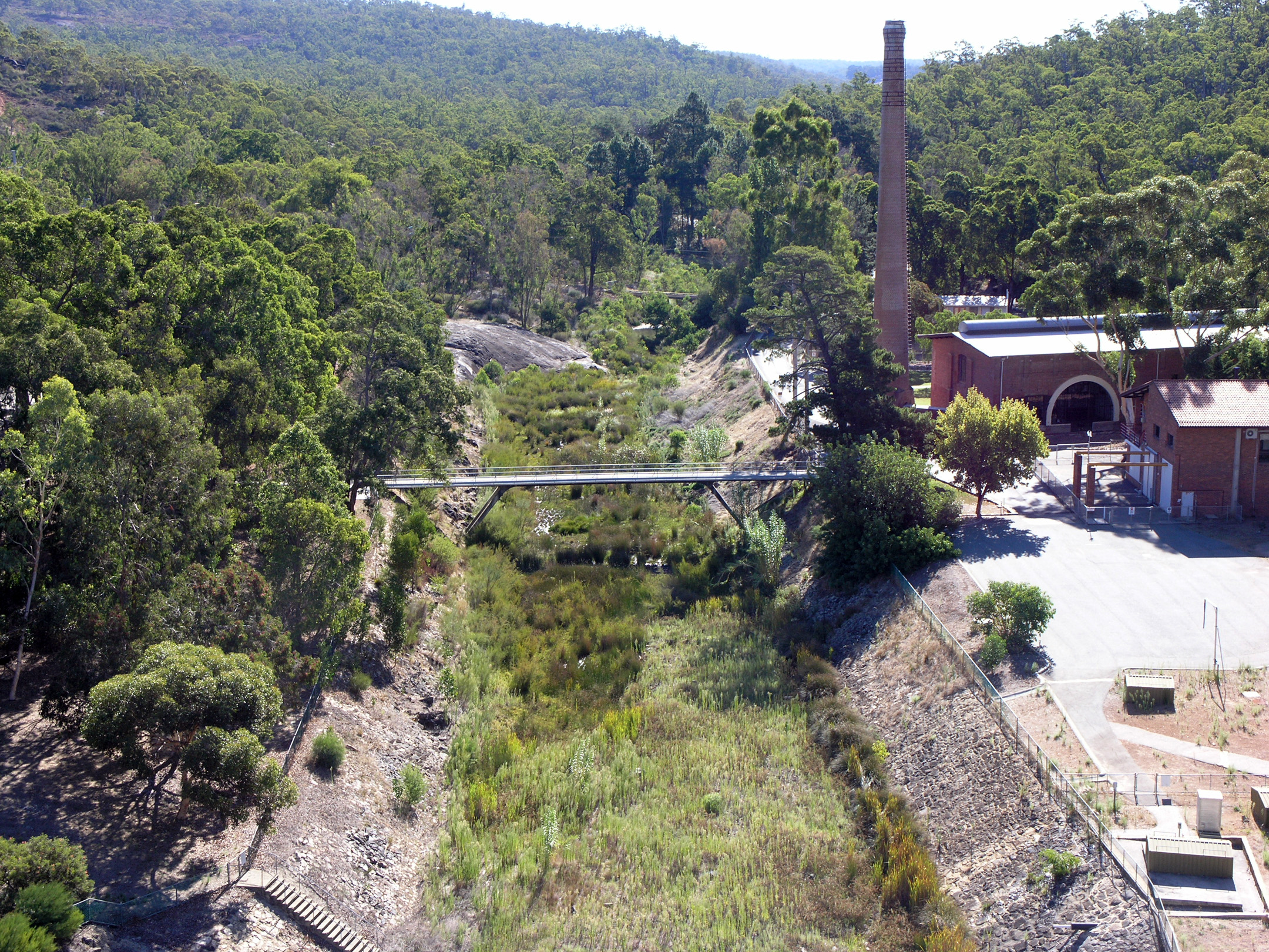
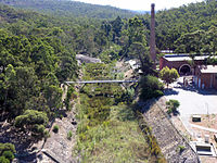 Helena river bed.
The old 'Pumping Station Number 1' is now the C Y O'Connor Museum run by the National Trust. There is also the Kookaburra outdoor cinema, and the Department of Environment and Conservation has the Hills Forest activity centre, as well as a regional administrative office.
Before rationalisation of its work force at this locality, the Water Authority of Western Australia's operations at the Weir maintained housing for its workers. There is a youth hostel (built at the site of the now defunct primary school), an Art Gallery in the area and many picnicking spots. There is still rangers housing at the site, along with functioning pumping stations and water treatment facilities.
Bibbulmun Track
The 963 kilometres (598 mi) walking trail Bibbulmun Track commences in Kalamunda following Piesse Brook, then along the south side of the Helena valley. Crossing the weir wall the track follows the northern side of C.Y.O'Connor lake before turning south and continuing the journey to Albany.
Golden Pipeline Project
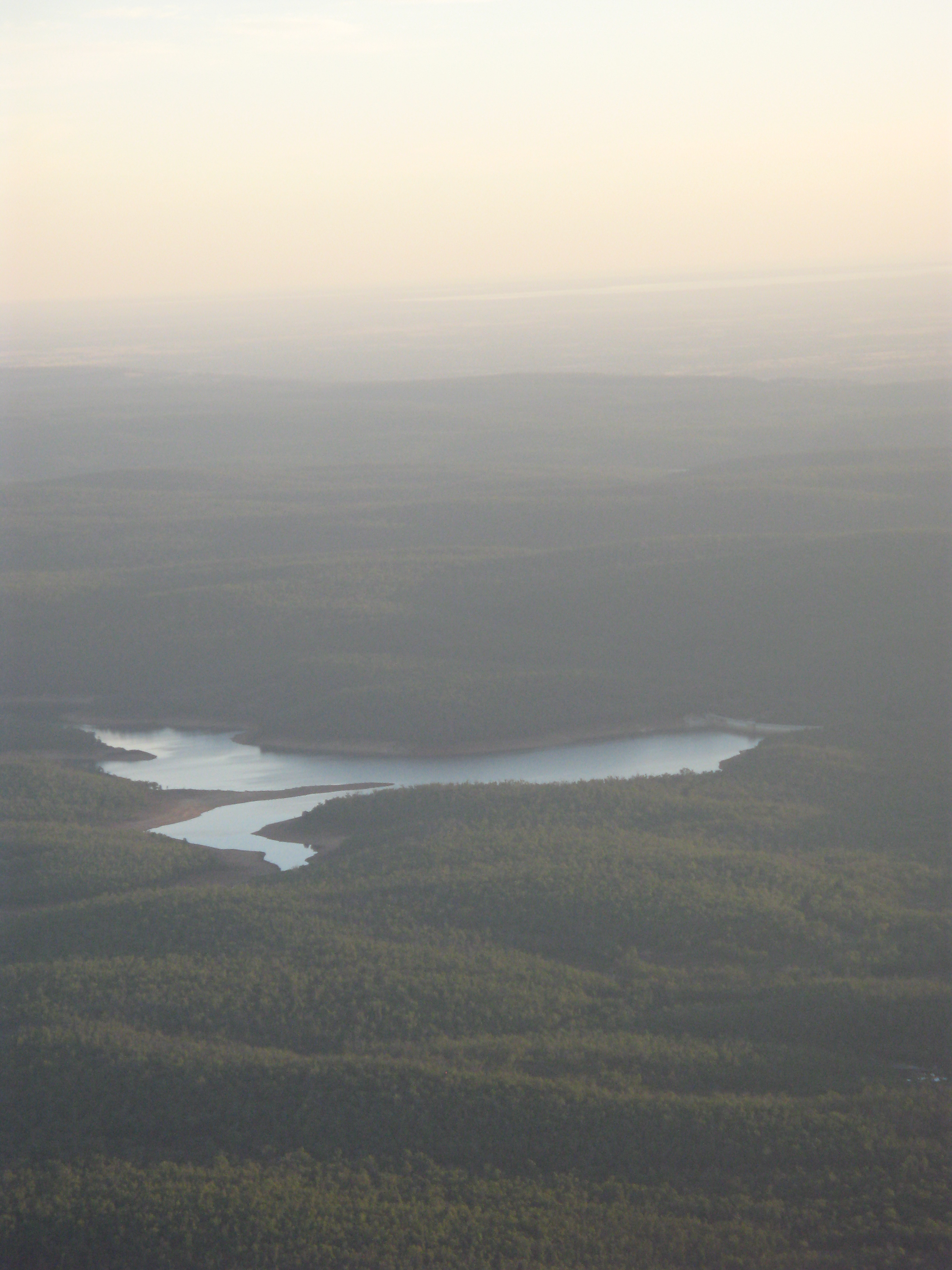
 Lake C. Y. O'Connor from the air, looking southwest
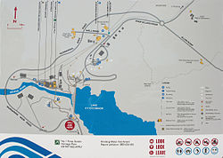 Mundaring Weir information sign.Main article: Goldfields Water Supply Scheme
The history and context of the whole Goldfields Water Supply Scheme was celebrated by the Golden Pipeline project, where the Water Corporation had the National Trust of Australia (WA) create an 'interpretation' of the history of the scheme with guide books, trails, and web-sites to provide information about the history of the scheme. Most of this project was developed between 2001 and 2003.
References
- ^ General information and history of Mundaring www.theage.com.au (accessed 1 April 2006)
- ^ Signs around the weir and also http://www.watercorporation.com.au/M/mundaring_wtp.cfm Mundaring Weir Water Supply Improvement Project
- ^ Daring Rides on a Wooden Switchback Wanderer, H. Australian Railway Historical Society Bulletin, February, 1970 pp46-48
- ^ a b History of the Mundaring Weir Hotel www.mundaringweirhotel.com.au (accessed 1 April 2006)
Further reading
- Elliot, Ian (1983). Mundaring - A History of the Shire (2nd ed. ed.). Mundaring: Mundaring Shire. ISBN 0-9592776-0-9.
- Watson, Lindsay (1995). The railway history of Midland Junction : commemorating the centenary of Midland Junction, 1895-1995. Swan View, W.A. ISBN 0-646-24461-2 (pbk.).
External links
- Mundaring and Hills Historical Society Website
- Landgate (History of Perth Metropolitan place names)
- Mundaring Weir Photo Gallery
- Shire of Mundaring official site
- - Water Corporation Dam storage
- Golden Pipeline Project Guide
Suburbs of the Shire of Mundaring | Perth | Western Australia Bailup · Bellevue · Beechina · Boya · Chidlow · Darlington · Glen Forrest · Greenmount · Helena Valley · Hovea · Mahogany Creek · Midvale · Mount Helena · Mundaring · Parkerville · Sawyers Valley · Stoneville · Swan View · The Lakes · Wooroloo
Coordinates: 31°57′36″S 116°10′17″E / 31.9600°S 116.1713°E
Categories:- 1951 establishments in Australia
- Suburbs of Perth, Western Australia
- Reservoirs and dams in Australia
- Weirs
- Water management in Western Australia
- Darling Range
- Mundaring, Western Australia
- Mundaring Weir, Western Australia
-


Wikimedia Foundation. 2010.