- Hiiumaa
-
Hiiumaa 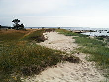
Tahkuna peninsula is the most northern part of Hiiumaa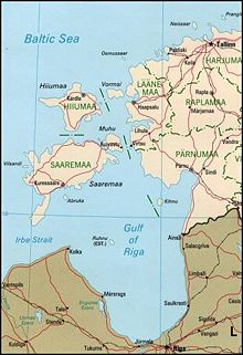
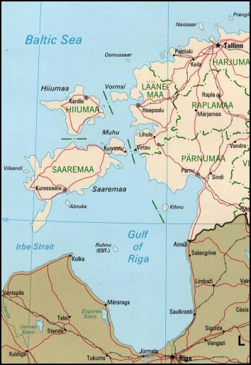
Geography Location Baltic Sea Coordinates Coordinates: 58°52′N 22°35′E / 58.867°N 22.583°E Archipelago West Estonian archipelago Area 989 km2 (381.9 sq mi) Highest elevation 68 m (223 ft) Highest point Tornimägi Country EstoniaCounty Hiiu County Largest city Kärdla (pop. 3,736) Demographics Population 11,087 Hiiumaa (Finnish: Hiidenmaa, German: Dagö, Swedish: Dagö, Danish: Dagø) is the second largest island (989 km²) belonging to Estonia. It is located in the Baltic Sea, north of the island of Saaremaa, a part of the West Estonian archipelago. Its largest town is Kärdla.
Contents
Name
Hiiumaa is the main island of Hiiu County, called Hiiumaa or Hiiu maakond in Estonian. The Swedish and German name of the island is Dagö (day island), Dagø in Danish — a calque of its old Finnish name Päivänsalo (day island); compare Ösel (Yösalo – night island) for Saaremaa. In modern Finnish it is called Hiidenmaa, literally hiisi's land. In Old Gutnish it was Dagaiþ (day isthmus), from which the local North Germanic name "Daë" is derived.
History
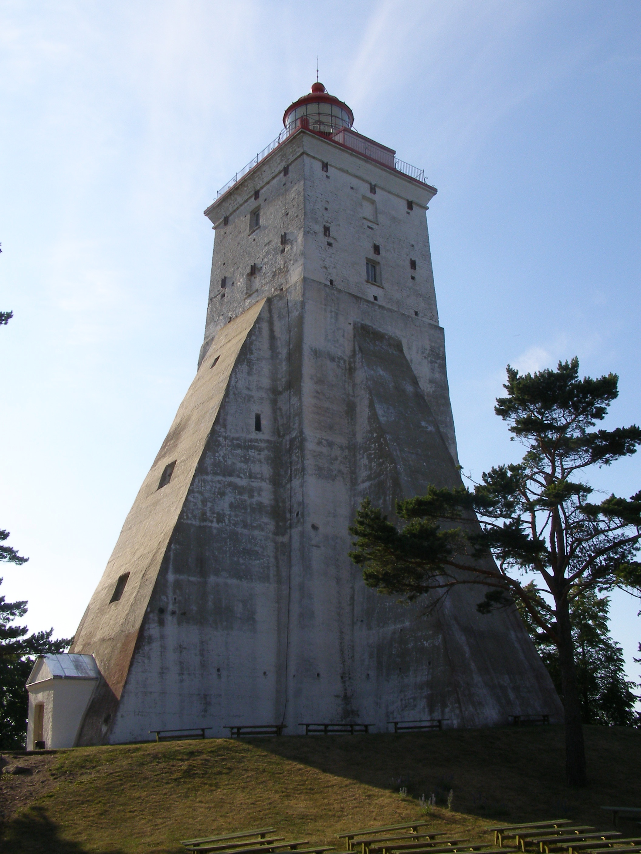
 Kõpu Lighthouse is one of the best-known landmarks
Archaeological evidence of the first human settlement in Hiiumaa dates to as early as the 4th century BC. The first documented record of the island of Dageida was made by contemporary chroniclers in 1228, at the time when Hiiumaa, along with the rest of Estonia, had been conquered by Germanic crusaders. In 1254, Hiiumaa was divided between the Bishopric of Ösel-Wiek and the Livonian branch of the Teutonic Order, who were also partly acting on behalf of the Hanseatic League.
The island was part of Swedish Estonia from 1563–1720, after which it passed to the Russian Empire as part of the Governorate of Estonia, although Dagö's Swedish population kept most of their privileges. Most of the island's previously numerous Swedish-speaking population emigrated or were "Estonianised" during the period of Imperial Russian rule, although a small minority remains to this day. Estonian Swedes are also known as "aibofolke" (meaning island people in Swedish) or "rannarootslased" (meaning coastal Swedes in Estonian).
Hiiumaa was occupied during World War I by the Imperial German Army, in Operation Albion. After the war, it became a part of independent Estonia. It was annexed by the Soviet Union in 1940, by Nazi Germany in 1941, and by the Soviets again in 1944. It was then a part of the Estonian Soviet Socialist Republic until the Soviet Union's collapse in 1991. During the Soviet era Hiiumaa was declared a restricted zone, closed to foreigners and to most mainland Estonians. Since 1991, the island has been a part of independent Estonia.
Some maritime activities did happen near the waters of Hiiumaa. The Soviet destroyer Gnevny was sunk 23rd June, 1941 after having hit with the German seamine. Two German motor torpedo boats, S43 and S106, were destroyed because of the Soviet seamines, 27th June, 1941. To the north of Hiiumaa, on 1st July, 1941, the Soviet submarine M-81 was destroyed because of a German seamine. On the Hiiumaa waters itself again on 25th June, the Soviet minesweeper T-208 Shkiv was hit with a German seamine and was destroyed. The same happened to the Soviet minesweepers T-216, on 7th July, 1941 and T-201 Zarjad, on 30th July, 1941. Also the Soviet submarine, SC-307, fired a torpedo at the German submarine U-144, which sank, 10th August, 1941. [1]
Transport
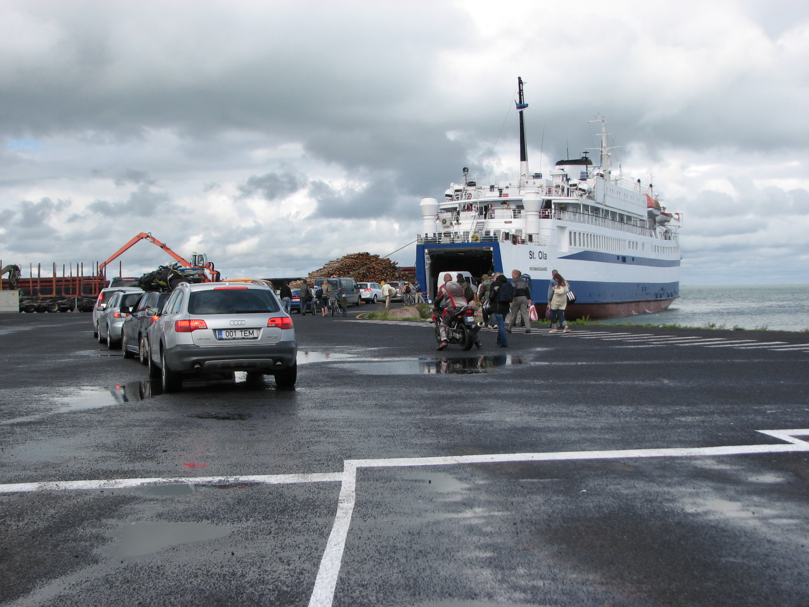
 Cars boarding the ferry to mainland at Heltermaa
Road transport from Estonian mainland to Hiiumaa involves a 90-minute (28 km) ferry crossing from Rohuküla to Heltermaa, which is 25 km by road from Kärdla. There are about 10 ferry departures a day.[2] In the summer weekends, getting car space on the ferry usually requires advance booking. There are about 2 scheduled buses a day between Tallinn (the capital of Estonia) and Kärdla.[3] In the winter, the island can be reached, conditions permitting, via a 26.5 km ice road (the longest in Europe) across the frozen Baltic Sea.[4][5]
Hiiumaa is served by Kärdla Airport, with regular flights to Tallinn.
Bicycle rental is available in Kärdla and there is a good bicycle path built from Kärdla towards Kõrgessaare.
Notables
- Aleksander Maaker (1880-1970 CE), the last traditional player of the torupill (Estonian bagpipe)
Gallery
-

Tahkuna lighthouse -
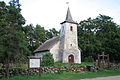
Church of Kassari -
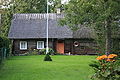
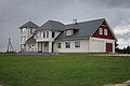
Old farmhouse -
Sõru museum
See also
References
- ^ Keskinen, Kalevi; Mäntykoski, Jorma, eds (1991). The Finnish Navy At War in 1939-1945 (Suomen Laivasto Sodassa 1939-1945). Espoo: Tietoteos Ky. pp. 154. ISBN 951-8919-05-4. http://openlibrary.org/books/OL1778118M/Suomen_Laivasto_sodassa_1939-1945.
- ^ "Ferry schedules and booking". Tuulelaevad. http://www.tuulelaevad.ee/webroot/.
- ^ "Bus schedules and booking". BussiReisid. http://www.bussireisid.ee/index.html?MENU=&KEEL=en.
- ^ Estonia claims Europe's longest ice highway. The Independent. 19 February 2011. Retrieved 19 February 2011.
- ^ BBC: No seatbelts allowed on Europe's longest ice road
External links
- Hiiumaa County government Official site
- Hiiumaa at the Open Directory Project
- www.mil.hiiumaa.ee Pictures of Coastal batteries WWI and WWII in Hiiumaa
Islands of Estonia Abruka · Adralaid · Aegna · Ahelaid · Aherahu · Ahessäär · Ahtra · Aksi · Allirahu · Allu · Alumine Vaika · Anekäbrud · Ankrurahu · Annilaid · Antsulaiud · Anulaid · Auklaid · Eerikukivi · Eerikulaid · Elmrahu · Esirahu · Gretagrund · Hanemaa · Hanerahu · Hanikatsi laid · Hara · Harilaid (islet) · Harilaid (peninsula) · Hellamaa rahu · Hiiumaa · Härjakare · Härjamaa · Hobulaid · Hõralaid · Hülgelaid · Hülgerahu · Imutilaid · Innarahu · Juksirahu · Kadakalaid · Kaevatsi · Kahtla · Kajakarahu · Käkimaa · Käkirahu · Kakralaid · Kakrarahu · Karirahu · Kassari · Kasselaid · Keri · Keskmine Vaika · Kesselaid · Kihnu · Kitselaid · Koerakuiv · Kõinastu laid · Koipsi · Kõrgelaid · Kõrksaar · Kõverlaid · Kreenholm · Kriimi laid · Kräsuli · Kuivarahu · Külalaid · Kullilaid · Kullipank · Kumari · Kungli · Kunnatilaid · Kuradisäär · Kurgurahu · Külalaid · Küllisäär · Laasirahu · Laidu · Läkumätas · Langekare · Leemetikare · Liia · Liisi · Liivakari · Linnusitamaa · Loonalaid · Luigerahu · Maakrirahu · Manilaid · Mardirahu · Maturahu · Mihklirahu · Mohni · Mondelaid · Muhu · Munaderahu · Munasaar · Mustarahu · Mustpank · Mustpank (Vaika) · Nabralaid · Naissaar · Naistekivi maa · Ninalaid · Noogimaa · Nootamaa · Nosurahu · Öakse · Oitma · Ojurahu · Öörahu · Orikalaid · Osmussaar · Paelaid · Pakri Islands · Pakulaid · Papilaid · Papirahu · Pasilaid · Pedassaar · Pihanasu · Pihlakare · Pihlalaid · Piirissaar · Pikknasv · Piskumadal · Prangli · Puhtulaid · Puningalaid · Põdvalaid · Põiksäär · Pühadekare · Rammu · Rannasitik · Riinurahu · Ristlaid · Rohurahu · Rohusi saar · Rooglaid · Ruhnu · Rukkirahu · Rusulaid · Saare ots · Saaremaa · Saarnaki laid · Salava · Sangelaid · Seasaar · Selglaid · Sepasitik · Sillalaid · Sipelgarahu · Sitakare · Sokulaid · Sorgu · Suuregi laid · Suurepoldi · Suurlaid · Suur-Pakri · Suurrahu · Sõmeri · Taguküla laid · Tarja · Tauksi · Telve · Tiirloo · Tondirahu · Tondisaar · Täkulaid · Täkunasv · Udrikulaid · Uhtju saar · Uhtju saared · Ulkkarri · Umalakotid · Ülemine Vaika · Umblu · Urverahu · Uuluti laid · Uus-Nootamaa · Vahase · Vahelmisrahu · Vaika saared · Väike-Pakri · Väike-Tulpe · Vaindloo · Valgerahu · Vareslaid (Käina) · Vareslaid (Väinameri) · Varesrahu · Vasikalaid · Vesiloo · Vesitükimaa · Viirelaid · Vilsandi · Vissulaid · Vohilaid · Vormsi · Võilaid · Võiste · Võnnu · Võrgukare ·
Inhabited islands in the Baltic Sea Denmark Estonia Finland Archipelago Sea Islands (Åland Islands) · Hailuoto · Kimitoön · Laajasalo · Lauttasaari · Replot · SuomenlinnaGermany Poland Russia Sweden Categories:- Islands of Estonia
- Hiiu County


Wikimedia Foundation. 2010.