Ash Vale railway station

Ash Vale railway station

Infobox UK station
name = Ash Vale


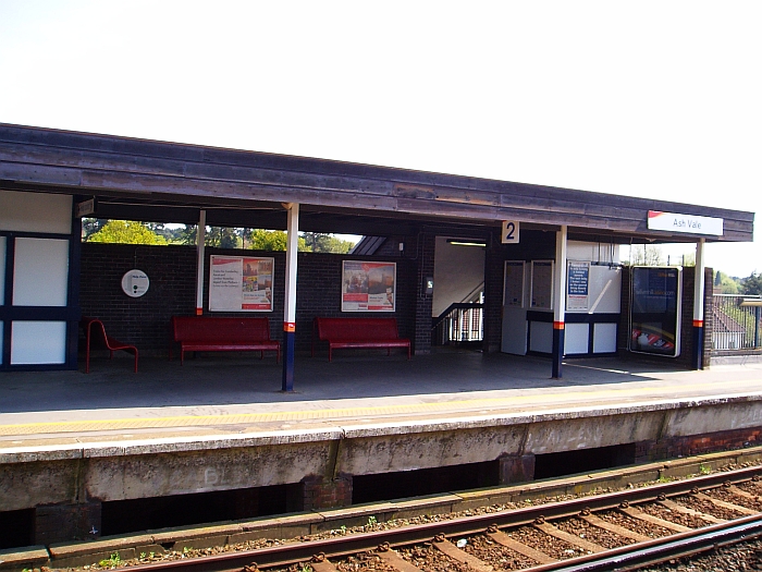
caption = Ash Vale railway station
manager = South West Trains
locale = Ash Vale
borough = Guildford
code = AHV
usage0405 = 0.395
usage0506 = 0.398
usage0607 = 0.407
platforms = 2
start = 2 May 1870

Ash Vale is a railway station serving the village of Ash Vale in Surrey, England. It is situated at the junction of the London to Alton line and the line from Ascot to Guildford. The station, and all trains serving it, are operated by South West Trains.

The station is on an embankment and is adjacent to the Basingstoke Canal. The station opened in May 1870 under the name of "North Camp and Ash Vale", changing to its present name on 30 March 1924. The original main station building of the south side had to be demolished due to subsidence, the current replacements dating from 1972.

It is approximately half a mile from Ash Vale to North Camp station on the North Downs Line (the line between Gatwick Airport, Guildford and Reading), a distance passengers are expected to walk to make any connection. Only disabled passengers may make the argument that to do so would not be "reasonable" - the National Routeing Guide which defines route validity allows for the less able taking circuitous routes at the discretion of staff.

ervices

On weekdays, there are trains approximately every 30 minutes between London Waterloo and Alton, and between Ascot and Guildford. On Sundays, trains are every 30 minutes between London and Alton, and every 60 minutes between Ascot and Guildford.

Gallery

External links

###@@@KEYEND@@@###


Wikimedia Foundation. 2010.

Игры ⚽ Поможем написать курсовую

Look at other dictionaries:

  • Merthyr Vale railway station — Merthyr Vale Ynysowen Locatio …   Wikipedia

  • Ash Vale — infobox UK place country = England official name= Ash Vale map type= Surrey population = 9000 (2006) shire district= Guildford shire county = Surrey region= South East England constituency westminster= Guildford post town= Aldershot postcode… …   Wikipedia

  • Frimley railway station — Infobox UK station name = Frimley manager = South West Trains locale = Frimley borough = Surrey Heath code = FML lowusage0405 = 181,097 lowusage0506 = 197,992 lowusage0607 = 198,063 platforms = 2 start = 1878Frimley railway station is a railway… …   Wikipedia

  • Mountain Ash railway station — Coordinates: 51°40′54″N 3°22′35″W / 51.6817°N 3.3765°W / 51.6817; 3.3765 …   Wikipedia

  • Merthyr Tydfil railway station — Merthyr Tydfil Merthyr Tudful …   Wikipedia

  • North Camp railway station — North Camp Location Place …   Wikipedia

  • Cross Inn railway station — Cross Inn Location Place Llantrisant Area Rhondda Cynon Taf Coordinates …   Wikipedia

  • Dinas Rhondda railway station — Coordinates: 51°37′03″N 3°26′14″W / 51.6174°N 3.4371°W / 51.6174; 3.4371 …   Wikipedia

  • Dingle Road railway station — Coordinates: 51°26′24″N 3°10′48″W / 51.4400°N 3.1801°W / 51.4400; 3.1801 …   Wikipedia

  • Dinas Powys railway station — Coordinates: 51°25′53″N 3°13′08″W / 51.4314°N 3.2188°W / 51.4314; 3.2188 …   Wikipedia

Share the article and excerpts

Direct link
Do a right-click on the link above
and select “Copy Link”